Corfu Dives Nothing Like the Aegean, and the Wind Record Says Why
 by Yannick Schroth
Sep 20, 2026
12 min read
by Yannick Schroth
Sep 20, 2026
12 min read
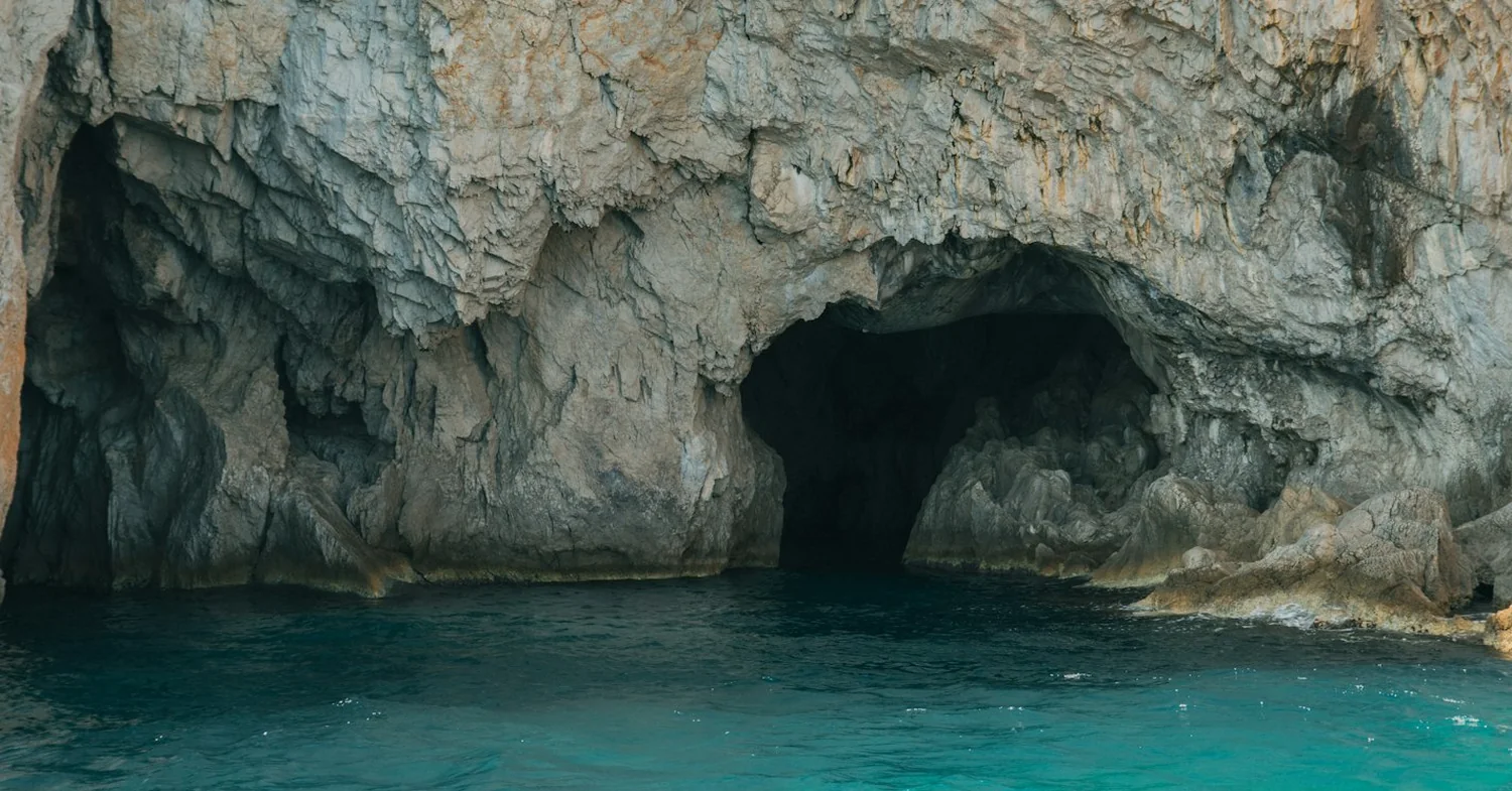
Photo: Unsplash (free licence).
Key takeaways
- The Kerkyra wind record is calm or variable in 47.16% of observations, with north and north-east together at 6.76% and the prevailing direction south in nine months of the year
- Corfu is built from the Ionian and pre-Apulian geotectonic zones, split by the Ionian Thrust, whose southern branch runs parallel to the western shoreline
- Two wrecks in Corfu waters sit on the Greek state list of 91 wreck monuments open to recreational diving: a Junkers Ju 88 at 26 m and the Sara off Othonoi at 35 m
- Sea temperature off the west coast, 2015 to 2024: monthly means of 15.4°C in March and 26.3°C in August, with October at 23.0°C against June at 22.4°C
- Lake Korission is separated from the open Ionian by a strip of land up to 200 m wide, and both of the island’s registered wind stations sit on that stretch of coast
Corfu sits in the Ionian, and the wind record has no meltemi in it
The Greek islands that sell wind sell the meltemi, and the meltemi is an Aegean animal. Rhodes, Naxos and Kos are all built on it. Corfu is the northernmost Ionian island, it lies outside that system, and the station record says so in numbers rather than adjectives.
The Hellenic National Meteorological Service publishes annual wind frequencies for its Kerkyra station, at 39.61°N and 19.91°E, one metre above sea level, with a data period of 1955 to 2010. The single largest entry in that table is not a direction at all. The wind is calm or variable in 47.16% of observations.
Of the rest, south takes 10.84% and south-east 10.28%. West takes 8.28% and east 7.92%. North manages 5.12% and north-east 1.64%, so the whole northerly quadrant, the quadrant the meltemi arrives from, accounts for 6.76% of the record. Summed across the Beaufort classes in the same table, winds of 5 Beaufort or more occur in 3.50% of observations and 6 Beaufort or more in 1.01%.
The Rodos station makes the contrast concrete, since the agency publishes the same table in the same format. There the wind is calm or variable in 19.62% of observations, west alone accounts for 41.60%, and 5 Beaufort or more turns up in 10.29%. Rhodes is windy roughly three times as often as Corfu.
The seasonal pattern is different too. At Kerkyra the prevailing direction is south in January through May and September through November, south-east in December, and west in June, July and August. The summer wind on Corfu is a westerly off the sea, and it builds in the afternoon on the west and south-west coasts rather than tearing down a channel from the north.
For a diver that inverts the Aegean planning problem. Summer afternoons rarely cancel a boat here. The days that do get cancelled tend to be winter and spring southerlies, which are the strongest entries in the whole Kerkyra table: every Beaufort class above 5 peaks on the south and south-east rows.
Limestone and the Ionian Thrust: why the west coast dives are walls and caves
Corfu lies on the north-western edge of the Hellenic Fold and Thrust Belt, and it is not made of one thing. The island is built from two geotectonic zones, the Ionian and the pre-Apulian, which is unusual for a Greek island of this size and is the root of everything a diver sees on the west coast.
The two zones are separated by the Ionian Thrust, a crustal-scale fault system that pushes the lower Ionian zone over the pre-Apulian one. Its trace is marked by intrusive Triassic evaporites and the corresponding Triassic breccia, which outcrop in the central part of the island. Major strike-slip faults have cut that thrust into two parts.
The northern part bisects the island. The southern part is the one that matters here: the thrusting runs parallel to the western shoreline. Add the South Salento to North Corfu strike-slip zone, which has controlled the basin since the Oligocene, and the west coast is a line of carbonate rock that has been broken along its length for millions of years.
The rock itself is limestone in several ages. Jurassic Pantokrator limestone and Senonian Vigla limestone form a large anticline in the north-east of the island. In the north-west, at Agios Georgios Pagon, Cretaceous limestone basement is exposed south of the fault zone after a thick transitional band of loose breccia and conglomerate.
That is the recipe for the diving around Paleokastritsa. A fractured carbonate coast takes swell along joints and bedding planes, and the sea turns those weaknesses into arches, chimneys, swim-throughs and roofed caverns. Vertical relief starts a few metres off the rocks, and what divers call reef here is limestone rather than anything built by an animal.
It also shapes the practical side. There is very little gentle sand on the west coast, so entries are rock, and a torch is not optional if you dive the cavern sites. Our travel dive torch guide covers what survives hand luggage.
Sea temperature off the west coast, month by month
The NOAA daily optimum interpolation analysis carries a grid cell centred on 39.625°N and 19.625°E, in open water off the Corfu west coast. Across the ten years 2015 to 2024 the monthly means from that cell run as follows, in degrees Celsius: January 16.2, February 15.5, March 15.4, April 16.3, May 18.8, June 22.4.
Then July 24.8, August 26.3, September 25.3, October 23.0, November 20.6 and December 17.9. The ten-year mean for the whole series is 20.3°C. The coldest single day in it is 14.3°C on 23 March 2018 and the warmest is 28.8°C on 10 August 2017.
Two things in that list are worth planning around. The cold floor is March, not February, because the sea lags the air by several weeks. And the autumn beats the spring by a wide margin: October at 23.0°C is warmer than June at 22.4°C, and November at 20.6°C is warmer than May at 18.8°C.
In neoprene that means a 5 mm suit covers the usable year, a hood and gloves earn their keep from February into May, and a 3 mm shorty is an August and September item only. Our travel wetsuit guide deals with the packing side of that.
Air and rain pull in the opposite direction. The Kerkyra station’s twelve monthly precipitation means add to roughly 1,111 mm a year, with December at 189.9 mm and November at 187.1 mm. July averages 8.7 mm over 3.3 rain days, against 0.3 mm over 0.2 days at Rodos. Corfu gets summer thunderstorms that the south-east Aegean simply does not.
So the autumn shoulder is a trade. The water is at its second best, the light is good, and the weather is the thing that will move your dive, not the temperature.
The two wrecks Greece lists in Corfu waters
Greece did not open its historic wrecks to recreational divers by custom. It did it by joint ministerial decision 92225/2022, published in the government gazette as FEK B 1273 of 18 March 2022 and signed by the ministers of national defence, culture and sports, and shipping. It sets the terms for diving on 91 wrecks of ships and aircraft that have been declared monuments.
Those 91 are metal ships and aircraft that sank between 1868 and 1970, mostly during the Second World War, lying between 10 and 120 metres. Two of them are in Corfu waters.
The first is a Junkers Ju 88 that came down near Agios Stefanos, on the north-west corner of the island, recorded as 26 June 1941 and attributed to damage rather than combat. Its listed maximum depth is 26 metres, which puts it inside recreational limits for a diver with a deep card and a plan.
The second is the Sara, off Othonoi, the outermost of the Diapontia islands north-west of Corfu. She went down on 2 February 1925. The state list gives a maximum depth of 35 metres; dive operator accounts put her at 32, so treat the depth as disputed and confirm it at the briefing.
The conditions attached to both are strict and worth knowing before you book. Diving is permitted only once a wreck has been documented. Divers may not touch, damage or alter a wreck, and collecting, removing or simply moving any object, from the wreck or from the seabed around it, is prohibited. Searching for movable objects needs written permission from the underwater antiquities service.
Othonoi is a boat trip rather than a shore entry, which is the practical difference between the two. If wrecks are the reason you travel, our wreck diving guide puts a two-wreck island in perspective.
Where Greek law keeps divers out of the water
Article 11 of Law 3409/2005 sets out the categories of water closed to recreational diving in Greece, and it works by type of place rather than by list of beaches. Declared marine areas of underwater archaeological sites are closed, unless the area has been set up as an underwater museum where a supervised, guided dive is allowed.
The rest of the article covers areas of ship transit or anchorage, military exercise areas, water where rental motorised craft operate, ecologically sensitive marine ecosystems under environmental legislation, and the routes of submarine cables and utility systems. On top of all that, the port authority may impose its own prohibitions for the safety of vessels or people.
On Corfu the transit and anchorage clause is the one with teeth. The east side of the island is the approach to Corfu port and to the mainland ferry routes, so the water that looks most inviting from a hotel terrace is often the water a dive boat will not use.
The environmental clause has a name here too. Two Natura 2000 sites sit directly on the coastline a visiting diver is most likely to swim from, and the next two sections are about them.
Posidonia from Kanoni to Messonghi, the protected strip on the east coast
The coastal marine zone from Kanoni to Messonghi is a Special Area of Conservation, Natura 2000 site GR2230005. It covers 8.88 square kilometres, of which 8.53 are sea, and it runs along the east coast between those two villages.
At the Kanoni end the water is shallow and the bottom exposed, with smooth rock at 0.5 metres over a sandstone substrate. Between the upper rocks, the seagrass Cymodocea nodosa grows on sand. That is snorkelling depth rather than diving depth, and it is the first thing most visitors to Corfu put their face in.
South of Messonghi the site changes character. Posidonia oceanica meadows extend below 1.5 metres and grow denser towards the village, over a seabed that is rocky in places and sandy with stones and boulders of every size elsewhere. Brown algae and Cystoseiretum crinitae communities dominate the rock.
Two marine vertebrates are recorded for the site. One is the bottlenose dolphin, Tursiops truncatus, listed in Annex II of Directive 92/43/EEC and protected by the Bern Convention, by CITES and by Greek Presidential Decree 67/1981. The other is the pipefish Syngnathus abaster, which is a seagrass animal and tells you what the habitat is.
For a diver this is the opposite dive to Paleokastritsa: shallow, green, slow, and entirely about what lives in the grass. Posidonia grows a couple of centimetres a year, so fin strokes and dragged gauges matter more here than on rock. Our shore diving guide covers the entry discipline that follows from it.
The Corfu Channel: a frontier, a shipping lane and the mines of 1946
The water between Corfu and Albania is a strait in the geographical sense, and the International Court of Justice described what that means in its judgment of 9 April 1949. The channel constitutes a frontier between Albania and Greece, and a part of the strait lies wholly within the territorial waters of those two states.
The case that produced that finding still shapes the seabed. On 22 October 1946 two British cruisers and two destroyers entered the North Corfu Strait from the south, along a channel that had been swept in 1944 and check-swept in 1945. The destroyer Saumarez struck a mine off Saranda and was gravely damaged.
The Volage was sent to her assistance and struck another mine while towing her. Forty-five British officers and sailors died and forty-two were wounded. A sweep on 12 and 13 November 1946 recovered 22 mines of German origin from the channel.
The court’s description of the geography is the part a diver should hold on to. The channel is easily watched, it is dominated by heights offering excellent observation points, and it runs close to the coast: the nearest mine lay 500 metres from the shore. This is not open sea, and it never was.
The diving on that side reflects it. The north-east coast is sheltered, the drop-offs sit close in against a narrow international waterway with commercial traffic on it, and the prohibition on diving in transit and anchorage areas is a live constraint rather than a formality.
It is also the part of Corfu where the Mediterranean monk seal turns up. Camera traps set during surveys on the Erimitis peninsula, in the north-east, recorded monk seals using caves, described as the first documentation of cave use by the species in that area, and a seal was reported in the straits on 17 July 2023. Those caves are a refuge on a coast the animals travel along, so an encounter is luck and never an excursion.
Lake Korission, the Chalikounas barrier and the two wind stations
The south-west coast is a different island again. Lake Korission, the largest lagoon on Corfu, is 5,300 metres long and 1,500 metres wide, covers roughly 5 square kilometres, and is shallow throughout at water depths below 1.5 metres.
It is separated from the open Ionian by a strip of land up to 200 metres wide. North of the outlet that strip is a beach barrier carrying recent sand dunes up to 2 metres high. South of it, uplifted Plio-Pleistocene formations carry old pre-Holocene dunes reaching 15 metres, and the hills inland, up to 60 metres, are older dunes marking a former shoreline.
The lagoon reaches the sea through an artificial channel 8 metres wide and less than a metre deep, whose seaward exit is sheltered by placed breakwaters. Salinity in the lagoon runs above 40 practical salinity units in summer and around 20 in winter. Offshore, the bathymetry is smooth and the sandy bed dips at gradients of up to 12 degrees.
All of that is protected. The lagoon and its surroundings form Special Area of Conservation GR2230002, covering 22.92 square kilometres, and the Special Protection Area GR2230007 covers 10.51. The site description names the strip of land between Garziki and the start of Agios Georgios beach, the one that separates the lake from the sea, as the most important part of the whole area.
What grows on it is the reason. Stands of Juniperus phoenicea hold the southern sandy beaches, remnants of a larger forest that once covered more of Corfu, and the Crucianelletum maritimae dune community reaches its easternmost limit here, the only occurrence of that limit in Greece.
This is also where the island’s wind sits. Of the two VDWS stations on Corfu, one is filed at Chalikounas, the beach on that barrier strip, and one at Agios Georgios near Argyrades, the long sandy bay that starts where the barrier ends. Corfu has two beaches called Agios Georgios and the register names the southern one, not Agios Georgios Pagon in the north-west.
Put the geology and the wind record together and the split makes sense. The south-west is sand, shallow water and a gentle offshore gradient under the summer westerly. The west and north-west are limestone walls. One coast is for kite and board, the other is for cylinders.
The 10 registered businesses on Corfu, and what a listing settles
Ten watersports businesses in and around Corfu appear in the registers this directory reads, read on 4 September 2026. Eight are dive businesses published by SSI in its register of affiliated training centres. Two are VDWS stations. None is a Green Fins member, and all ten publish a website in the register.
The split follows the coasts exactly. The eight SSI entries are scuba operations, filed under Corfu itself. The two VDWS entries are a kitesurfing and stand-up paddle station at Chalikounas and a sailing and windsurfing station at Agios Georgios near Argyrades, which is to say both of them sit on the south-west sand rather than on the limestone.
What an entry in a register settles is narrow. It says the body lists the business, on the date given. It says nothing about the teaching, the equipment, the boats, the briefings or whether the centre is trading this season. Every entry on the Corfu operator list links back to the page it was read from, so each affiliation can be checked at the source instead of taken on trust.
The state licence is a separate question with an unsatisfying answer. Greece requires anyone providing recreational diving services to register under Law 3409/2005 through the port police directorate of the shipping ministry, and to renew the declaration every five years with the local port authority. No public list of those registrants can be read, because ynanp.gr and gov.gr both answer a plain request with HTTP 403. Which registers can be read logs what each source returned and on what date.
If Corfu is a base rather than a week, the rest of the Ionian and Aegean are a ferry away, and our Paros page covers the working side of a Greek island stay. The European watersports round-up sets Corfu against the alternatives on this continent.
FAQ: scuba diving in Corfu
Does Corfu get the meltemi?
No. The meltemi is an Aegean wind and Corfu is the northernmost Ionian island. In the annual wind frequencies published for the Kerkyra station, north accounts for 5.12 per cent of observations and north-east for 1.64 per cent, while south accounts for 10.84 and south-east for 10.28. The prevailing direction is south in nine months of the year and west in June, July and August. The summer wind here is a westerly sea breeze, not a northerly gradient wind.
How windy is Corfu compared with Rhodes?
Much less windy. The same agency publishes the same table for both stations. At Kerkyra the wind is calm or variable in 47.16 per cent of observations and reaches 5 Beaufort or more in 3.50 per cent. At Rodos it is calm or variable in 19.62 per cent and reaches 5 Beaufort or more in 10.29 per cent, with west alone accounting for 41.60 per cent of observations. That difference is the reason Corfu reads as a diving island and Rhodes as a windsurfing one.
When is the water warmest for diving in Corfu?
August, and the autumn holds far better than the spring. In the NOAA daily sea surface temperature analysis for the grid cell just off the west coast, monthly means over 2015 to 2024 ran 26.3 degrees Celsius in August, 25.3 in September and 23.0 in October, against 18.8 in May and 22.4 in June. October is warmer in the water than June and November is warmer than May. The coldest month is March at 15.4 degrees, not February.
What wetsuit do you need for diving in Corfu?
A 5 mm suit covers the whole season and a 3 mm shorty works only in the August and September window. The water off the west coast sat between monthly means of 15.4 and 26.3 degrees Celsius over ten years, so late winter and spring are a hood and gloves proposition rather than a shorty one. The coldest single day in that ten-year series was 14.3 degrees on 23 March 2018 and the warmest was 28.8 degrees on 10 August 2017.
Which wrecks can you dive in Corfu?
Two lie in Corfu waters on the Greek state list of wreck monuments open to recreational diving, set out in joint ministerial decision 92225/2022. One is a Junkers Ju 88 that came down near Agios Stefanos in the north-west, recorded as 26 June 1941, at a maximum depth of 26 metres. The other is the Sara off Othonoi in the Diapontia islands, sunk on 2 February 1925, listed at a maximum depth of 35 metres, although operator accounts put it at 32.
Why is the diving at Paleokastritsa caves and walls rather than reef?
Because the coast is carbonate rock that has been faulted, not a biological structure. Corfu sits on the north-western edge of the Hellenic Fold and Thrust Belt and is built from two geotectonic zones, the Ionian and the pre-Apulian, separated by the Ionian Thrust. A southern branch of that thrust runs parallel to the western shoreline. The sea works the joints and fractures in the limestone into arches, chimneys and caves, so vertical relief starts a few metres from the rocks.
Where in Corfu is diving prohibited?
Greek law sets the categories rather than naming beaches. Under article 11 of Law 3409/2005, recreational diving is prohibited in declared marine areas of underwater archaeological sites, in areas of ship transit or anchorage, in military exercise areas, where rental motorised watercraft operate, in ecologically sensitive marine ecosystems and over submarine cables and utility systems, and the port authority can add its own prohibitions for safety. On Corfu the transit and anchorage rule bites hardest on the east side, which is the approach to the port.
What is protected underwater on the east coast of Corfu?
The coastal marine zone from Kanoni to Messonghi is a Special Area of Conservation, site GR2230005, covering 8.88 square kilometres of which 8.53 are sea. Posidonia oceanica meadows run below 1.5 metres south of Messonghi and thicken towards that village, with Cymodocea nodosa on sand and Cystoseira communities on rock. Two marine vertebrates are recorded for the site: the bottlenose dolphin Tursiops truncatus and the pipefish Syngnathus abaster.
Are there monk seals in Corfu?
Yes, in the north-east, and not as a booked activity. Camera traps set during surveys on the Erimitis peninsula recorded monk seals using caves, described as the first documentation of cave use by the species in that area, and a monk seal was reported in the straits on 17 July 2023. The caves are a refuge on a coast the animals move along, so an encounter is luck rather than an itinerary.
How many dive centres are there on Corfu?
Ten watersports businesses in and around Corfu appear in the registers this directory reads, read on 4 September 2026. Eight are dive businesses published by SSI in its register of affiliated training centres and two are VDWS stations, one filed at Chalikounas and one at Agios Georgios near Argyrades. None is a Green Fins member. All ten publish a website in the register.
Is there a Greek licence you can check a Corfu dive operator against?
There is a licence, and no list to check it against. Greece requires anyone providing recreational diving services to register under Law 3409/2005 through the port police directorate of the shipping ministry, with a five-year renewal at the local port authority. No public list of those registrants can be read, because ynanp.gr and gov.gr both answer a plain request with HTTP 403. A register entry from a training agency is a membership record and settles nothing about the licence.
Founder of NOMADREEF and a former digital nomad. This guide is sourced from the references below; conditions, prices and rules change, so verify current details, and follow qualified local guidance and safety briefings. About the author · LinkedIn ↗
Sources
- Every Corfu wind and rainfall figure. Kerkyra station at 39.61°N, 19.91°E, altitude 1 m, data period 1955-2010: prevailing wind direction by month, monthly mean precipitation heights and precipitation days. Hellenic National Meteorological Service, climatic data for Kerkyra. The direction and Beaufort-class percentages come from the same station’s annual wind frequencies table, which gives calm or variable at 47.16%. The totals per direction and the shares at 5 and 6 Beaufort and above are sums of the published classes in that table. The annual precipitation figure of roughly 1,111 mm is the sum of the twelve published monthly means. Both read 20 September 2026.
- The Rhodes comparison. Rodos station, same agency, same table format, data period 1955-2010: calm or variable 19.62%, west 41.60%, 5 Beaufort or more 10.29%, July precipitation 0.3 mm over 0.2 days. Climatic data for Rodos and the Rodos annual wind frequencies. Read 20 September 2026.
- The geology of the island and the west coast. Corfu on the north-western edge of the Hellenic Fold and Thrust Belt, built from the Ionian and pre-Apulian zones; the Ionian Thrust as a crustal-scale system pushing the Ionian zone over the pre-Apulian, marked by intrusive Triassic evaporites and breccia in the central part of the island; the northern branch bisecting the island and the southern branch running parallel to the western shoreline; the South Salento to North Corfu strike-slip zone; Jurassic Pantokratoras and Senonian Vigla limestones forming a large anticline in the north-east; Cretaceous limestone exposed at Agios Georgios Pagon after a transitional zone of breccia. Tserolas, Mpotziolis, Maravelis and Zelilidis, Preliminary geochemical and sedimentological analysis in NW Corfu, Bulletin of the Geological Society of Greece 50(1), 402-412 (2016). Read 20 September 2026.
- Every sea temperature figure. NOAA daily Optimum Interpolation Sea Surface Temperature, version 2.1, grid cell centred on 39.625°N and 19.625°E off the west coast of Corfu, 3,637 daily values from 1 January 2015 to 31 December 2024. Monthly means, the ten-year mean of 20.3°C, the coldest day of 14.3°C on 23 March 2018 and the warmest of 28.8°C on 10 August 2017 are calculated from that daily series, retrieved through NOAA CoastWatch ERDDAP on 20 September 2026.
- The wreck rules and the two Corfu entries. Joint ministerial decision 92225/2022, published as FEK B 1273 of 18 March 2022, setting the terms for recreational diving on 91 wrecks of ships and aircraft declared monuments, which sank between 1868 and 1970 and lie between 10 and 120 metres; the requirement that a wreck be documented before diving is permitted; the prohibition on touching, damaging or altering a wreck or collecting, removing or moving any object from it or the seabed around it; and the written permission required from the underwater antiquities service to search for movable objects. Ministry of Culture and Sports announcement, carried in full by Capital.gr, read 20 September 2026. The two Corfu entries, the Junkers Ju 88 near Agios Stefanos on 26 June 1941 at a maximum 26 metres and the Sara off Othonoi on 2 February 1925 at a maximum 35 metres, are triangulated across two independent reports of the annex, Start Media Corfu and Kiss 92.9, both read 20 September 2026. The depth of the Sara is disputed: 32 metres appears in operator accounts of the same wreck.
- Where diving is prohibited. Law 3409/2005, article 11: declared marine areas of underwater archaeological sites, except where designated as underwater museums with supervised guided dives; areas of ship transit or anchorage; military exercise areas; areas where rental motorised watercraft operate; ecologically sensitive marine ecosystems; and submarine cables and utility systems, with the port authority able to impose further prohibitions for safety. Text of article 11. Read 20 September 2026.
- The east coast marine site. Natura 2000 site GR2230005, Coastal Marine Zone from Kanoni to Messonghi, a Special Area of Conservation of 8.88 km² of which 8.53 km² is sea; smooth rock at 0.5 m on sandstone substrate at the Kanoni end; Cymodocea nodosa on sand; Posidonia oceanica below 1.5 m south of Messonghi and denser towards the village; brown algae and Cystoseiretum crinitae; Tursiops truncatus, on Annex II of Directive 92/43/EEC and protected under the Bern Convention, CITES and Presidential Decree 67/1981, and Syngnathus abaster. Management body for Kalamas, Acheron and Corfu, GR2230005 site description. Read 20 September 2026.
- Lake Korission and the barrier. Lagoon 5,300 m long and 1,500 m wide, about 5 km², water depths below 1.5 m; separated from the open Ionian by a strip of land up to 200 m wide, with recent dunes to 2 m north of the outlet and uplifted Plio-Pleistocene formations carrying old dunes to 15 m south of it; hinterland hills to 60 m as older dunes; artificial channel 8 m wide and under 1 m deep with breakwaters at the seaward exit; salinity above 40 psu in summer and about 20 psu in winter; nearshore sandy bed dipping at up to 12 degrees. Alexopoulos et al., A contribution to environmental research of the Korissia coastal wetland, Bulletin of the Geological Society of Greece 40(4), 1892-1903 (2007). Read 20 September 2026. The paper gives summer salinity as above 40 psu in its abstract and above 45 psu in its results, so the lower figure is used here.
- The protected status of Korission. Special Area of Conservation GR2230002, Limnothalassa Korission, 22.92 km², whose site description names the strip of land separating the lake from the sea, between Garziki and the start of Agios Georgios beach, as the most important part of the area, with Juniperus phoenicea stands on the southern sandy beaches and the Crucianelletum maritimae community at its easternmost limit, the only one in Greece: GR2230002 site description. Special Protection Area GR2230007, Korission Lagoon and Lagoudia Island, 10.51 km²: GR2230007 site description. Both read 20 September 2026. That Chalikounas is the beach on that barrier strip is triangulated across Greek local publishers rather than taken from the site description, which names the strip by its endpoints instead.
- The Corfu Channel. The strait as a frontier between Albania and Greece with part of it wholly within the territorial waters of those states; the passage of two British cruisers and two destroyers on 22 October 1946 along a channel swept in 1944 and check-swept in 1945; the Saumarez mined off Saranda and the Volage mined while towing her; 45 dead and 42 wounded; 22 mines recovered in the sweep of 12 and 13 November 1946; the channel easily watched, dominated by heights offering excellent observation points, with the nearest mine 500 metres from the shore. International Court of Justice, Corfu Channel (United Kingdom v. Albania), judgment of 9 April 1949. Read 20 September 2026. No width for the strait is given here because the published figures vary and none of them traces to a hydrographic authority.
- Monk seals in north-east Corfu. Camera-trap documentation of monk seals using caves during surveys on the Erimitis peninsula, described as the first documentation of cave use by the species in that area, from the Ionian Environment Foundation, and the report of a monk seal in the straits on 17 July 2023 from Save Erimitis. Both read 20 September 2026.
- The ten businesses. Ten watersports businesses in and around Corfu, read 4 September 2026: eight from the SSI register of affiliated training centres and two from the VDWS station register, filed at Chalikounas and at Agios Georgios near Argyrades. None appears as a Green Fins member, and Green Fins is not cited per entry because its member pages render nothing a reader can confirm. Every entry, with the page it was read from, is on the Corfu operator list.
- The Greek diving licence. Registration of recreational diving service providers under Law 3409/2005 through the port police directorate of the shipping ministry, with a five-year renewal at the local port authority, and the absence of any readable public list of registrants: ynanp.gr and gov.gr both answer a plain request with HTTP 403. The full log is on which registers can be read.