Three Wind Spots on Kos: Marmari, Mastichari and Kefalos Bay
 by Yannick Schroth
Sep 20, 2026
11 min read
by Yannick Schroth
Sep 20, 2026
11 min read
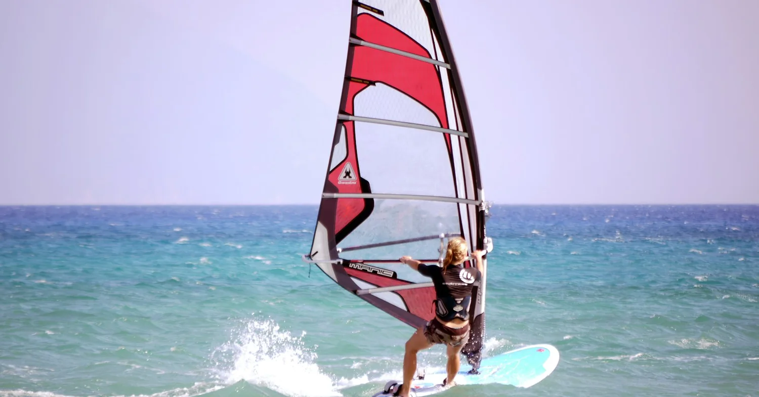
Photo: Unsplash (free licence).
Key takeaways
- Three separate wind spots: Marmari and Mastichari on the north coast, Kefalos Bay in the south-west, and Agios Theologos as a windsurf-only wave spot beyond it
- The etesian flow is almost northerly over the central Aegean and turns north-westerly further south, which is why one wind gives Kos two completely different water states
- Kos publishes more than ten miles of coastal bike lane, about 6,500 rental bicycles and a flat 60 km route, and was certified a Bike Friendly Destination in April 2022
- The 2017 earthquake was magnitude 6.6, centred 11 km east-north-east of Kos; the castle reopened in 2025 and the Defterdar Mosque restoration finished in June 2026
- Bodrum is a ferry of 15 minutes to an hour, but it is a Schengen exit and re-entry, logged in the EU Entry/Exit System since 10 April 2026
Marmari and Mastichari: the two wind spots on the north coast of Kos
Kos runs north-east to south-west for 42.1 kilometres and is never more than 11.5 wide. The north coast is the long flank that faces the channel toward Pserimos and Kalymnos, and it holds the two spots most people mean when they say they are going to Kos to ride.
Marmari is roughly 14 kilometres from Kos town and has the reputation for strength. The school on the beach attributes that to two islets about eight kilometres offshore that squeeze the flow into a jet before it reaches the sand, which is an operator explanation rather than a measured one. What is not in dispute is the result: on a given afternoon Marmari is usually the windiest of the three spots on the island.
Mastichari sits about 21 kilometres out, a working fishing harbour with the widest sand beach on Kos running west of the port. Its bay takes the northerly meltemi and the westerly afternoon thermal as side or onshore wind, which is the reason the teaching happens here. Spot guides put the ordinary working band at 12 to 23 knots, with a sandy bottom, negligible tide and chop rather than swell.
The practical difference between the two is temperament, not geography. Both face the same quarter, both are sand, both have a shallow shelf to stand up in. Mastichari is the forgiving one and Marmari is the one you graduate to, and the drive between them is about fifteen minutes. Basing between them costs nothing and keeps both open.
Kefalos Bay and Agios Theologos: the same meltemi on a coast that faces away
Then the island turns. Past the airport at Antimachia the land narrows to an isthmus and the last twelve kilometres swing south-west into the Kéfalos peninsula, and the coast that was pointing at the wind is now pointing away from it.
Kefalos Bay opens to the south-west. A north-westerly therefore arrives cross-offshore, blowing off the land and across the bay, and wind that has just come over high ground onto sheltered water does not build chop. The bay is published as mirror-flat in the afternoon, light in the morning, and averaging around 25 knots between June and the end of September. That is a different sport from Marmari on the same day.
Offshore wind is also the one that punishes equipment failure, because everything that stops working drifts away from the beach rather than toward it. This is the reason the Kefalos centres run supervised rental with cover on the water and why riding the bay off the roof of a hire car is a poor idea. Kefalos is about 40 kilometres from Kos town, which makes it a base rather than a day trip.
Beyond it, on the exposed western tip, is Agíos Theológos. A cape north of the village organises the swell into what spot guides rate among the better wave setups in the Aegean, with force 7 on a strong day and mast-high faces at the top end.
It is a windsurf spot and effectively not a kitesurf one. The access track is unmade, the shoreline is rock, and there is no landing ground in the lee for a long stretch. The schools run it as a guided excursion with the gear on a trailer.
Why the meltemi reaches Kos from the north-west, and what each coast does with it
The meltemi is the same system covered on the Rhodes page and the Naxos page: the summer etesian northerly of the Aegean, driven by high pressure over central Europe and the Balkans against the thermal low over Anatolia, strongest and most persistent in July and August, and often over 15 metres per second, about 29 knots, across the Aegean.
The part that matters here is the bearing. Published climatology describes the flow as taking an almost northerly direction in the central sector and turning north-westerly further south, and the Dodecanese sits in that southern band. So the wind that hits Naxos as a northerly hits Kos with west in it, and an island aligned north-east to south-west presents two different faces to it.
That single fact explains the whole spot map. A north-westerly on a north-facing coast is onshore to side-onshore, which is what makes Marmari and Mastichari teachable and why a rider who goes down there drifts back to sand. The same north-westerly on a south-west-facing bay is cross-offshore, which is what makes Kefalos flat and why it is not a place to learn alone.
Layered on top is a thermal component. Kos schools and spot guides consistently describe a wind that fills around the middle of the day and drops close to sunset, which is a local heating effect riding on the synoptic flow rather than a replacement for it. Treat it as a bias, not a timetable, and rig for the afternoon rather than the hour you are standing in.
Cycling on Kos: a flat island with a bike lane along the coast
This is the thing that genuinely separates Kos from Rhodes and Naxos for anyone staying more than a fortnight. Rhodes puts its best wind 90 kilometres from the airport. Naxos puts a lagoon in walking distance and everything else behind a hire car. Kos is flat enough and built enough that a bicycle is a real answer.
The municipality publishes more than ten miles of bike lane along the coast, around 6,500 bicycles available to rent on the island, and a network that includes a completely flat 60-kilometre route alongside a 110-kilometre one with a thousand metres of climbing. Kos was certified a Bike Friendly Destination on 15 April 2022 by NatTour with the Hellenic Society for the Protection of Nature.
What that buys a rider is a daily radius without a car. Kos town to the beaches along the north coast is flat made surface, and the coastal lane runs the length of the waterfront. The hot springs at Embros Therma, roughly 12 kilometres south-east of town, are a common ride and the one that actually climbs.
The limit is distance. Mastichari at about 21 kilometres and Kefalos at roughly 40 are not a commute you want to make twice a day into a headwind with a board bag. KTEL buses run the island from Kleopatras in Kos town and the schools run shuttles. The realistic pattern is a bicycle for town, work and the near coast, and wheels or a bus for the far spots.
Kos town since the 2017 earthquake: the castle, the mosque and the harbour
At 01:31 local time on 21 July 2017 a magnitude 6.6 earthquake struck 11 kilometres east-north-east of Kos at a depth of 7 kilometres. Two people died on the island and more than 120 were injured, and a small tsunami reached heights of up to 1.9 metres on nearby coasts.
The damage fell on exactly the part of Kos town a visitor walks through. The old town took the worst of it, along with the cathedral, the 18th-century Defterdar Mosque, whose minaret collapsed, and the 14th-century Castle of Neratzia at the harbour mouth. The floor of the main harbour cracked and the port was declared unsafe, with ferry traffic moved away while it was made good.
Nine years later the answer to whether this still matters is mostly no. The Castle of Neratzia was restored by the culture ministry with 2.5 million euro from the Recovery and Resilience Fund, with wall reinforcement, partial reconstruction of the superstructure and gravel piles to stabilise the ground under the north-east enclosure, and was reopened in September 2025. The Defterdar Mosque restoration was completed in June 2026.
What is left is ordinary and visible. Individual buildings in the old town remain fenced or propped, and restoration programmes across the Dodecanese are still running. It is a reason to look up while walking, not a reason to choose a different island.
Diving Kos and Pserimos: the Thor Star, and the Greek rules that still bind
Kos diving is mostly not off Kos. The boats run north to Pserimos, the small inhabited islet in the channel between Kos and Kalymnos, because that is where the topography is. The island is volcanic in origin and the seabed reflects it: reef, drop-offs and caves rather than the sand and rubble of a bay.
Three sites carry most of the traffic. The Thor Star, a 73-metre steel vessel built in 1965, lies broken in three off the south-east of Pserimos, with the bow at 5 metres and the stern at a maximum of 24, so a mixed-certification boat can all dive it. The Potteries is a reef at a maximum of 12 metres scattered with ancient amphorae. The Cave of the Black Rock has an entrance at 8 metres and drop-offs from 20 down to 50.
The legal frame is the one already set out for Rhodes, and it applies here unchanged. Recreational diving was opened by Law 3409/2005 and carried forward by Law 4688/2020. Diving is prohibited in declared underwater antiquity zones, fragile marine areas, shipping lanes and anchorages, military areas, and within 100 metres of the launch point of rented recreational motorboats.
Two rules bite specifically at Pserimos. A wreck submerged more than 50 years may be dived only with a registered provider of recreational diving services, and so may any dive from one hour after sunset to one hour before sunrise. The amphora field is the other half of the point: a seabed with pottery on it is the sort of place the culture ministry declares.
The boats work inside those lines, so none of this is felt on a normal charter day. Arriving with your own tanks and a chart is how a visitor finds the edges of the framework instead.
Kitesurfing rules that reach Marmari and Mastichari
Greece regulates kitesurfing nationally through General Port Regulation No 20, enforced by the local port authority, so the rules set out on the Naxos page apply at Marmari and Mastichari exactly as they do at Mikri Vigla.
Two of them shape a Kos trip. Kitesurfing is barred under 16, with 14- and 15-year-olds allowed only on written parental consent, proof of swimming ability and an instructor supervising inside 100 metres. And above 6 Beaufort a certified lifeguard and a rescue vessel are required, which at Marmari in August is an ordinary afternoon rather than an edge case.
The geometry rules matter more here than they look. Mastichari is a working ferry harbour with boats to Kalymnos running through the day, and the regulation keeps riders out of ports and fishing shelters, 200 metres off swimmers and anchored vessels, and inside one nautical mile of shore. The launch corridors marked with yellow buoys on that beach are the rule made visible.
Crossing from Kos to Bodrum, and what leaving Schengen now involves
Kos is close enough to Turkey that the 2017 earthquake damaged Kos town and Bodrum in the same minute. Ferries run from Kos main port all year, more than ten sailings a day in summer, departures generally between about 08:45 and 19:00, and a crossing of 15 minutes to an hour depending on the vessel. As a day trip it is the easiest excursion on the island.
As paperwork it has become the most involved. Kos is in the Schengen area and Turkey is not, so the trip is a Schengen exit and a Schengen re-entry, each of them now recorded in the EU Entry/Exit System. The EES began operating progressively on 12 October 2025 and became fully operational on 10 April 2026, replacing passport stamping for non-EU nationals with a record of name, travel document, fingerprints, facial image and the date and place of each crossing.
For an EU or EEA passport holder that is a formality. For a non-EU nomad running a 90-day Schengen allowance it is worth thinking about twice: the day out is registered on both legs, the re-entry has to be permitted by whatever authorisation you hold, and a single-entry Schengen visa does not survive the trip.
Turkey has its own requirements on the far side. Most EU nationals enter visa-free for short stays and several may travel on a national identity card; other nationalities apply through the official e-Visa service, and a general rule requires travel documents valid for at least 60 days beyond the intended stay, with exemptions for those entering on an ID card. Check your own nationality against the Turkish foreign ministry page rather than against a ferry operator.
Nisyros and Kalymnos: what a Kos day without wind is for
The meltemi does not blow every day, and Kos is better supplied with alternatives than most wind islands because it sits in the middle of a cluster rather than at the edge of one.
Nisyros is the volcanic one. Boats run in season from Kardamena, Kos town and Kefalos, with the Kardamena crossing at roughly 45 minutes, and the object of the trip is the Stefanos crater in the caldera: an elliptical phreatic crater of about 260 by 350 metres and a maximum depth of 27, shaped by two north-east trending faults marked by a line of fumarolic vents, and one of the largest of its kind anywhere. You walk down into it. The floor steams and smells of sulphur.
Kalymnos is the other direction and the other temperament. Ferries cross from Mastichari in about 30 to 45 minutes, several times a day, and the island is one of the best-known sport climbing destinations in Europe, with limestone running straight down to the sea. A rider with a climbing partner and a flat forecast has a better day there than on the beach.
Both of these sit in the same category as the Kos bicycle: they make a windless week cost less. That is worth more on a four-week stay than an extra knot of average wind, and it is the argument for Kos over a smaller, purer wind island.
The 11 registered watersports businesses on Kos, and what a listing settles
Eleven watersports businesses on Kos appear in the registers: 8 published by VDWS, 2 by SSI and 1 by IKO in their own registers of affiliated centres, read 3 September 2026. 7 of the 11 publish a website. They sit at Marmari, Mastichari, Kefalos and Antimachia, plus Kos town.
The distribution says something about the island that a spot guide does not. Eight of eleven are VDWS entries, which is a German-language body oriented to windsurfing, kitesurfing and wingfoiling, and only one is IKO. That is a wind island with a windsurf centre of gravity rather than a kite monoculture, and the geography behind it is the three-spot spread rather than one crowded bay.
What a register entry settles is narrow, and worth stating plainly. It says the body lists the business, on the date given. It says nothing about the teaching, the kit, the boats, the insurance, or whether the centre opens this season. Every entry on the Kos operator list links back to the register page it came from, so the affiliation can be checked at the source instead of taken from here.
The listing that would settle more does not come out. Greece requires providers of recreational diving services to register through the port police directorate of the shipping ministry, renewed every five years with the local port authority, so the state register exists. The list does not: ynanp.gr and gov.gr both answer a plain request with HTTP 403, checked 19 September 2026. The situation is logged on which registers can be read.
On staying legally for longer, Greece runs a digital nomad visa under Law 4825/2021 for non-EU nationals, with the income test set out in the Paros guide. EU and EEA passport holders need none of it, and on Kos the sharper administrative question is the Schengen border sitting fifteen minutes offshore rather than the visa itself.
FAQ: windsurfing and kitesurfing on Kos
Where do you windsurf and kitesurf on Kos?
In three places, and they are far apart. Marmari and Mastichari sit on the north coast, about 14 and 21 kilometres from Kos town, and both take the meltemi onshore to side-onshore over sand. Kefalos Bay is at the far south-west end of the island, roughly 40 kilometres out, where the same wind arrives cross-offshore and the water goes flat. Agios Theologos, on the exposed west-facing tip beyond Kefalos, is a wave spot for windsurfers and not a kitesurfing beach.
Is Marmari or Mastichari better for a first week on Kos?
Mastichari, most weeks. It is the widest sand beach on Kos, the schools there teach off a long shallow shelf, and the bay takes both the northerly meltemi and the westerly thermal as side or onshore wind. Marmari is the windier of the two, which is exactly what a beginner does not want in August. Riders who have their water starts tend to move to Marmari after a few days.
When is the windsurfing and kitesurfing season on Kos?
The meltemi season runs roughly June to September, with peak intensity and persistence in July and August, and the Kos centres typically trade from spring into October. Spot guides put the working band at about 12 to 23 knots at Mastichari, with Kefalos Bay averaging around 25 knots in the afternoon between June and the end of September. May and October are the quiet shoulders. Outside that window Kos is a Greek island with beaches rather than a wind destination.
What is different about Kefalos Bay compared with the north coast of Kos?
The angle, and therefore the water. Kefalos Bay opens to the south-west, so the north-westerly meltemi blows off the land rather than onto it, and cross-offshore wind over a sheltered bay produces flat water instead of chop. Mornings there are light and afternoons average about 25 knots in season. The trade-off is that offshore wind is unforgiving of a broken mast foot or a dropped kite, which is why riding it through a centre with a boat is the normal arrangement.
How strong is the meltemi on Kos, and which direction does it come from?
The etesian flow is almost northerly over the central Aegean and turns north-westerly further south, which is the angle the Dodecanese gets. Wind speed over the Aegean often exceeds 15 metres per second, about 29 knots, and peak intensity falls in July and August. On Kos the schools and spot guides describe a thermally reinforced pattern that fills around midday and drops near sunset, which sits on top of the synoptic wind rather than replacing it. Rig for the afternoon.
Can you get around Kos by bicycle instead of hiring a car?
More than on most Greek wind islands. The municipality publishes more than ten miles of coastal bike lane, around 6,500 rental bicycles on the island, and a completely flat 60-kilometre route, and Kos was certified a Bike Friendly Destination in April 2022. Kos town to Tigaki and on toward Marmari is flat riding on made surface. Mastichari at about 21 kilometres and Kefalos at roughly 40 are a different proposition, and for those the KTEL bus or a school shuttle is the usual answer.
Can you dive on Kos, and what does Greek law allow?
Yes. Recreational diving in Greece was opened by Law 3409/2005 and carried forward by Law 4688/2020. Diving is prohibited in declared underwater antiquity zones, in fragile marine areas, in shipping lanes and anchorages, in military areas, and within 100 metres of the launch point of rented recreational motorboats. Wrecks submerged more than 50 years, and dives between one hour after sunset and one hour before sunrise, need a registered provider. Most Kos boat diving happens around the islet of Pserimos, which is inside all of that.
Do the Greek kitesurfing rules apply at Marmari and Mastichari?
They do, because General Port Regulation No 20 is national and the local port authority enforces it. Kitesurfing is barred under 16, with 14- and 15-year-olds allowed only on written parental consent, proof of swimming ability and an instructor supervising inside 100 metres. Above 6 Beaufort a certified lifeguard and a rescue vessel are required, which on a Kos August afternoon is not a rare condition. Riders also keep 200 metres from swimmers and stay inside one nautical mile of shore.
Is a day trip from Kos to Bodrum still straightforward?
Mechanically, yes: ferries run from Kos main port year round, more than ten sailings a day in summer, and the crossing is between 15 minutes and an hour depending on the boat. Administratively it is now a border formality rather than a boat ride. Kos is in the Schengen area and Turkey is not, so the trip is an exit and a re-entry, recorded in the EU Entry/Exit System that has replaced passport stamping for non-EU nationals since 10 April 2026. Most EU citizens enter Turkey visa-free; other nationalities should check the e-Visa rules before booking.
Is Kos still damaged from the 2017 earthquake?
Not in any way that changes a trip now. The magnitude 6.6 quake of 21 July 2017 was centred 11 kilometres east-north-east of Kos at a depth of 7 kilometres, and it damaged the old town, the cathedral, the Defterdar Mosque and the Castle of Neratzia, and cracked the floor of the main harbour. The castle was restored with 2.5 million euro from the Recovery and Resilience Fund and reopened in 2025, and the mosque restoration was completed in June 2026. Individual buildings in the old town are still fenced.
How many watersports schools are there on Kos?
Eleven watersports businesses on Kos appear in the registers: 8 published by VDWS, 2 by SSI and 1 by IKO in their own registers of affiliated centres, read 3 September 2026. Seven of the eleven publish a website. They sit at Marmari, Mastichari, Kefalos and Antimachia, plus Kos town. A register entry says the body lists the business on the date given, and nothing about the teaching, the kit or the boats.
Founder of NOMADREEF and a former digital nomad. This guide is sourced from the references below; conditions, prices and rules change, so verify current details, and follow qualified local guidance and safety briefings. About the author · LinkedIn ↗
Sources
- The direction the etesians take over the southern Aegean. The flow takes “an almost northerly direction at the central sector and turning to a north-western direction further south”, with peak intensity and persistence in July and August and wind speed over the Aegean frequently exceeding 15 m/s: Weather and Climate Dynamics 3, 811–830 (2022). Read 20 September 2026. The everyday figures of 5 to 7 Beaufort on a meltemi day are carried over from the Rhodes page, where they are triangulated across marine and meteorological sources rather than taken from a single station series.
- The three Kos spots, and what each one does with the wind. Marmari as the windiest spot on the island, with the jet attributed to two islets about 8 km offshore, and Mastichari as the widest sand beach on Kos with north and west wind arriving side or onshore, both operator-published: kitesurfingkos.com, Marmari and kitesurfingkos.com, Mastichari. The Mastichari working band of 12 to 23 knots, north-westerly, sandy bottom and negligible tide: kiteguide.com. Kefalos Bay as cross-offshore with mirror-flat water, light mornings and an afternoon average of about 25 knots from June to the end of September: Windsurf Magazine. Agios Theologos as a wave spot reaching force 7, with no lee landing ground, unmade access and a rocky shoreline, rated for expert kiters only: spotnetz.de. Read 20 September 2026; the spot descriptions are triangulated across these independent guides rather than resting on one centre’s marketing.
- Cycling on Kos. More than ten miles of bike lane along the coast, about 6,500 bicycles available for rent, a completely flat 60 km route against a 110 km route with 1,000 m of ascent, and the Bike Friendly Destination certification awarded on Friday 15 April 2022 by NatTour with the Hellenic Society for the Protection of Nature, all published by the municipality: kos.gr, cycling in Kos. Read 20 September 2026.
- The 2017 earthquake, by the instruments. Magnitude 6.6 at 22:31:11 UTC on 20 July 2017, which is 01:31 local on 21 July, located 11 km east-north-east of Kos at 36.929°N 27.414°E and a depth of 7 km: USGS event us20009ynd. Read 20 September 2026. The damage list (old town, cathedral, Defterdar Mosque minaret, Castle of Neratzia, cracked harbour floor, two deaths, more than 120 injured on the island, tsunami run-up to 1.9 m) is compiled from contemporary reporting rather than from a single official damage assessment: 2017 Aegean Sea earthquake, read 20 September 2026, and treated as triangulated secondary material.
- What has reopened in Kos town. The Castle of Neratzia restored with €2,500,000 from the Recovery and Resilience Fund, including wall reinforcement, partial reconstruction of the superstructure and gravel piles under the north-east enclosure, inaugurated by the Minister of Culture during a working visit to Kos and opened to visitors free of charge at first: Days of Art in Greece, reporting the Ministry of Culture announcement of 30 September 2025. The Defterdar Mosque, an 18th-century foundation whose minaret collapsed in 2017, restored and inaugurated in June 2026: Defterdar Mosque. Read 20 September 2026. The Greek Ministry of Culture’s own monument pages for Kos are served over plain HTTP only, so the ministry announcement is cited through the outlet that republished it.
- What Greek law allows underwater. Law 3409/2005 on recreational diving, carried forward by Law 4688/2020. Article 11 sets the prohibitions: marine areas designated by the culture ministry, fragile marine areas, ship transit lanes and anchorages, military areas, 100 m either side of the launch point of rented recreational motorboats, and the hours from one hour after sunset to one hour before sunrise. Full text at Article 11. The 50-year threshold for wrecks comes from the same framework as amended. The state’s own service page describing the duty to register as a provider, gov.gr, answers a plain request with HTTP 403. Read 20 September 2026.
- The Greek provider register, and why it is not cited per operator. Registration of recreational diving service providers runs through the port police directorate of the shipping ministry, with a five-year renewal at the local port authority. No public list is served: ynanp.gr and gov.gr both answer a plain request with HTTP 403, checked 19 September 2026. Recorded on which registers can be read.
- Greek kitesurfing rules. General Port Regulation No 20 (Government Gazette B 444 of 26 April 1999, amended 30 May 2018 and 21 December 2022): minimum age 16, with 14- and 15-year-olds on written parental consent, proof of swimming and supervision inside 100 m; a certified lifeguard and rescue vessel required above 6 Beaufort; 200 m from swimmers, anchored vessels, rocks and dive buoys; a limit of one nautical mile offshore; no riding before sunrise or after sunset; and marked launch corridors at least 100 m wide. Published by Safe Water Sports, which hosts the Greek water-sports legislation: kitesurf regulations. Read 20 September 2026. The same regulation is set out at length on the Naxos page.
- The Kos dive sites and their depths. The volcanic seabed, the thermal springs at Therma, the archway tunnel and the Pserimos sites are described by the municipality at kos.gr, scuba diving. The depths are operator-published: Thor Star, a 73.51 m steel vessel built in 1965 and now in three pieces off south-east Pserimos with the bow at 5 m and the stern at 24 m; the Potteries and the Gardens at a maximum of 12 m; the Cave of the Black Rock off north-east Pserimos with an 8 m entrance and drop-offs from 20 m to 50 m: Liamis Dive Centre dive-site list. Read 20 September 2026.
- The Schengen exit at Bodrum. The EU Entry/Exit System registers non-EU nationals travelling for a short stay across 29 European countries, recording name, travel document data, fingerprints, facial image and the date and place of each entry and exit; it started progressively on 12 October 2025 and became fully operational on 10 April 2026, replacing the stamping of passports: European Commission, Entry/Exit System. Turkish entry requirements, including the e-Visa service, the national identity card route for certain European nationals and the requirement for travel documents valid at least 60 days beyond the duration of stay: Republic of Türkiye, Ministry of Foreign Affairs. The ferry pattern of more than ten daily summer crossings from Kos main port, departures between about 08:45 and 19:00 and a crossing of 15 minutes to an hour is operator-aggregated: Ferryhopper, Kos to Bodrum. Read 20 September 2026.
- Nisyros and Kalymnos. The Stefanos crater as an elliptical phreatic crater of 260 by 350 m with a maximum depth of 27 m, shaped by two north-east trending active faults marked by an alignment of fumarolic vents, and one of the largest phreatic craters in the world: Nisyros Geopark. Seasonal boats from Kardamena, Kos town and Kefalos with the Kardamena crossing at about 45 minutes, and the Mastichari to Kalymnos crossing at about 30 to 45 minutes with several sailings a day, are operator-aggregated and triangulated across Ferryhopper and Direct Ferries. Read 20 September 2026.
- The island itself. Kos measuring 42.1 by 11.5 km, a population of 37,089 at the 2021 census and third largest of the Dodecanese: Kos. Kos International Airport “Ippokrátis” sitting beside Antimachia about 23 km south-west of Kos town: Kos International Airport. Read 20 September 2026. The road distances from Kos town used above, roughly 14 km to Marmari, about 21 km to Mastichari and roughly 40 km to Kefalos, are triangulated across routing and bus-timetable sources rather than taken from an official distance table, and are given as approximations for that reason.
- The eleven businesses. 8 published by VDWS, 2 by SSI and 1 by IKO in their own registers of affiliated centres, read 3 September 2026; 7 of the 11 publish a website; located at Marmari, Mastichari, Kefalos and Antimachia, plus Kos town. From vdws.de, divessi.com and ikointl.com. Each entry links to the register page it came from on the Kos operator list.