Miami Diving: A National Park That Is 95 Per Cent Water, and a Federal Box That Bans Spearguns
 by Yannick Schroth
Sep 20, 2026
15 min read
by Yannick Schroth
Sep 20, 2026
15 min read
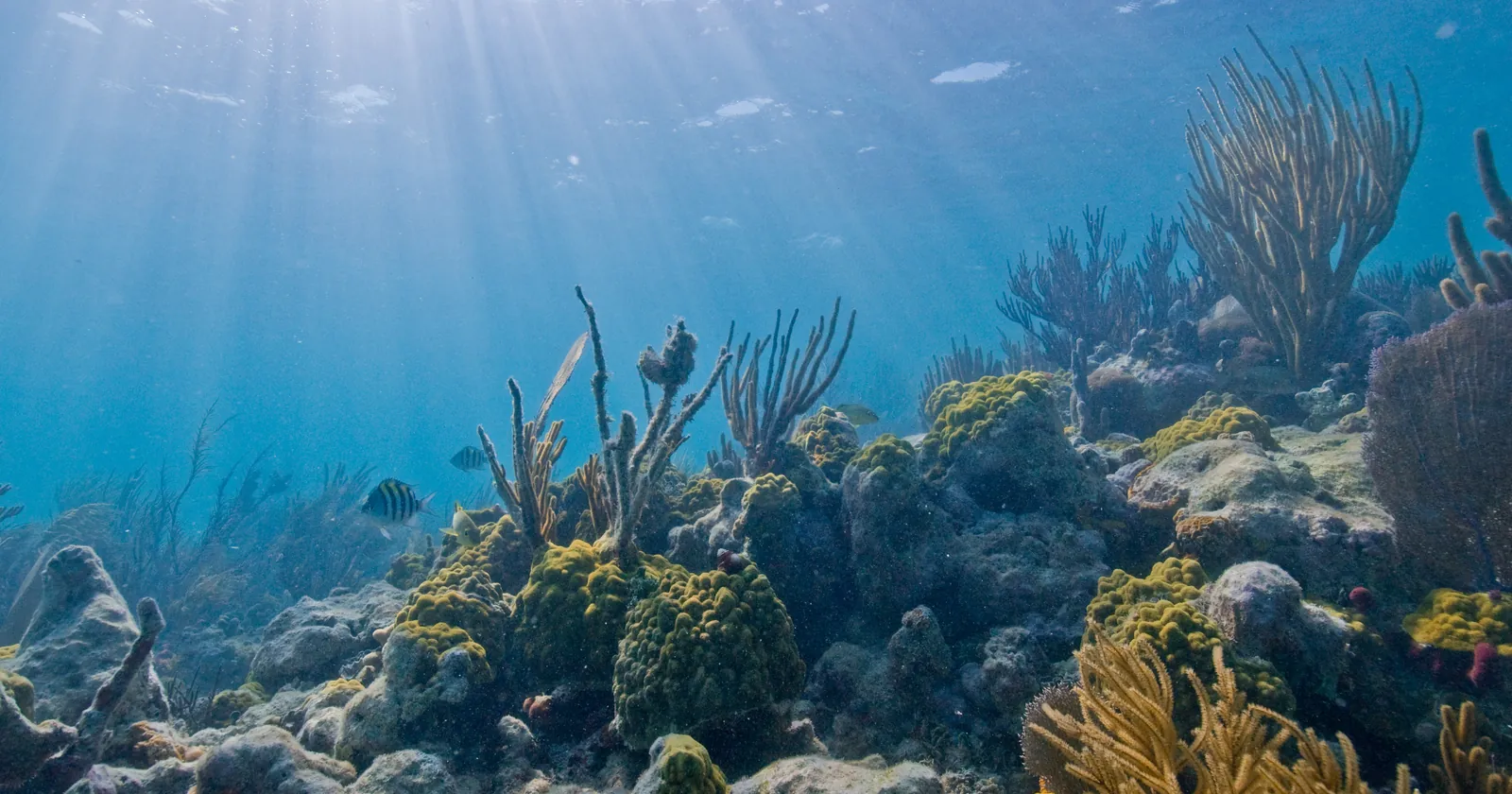
Photo: US National Park Service, Wikimedia Commons, public domain.

Key takeaways
- Biscayne National Park covers about 172,971 acres with 9,075 acres of land, holds the northern end of the Florida Reef and is reached almost entirely by boat
- The Maritime Heritage Trail buoys six sites; Park Service buoy data puts the Mandalay at 8 to 11 feet, the Erl King at 15 to 20, the Alicia at 16 to 20 and the Lugano at 18 to 22
- HMS Fowey, lost in 1748, lies in a closed area where swimming, snorkelling, diving and anchoring are barred, and Florida added a trap ban over it in February 2023
- Rule 50 CFR 622.182 bans spearfishing gear in a box off Key Biscayne measured in minutes of latitude, and the Neptune Memorial Reef sits inside it at 43 to 45 feet
- The 17-month PortMiami dredge of 2013 to 2015 moved 4.39 million cubic metres of material, and three peer-reviewed studies still disagree about what it cost the reef
Most Miami diving happens inside a national park that is 95 per cent water
The boat ride out of Miami does not end at a dive site so much as at a park boundary. Biscayne National Park begins just south of Key Biscayne and covers roughly 172,971 acres, about 69,998 hectares. Of that, only 9,075 acres is dry, and the Park Service states flatly that the park is 95 per cent water.
What sits under the surface is the top end of a single long structure. The park protects the northern extent of the Florida Reef, a coral barrier tract the Park Service measures at about 275 kilometres, or 170 miles. Inside the boundary are more than 40 keys and 4,825 acres of mostly undeveloped mangrove shoreline. Elliott Key is the largest island in the park, and a track called Spite Highway still runs roughly six miles down the middle of it.
The park calls itself the largest marine park in the national park system, and describes its reefs as “the only continental subtropical coral reef and marine environment in the United States”. Both claims come from its own foundation document rather than from an independent ranking. Read them as the agency’s framing of what it manages.
Access is the practical catch. The foundation document says the primary means of reaching park waters is “by private, partner, or commercial permit-holding operators”, which in plain terms means a boat. Park headquarters sits on the mainland at Convoy Point, 9700 SW 328th Street in Homestead, well south of the hotel strip. Nobody swims to this reef from South Beach.
The founding law of Biscayne National Park keeps its reefs open to fishing
Divers arriving from the Keys often expect a no-take zone and find anglers instead. The reason is statutory and it is old. Section 4 of Public Law 90-606, signed on 18 October 1968, established Biscayne National Monument and provided that waters within it “shall continue to be open to fishing in conformity with the laws of the State of Florida except as the Secretary [of the Interior] … fishing is prohibited, limited or otherwise regulated in the interest of sound conservation”.
That language survived the upgrade. On 28 June 1980, Public Law 96-287 turned the monument into a park and added land north of Boca Chita Key, and section 103(a) repeated much the same sentence about fishing. Congress wrote the rod into the deed. Any restriction since has had to be argued against that starting point.
The argument came to a head in 2015. A final general management plan, released on 5 June 2015, proposed a no-fishing marine reserve zone of 10,502 acres, about 6 per cent of park waters, on the grounds that a marine reserve is one of the most effective ways to let a reef recover.
It never opened. In February 2020 the Florida Fish and Wildlife Conservation Commission approved a fisheries management plan for the park with no reserve in it, substituting five Coral Reef Protection Areas: Fowey Rocks Lighthouse, Alina’s Reef, Marker 3 Reef, Lob120 Reef and Ball Buoy. Inside those five, all traps and all lobster harvest are prohibited. Hook and line fishing continues.
The rest of the rulebook is state law under chapter 68B-7 of the Florida Administrative Code, in force from 1 July 2020 with updates on 1 April 2023 and 1 March 2026. Nine species carry higher minimum sizes inside the park than outside it, and a 10-fish aggregate bag covers drums, flounder, grouper, jacks, porgies and snapper. Lobster harvest stops entirely in the Biscayne Bay and Card Sound Lobster Sanctuary, from the shore out to the barrier islands.
The Maritime Heritage Trail is six sites, and the park publishes the depth of every buoy
Wreck diving here is shallow, marked and documented to a degree that is unusual. The park has mapped six sites into a Maritime Heritage Trail, produced brochures for them and installed mooring buoys, and it publishes the coordinates and depth of each individual buoy. Use of a buoy is limited to four hours by any one boat.
Sorted by depth, the trail runs from snorkel to scuba. The Mandalay, a steel-hulled schooner lost in 1966 and known as the red carpet ship of the windjammer fleet, sits under four buoys reading 8 to 11 feet. Next up is the Arratoon Apcar, aground in 1878 near the men who were then building Fowey Rocks Lighthouse, at 11 to 18. Deeper again come the Erl King of 1891 at 15 to 20 feet, the Alicia of 1905 at 16 to 20, and the Lugano of 1913 at 18 to 22.
Two of them carry a story worth knowing before you get wet. The Alicia went down loaded with silks, silverware and fine household goods, and the salvage disputes that followed, in the park service’s own words, “led to a permanent rewriting of U.S. salvage laws”. The Lugano had been the largest vessel ever wrecked in the Florida Keys. An unnamed nineteenth-century wooden sailing vessel, marked only by its ballast stones, lies under two buoys at 10 and 11 feet.
The seventh feature on the trail is not a wreck at all. Fowey Rocks Lighthouse was constructed between 1875 and 1878, first lit in 1878, stands 130 feet above the water and is nicknamed the Eye of Miami. Nine mooring buoys ring its base at 8 to 30 feet, with a tenth at 56 feet, and the Coast Guard still maintains the light. The tower itself is closed, and the park’s foundation document estimates it will reach catastrophic impairment within 25 years.
Six is not the whole inventory. The same document counts “more than 100 submerged archeological sites in the park”, including wrecks, navigational aids and loose artifacts, most of them unbuoyed and unmarked. Our wreck diving guide covers coasts where the shipping did the same work.
Two Miami wrecks with opposite rules: HMS Fowey and the Half Moon
One wreck here is older than the United States and you may not go near it. HMS Fowey, a fifth-rate Royal Navy frigate, struck a reef and sank on 27 June 1748 at what is now called the Legare Anchorage, east of Elliott Key. Restrictions on in-water activity have stood there since about the time of Hurricane Andrew in 1992. Swimming, snorkelling, diving and anchoring are all prohibited inside the closed area.
Her legal status is stranger than her depth. Britain never relinquished title, and the park announced an agreement with the United Kingdom in 2013 recognising British ownership while the National Park Service manages the site, under its own policies, the Sunken Military Craft Act of 2004 and the UNESCO underwater heritage framework. The park’s own inventory of administrative commitments dates the memorandum 13 August 2015, so the two records differ on which signature counts.
Protection kept tightening. A major in-situ stabilisation project was carried out on the wreck in 2014, and on 21 February 2023 the state wildlife commission banned recreational and commercial traps across the Legare Anchorage site, roughly 1.2 square miles. Trawling was already out. The foundation document explains the vigilance in one sentence: the park “suffers from one of the highest number of incidents of vandalism, especially relating to looting of shipwrecks, within the national park system”.
Now the opposite case. Just outside Bear Cut, between Virginia Key and Key Biscayne, lies the Half Moon, a 366-ton two-masted steel schooner-yacht built in Germany in 1908 for Count Bohlen und Halbach and originally named Germania. Seized as a prize of war in 1914 and taken to New York, she ended her working life in Miami as a floating saloon and sank in the early 1930s. The Park Service dates the loss to a storm in 1930 and gives her as 155 feet by 40.
She is Florida’s seventh Underwater Archaeological Preserve, and the state invites people onto her. The wreck lies in 8 to 10 feet of water, with structure three to four feet below the surface, which makes her a snorkel as much as a dive. Miami-Dade’s artificial reef catalogue files the same site as a 154-foot steel sailing yacht in 10 feet. One is a grave. The other is a swim.
The speargun ban off Key Biscayne has its corners in the Code of Federal Regulations
North of the park boundary, one stretch of water off Key Biscayne is governed by a federal fishery rule rather than by park regulation, and divers regularly miss it. Section 622.182 of title 50 of the Code of Federal Regulations lists fifty-one special management zones in the South Atlantic. Number twenty-one on that list is named Key Biscayne/Artificial Reef H.
The rule draws it as a rectangle, corner by corner. It is “bounded on the north by 25°42.82′ N. lat.; on the south by 25°41.32′ N. lat.; on the east by 80°04.22′ W. long.; and on the west by 80°05.53′ W. long.” That is one and a half minutes of latitude from top to bottom, a box you can cross on one tank of air.
Two restrictions bite inside it. Table 2 of the section says that in zones (a)(1)(xix) and (a)(1)(xxi), “Use of spearfishing gear is prohibited”, and a separate line bars a sea bass pot or bottom longline across all fifty-one. Of the fifty-one zones the section lists, exactly two carry that speargun ban, and both of them are off Florida: the Ft. Pierce Inshore Reef and this one.
Miami-Dade County repeats the rule in plainer words in its own reef catalogue, where the whole site is headed Key Biscayne SMZ and annotated to say that spear guns, long lines and fish traps are prohibited. Note the mismatch: the county writes fish traps, the federal text says sea bass pot. If you fish as well as dive, read the federal wording rather than the summary.
The county also marked the box physically. In June 1997 it dropped two structures named SMZ Buoy Reef NW and SMZ Buoy Reef SW, ten and eleven modules apiece with 550 tons of limestone boulders each, in 38 feet of water. Their published coordinates land on the northwest and southwest corners of the federal rectangle. Leave the gun on the boat and take the action camera instead.
A Boeing 727, three tugs and a 215-foot barge went down off Key Biscayne
Inside and around that box lies a long run of deliberately sunk steel, put there on purpose and written down. Miami-Dade County started its artificial reef programme in 1981 and now manages 11 inshore and 17 offshore sites, into which it records placing nearly 50 large vessels, two retired oil production platforms, thousands of tons of cast concrete and limestone, and surplus United States Army tanks.
The Key Biscayne site predates the programme itself. A 120-foot steel ship named Biscayne went down in December 1974 in 60 feet. The Orion, a 118-foot steel tug, followed in December 1981 in 88 feet, and the 200-foot Lakeland in June 1982 in 135. By January 1985 the 220-foot Proteus was on the bottom at 72 feet.
Then came the run of tugs that most Miami boats still dive. The Rio Miami, 105 feet, went in during November 1989 at 67 feet, and the county credits her 30 feet of relief, a tall profile for a 105-foot hull. Belzona I followed in May 1990 at 68 feet, Belzona II in February 1991 at 60, and Belzona III in June 1991 at 65. The 215-foot Belzona Barge settled in 40 feet in August 1991, which puts it well inside a first dive of the day.
An aircraft is on this list too, and the county files it like any other object. Spirit of Miami, a 727 jet, was deployed in September 1993 in 115 feet with 15 feet of relief. Nearby, the 235-foot Sheri-Lyn lies in two pieces at 100 feet, bow and stern sunk separately in June 1987. Two M60 army tanks went down further north in June 1994, in 47 and 49 feet.
Three of the hulls arrived by way of the courts. In July 2001 the county sank the Etoile de Mer, the Miguana and the Brandy Wine, all three recorded in the catalogue as seized by US Customs, at 131, 138 and 145 feet. Plenty of the list is far beyond recreational reach: the Davey Hurst sits at 265 feet, the Tenneco oil platforms at 105, 110 and 185. The newest entry is not steel at all, but 22 concrete cars placed off South Beach in October 2025 in 22 feet.
Neptune Memorial Reef is a cemetery, and the county files it at 43 to 45 feet
Somewhere in that same rectangle, divers swim through a graveyard. The Neptune Memorial Reef is a permitted artificial reef built as an interpretation of the lost city of Atlantis, into whose concrete features cremated remains are set. Its operators place it 3.25 miles east of Key Biscayne. It is a cemetery that people book as a dive.
The county files it like any other deployment, and the numbers are more precise than the marketing. Phase I, listed as concrete prefabricated pieces, went in during October 2007 at 45 feet with 20 feet of relief. A second phase followed in August 2018 at 43 feet with 13 feet of relief. Both are recorded at 25°42.035′ N, 80°05.398′ W.
That position matters for more than navigation. It falls inside the Key Biscayne special management zone, and the county files the memorial under exactly that heading, which means the federal speargun ban runs over the graves as well as over the tugs. Depth figures quoted elsewhere for the site, usually 40 feet, do not match the county record. Where the two differ, the county catalogue is the one with a deployment date attached.
Seventeen months of dredging at PortMiami, and the argument over what it killed
Ask about the state of the reef here and the conversation turns, fast, to a shipping channel. Widening the entrance at the Port of Miami ran, in the words of the study that measured it, “during a 17-month period between November 20, 2013, and March 16, 2015”, and moved a reported 4.39 million cubic metres of material. Three peer-reviewed papers have since tried to price the damage. They do not agree.
Miller and colleagues, publishing in PeerJ in 2016, went back in December 2015 and sampled at 100, 200, 300, 500 and 700 metres from the channel. Mean sediment depth at the reference location was 0.3 cm against 3.0 cm at 200 metres, ten times higher. Complete colony mortality hit 17 of 55 channel-side colonies, 31 per cent, against 6 of 58 at reference sites. Their sharpest finding was about the monitoring: effects reached 700 metres while the project’s own programme looked out to 50.
The counter-case is just as quantified. Gintert and colleagues, in Environmental Monitoring and Assessment in 2019, compared measured mortality at 30 sites across Miami-Dade County against three predictive scenarios. Species-specific disease susceptibility determined 93.3 per cent of the mortality, they found, while dredging stress predicted it 6.7 per cent of the time.
Their headline figure is that climate-driven disease was “more than an order of magnitude (14x) more deadly” than the dredge. One caveat belongs next to it. Several of the authors worked for the consultancy running the port’s compliance monitoring and one for the county environmental department, which the paper states in its own author list.
Then the question reopened from an unexpected direction. Dobbelaere and colleagues, writing in Marine Pollution Bulletin in 2024 from UCLouvain with co-authors at Louisiana State, NOAA and the Florida wildlife commission, note that stony coral tissue loss disease “reportedly initiated in September 2014 at a reef site off Virginia Key” during the dredging. Their ocean model found the site could have been reached by fine sediments from the work, “especially those involving non-conventional rock-chopping techniques”, and ruled wastewater unlikely.
For a visiting diver the practical reading is narrow. The sites closest to Government Cut carry the longest paper trail of damage in Florida, the disease and the dredge overlapped in time and place, and no published study has separated them to everyone’s satisfaction. Expect low stony coral cover and a lot of fish. The question is not settled.
The corals in Miami’s shipping channel did not die the way the offshore reefs did
One result from the same water runs against every expectation. NOAA and university researchers have monitored sites inside the Port of Miami since 2018, and reported in Scientific Reports in 2023 that those sites show “periodic extremes in temperature, seawater pH, and salinity, far in excess of what have been measured in most coral reef environments”. Corals grow there anyway.
Which corals is the detail that matters. Diverse coral communities are recorded “growing on artificial substrates at these sites”, and many of the more prevalent species in them “are now conspicuously absent or in low abundance on nearby reefs, owing to their susceptibility and exposure to stony coral tissue loss disease”. Seawalls are holding species the reef has lost.
The authors put the limit on their own finding, and it is worth quoting rather than paraphrasing. “Natural reef frameworks, however, are largely absent at the urban sites and while diverse fish communities are documented, it is unlikely that these communities provide the same goods and services as natural reef habitats.” A tolerant coral on concrete is not a reef.
None of this is a dive site. The work runs on port structures inside a busy commercial channel, which is why the best-known window onto it is a camera. Coral Morphologic, a co-author on the paper, has run the Coral City Camera on a port structure since February 2020 and says it has logged 220 fish species and 27 of Florida’s 48 stony coral species at the one site.
Five Miami watersports businesses sit in a register, and four of them dive
Our own list is short, and its shape says something about the city. The Miami operator list holds 5 businesses, read on 20 September 2026: 4 published by SSI in its register of affiliated training centres and 1 by IKO in its register of affiliated kitesurf schools. Four of the five publish a website there.
The sports do not separate cleanly. Juliet Sailing and Diving is filed under both sailing and diving, which fits a city where the same boat sells both; South Florida Kiteboarding LLC is the sole IKO entry and is the one with no website in its register. SSI additionally rates Ace Diving for freediving, extended range and rebreather programmes, and Underwater Unlimited for freediving. A rating is a listing, not a promise that anything runs this week.
Read the shortness of that list correctly. These are membership registers rather than licences, and a business that never joined SSI or IKO does not appear in either, whatever it teaches. IKO’s own site claims more than 350 affiliated schools against the 291 its feed returns, which is the size of the gap in one register alone. Which registers can be read sets out what each source returns and when it was read.
One practical number is worth carrying regardless of who you book. Divers Alert Network runs an emergency line on +1-919-684-9111, staffed around the clock, and its own guidance is to call 911 or the local equivalent first and to get the injured person to the nearest medical facility, then contact DAN. Hyperbaric treatment is arranged through that route, not looked up in advance. Cover for it is a separate purchase, which is what our dive insurance comparison is for.
Note: Conditions, safety guidance, and visa rules change. Verify current information with official sources (dive operator, coastguard, and the relevant government) before you travel or dive.
FAQ: scuba diving in Miami
Is diving in Miami inside a national park?
Much of it is. Biscayne National Park runs south from Key Biscayne and covers about 172,971 acres, of which the Park Service says 95 per cent is water and 9,075 acres is land. It holds the northern end of the Florida Reef. Park waters are reached almost entirely by boat, either private or through an operator holding a commercial permit, and the mainland headquarters sits at Convoy Point in Homestead.
Which Miami wrecks can you dive, and which are closed?
The park's Maritime Heritage Trail marks six sites with mooring buoys, and the Park Service names the Erl King, the Alicia and the Lugano as the ones best suited to scuba. The Mandalay and the Arratoon Apcar are shallow enough to snorkel. HMS Fowey, lost in 1748 in the Legare Anchorage, is closed: swimming, snorkelling, diving and anchoring are all barred there.
Can you spearfish while diving off Key Biscayne?
Not inside the marked box. Federal rule 50 CFR 622.182 lists a special management zone called Key Biscayne/Artificial Reef H, bounded north by 25 degrees 42.82 minutes and south by 25 degrees 41.32 minutes, east by 80 degrees 04.22 minutes and west by 80 degrees 05.53 minutes. For that zone the rule says use of spearfishing gear is prohibited. Sea bass pots and bottom longlines are barred there too.
How deep is the Neptune Memorial Reef off Miami?
The Miami-Dade artificial reef catalogue files Phase I at 45 feet with 20 feet of relief, deployed in October 2007, and Phase II at 43 feet with 13 feet of relief, deployed in August 2018. Both sit at 25 degrees 42.035 minutes north, 80 degrees 05.398 minutes west. The memorial's own site places it 3.25 miles east of Key Biscayne.
Did the PortMiami dredging damage the reef that Miami divers visit?
The research disagrees about how much. Miller and colleagues found sedimentation effects up to 700 metres from the channel, with complete mortality in 31 per cent of channel-side colonies against 10 per cent at reference sites. Gintert and colleagues, comparing 30 sites across Miami-Dade, concluded that disease susceptibility explained 93.3 per cent of mortality and dredging 6.7 per cent. A 2024 modelling study put the dredge back in the frame.
Why is there no no-fishing marine reserve on the Miami reef?
Because the park's founding statute protects fishing access. Public Law 90-606 of 18 October 1968 says park waters shall continue to be open to fishing in conformity with the laws of the state of Florida, and the 1980 law that made the monument a park repeated it. A 10,502-acre marine reserve zone was proposed in 2015. In February 2020 the state approved five Coral Reef Protection Areas instead.
Founder of NOMADREEF and a former digital nomad. This guide is sourced from the references below; conditions, prices and rules change, so verify current details, and follow qualified local guidance and safety briefings. About the author · LinkedIn ↗
Sources
- The park’s size, its reef and its water share. Approximately 69,998 hectares (172,971 acres); authorised as a national monument on 18 October 1968 and redesignated and expanded on 28 June 1980; the northern end of the Florida Reef, an extensive coral barrier tract of about 275 km (170 mi). National Park Service, NPS Geodiversity Atlas, Biscayne National Park. The figure of 9,075 acres of land is the NPS land total reported for the park; the statement that “Biscayne National Park is 95% water” is on the park’s own front page. Elliott Key as “the largest island in the park” and the roughly six-mile Spite Highway down its centre are from Elliott Key. All read 20 September 2026.
- The founding statutes, the access note, the wreck count and the vandalism finding. Public Law 90-606 of 18 October 1968 and its section 4 on fishing; Public Law 96-287 of 28 June 1980 and its section 103(a); 4,825 acres of mangrove shoreline and more than 40 keys; “the primary means of access to park waters is by private, partner, or commercial permit-holding operators”; the largest marine park in the national park system and “the only continental subtropical coral reef and marine environment in the United States”; more than 100 submerged archeological sites; Legare Anchorage restrictions in place since about the time of Hurricane Andrew (1992); the 2014 HMS Fowey stabilisation project; the memorandum with the United Kingdom dated 13 August 2015; Fowey Rocks Lighthouse listed in the national register in 2011 and estimated to reach catastrophic impairment within 25 years; one of the highest rates of shipwreck looting and vandalism in the national park system; the City of Islandia dissolved in 2012. National Park Service, Biscayne National Park Foundation Document (PDF). Read 20 September 2026.
- The marine reserve that was proposed and the areas that replaced it. A no-fishing marine reserve zone of 10,502 acres, about 6 per cent of park waters, in the final general management plan released 5 June 2015. National Park Service, Final Biscayne National Park General Management Plan Released. The five Coral Reef Protection Areas (Fowey Rocks Lighthouse, Alina’s Reef, Marker 3 Reef, Lob120 Reef and Ball Buoy), the trap and lobster prohibition inside them, the nine raised minimum sizes, the 10-fish aggregate bag, the Biscayne Bay and Card Sound Lobster Sanctuary, and the effective dates of 1 July 2020, 1 April 2023 and 1 March 2026 under chapter 68B-7 of the Florida Administrative Code are from the Florida Fish and Wildlife Conservation Commission, Biscayne National Park fishing regulations. Both read 20 September 2026.
- Every trail wreck, its year and its buoy depths. Six mapped wrecks with brochures and mooring buoys; Arratoon Apcar (1878), Fowey Rocks Lighthouse (1878), Erl King (1891), Alicia (1905), Lugano (1913), Mandalay (1966) and an unnamed nineteenth-century wooden sailing vessel; the Erl King, Alicia and Lugano best suited to scuba; the Alicia’s cargo and the rewriting of United States salvage law; the Lugano as the largest vessel ever wrecked in the Florida Keys. National Park Service, Maritime Heritage Trail. Buoy-by-buoy depths (Mandalay 8, 9, 10 and 11 ft; Arratoon Apcar 11, 15, 16 and 18 ft; Erl King 15, 16, 19 and 20 ft; Alicia 16, 19, 20 and 20 ft; Lugano 18, 19 and 22 ft; Schooner Wreck 10 and 11 ft; Fowey Rocks 8 to 30 ft over nine buoys plus one at 56 ft) and the four-hour limit are from Mooring Buoy Locations. Fowey Rocks Lighthouse built 1875 to 1878, first lit 1878, 130 feet, the Eye of Miami, light still maintained by the Coast Guard, from Fowey Rocks Lighthouse. All read 20 September 2026.
- HMS Fowey and the closure over her. A fifth-rate frigate that struck a coral reef and sank on 27 June 1748; the agreement with the United Kingdom recognising British title while the National Park Service manages the wreck under its own policies, the Sunken Military Craft Act of 2004 and UNESCO underwater heritage conventions; the wreck closed to the public. National Park Service, National Park Service Signs Agreement with Great Britain to Protect 18th-Century Shipwreck. The trap prohibition of 21 February 2023 over the Legare Anchorage site, approximately 1.2 square miles east of Elliott Key, with trawling already banned, is from the Florida Fish and Wildlife Conservation Commission, FWC approves rule to protect cultural resources in Biscayne National Park. Both read 20 September 2026. The park announces the agreement as signed in 2013 while its own foundation document dates the memorandum 13 August 2015; both are given as stated.
- The Half Moon. Built in Germany in 1908 for Count Bohlen und Halbach as the Germania, a 366-ton two-masted steel schooner-yacht; seized as a prize of war in 1914 and taken to New York; renamed in Miami and used as a floating saloon until sunk in the early 1930s; lying in 8 to 10 feet just outside Bear Cut. Florida Public Archaeology Network and the Florida Division of Historical Resources, Museums in the Sea, Half Moon. Florida’s seventh Underwater Archaeological Preserve, dimensions of 155 feet by 40 feet, a loss dated to a storm in 1930, and structure three to four feet below the surface, from the National Park Service, Half Moon Shipwreck. Both read 20 September 2026. The state dates the sinking to the early 1930s and the Park Service to 1930; the county catalogue records the hull as 154 feet against the Park Service’s 155.
- The special management zone and the speargun ban. The zone the rule calls Key Biscayne/Artificial Reef H (the rule writes the name with a dash before the H) is “bounded on the north by 25°42.82′ N. lat.; on the south by 25°41.32′ N. lat.; on the east by 80°04.22′ W. long.; and on the west by 80°05.53′ W. long.”, at paragraph (a)(1)(xxi); Table 2 to paragraph (a)(2), row “(a)(1)(xix) and (a)(1)(xxi): Use of spearfishing gear is prohibited”, and row “(a)(1)(i) through (li): Use of a sea bass pot or bottom longline is prohibited”; the section lists fifty-one zones, of which (xix), the Ft. Pierce Inshore Reef, and (xxi) are the two carrying the speargun ban. 50 CFR 622.182, gear-restricted areas. Read 20 September 2026.
- Every artificial reef date, depth, length and relief off Miami. Programme established 1981; 11 inshore and 17 offshore sites; nearly 50 large vessels, two retired oil production platforms and surplus army tanks. Under the Key Biscayne SMZ heading, with the county’s own note that spear guns, long lines and fish traps are prohibited there: Biscayne (120-foot steel ship, Dec 1974, 60 ft); Orion (118-foot steel tug, Dec 1981, 88 ft); Lakeland (200-foot steel ship, Jun 1982, 135 ft); Proteus (220-foot steel hull, Jan 1985, 72 ft); Sheri-Lyn bow and stern (235-foot steel ship, Jun 1987, 100 ft each); Rio Miami (105-foot steel tug, Nov 1989, 67 ft, 30 ft relief); Belzona I (85-foot tug, May 1990, 68 ft), Belzona II (90-foot, Feb 1991, 60 ft), Belzona III (100-foot, Jun 1991, 65 ft); Belzona Barge (215-foot steel barge, Aug 1991, 40 ft); Spirit of Miami (727 jet, Sep 1993, 115 ft, 15 ft relief); SMZ Buoy Reef NW and SW (Jun 1997, 10 and 11 modules, 550 tons of limestone boulders each, 38 ft, at 25°42.800′/ 80°05.516′ and 25°41.317′/80°05.517′); Davey Hurst (Apr 1998, 265 ft); Etoile de Mer, Miguana and Brandy Wine, all recorded as seized by US Customs (Jul 2001, 131, 138 and 145 ft); Neptune Memorial Reef Phase I (Oct 2007, 45 ft, 20 ft relief) and Phase II (Aug 2018, 43 ft, 13 ft relief), both at 25°42.035′ N, 80°05.398′ W. Elsewhere: Tenneco platforms (Oct 1985, 105, 110 and 185 ft); Army Tank #1 and #2, M60 (Jun 1994, 49 and 47 ft); Half Moon Wreck (154-foot steel sailing yacht, 1930, 10 ft); Reefline, 22 concrete cars (Oct 2025, 22 ft). Miami-Dade County Department of Environmental Resources Management, Artificial Reef Program catalogue, November 2025 (PDF), and Artificial Reef Deployments. Both read 20 September 2026.
- Neptune Memorial Reef’s own account of itself. Sited 3.25 miles east of Key Biscayne, built as an artistic interpretation of the lost city of Atlantis, with cremated remains deployed to the reef. Neptune Memorial Reef. Read 20 September 2026. The depth of 40 feet quoted for the site in secondary listings is not on the memorial’s own page and does not match the county deployment record of 43 and 45 feet used above.
- The dredge and the three studies. The 17-month project between 20 November 2013 and 16 March 2015, 4.39 million m³ dredged, assessment locations at 100, 200, 300, 500 and 700 m, mean sediment depth 0.3 cm at reference against 3.0 cm at 200 m, complete mortality in 17 of 55 channel-side colonies (31 per cent) against 6 of 58 reference colonies, and impacts detected to 700 m where project monitoring reached 50 m: Miller et al., Detecting sedimentation impacts to coral reefs resulting from dredging the Port of Miami, Florida USA, PeerJ 4:e2711 (2016). The 30 sites, the 93.3 per cent and 6.7 per cent split and the 14x figure: Gintert et al., Regional coral disease outbreak overwhelms impacts from a local dredge project, Environmental Monitoring and Assessment 191:630 (2019); the paper’s author list records affiliations at Dial Cordy and Associates, the firm running the port’s marine monitoring, and at the Miami-Dade Division of Environmental Resources Management. The onset off Virginia Key in September 2014, the rock-chopping finding and the exclusion of wastewater: Dobbelaere et al., Investigating the link between the Port of Miami dredging and the onset of the stony coral tissue loss disease epidemics, Marine Pollution Bulletin 207:116886 (2024). All read 20 September 2026.
- The port corals. Monitoring since 2018; “periodic extremes in temperature, seawater pH, and salinity, far in excess of what have been measured in most coral reef environments”; diverse coral communities on artificial substrates; prevalent species “conspicuously absent or in low abundance on nearby reefs” because of stony coral tissue loss disease; and the authors’ own caveat that natural reef frameworks are largely absent. Enochs et al., Coral persistence despite marginal conditions in the Port of Miami, Scientific Reports 13:6759 (2023). Read 20 September 2026. The camera going live in February 2020, the 220 fish species and the 27 of Florida’s 48 stony coral species are the operator’s own figures for its own site, Coral Morphologic, Coral City Camera, not an independent count.
- The five businesses. Five watersports businesses on the Miami operator list, read 20 September 2026: four published by SSI in its register of affiliated training centres and one by IKO in its register of affiliated schools, with four of the five publishing a website there. SSI additionally rates Ace Diving for freediving, extended range and rebreather programmes and Underwater Unlimited for freediving. The gap between IKO’s claim of more than 350 affiliated schools and the 291 its feed returns, and the limits of each source, are set out on which registers can be read.
- The emergency line. The DAN emergency hotline on +1-919-684-9111, available 24/7/365, and the instruction to call 911 or the local equivalent first and get the injured person to the nearest medical facility before contacting DAN. Divers Alert Network, Emergency Assistance. Read 20 September 2026. Which Miami hospital operates a chamber on a given day is not stated here: the hospital pages that would confirm it could not be opened, and hyperbaric treatment is arranged through the hotline rather than chosen in advance.