Key West Diving: The Reefs Still Under the 1997 Rules, the Vandenberg and the Dry Tortugas Permits
 by Yannick Schroth
Sep 24, 2026
15 min read
by Yannick Schroth
Sep 24, 2026
15 min read
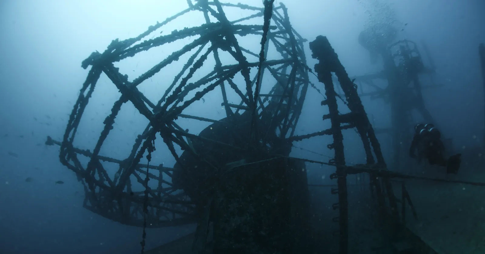
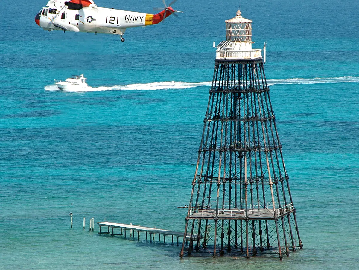
Photo: US Navy, Mass Communication Specialist 2nd Class Nicholas S. Tenorio, January 2015, Wikimedia Commons, public domain.
_wreck_off_Key_West_in_January_2015.JPG)
Key takeaways
- Governor DeSantis certified the 2025 Florida Keys sanctuary rule unacceptable in state waters on 3 March 2025, and NOAA’s zone data places Sand Key, Rock Key and Eastern Dry Rocks in state waters
- The 2025 rule abolished Rock Key SPA and banned anchoring in every SPA from 19 January 2027, yet NOAA’s own SPA page lists all three Key West areas among the exceptions and still lists Rock Key
- Western Dry Rocks closes to fishing from 1 April to 31 July under a Florida rule that sunsets on 31 March 2028; the rule does not restrict diving
- FWC files the Vandenberg at 145 feet with 100 feet of relief; a NOAA study found scuba diving on the nearby natural reefs rose 23.5 percent after the sinking, so the wreck did not relieve them
- Diving in Dry Tortugas National Park from a private boat needs a park permit under 36 CFR 7.27, and the ferry and seaplane cannot carry scuba tanks
Key West’s reef dives sit in state waters, where the 2025 sanctuary rules were blocked
The reef line southwest of Key West carries three Sanctuary Preservation Areas of the Florida Keys National Marine Sanctuary: Sand Key, Rock Key and Eastern Dry Rocks. The sanctuary’s buoy file lists 26 mooring buoys at Sand Key Reef, 12 at Eastern Dry Rocks and 11 at Rock Key. NOAA’s zone data, revised on 28 April 2026, gives all three the same attribute: within state waters, yes. That one field decides which rulebook a dive boat is under.
On 17 January 2025 NOAA published the final rule of its Restoration Blueprint, 90 FR 6104, rewriting the sanctuary’s regulations. The rule set its own condition. It would take effect after 45 days of continuous session of Congress, but if Florida’s governor certified any part unacceptable, that part “will not take effect in State waters of the sanctuary”.
On 3 March 2025 Governor Ron DeSantis wrote to the Secretary of Commerce and did exactly that. He certified that the designation documents and final rule “are unacceptable, and therefore, shall not take effect in the area of the Sanctuary lying within the seaward boundary of the State of Florida”, and added that prior rules and management plans “will remain in place”.
So the water off Key West runs on two sets of paper. Past the state line, the 2025 rules apply; Keys Weekly reported in March 2026 that NOAA treats them as in force in federal waters since 5 March 2025. Inside the line, the 1997 text still governs. Published figures for how the sanctuary divides between the two disagree with each other, so no share is given here.
One oddity catches anyone who looks the rules up. NOAA’s regulations page sends readers to 15 CFR 922 Subpart P, and the electronic code, current to 22 September 2026, still prints the 1997-era text with only a pointer to the 2025 amendment. The rule promised a Federal Register notice announcing its effective date. A search of the register on 24 September 2026 found none.
Rock Key was cut from the 2025 rule and is still a Key West preservation area
The 2025 rule did not only tighten. In its answers to public comments, NOAA listed five marine zones it was eliminating “due to resource condition changes”, and two of them were preservation areas: Rock Key and French Reef. Removing them, NOAA wrote, “removes restrictions on fishing in these areas”. Read on its own, the federal rule opens Rock Key to fishing.
At Key West the removal never landed. The sanctuary’s page of Sanctuary Preservation Areas still lists Rock Key SPA, and the 2026 zone data describes it at 0.104 square miles, in state waters and inside the Key West National Wildlife Refuge. Sand Key covers 0.448 square miles and Eastern Dry Rocks 0.142 in the same data. Southeast of town, the Western Sambo Ecological Reserve, 11.6 square miles with 22 buoys, is also filed in state waters and runs under the same 1997 prohibitions.
Inside the three preservation areas, the 1997 list applies. No discharge except cooling water or engine exhaust. No fishing. No possessing, moving, taking, damaging or spearing any coral, invertebrate, fish, algae, seagrass or shell, living or dead. No touching or standing on coral, living or dead. A boat carrying fish caught elsewhere must stow them and keep moving, because in a preservation area in state waters the vessel has to be in continuous transit.
Sand Key keeps one exception the 2025 rule deleted wherever it reached. The 1997 text allows “catch and release fishing by trolling” in four preservation areas, Sand Key among them, and the 2025 rule struck that line for all four. NOAA’s zone entry for Sand Key still carries it: fishing is prohibited “except for Sand Key where catch and release trolling is allowed”. A boat trolling a catch-and-release line through Sand Key is within the rules that apply there.
The 2027 anchoring ban skips all three Key West preservation areas
The 2025 rule’s summary is blunt: “anchoring is prohibited in all SPAs.” NOAA delayed that single provision until 19 January 2027 to finish a mooring buoy plan and install new buoys. For Key West that sentence is wrong. The sanctuary’s own SPA page says that in 2027, anchoring of any kind will be prohibited in SPAs “except for Hen and Chickens, Cheeca Rocks, Newfound Harbor Key, Eastern Dry Rocks, Rock Key, and Sand Key”. All three Key West areas are on that list.
What applies instead is the 1997 anchoring clause, and it is more specific than most summaries of it. No anchor, chain or rope may touch living or dead coral or any attached organism. “When anchoring dive boats, the first diver down must inspect the anchor”, and no further diving may take place until it is placed correctly. Anchoring instead of mooring when a mooring buoy is available is itself prohibited, so a free buoy is not optional.
A short run up the Keys, the picture changes. NOAA’s zone data puts the Looe Key preservation area in federal waters, and its entry carries the note that in 2027 anchoring by any means will be prohibited. The Key West Nursery Restoration Area, 47.6 acres of active coral nursery, is also federal and is transit only: no stopping, no anchoring, no fishing. A boat may cross it and may not stay.

Western Dry Rocks closes to fishing from April to July, not to Key West divers
West of Sand Key lies a Key West reef with a calendar attached. Florida Administrative Code rule 68B-6.004, in force since 1 April 2021, draws a box of state waters by four corner coordinates and states that “fishing and possession of fish are prohibited within Western Dry Rocks” from 1 April through 31 July. The Florida Fish and Wildlife Conservation Commission describes a one-square-mile area about 10 miles southwest of Key West, where snapper, grouper and permit gather to spawn.
The rule says nothing about diving. A diver who takes nothing is outside it, and the sanctuary buoy file lists eight mooring buoys on the site. A spearfisher is inside it: the rule’s stowage clause names spear gear, and on a boat crossing the box “appropriately stowed” means spear shafts may not be inserted into any spearing device. The closure also carries an end date. It “shall only remain in effect through March 31, 2028” unless the Commission renews or expands it.
The federal rule would have gone further. The 2025 text created a Western Dry Rocks Wildlife Management Area requiring “continuous transit without interruption and no anchor” from 1 April to 31 July, which would have ended stopping a boat there to dive. NOAA’s own answer to comments conceded “this area is in State waters”, and the same answer gives the closing date as July 3 where the regulation table says July 31. The April 2026 zone data lists no Western Dry Rocks zone at all.
The Vandenberg added Key West divers instead of taking them off the reef
The big wreck off Key West is a former missile tracking ship. The state wildlife commission’s artificial reef database files the General Hoyt S. Vandenberg as a 522-foot ship of 13,300 tons, deployed on 27 May 2009 in 145 feet of water with 100 feet of relief, and marks its jurisdiction as State. NOAA gives her length as 520 feet and calls her the largest vessel sunk as an artificial reef in the sanctuary. Two mooring buoys mark the site.
The sinking came with an ecological promise attached. Before permitting it, NOAA commissioned a study, and the hypothesis was that a new wreck would draw divers away from the natural reefs. The study compared May 2007 to April 2008 with July 2009 to June 2010, using dive shop logbooks and 72 days of on-water counts in each period.
The result ran the other way. Charter dives by scuba divers rose by 92.1 percent, and scuba diving on the surrounding natural reefs by 23.5 percent, or 5,214 dives, while diving on artificial reefs rose by 442 percent. The natural reefs’ share of use fell from 67 to 46.5 percent, but in NOAA’s words the hypothesis that the Vandenberg would reduce pressure on them “was not supported”. NOAA credits the Spiegel Grove, sunk off Key Largo in 2002, with benefits to the economy and the reef.
The Vandenberg has neighbors, and the state line runs between them. The commission’s database files Joe’s Tug, a 90-foot tugboat deployed on 21 January 1989 in 65 feet, as State. The Cayman Salvage Master, a 187-foot former US Army minelayer deployed on 30 April 1985 in 92 feet, is filed as Federal; the sanctuary’s buoy file calls the same wreck the Cayman Salvor. Two wrecks on one morning can sit under two sanctuary rulebooks. Our wreck diving guide covers other coasts built around sunk steel.
Key West dive-flag distances come from a Florida statute that asks for reasonable effort
The flag rule on the state-water reefs is Florida Statutes section 327.331, and it is worded more carefully than the usual summary. Every diver must prominently display a divers-down warning device: a red symbol with a white diagonal stripe, at least 20 by 24 inches when flown from a vessel and 12 by 12 inches when displayed from the water. On a boat it goes at the highest point, and it comes down once every diver is aboard. A divers-down buoy may not be displayed on board.
The distances carry a qualifier the retellings drop. On open water, divers “must make reasonable efforts to stay within 300 feet” of the device, and a boat operator “must make a reasonable effort to maintain a distance of at least 300 feet”. A boat that does come within 300 feet must “proceed no faster than is necessary to maintain headway and steerageway”. In rivers, inlets and navigation channels, both distances drop to 100 feet. A violation is a noncriminal infraction.
The sanctuary adds its own layer on each side of the line. The 1997 text still bars a boat from exceeding 4 knots, or making a wake, within 100 yards of a red and white divers-down flag, “or the blue and white ‘alpha’ flag in Federal waters”. The 2025 text drops the reasonable-effort wording altogether: divers “must stay within 300 feet” of the flag, and boats must hold idle speed and no wake inside that distance.
Fish feeding is banned on both sides, by different instruments. Florida rule 68B-5.005, in force since 1 January 2002, says “no diver shall engage in the practice of fish feeding” and bars any vessel for hire from carrying passengers to feed fish or watch it done in state waters. The 2025 sanctuary rule prohibits attracting or feeding fish, “including sharks”, from any vessel or while diving.
Dry Tortugas diving from Key West needs a private boat for the tanks, and a park permit
Almost 70 miles west of Key West, according to the National Park Service, lie the seven islands of Dry Tortugas National Park. The practical catch for divers is stated on the park’s own page: the ferry and seaplane cannot carry compressed canisters, so anyone planning to scuba dive must arrive by their own boat or a charter vessel. Visitors who take the ferry can snorkel. They cannot bring a tank.
The boat then needs paper, and the park’s boating page, updated on 31 August 2026, does not mention it. Rule 36 CFR 7.27(h) requires a permit from the superintendent “for all non-commercial vessels for which occupants are engaged in recreational activities”, naming mooring buoys, snorkeling and diving. The same section defines a permit as an authorization “in writing or orally (e.g., via radio or telephonically)”, and transit without stopping needs none. For the park’s permitting process, the sanctuary tells boaters to hail the park on VHF channels 10 and 16.
Inside the park’s Research Natural Area, 46 square statute miles in its northwest portion, anchoring and fishing are both prohibited and boats must use the designated mooring buoys, which the park limits to two hours of day use. Overnight anchoring is allowed only on sand within one nautical mile of the Garden Key light. Spearfishing and lobster harvest are banned park-wide, and guided diving for a fee needs a commercial authorization.
North of the park, the sanctuary’s Tortugas North Ecological Reserve needs a free permit, requested at least 72 hours ahead, valid up to two weeks. Diving is allowed from its buoys and anchoring is not; boats may not stop in Tortugas South. NOAA’s zone data puts part of Tortugas North in state waters, and the 1997 text that governs that part also requires a radio or telephone call to sanctuary staff 30 minutes to 6 hours before entering and on leaving. The permit page no longer mentions it.
Weather is the other permit. The park warns that a tropical storm can arise any day of the year, and that summer brings the calmer, rainier months while winter brings high winds. The National Hurricane Center puts the Atlantic hurricane season at 1 June to 30 November, with the peak on 10 September and most activity between mid-August and mid-October. Calm crossings and storm season overlap.
Key West’s Eastern Dry Rocks kept outplanted elkhorn through the 2023 heat, not staghorn
The reefs off Key West reached the disease front late. The sanctuary’s history of stony coral tissue loss disease records it in the Lower Florida Keys in spring 2018 and “beyond Key West” by the winter of 2018 to 2019, after isolated cases near Virginia Key in fall 2014. NOAA says it affects nearly half of the stony coral species on Florida’s reef. Dry Tortugas held out longest: the park found lesions on 11 colonies on 29 May 2021.
Then came the heat of 2023. After it, a NOAA cruise surveyed 64 locations at five of the seven Mission: Iconic Reefs sites, and Eastern Dry Rocks off Key West was one of them. Preliminary data released on 15 February 2024 found less than 22 percent of about 1,500 outplanted staghorn corals alive, all of them at the two northernmost reefs surveyed. Live outplanted elkhorn turned up at only three sites, and Eastern Dry Rocks was one.
Set expectations by that. NOAA’s zone entries for the three Key West preservation areas say they once held thickets of elkhorn and now contain “a high abundance of large ESA-listed star corals, remnant populations of ESA-listed pillar corals and a diverse assemblage of other boulder and plating coral species”. The same entries call all three important sites for “ongoing restoration of ESA-listed elkhorn and staghorn corals”, so much of the branching coral is restoration work. The Miami guide follows the same disease back to where it was first reported.
Six Key West dive businesses in the registers, three of them filed up the Keys
The Key West operator list holds 6 businesses. Five are published by SSI in its register of affiliated training centers, read on 20 September 2026, and one, Southpoint Divers, is a Green Fins digital member, read on 14 August 2026 and self-evaluated rather than assessed in person. All six publish a website.
The register’s town field says something about where Key West diving is sold. Of the five SSI entries, only Dive Key West and Finz Dive Center are filed in Key West. Captain Hook’s Looe Key Reef Adventures is filed in Big Pine Key, Looe Key Reef Resort in Ramrod Key, and Mote Marine Laboratory in Summerland. Where a business is filed is not where it dives, but two of them carry Looe Key in their names, and Looe Key sits in federal waters, where the 2027 anchoring ban applies.
SSI rates Captain Hook’s for Extended Range and Looe Key Reef Resort for Freediving, and it publishes the same website for Captain Hook’s and Dive Key West. A rating is a listing, not evidence that a course runs this season. These are membership registers rather than licenses; which registers can be read sets out what each one returns.
One number is worth carrying whoever you book. Divers Alert Network runs an emergency line on +1-919-684-9111, and its own guidance is to call 911 first in a life-threatening emergency, or get the injured person to the nearest medical facility, and to contact DAN after that. Cover for treatment is a separate purchase, which is what the dive insurance comparison is for.
FAQ: scuba diving in Key West
Can you anchor at Sand Key or Rock Key when diving in Key West?
Only under the 1997 conditions, and not if a mooring buoy is free. Both preservation areas lie in Florida state waters, where the 2025 sanctuary rule did not take effect. The 1997 text prohibits anchoring instead of mooring when a buoy is available, and bars any anchor, chain or rope from touching coral. The first diver down must inspect the anchor. The NOAA SPA page lists Sand Key, Rock Key and Eastern Dry Rocks among the exceptions to the 2027 anchoring ban.
How deep is the Vandenberg wreck off Key West?
The Florida Fish and Wildlife Conservation Commission files the General Hoyt S. Vandenberg in 145 feet of water with 100 feet of relief. Its database gives the ship as 522 feet long and 13,300 tons, deployed on 27 May 2009, under state jurisdiction. NOAA gives the length as 520 feet and calls her the largest vessel sunk as an artificial reef in the Florida Keys National Marine Sanctuary.
Can you dive Western Dry Rocks during the spring closure?
Yes, if you take nothing. Florida rule 68B-6.004 prohibits fishing and the possession of fish inside the Western Dry Rocks box from 1 April through 31 July, and its stowage clause covers spear gear. The rule does not restrict diving. A 2025 federal zone that would have required continuous transit there did not take effect, because the site lies in state waters. The state closure runs through 31 March 2028 unless renewed.
Do you need a permit to dive the Dry Tortugas from Key West?
On a private boat, yes. Rule 36 CFR 7.27(h) requires a permit from the park superintendent for non-commercial vessels whose occupants dive, snorkel or use mooring buoys, and the rule accepts an oral permit given by radio or telephone. The ferry and seaplane cannot carry scuba tanks. The sanctuary’s Tortugas North Ecological Reserve outside the park needs a separate free permit, requested at least 72 hours ahead.
How close must boats stay to a dive flag in Key West?
In state waters, Florida Statutes section 327.331 asks boat operators to make a reasonable effort to stay at least 300 feet from a divers-down device on open water, and 100 feet in rivers, inlets and channels. A boat inside those distances must go no faster than needed to keep headway and steerageway. Divers must make reasonable efforts to stay within the same distances of their flag.
Note: Conditions, safety guidance and regulations change. Verify current information with official sources, including the dive operator, the park authority and the relevant government department, before you travel or dive.
Founder of NOMADREEF and a former digital nomad. This guide is sourced from the references below; conditions, prices and rules change, so verify current details, and follow qualified local guidance and safety briefings. About the author · LinkedIn ↗
Sources
- The 2025 rule, its effective-date condition and what it changed near Key West. Primary source. NOAA, Regulations for the Florida Keys National Marine Sanctuary Management Review: Blueprint for Restoration, 90 FR 6104, 17 January 2025: the DATES clause on 45 days of continuous session of Congress and non-effect in State waters on the governor’s certification, with “NOAA will publish an announcement of the effective date”; the delay of § 922.164(e)(3) and related anchoring provisions until 19 January 2027; “anchoring is prohibited in all SPAs”; the removal of the catch and release trolling exception at Conch Reef, Alligator Reef, Sombrero Key and Sand Key; the elimination of Rock Key and French Reef SPAs (response to comment 27); the Western Dry Rocks Wildlife Management Area with continuous transit and no anchoring from April 1 to July 31, and the response to comment 57 stating “this area is in State waters” and giving April 1 to July 3; the new flag rule with 100 and 300 feet; the fish-feeding prohibition; the Tortugas North access changes. Federal Register 2025-00496. No effective-date notice for this rule appeared in a Federal Register search of 15 CFR part 922 run on 24 September 2026. Both read 24 September 2026.
- The governor’s certification. Primary source. Letter from Governor Ron DeSantis to Secretary of Commerce Howard Lutnick, 3 March 2025, certifying under 16 U.S.C. 1434(b)(1) and Public Law 101-605 that the designation documents and final rule “are unacceptable, and therefore, shall not take effect in the area of the Sanctuary lying within the seaward boundary of the State of Florida”, and that prior rules and management plans “will remain in place”, read in the copy with its attached agency memoranda published by Bonefish & Tarpon Trust (PDF). Read 24 September 2026. The attached memoranda put the state-water share of the sanctuary at 65 percent, the 2025 rule says approximately 60 percent, and press reports give 49 and 40; with the sources in disagreement, the article states no share.
- How the split has been applied since. Secondary sources, triangulated. That the 2025 rules apply in federal waters and the 1997 rules in state waters, and NOAA’s statement that the rules took effect in federal waters on 5 March 2025 and that it plans to announce the effective date in a Federal Register notice: Keys Weekly, 12 March 2026; Keys Weekly, 19 June 2025; E&E News, 13 March 2025; Harvard Environmental and Energy Law Program tracker. All read 24 September 2026. The 5 March 2025 date rests on the Keys Weekly report of NOAA’s statement; no NOAA document confirming it was found.
- The 1997 text still in force in state waters. Primary source. 15 CFR part 922 subpart P, eCFR, up to date as of 22 September 2026, carrying the note “Link to an amendment published at 90 FR 6136, Jan. 17, 2025”: § 922.163(a)(5)(iii)(C) on 4 knots or no wake within 100 yards of the divers-down flag or the alpha flag in federal waters; § 922.164(d)(1)(i) to (vi) on discharges, taking, the trolling exception at four SPAs including Sand Key, touching coral, anchoring and the first diver down inspecting the anchor, anchoring instead of mooring when a buoy is available, and continuous transit in state-water SPAs; § 922.167 on Tortugas North permits and the call-in 30 minutes to 6 hours before entering and on leaving. 15 CFR 922 Subpart P. Read 24 September 2026.
- Which Key West zones lie in state waters, and what applies in each. Primary source. NOAA Office of National Marine Sanctuaries, FKNMS Zone Boundaries with Attributes, 28 April 2026: Sand Key SPA (0.448 sq mi), Rock Key SPA (0.104 sq mi) and Eastern Dry Rocks SPA (0.142 sq mi) within state waters and within a national wildlife refuge, with the 1997 prohibitions and the Sand Key trolling exception; Looe Key SPA in federal waters with the 2027 anchoring note; Key West Nursery Restoration Area, 47.6 acres, federal, transit only; Tortugas North split into an Ecological Reserve in state waters and a Conservation Area in federal waters; no Western Dry Rocks zone listed. The SPA list and the 2027 exception for Hen and Chickens, Cheeca Rocks, Newfound Harbor Key, Eastern Dry Rocks, Rock Key and Sand Key are from Sanctuary Preservation Areas; the regulations summary pointing readers to 15 CFR 922 Subpart P is Sanctuary Regulations. Buoy counts (Sand Key Reef 26, Eastern Dry Rocks 12, Rock Key 11, Western Dry Rocks 8, Vandenberg Wreck 2, Cayman Salvor Wreck 2) are from the sanctuary’s mooring buoy file. All read 24 September 2026.
- Western Dry Rocks. Primary sources. Florida Administrative Code rule 68B-6.004: the state-water box by four coordinates, “fishing and possession of fish are prohibited” from April 1 through July 31, the definition of appropriately stowed including spear shafts, and the end date of March 31, 2028; adopted effective 1 April 2021. Read in the Legal Information Institute reproduction of the rule, because the state rules portal did not respond on 24 September 2026. The one-square-mile area, about 10 miles southwest of Key West, and the spawning snapper, grouper and permit are from the FWC release of 26 February 2021. Both read 24 September 2026.
- The Vandenberg and the neighboring wrecks. Primary sources. Florida Fish and Wildlife Conservation Commission, Artificial Reef Locations in Florida, Monroe County records: Hoyt Vandenberg (MO0062), 522 feet, 13,300 tons, 145 feet deep, 100 feet of relief, deployed 27 May 2009, State; Joe’s Tug (MO0053), 90 feet, 65 feet deep, 21 January 1989, State; Cayman Salvage Master (MO0024), 187-foot former US Army minelayer, 92 feet deep, 30 April 1985, Federal. The 520-foot length, the largest vessel sunk as an artificial reef in the sanctuary, the pre- and post-deployment periods, the 72 sampling days, the 92.1 percent rise in charter dives by scuba divers, the 23.5 percent (5,214 dives) and 442 percent changes, the fall from 67 to 46.5 percent and the hypothesis “was not supported”: NOAA, Economic Impact of the USS Vandenberg fact sheet (PDF) and full report (PDF); the Spiegel Grove comparison from New Artificial Reefs. All read 24 September 2026. The two agencies differ by two feet on the ship’s length; both figures are given.
- Flags and fish feeding. Primary sources. Florida Statutes section 327.331 (2026), on the divers-down warning device, its sizes, the 100- and 300-foot distances with the reasonable-effort wording, headway and steerageway speed, and the noncriminal infraction. Fla. Stat. 327.331. Florida Administrative Code rule 68B-5.005, new 1 January 2002, read in the Legal Information Institute reproduction. Both read 24 September 2026.
- Dry Tortugas National Park. Primary sources. 36 CFR 7.27: the permit definition including oral permits, the 46-square-statute-mile Research Natural Area, the fishing closure there, the spearfishing and lobster prohibitions, the anchoring rules and the permit requirement in paragraph (h). 36 CFR 7.27. Almost 70 miles west of Key West and seven islands: Basic Information; overnight anchoring within one nautical mile of the Garden Key light, the two-hour buoy limit, the weather note, and a page updated 31 August 2026 that does not mention the vessel permit: Boating and Mooring Buoys; no compressed canisters on the ferry or seaplane: Swimming, Snorkeling, and Diving; the disease found on 11 colonies on 29 May 2021: NPS news release, 2 June 2021. The free Tortugas North permit, 72 hours ahead, two weeks at most, buoys only, diving allowed, no stopping in Tortugas South, and the VHF channels: NOAA, Tortugas North Access Permits. All read 24 September 2026.
- Hurricane season. Primary source. 1 June to 30 November, peak on 10 September, most activity from mid-August to mid-October. NOAA National Hurricane Center, Tropical Cyclone Climatology. Read 24 September 2026.
- Disease and the 2023 heat. Primary sources. The disease timeline from fall 2014 near Virginia Key to spring 2018 in the Lower Keys and winter 2018 to 2019 beyond Key West, and nearly half of the stony coral species affected: NOAA, Florida’s Coral Reef Disease Outbreak. The 64 locations at five Mission: Iconic Reefs sites including Eastern Dry Rocks, less than 22 percent of about 1,500 outplanted staghorn alive and only at Carysfort and Horseshoe, and live elkhorn at three sites including Eastern Dry Rocks: NOAA, Researchers assess Florida Keys coral health following marine heat wave, 15 February 2024. The description of the three Key West preservation areas’ corals is from the zone data in source 5. All read 24 September 2026.
- The six businesses. Six diving businesses on the Key West operator list: five published by SSI in its register of affiliated training centers, read 20 September 2026, with the towns Big Pine Key, Key West, Key West, Ramrod Key and Summerland, Extended Range for Captain Hook’s Looe Key Reef Adventures and Freediving for Looe Key Reef Resort, and one website shared by Captain Hook’s and Dive Key West; one Green Fins digital member, Southpoint Divers, read 14 August 2026, self-evaluation only. The limits of each source are set out on which registers can be read.
- The emergency line. Primary source. The DAN emergency hotline on +1-919-684-9111, and the instruction to call 911 or the local equivalent first, or go to the nearest medical facility, before contacting DAN. Divers Alert Network, Emergency Assistance. Read 24 September 2026. No recompression chamber is named here: no primary source for a chamber serving Key West was read, and treatment is arranged through that route rather than chosen in advance.