La Paz Diving in Baja California Sur: Espíritu Santo, the Sea Lions and the Whale Shark Count
 by Yannick Schroth
Sep 25, 2026
13 min read
by Yannick Schroth
Sep 25, 2026
13 min read
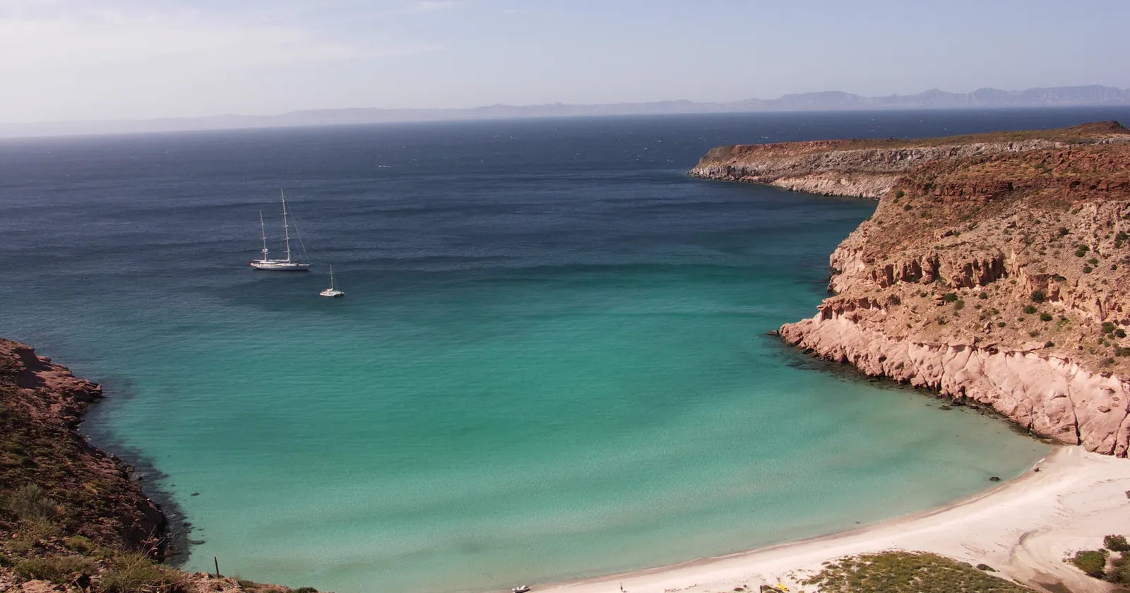
Ensenada Grande on Isla Partida, in the Espíritu Santo archipelago. Photo: Traveljournalist, Wikimedia Commons, public domain.

Key takeaways
- The 2007 decree protects “exclusivamente la zona marina” of the Espíritu Santo archipelago, 48,654 hectares; the islands are a separate protected area dating from 1978
- At Los Islotes the first 5 meters from shore are closed to all tourism, the band from 5 to 30 meters is for swimmers and divers only, and no more than 180 people may be in it at once
- CONANP has restricted swimming and scuba at Los Islotes from 1 June to 31 August since 2017, a measure that is not written into the park’s published rules
- Espíritu Santo sits in the top tier of article 198 of the Ley Federal de Derechos, 225.56 pesos a day for 2026, against 125.32 for Cabo Pulmo
- Whale sharks in La Paz are a surface swim by law, and in the 2026-27 season no boat may go out while five or fewer sharks are counted
La Paz’s best-known dive sites lie in a national park that protects only the sea
Los Islotes, El Bajo and the artificial-reef wrecks all lie in water that became a national park by a presidential decree published in the Diario Oficial de la Federación on 10 May 2007. Its title says what it covers: “exclusivamente la zona marina” of the Espíritu Santo archipelago, in the Gulf of California off the municipality of La Paz, Baja California Sur. That is 48,654 hectares of sea in two polygons, one around the islands and a 905-hectare square over the seamount called El Bajo.
The islands are a different protected area. The decree itself recalls that Espíritu Santo, Partida, Ballena, Gallo, Gallina and Los Islotes were already covered by a 1978 reserve for migratory birds and wildlife, given the category of an area for the protection of flora and fauna in 2000. A beach landing at Ensenada Grande and the reef in front of it fall under two different instruments.
Inside the marine park, three core zones cover 666 hectares: Los Islotes, Punta La Bonanza and Bahía San Gabriel. The decree allows only conservation, low-impact tourism, research, monitoring and education there, with prior authorization, and bans fishing and every other kind of extraction. Bahía San Gabriel holds patches of five reef-building coral species, with coral abundance the management program puts higher than in similar patches at Cabo Pulmo. The other 47,988 hectares are a buffer zone where fishing continues under rules.
The park is run by a directorate of CONANP, the federal protected areas commission, and enforcement falls to PROFEPA with the Navy. The decree gave SEMARNAT 365 days to write the management program. Its summary appeared in the Diario Oficial on 19 January 2015, nearly eight years later, and its 59 administrative rules are what a La Paz dive boat works under today.
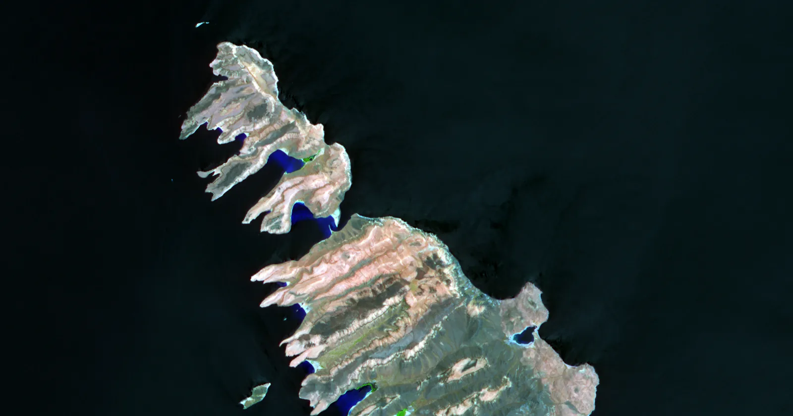

Los Islotes off La Paz: 5 meters for the sea lions, 25 for the swimmers
Los Islotes are the rocks at the northern end of the archipelago, roughly 50 kilometers north of La Paz in a straight line. The program describes a rocky reef over sandy bottom and a colony of more than 500 California sea lions, and it notes that although this is the smallest colony in the southern Gulf, it has one of the highest levels of tourist visits in the region. CONANP’s census in the 2022 breeding season counted 674 animals, 206 of them pups.
The program cuts the water around the rocks into bands. The first, a subzone called Los Islotes-Lobos, runs from the shoreline out to 5 meters in front of the breeding sites. Tourism of every kind is on its list of activities not permitted, low-impact tourism included, and no boat may enter except for research, monitoring or education. It exists, the program says, to protect the breeding and nursing sites and to protect visitors from attacks when they intrude on breeding territory.
The next band, Los Islotes-Natación, runs from 5 to 30 meters off the shore, and its outer edge is the line of mooring buoys the park installed. Rule 46 limits it to swimming, snorkeling and scuba, with boats allowed in only to drop people off and collect them. Rule 23 caps the number of people swimming or diving in it at 180 at any one time. Feeding wildlife is on the banned list in every subzone that visitors may enter.
The buoys have their own rule. Rule 24 reserves them for pangas up to 30 feet, 10 meters, and caps a stay at 3 hours for scuba and 90 minutes for snorkeling. The captain must stay aboard, no stern anchor may go down while the boat is tied on, and when every buoy is taken you either wait or anchor on sand outside the buoy field.
Bigger boats face a harder line. The rules define a larger vessel as one of 12 to 25 meters, and the core subzone around Los Islotes allows smaller vessels to anchor while listing anchoring by larger ones as not permitted. A liveaboard over 12 meters can neither use the buoys nor anchor in that subzone, which is worth asking about before you book the colony from one.
La Paz’s summer sea lion closure comes from CONANP, not the published park rules
Read all 59 rules and you will not find a summer closure. The management program published in 2015 contains no seasonal closure at Los Islotes. The June to August restriction goes back to a decision CONANP announced on 22 July 2017, after at least six tourists had been bitten in a few weeks inside the area of the breeding colony.
CONANP explained it by the colony. The population had grown 26 percent in ten years, and more males competing for females in the mating season become territorial and can turn aggressive; adult males weigh more than 500 kilograms. Swimming, snorkeling and scuba at Los Islotes were suspended until 1 September 2017, and boats could only watch from at least 30 meters off the rocks.
By September 2022 CONANP was describing an annual three-month restriction on swimming and scuba at Los Islotes, “del 1 de junio al 31 de agosto”, applied since 20 July 2017. It called the result the healthiest breeding colony of California sea lions in the Gulf of California, with a positive growth trend of 3.8 percent over the last ten years. Because this is an administrative measure and not a published rule, confirm with the operator that it applies in the year you travel.
La Paz snorkel and freediving rules put a life jacket on everyone in the water
Rule 22 covers what the program calls buceo libre, and it has four parts. Keep at least 2.5 meters from coral formations. No gloves. Life jackets are “obligatorio para todos los usuarios y guías”. And the maximum number of divers per diving instructor is six.
The definition in rule 3 is what makes this bite. Buceo libre is swimming and watching underwater life with a mask, fins, snorkel, weight belt and a flotation or life vest. A weight belt is freediving equipment, and the rule draws no line between a snorkel tour and breath-hold training, so as written a life jacket is compulsory for anyone freediving inside the park.
If you are coming to La Paz for a freediving course, ask the school where its depth sessions take place. Our freediving safety page covers the basics of training on a single breath.
Scuba, defined in the same rule as diving with a self-contained breathing set, is mostly limited by place. It is allowed in the three core zones (rule 45), in the swimming band at Los Islotes (rule 46) and across the buffer subzones (rule 49). Jet skis, towed inflatables, recreational submarines and scooters are excluded from all of them, and rule 31 holds boats to 4 knots in coves, bays, channels and dive areas.
El Bajo, the La Paz seamount, is open to spearfishing as well as scuba
The park’s second polygon is a square of 905 hectares over El Bajo, which the program places about 9 nautical miles north-east of Isla Espíritu Santo: a seamount rising from 100 meters with three peaks at about 20 meters. The program links its productivity to the island effect and upwelling, and names seasonal aggregations of scalloped hammerheads, mantas and whale sharks, which it says gave these seamounts their worldwide fame for scuba and underwater photography.
It also repeats a finding from researchers who have worked there: the site has a magnetic pattern that hammerheads use to guide themselves on night-time feeding runs into deeper water. That is the program’s summary of other people’s research, not a finding of its own.
It is a fishing ground too, and the rules say so. El Bajo is a sustainable-use subzone, not a core zone. Rule 48 allows sport fishing there with rod or harpoon, as it does across the La Partida-Espíritu Santo subzone around the islands, and commercial fishing is allowed with hand lines only. Divers share the water with spearfishers, and rule 38 keeps boats doing different activities at least 250 meters apart.
La Paz wreck diving: three ships sunk in 1999 and the Salvatierra in the San Lorenzo Channel
The park has a single public-use subzone, and it exists for divers. Its three polygons on the western side of the archipelago hold three wrecks placed as artificial reefs in 1999, the Lapas 03, the Fang Ming and the C-59 Francisco Márquez, plus a sculpture called Estancias Submarinas set at 14 meters in the Ensenada del Candelero in 2010. The program says the point is to give divers alternative sites and take pressure off the busiest ones. All fishing is banned there.
The Salvatierra is older and was never meant to be a reef. It was a ferry that sank in the San Lorenzo Channel in the mid-1970s after hitting a reef the dive trade calls Suwanee or Swanee. A 1998 fish survey by the IPN marine science center in La Paz describes the wreck at 20 meters, with its main structure at 15, covered in algae and black coral.
The same survey adds the line that matters for planning: at this site there are always fairly strong currents, their direction and strength set by the tide. SEMARNAT’s whale shark plan describes the channel as the shallow, narrow one of the bay’s two main openings to the Gulf. The coordinates PADI publishes for the wreck fall inside the decree’s Espíritu Santo polygon, under a kilometer from a 5.4-hectare hook-and-line fishing polygon the program names Bajo El Swany. For more ships built into reefs, see the wreck diving list.
La Paz dives at Espíritu Santo pay the top tier of Mexico’s park fee
Article 198 of the Ley Federal de Derechos charges a fee per person per day for scuba, snorkeling and other non-extractive use of federal protected areas, in tiers. The Espíritu Santo marine park was added to fracción I, the tier for areas of low carrying capacity, by the decree of 13 November 2008. For 2026 that tier is 225.56 pesos, and article 198 rounds it to 225 pesos for payment. The islands’ own protected area, Islas del Golfo de California, sits in the same tier.
That makes a day at Espíritu Santo dearer than a day at Cabo Pulmo or Balandra. Cabo Pulmo and Balandra are both in fracción I Ter, at 125.32 pesos for 2026. Cabo Pulmo is a separate national park, declared in 1995 off the coast of the municipality of Los Cabos, so it is its own trip with its own fee and its own rules, not an extension of an Espíritu Santo day.
Who owes the fee, how the bracelet works and the resident discount follow the same article everywhere in Mexico, and the Cancún diving guide sets them out. The short version: the law puts the payment on the permit-holding operator, so ask whether it is in the price. The whale shark refuge is not a protected natural area and does not appear by name on any of article 198’s lists.
Whale sharks in La Paz are a snorkel by law, not a dive
The whale sharks off La Paz sit in a different legal space from the park. SEMARNAT declared the Área de Refugio Bahía de La Paz by an agreement published on 29 November 2018 under the wildlife law: 22,749.08 hectares of territorial sea from San Juan de la Costa in the north to the entrance of the ensenada, between the tip of El Mogote and the La Paz malecón. CONANP administers it.
The agreement gives its reasons. Juveniles of four to five meters aggregate here and return to the site, which makes the bay a secondary nursery area, and the presence of pregnant females in deeper water suggests the deep part of the bay is a primary one. The species is listed as threatened, amenazada, in NOM-059-SEMARNAT-2010.
The binding standard, NOM-171-SEMARNAT-2018, published on 19 November 2019, defines the activity as nado: moving only across the surface with mask, fins and snorkel, plus a life jacket or wetsuit, “sin la realización de inmersiones (apnea)”. That excludes scuba and breath-hold dives alike. A voluntary 2008 standard had put buceo in its title; the binding one that followed covers observation and swimming only. The September 2026 plan for La Paz adds that swimmers stay grouped at the surface and never go below the shark.
The swim itself is tightly drawn. Up to five swimmers per guide, at least 2 meters from the head and sides and 3 meters from the tail, never in front of the shark. One boat per shark for up to 30 minutes, others waiting 50 meters off. No touching or riding, no flash, selfie sticks, drones or underwater scooters, and no sunscreen that is not biodegradable before you get in; the reef-safe sunscreen page covers what a label can and cannot tell you.
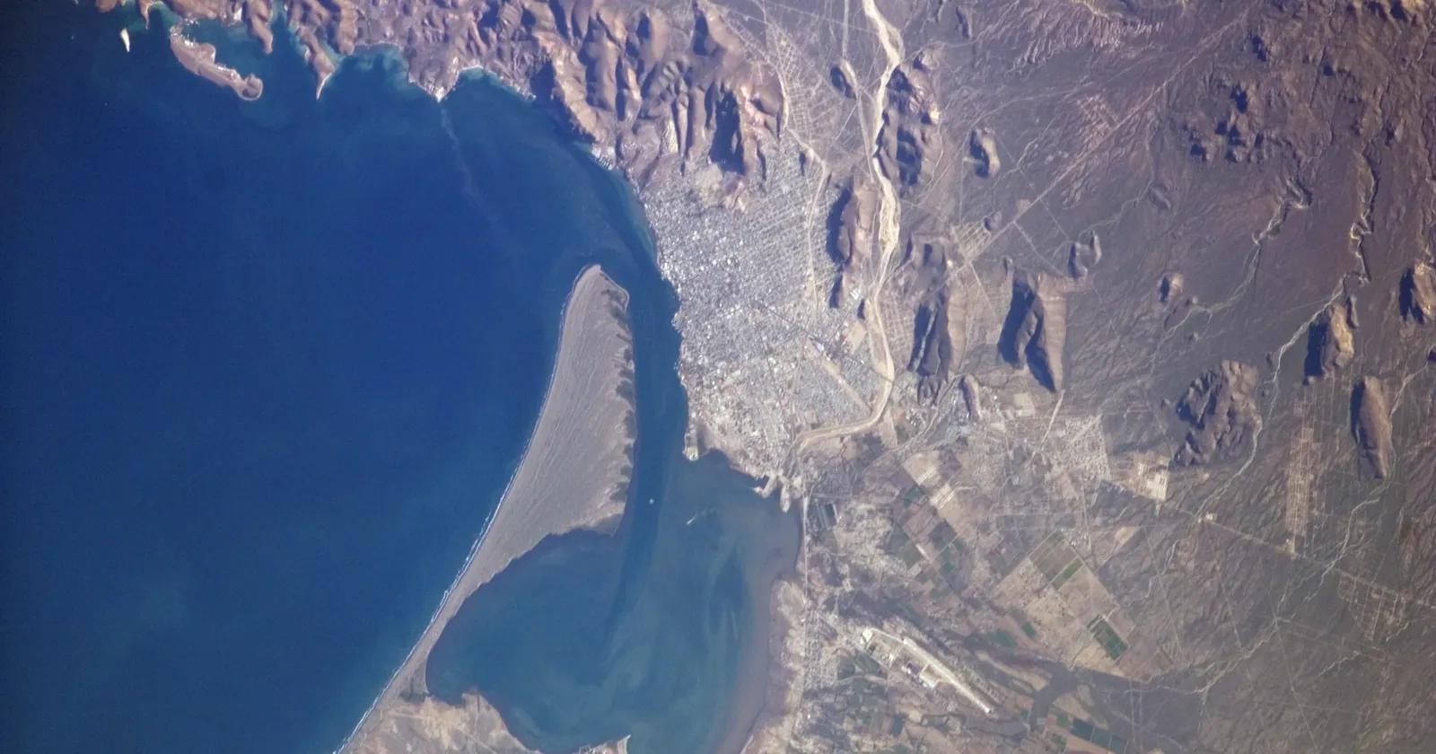

The La Paz whale shark count sets the number of boats in 2026-27
The season notice SEMARNAT’s wildlife directorate signed on 17 September 2026 opens the season on 1 October 2026 and closes it on 30 April 2027. The new management plan, dated September 2026, runs for three seasons to 2028-29. Swimming is allowed only in Zona I, a strip along the northern shore of El Mogote and the coast to its west. Zona II is for conservation with no swimming, and Zona III is a transit lane at up to 7 knots.
What is new is how capacity is set. The sharks in Zona I are counted at least twice a week by running the zone out and back, with a person designated by CONANP validating the count. The average of the two latest official counts, rounded up, is the number that decides how many boats may work each of the four daily shifts.
The table in the notice is blunt. Five or fewer sharks: no boats at all. Six sharks: 6 boats a shift, 24 a day. Seven to nine sharks: 7 a shift, 28 a day. Ten to thirteen: 8 to 11 a shift. Only with 14 or more sharks do all 56 boats a day go out, 14 at a time. A booked trip can be cancelled by a count: the plan lets the activity start and continue only while six or more sharks are registered.
For the season, 112 authorizations are to be issued, each covering one holder, one boat of no more than 11 meters and one flag, the banderola the boat must fly where you can see it. The notice opened applications the day after publication, two weeks before opening day, although NOM-171 has the notice appear two months ahead. Look for the flag.
If you are wintering nearby, the La Ventana guide covers the kite town that shares the same months, and the whale shark destinations page compares this bay with the others.
La Paz water runs from about 20°C in winter to 30°C in summer, and summer is hurricane season
SEMARNAT’s whale shark plan, citing oceanographic studies of the bay, puts the surface temperature at roughly 20°C in winter and 30°C in summer. The water column is stratified from May to October and more mixed the rest of the year, and surface nutrients run highest between December and May. The plan ties the sharks’ presence to high zooplankton biomass, and their season falls in the cooler half, when a proper wetsuit earns its place in the bag.
The warm half is the storm half. The eastern Pacific hurricane season runs from 15 May to 30 November, with a peak in late August, according to the US National Hurricane Center. When Hurricane Odile came ashore just east of Cabo San Lucas at 0445 UTC on 15 September 2014 as a category 3 storm, the center’s report, drawing on media accounts, recorded considerable damage in La Paz, with up to 10,000 people left homeless and boats capsized or pushed ashore.
Lay the three calendars over each other and December to April is the stretch where the whale shark season is open, Los Islotes is outside its closure and the hurricane season is over. The price is water at the cool end of its range. June to August gives the warmest diving but the sea lion restriction, and late summer carries the storm risk.
What Mexican rules ask of a La Paz dive operator, and the recompression question
The park program tells operators to assign a guide to each group and lists the tourism standards that guide must meet, including NOM-05-TUR-2003 for dive operators. That standard was cancelled the following year: NOM-012-TUR-2016, published on 2 September 2016, did it in its second transitory article, and the Economy ministry’s standards catalogue lists the 2016 standard as in force. Rule 16 of the park adds civil liability and third-party insurance for every tourism operator.
NOM-012 is short and practical. The operator must ask for a valid certification, or run an introductory program before any dive. It must carry a first-aid kit and oxygen therapy equipment (8.3), and hold a written contingency plan that identifies the nearest place of medical care (8.4). Depth limits for adults go by level: 12 meters on an introductory program, 18 meters at basic level with four logged dives, 30 at intermediate with nine, and 39 at advanced with sixty.
Section 8.4 is where to take the recompression question. Ask which facility the written plan names, whether that facility can treat a diver with decompression illness, and how the operator gets you there from Los Islotes or El Bajo. Then check that your dive insurance covers the evacuation and the chamber, not only the hospital.
Six La Paz dive businesses in the SSI register, including a freediving school and a liveaboard
The La Paz operator list holds six businesses, read on 25 September 2026, all published by SSI in its register of affiliated centers. One is Hipoxia Freediving, which SSI rates for Freediving instructor training as well as Freediving and Mermaid. One is the Valentina Liveaboard. SSI also rates two of the other dive centers for freediving, and all six publish a website in the register.
What a listing proves is narrow: that SSI lists the business on that date. It says nothing about the teaching or the boats, or whether the business holds the CONANP authorization rule 8 requires for tourism in the park, or a banderola for the whale sharks. Those are the two documents to ask about, and rule 7 obliges an operator to show its authorization to the park directorate and PROFEPA whenever they ask. Which registers can be read sets out what each source can and cannot tell you.
FAQ: scuba diving in La Paz, Baja California Sur
Can you swim with the sea lions at Los Islotes in summer?
Not from June to August. CONANP has restricted swimming and scuba at Los Islotes from 1 June to 31 August each year since 20 July 2017, during the breeding and nursing season, after at least six tourists were bitten in 2017. The restriction is an administrative measure rather than one of the park’s published rules, so confirm it for your year. Outside it, swimmers and divers use the band from 5 to 30 meters off the rocks, with no more than 180 people in it at once.
Can you scuba dive with whale sharks in La Paz?
No. NOM-171-SEMARNAT-2018 defines the activity as surface swimming with mask, fins and snorkel plus a life jacket or wetsuit, without breath-hold dives. The 2026-2029 plan for the Bahía de La Paz refuge keeps swimmers grouped at the surface, up to five per guide, at least 2 meters from the head and sides of the shark and 3 meters from the tail.
When is whale shark season in La Paz?
The 2026-27 season runs from 1 October 2026 to 30 April 2027, in Zona I of the Bahía de La Paz refuge. The number of boats depends on the average of the two latest official counts: five or fewer sharks means no boats, six means 24 a day, and only 14 or more allows the maximum of 56 a day across four shifts.
How much is the Espíritu Santo park fee?
Article 198 of the Ley Federal de Derechos puts the Espíritu Santo marine park in fracción I, the top daily tier, at 225.56 pesos per person per day for 2026, rounded to 225 pesos for payment. Cabo Pulmo and Balandra are in fracción I Ter at 125.32 pesos. The law puts the payment on the permit-holding operator, so ask whether it is in the price.
How warm is the water for diving in La Paz?
SEMARNAT’s whale shark plan, citing oceanographic studies of the bay, puts the surface at roughly 20°C in winter and 30°C in summer, with a stratified water column from May to October. The eastern Pacific hurricane season runs from 15 May to 30 November, with a peak in late August.
Note: Conditions, safety guidance and regulations change. Verify current information with official sources, including the dive operator, the park authority and the relevant government department, before you travel or dive.
Founder of NOMADREEF and a former digital nomad. This guide is sourced from the references below; conditions, prices and rules change, so verify current details, and follow qualified local guidance and safety briefings. About the author · LinkedIn ↗
Sources
- The park and what it covers (primary). Decreto por el que se declara área natural protegida, con la categoría de Parque Nacional exclusivamente la zona marina del Archipiélago de Espíritu Santo, Diario Oficial de la Federación, 10 May 2007: article 1 on the 48,654-83-10.41 hectares in the El Bajo de Espíritu Santo and Espíritu Santo polygons, the three core zones of 666-40-09.38 hectares and the buffer zone of 47,988-43-01.03 hectares; the recital on the 1978 reserve and the 2000 recategorization of the islands; articles 2, 8, 11, 12 and 15; second transitory article on the 365-day deadline for the management program. DOF, 10 May 2007 (PDF, CONANP). Read 25 September 2026.
- The management program and its rules (primary). Acuerdo por el que se da a conocer el resumen del Programa de Manejo del Parque Nacional Zona Marina del Archipiélago de Espíritu Santo, DOF 19 January 2015: the subzones and their permitted and non-permitted activities, including Los Islotes-Lobos (shoreline to 5 meters, tourism not permitted) and Los Islotes-Natación (5 to 30 meters, bounded by the park’s mooring buoys); the colony of more than 500 sea lions; the coral patches of Bahía San Gabriel; El Bajo at about 9 nautical miles north-east of Isla Espíritu Santo, 100 meters deep with three peaks at about 20 meters; the public-use subzone with Lapas 03, Fang Ming and C-59 Francisco Márquez (1999) and Estancias Submarinas at 14 meters (2010); the polygon Bajo El Swany of 5.438614 hectares; rules 3 (definitions of vessels, buceo libre and buceo autónomo), 7, 8, 16, 18, 22, 23, 24, 31, 38, 45, 46, 48, 49 and 53. DOF, 19 January 2015. Read 25 September 2026. The distance of roughly 50 kilometers from La Paz to Los Islotes and the position of Bajo El Swany in the San Lorenzo Channel were calculated from the program’s UTM coordinates.
- The 2017 closure (primary). CONANP, “Se suspende temporalmente el nado con lobos marinos en el Archipiélago de Espíritu Santo, Baja California Sur”, 22 July 2017: 26 percent population growth in ten years, at least six bite incidents, males over 500 kg, suspension of swimming, snorkeling and scuba at Los Islotes until 1 September 2017, 30 meters minimum distance for boats. gob.mx/conanp. Read 25 September 2026.
- The annual restriction and the 2022 census (primary). CONANP, “Conanp destaca el éxito en la conservación del lobo marino de California”, 12 September 2022: 674 animals counted, 206 of them pups; restriction of swimming and scuba at Los Islotes “del 1 de junio al 31 de agosto”, applied since 20 July 2017 as an annual three-month period; growth trend of 3.8 percent over the last ten years. gob.mx/conanp. Read 25 September 2026. No CONANP notice for the 2026 closure was found, so the text asks readers to confirm it for their year.
- The fee (primary). Ley Federal de Derechos, consolidated text, last reform DOF 7 November 2025, amounts for 2026 updated by the Resolución Miscelánea Fiscal of 28 December 2025: article 198, fracción I at 225.56 pesos listing the Parque Nacional Zona Marina del Archipiélago de Espíritu Santo and the Área de Protección de Flora y Fauna Islas del Golfo de California; fracción I Ter at 125.32 pesos listing Cabo Pulmo and Balandra; rounding to multiples of 5 pesos. The addition of Espíritu Santo to fracción I is recorded in the decree of 13 November 2008 reproduced in the same file. Cámara de Diputados, LFD (PDF), read from the Internet Archive copy of 15 September 2026. Read 25 September 2026.
- Cabo Pulmo as a separate park (primary). Decree declaring Cabo Pulmo a marine national park “frente a las costas del Municipio de Los Cabos”, DOF 6 June 1995. DOF, 6 June 1995 (PDF, reproduction by the Commission for Environmental Cooperation). Read 25 September 2026.
- The whale shark refuge (primary). Acuerdo por el que se establece con el nombre de Bahía de La Paz el Área de Refugio para la protección de la especie que se indica, DOF 29 November 2018: 22,749.08 hectares in three zones from San Juan de la Costa to the entrance of the ensenada between El Mogote and the malecón; juveniles of four to five meters and the nursery reasoning; the listing as amenazada in NOM-059-SEMARNAT-2010; administration by CONANP. DOF, 29 November 2018. Read 25 September 2026.
- The whale shark standard (primary). NOM-171-SEMARNAT-2018, DOF 19 November 2019: definition 3.5 of nado “sin la realización de inmersiones (apnea)”; 4.1.3 on the notice two months before the season; 4.4 and 4.5 on distances, five users per guide and non-biodegradable sunscreen; 4.7 on prohibited conduct; the recital on the voluntary NMX-AA-142-SCFI-2008. DOF, 19 November 2019. Read 25 September 2026.
- The 2026-2029 whale shark plan (primary). SEMARNAT, Dirección General de Vida Silvestre, Plan de Manejo Tipo para el aprovechamiento no extractivo a través de la observación y nado con tiburón ballena en el Área de Refugio Bahía de La Paz, Temporada trianual 2026-2029, updated September 2026: counts at least twice a week validated by CONANP; n as the rounded-up average of the two latest counts; zones I to III; boats of at most 11 meters; five users per guide; surface swimming and distances; code of conduct; surface temperature of about 20°C in winter and 30°C in summer, stratification May to October and nutrients highest December to May, citing Reyes-Salinas et al. (2003), Obeso-Nieblas (2014) and Martínez-López et al. (2001); the San Lorenzo Channel as the shallow, narrow opening. gob.mx (PDF). Read 25 September 2026. The 2025-26 plan formerly published at the same attachment number now returns an error.
- The 2026-27 season notice (primary). SEMARNAT, Dirección General de Vida Silvestre, Aviso for the 2026-2027 season under 4.1.3 of NOM-171-SEMARNAT-2018, dated 17 September 2026: season 1 October 2026 to 30 April 2027; 112 authorizations on a one holder, one boat, one flag basis; four shifts; the table of boats per shift and per day against the number of sharks; the 11-meter limit; Zona III at 7 knots. gob.mx (PDF). Read 25 September 2026. The position of Zona I along El Mogote was read from the notice’s coordinates.
- Dive operator obligations (primary). NOM-012-TUR-2016, Para la prestación de servicios turísticos de buceo, DOF 2 September 2016: 8.1 and 8.2 on certification and introductory programs, 8.3 on first aid and oxygen therapy equipment, 8.4 on the written contingency plan and the nearest place of medical care, Table 4 on depth by level, second transitory article cancelling NOM-05-TUR-2003. DOF, 2 September 2016; status “vigente” after the systematic review of 29 October 2021 on the Secretaría de Economía standards catalogue. Read 25 September 2026.
- The Salvatierra (primary for its condition, triangulated for its story). Arreola Robles JL (1998), Diversidad de peces de arrecife en la región de La Paz, B.C.S., México, master’s thesis, CICIMAR, Instituto Politécnico Nacional: the wreck at 20 meters with the main structure at 15, algae and black coral, “siempre existen corrientes bastante fuertes cuya dirección e intensidad dependen del ciclo de mareas”. IPN repository (PDF). That it was a ferry that sank after striking the Suwanee or Swanee reef in the San Lorenzo Channel is triangulated from three independent secondary accounts: Richard M. Adcock’s 1997 account, Just Gotta Dive and PADI’s dive site page, which also gives the coordinates 24.38893, -110.31372. The year is not stated because the sources disagree: two give June 1976, PADI gives 19 June 1975, and the thesis gives an age that fits neither exactly. Its route is left out for the same reason. Read 24 September 2026.
- Hurricanes (primary). NOAA National Hurricane Center, tropical cyclone climatology: “The eastern Pacific hurricane season runs from May 15 to November 30”, with a peak in late August. nhc.noaa.gov/climo. Cangialosi JP and Kimberlain TB, Tropical Cyclone Report, Hurricane Odile (EP152014), National Hurricane Center, 2015: landfall at 0445 UTC on 15 September 2014 just east of Cabo San Lucas at 110 knots; considerable damage in La Paz with up to 10,000 inhabitants left homeless and boats capsized or pushed onshore, per media reports. NHC TCR (PDF). Read 25 September 2026.
- The six businesses. Six businesses on the La Paz operator list, read 25 September 2026, all published by SSI in its register of affiliated centers; SSI program ratings for Freediving at three centers and Freediving instructor training at one; all six publish a website there. The limits of each source are set out on which registers can be read.
- Left out. A recompression chamber in La Paz: no authority, hospital or navy source confirming one that treats divers could be read, so none is named and the text points to the operator’s plan under NOM-012-TUR-2016. Visibility figures: no primary source. The whale shark hours in the 2025-26 plan (08:00 to 17:00) are not carried over, because the 2026-2029 plan leaves hours and shifts to CONANP. The IUCN status quoted in the plan was not checked against the Red List and is not used.