Key Largo Diving: The Reefs Past Pennekamp’s Three-Mile Line, and the Rules That Changed There
 by Yannick Schroth
Sep 24, 2026
15 min read
by Yannick Schroth
Sep 24, 2026
15 min read
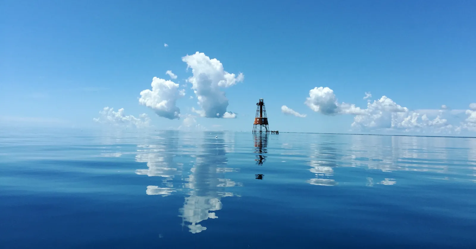
Photo: Nancy Diersing/NOAA, September 2015, Wikimedia Commons, public domain.
.jpg)
Key takeaways
- NOAA’s zone data files every preservation area off Key Largo outside state waters, and Florida’s park boundary file puts all of them outside Pennekamp, the Christ of the Abyss included
- The 2025 rule merged Key Largo Dry Rocks and Grecian Rocks into one area of about half a square mile, added 1.6 square miles of deep reef to Carysfort and eliminated French Reef as a preservation area
- From 19 January 2027 anchoring is banned in every preservation and restoration area off Key Largo; the 146.9-square-mile management area around them gets no anchoring ban
- Turtle Rocks, the one new preservation area the rule drew off Key Largo, lies inside the state park, and NOAA’s April 2026 zone data does not contain it
- In its first season the Spiegel Grove cut total use of the surrounding natural reefs by 13.7 percent, the opposite of what the Vandenberg later did off Key West
Key Largo’s reef line lies past Pennekamp’s three-mile edge, in federal water
The split is older than the sanctuary. On 15 March 1960, Proclamation 3339 created the Key Largo Coral Reef Preserve and explained its two halves: part of the reef lay “inside the three-mile limit” relinquished to Florida, and “the remainder lies on the sea bed of the outer Continental Shelf”. The inner half became John Pennekamp Coral Reef State Park, dedicated on 10 December 1960 and billed by Florida State Parks as the country’s first undersea park.
The park is a strip, not the whole reef. Its own brochure says it “extends three miles into the Atlantic Ocean” and runs about 21 miles along the coast. The federal half beyond it became the Key Largo National Marine Sanctuary in 1975, and NOAA now calls it the Key Largo Management Area: 146.9 square miles in the sanctuary’s zone data, revised on 28 April 2026, with the attribute “within state waters” set to no.
The reefs that fill Key Largo dive boats sit in that federal half. NOAA’s zone data marks the Carysfort, The Elbow, Key Largo Dry Rocks-Grecian Rocks and Molasses Reef preservation areas as outside state waters. Measured against the Florida Department of Environmental Protection’s own park boundary file, the nearest edge of the Dry Rocks area lies about a kilometer beyond the park line, Molasses about two and Carysfort about three.
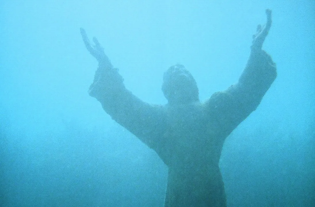
That puts the statue in federal water. NOAA says the Dry Rocks area is home to the “Christ of the Deep”, “a 9-foot bronze statue that sits in a sand channel on the offshore side of Key Largo Dry Rocks in less than 25 feet of water”, inside the Key Largo Management Area. A state tourism photograph from about 1985 captions the statue “at John Pennekamp Coral Reef State Park”, and most retellings still do. On the current boundaries, that is wrong.
It matters because of 2025. At Key West the reef preservation areas lie in state waters, where Florida’s governor blocked NOAA’s new sanctuary rule and the 1997 rules still govern. Off Key Largo the reefs are federal, and Keys Weekly reported in March 2026 that NOAA treats the new rule as in force in federal waters since 5 March 2025. The Key West guide sets out that dispute in full; what follows is what it changed here.
The 2025 rule merged two Key Largo reefs, enlarged Carysfort and dropped French Reef
NOAA’s final rule, published on 17 January 2025 as 90 FR 6104, lists the preservation areas from northeast to southwest, and four of the first five are Key Largo dives. Carysfort Reef “is expanded to the 90-foot contour to include additional deep reef habitat”, an addition of 1.6 square miles, which makes it the sanctuary’s largest preservation area at 3.78 square miles. The Elbow and Molasses Reef keep their boundaries.
Key Largo Dry Rocks and Grecian Rocks, one mile apart, were joined into a single area. Some commenters had asked for fishing access in the sand between them, and NOAA cut the zone from the 1.2 square miles in its earlier alternatives to 0.5 square miles “to focus the zone on the high relief reef areas”. NOAA’s page for the combined area puts it at 318 acres.
Anglers asked for trolling in the new deep water at Carysfort, and NOAA refused: an exception for fishing in the expansion areas “would not be compatible with the purpose and intent of SPAs to separate conflicting uses”. Inside every preservation area off Key Largo, NOAA’s zone entries list the same prohibitions: no discharge except cooling water or engine exhaust, no fishing, no removing or possessing marine life, and no touching or standing on living or dead coral.
French Reef went the other way. In its answers to comments, NOAA listed two preservation areas it was eliminating “due to resource condition changes”, Rock Key off Key West and French Reef, and wrote that removing them “removes restrictions on fishing in these areas”. French Reef lies inside the federal management area, so on NOAA’s reading it is now reef that anglers may fish again, under the management area’s gear rules.
The paperwork lags in places. The sanctuary’s preservation area page says there are 17 and lists 16, none of them French Reef. Its public buoy layer, last edited on 11 September 2025, still carries three French Reef SPA boundary buoys beside 20 moorings, one of them for large vessels. A yellow boundary buoy there no longer marks a no-fishing line.
From 19 January 2027 no Key Largo dive boat may anchor in a preservation area
The 2025 rule says “anchoring is prohibited in all SPAs”, and defines anchoring as securing a vessel to the seabed by any means except when using a mooring buoy. NOAA delayed that provision, and the same ban in the restoration areas, until 19 January 2027 to finish a mooring buoy plan. None of the Key Largo areas is among the six exceptions on the sanctuary’s SPA page, and each Key Largo zone entry notes that in 2027 anchoring by any means will be prohibited.
Until then the older wording applies: no anchoring on living or dead coral, and none when a mooring buoy is available. After it, a boat in a preservation area is on a buoy or not attached to the seabed at all.
The sanctuary’s 2025 buoy layer lists 33 moorings at Molasses Reef plus one for large vessels, 15 at Key Largo Dry Rocks, 12 at Grecian Rocks plus one for large vessels, 13 at Carysfort Reef, 8 at Carysfort South and 9 at The Elbow. The buoys are free, first come, first served, and not meant for overnight use.
A second rule waits for the same date. From 2027, a vessel longer than 65 feet may tie only to a buoy designated for large vessels, and a smaller boat may not take one. Until the provision takes effect, NOAA wrote, “large vessels may continue to use regular mooring buoys”.
The wider management area is treated differently on purpose. Commenters objected that a no-anchoring rule across it would hit fishing and that much of it is sand, and NOAA agreed “a no anchor regulation is not needed”. So a boat may still anchor on sand in the 146.9 square miles around the reefs, and not inside the preservation areas it surrounds.
The flag rule in federal water is also the 2025 text. Divers must stay within 300 feet of the divers-down flag on open water and 100 feet in inlets and channels, and boats must hold idle speed with no wake inside those distances and, outside marked channels, within 300 feet of any stationary vessel. The Pennekamp brochure asks snorkelers and divers to fly the flag every time. The state statute that governs flags in state water is covered in the Key West guide.
.jpg)
Turtle Rocks, the one new Key Largo preservation area, was drawn inside the state park
The 2025 rule created only two new preservation areas in the whole sanctuary, and one of them is off North Key Largo. The final rule enlarged Turtle Rocks from 2.3 square miles in the proposal to 2.5 square miles “in order to align this SPA with the existing John Pennekamp Coral Reef State Park marine zone”, and its corner coordinates are printed in appendix F.
Plotted on Florida’s park boundary file, all four corners fall inside Pennekamp, between about a quarter of a kilometer and two kilometers inside the park line. That is state water, and the governor’s certification of 3 March 2025 said the rule would not take effect there. NOAA’s April 2026 zone data contains no Turtle Rocks zone, and its preservation area page does not list one. Its mooring buoy page still names a “Turtle Rocks Sanctuary Preservation Area” among its zones, so NOAA’s own pages do not agree.
What protects Turtle Rocks today is the state. Florida Administrative Code rule 68B-24.0065 names “Turtle Rocks” first among ten areas of Pennekamp, each drawn by four corner coordinates, where no one may take spiny or slipper lobster or set a trap during the regular season, or have either species aboard. The same rule bars lobster harvest from any patch reef anywhere in the park.
The reef itself does not stop at the line. The sanctuary’s buoy layer lists 14 Turtle Rocks buoys, and on the park boundary file 5 of them sit inside Pennekamp and 9 outside it, in the federal management area. Two boats on the same reef can be under different rulebooks.
Diving from Pennekamp’s own docks: Key Largo’s park fees, lobster closures and speargun ban
Many first Key Largo dives start at the park itself. Its fee page lists $8 per vehicle plus 50 cents per person for up to eight people, $4.50 for a single-occupant vehicle and $2.50 per pedestrian or cyclist, and $10 per vessel to launch a boat for the day. Hours are 8 a.m. until sunset, 365 days a year. Admission is not guaranteed once the parking is full.
The trips are sold by the park concession. The park describes glass-bottom boats three times a day and snorkel boats four times a day, each 2.5 hours with about 1.5 hours on the reef, and four-hour scuba trips with two tanks at two locations. Coral Reef Park Company has run those services since 1963, according to the park. Given the boundaries above, a trip sold at the park can end on reef the park does not manage.
Two notices on the park page, as archived on 24 August 2026, are worth checking before a visit. A Florida Department of Health beach water advisory for elevated enterococci bacteria in nearshore waters took effect on 13 August 2026. Construction since 22 July 2026 has closed one of the two boat ramps and the boat sewage pump-out station and cut boat trailer parking. The live page refused automated requests on 24 September 2026, so neither notice could be confirmed as current.
The park’s brochure is short on rules and clear about them. Touching or standing on corals “may kill them and is therefore prohibited”. Spearfishing is prohibited, tropical fish may not be collected, and “no lobster may be harvested from or within any coral formation”. During Florida’s two-day lobster sport season, the last Wednesday and Thursday of July, rule 68B-24.0065 closes the whole park to lobster harvest and bans possessing lobster aboard any vessel from which someone is diving there.
Beyond the park, the federal rule goes further on spearguns. Across the Key Largo Management Area, 15 CFR 922.164(b) prohibits “fishing with, carrying, or possessing” pole spears, Hawaiian slings, pneumatic guns “or similar devices known as spearguns”, and bans collecting tropical fish. Recreational lobster by hand or hand gear remains allowed there. The 1960 Interior Department rules for the preserve, 43 CFR Part 15, are still printed in the federal code and say it more warmly: diving “for observation and pleasure is permitted and encouraged”.
The Spiegel Grove took Key Largo divers off the natural reefs, and the Vandenberg did not
The big wreck off Key Largo is a former Navy landing ship. The Florida Fish and Wildlife Conservation Commission files the Spiegel Grove as a 510-foot LSD-32 of 6,880 tons in 135 feet of water with 84 feet of relief, under federal jurisdiction, deployed on 17 May 2002. The same record adds “Pushed on Side on 6/10/02”. It lies inside the Key Largo Management Area, and the sanctuary keeps ten wreck moorings on it.
The sinking did not go to plan. NOAA’s condition report says the ship “landed upside down upon sinking”, that an “unplanned, unfunded salvage effort” moved it onto its starboard side, and that Hurricane Dennis in July 2005 “righted the ship to its originally intended position”. NOAA’s study dates the sinking to June 2002; the state record keeps the May date for the deployment and June for the roll.
The Key Largo Chamber of Commerce organized the sinking to bring in dive business, and NOAA tested a second promise: that a new wreck would take pressure off the natural reefs. Researchers used dive shop logbooks and on-water counts for ten months before and ten months after. Total use of the surrounding natural reefs fell 13.7 percent, and scuba dives on them fell 12.7 percent, or 17,834 dives. The natural reefs’ share of use dropped from 86.8 to 68.5 percent.
The authors flagged two limits: the data left out June and July, about a quarter of the year’s reef use, and the pattern might be the novelty of a new wreck. It is still the opposite of Key West. There, NOAA found scuba diving on the natural reefs rose after the Vandenberg went down, and its own summary says the Vandenberg, “unlike the Spiegel Grove, did not reduce user pressure”. The Key West guide has those numbers.
Two older wrecks sit south of Molasses. The Coast Guard cutters Duane and Bibb, both 327 feet, were sunk on 27 November 1987. NOAA puts the Duane upright in 120 feet of water, one mile south of Molasses Reef, with the crow’s nest at 60 feet, the bridge at 70, the superstructure deck at 90 and the main deck at 100; the Duane is listed in the National Register of Historic Places. The state files the Bibb on its starboard side at 130 feet, 95 feet to the rail.
Both lie just outside the Key Largo Management Area: on NOAA’s boundary and the state’s coordinates, the Bibb sits about 1.2 kilometers and the Duane about 1.8 kilometers beyond its line. The buoy layer lists three moorings on the Duane and two on the Bibb. At these depths gas planning matters, and our nitrox explainer covers what a mix changes; the wreck diving list covers other coasts built on sunk steel.
Carysfort and Horseshoe off Key Largo kept living staghorn through the 2023 heat
A 2024 study calls the summer of 2023 the most severe on record for Florida’s Coral Reef. The sanctuary recorded warm water from February, the longest-lasting marine heat wave in the region since 1991, and a BleachWatch alert on 28 July 2023 warning that significant bleaching was expected and mortality likely. NOAA called them the hottest ocean temperatures on record for the Keys.
Key Largo’s outer reefs had it easier than most. A study published in December 2024 tracked more than 4,200 brain and boulder corals at nine reefs from Sand Key to Carysfort. At seven of the nine, only 0 to 2 percent of colonies suffered any mortality, and Carysfort had none. Across the years since 1985 in which heat stress crossed the 4 degree heating week threshold, the authors found Grecian/Key Largo Dry Rocks and Carysfort “consistently the coolest” of their sites.
The branching corals fared worse. The same authors report seeing local extinctions of Acroporid corals at most of their sites. A NOAA survey in February 2024 of five Mission: Iconic Reefs sites found that less than 22 percent of about 1,500 outplanted staghorn corals were still alive, and only the two northernmost reefs surveyed, Carysfort Reef and Horseshoe Reef, both off Key Largo, had any living staghorn. Carysfort was also one of three sites with live elkhorn.
Both are restoration sites. NOAA’s plan for Carysfort calls it the largest demonstration site for elkhorn and staghorn restoration in the Keys, with more than 200,000 corals to be outplanted; Horseshoe is to get more than 75,000. Horseshoe’s NOAA site sheet says its two mooring buoys “support recreational fishing and diving”. The sheet predates the 2025 rule: the 219.7-acre Horseshoe Reef Habitat Restoration Area applies the preservation-area prohibitions, and NOAA’s zone data marks fishing there as not allowed.
The coral nurseries are closed to stopping. NOAA’s zone data lists Nursery Restoration Areas at Carysfort Reef, Key Largo, The Elbow and Tavernier, all federal, where entering is prohibited “except for continuous transit without interruption”: a dive boat may cross one, not stop in it. Coral Restoration Foundation, based in Tavernier, describes its Tavernier Coral Tree Nursery as an acre and a half of seafloor with more than 500 coral trees. The Miami guide traces the coral disease that hit these reefs before the heat.
Seven Key Largo dive businesses in the registers, two of them filed in Tavernier and Islamorada
The Key Largo operator list holds 7 businesses. Six are published by SSI in its register of affiliated training centers, read on 20 September 2026: Conch Republic Divers, Horizon Divers, Key Dives, Ocean First Key Largo, Quiescence Diving Services and Sea Dwellers Dive Center. Two, Key Dives and Silent World Dive Center, are Green Fins digital members, read on 14 August 2026 and self-evaluated rather than assessed in person. All seven publish a website.
The register’s town field shows how far “Key Largo” stretches. SSI files four of its six entries in Key Largo, Conch Republic Divers in Tavernier and Key Dives in Islamorada. Where a business is filed is not where its boats go, and every one of them reaches the same federal reefs described above.
SSI rates Horizon Divers for Extended Range and Rebreather, and Conch Republic Divers, Key Dives and Ocean First for Freediving. Silent World’s own website names PADI. A rating is a listing, not evidence that a course runs this season, and these are membership registers rather than licenses; which registers can be read sets out what each returns. Treatment cover for deep wreck diving is a separate purchase, which the dive insurance comparison covers.
FAQ: scuba diving in Key Largo
Is the Christ of the Abyss statue inside John Pennekamp Coral Reef State Park?
Not on today’s boundaries. NOAA places the statue in the Key Largo Dry Rocks-Grecian Rocks Sanctuary Preservation Area, in a sand channel on the offshore side of Key Largo Dry Rocks in less than 25 feet of water, and says that area lies within the federal Key Largo Management Area. Florida’s own park boundary file puts the whole preservation area outside the park, which extends three miles into the Atlantic.
Can dive boats anchor at Molasses Reef or French Reef off Key Largo?
At Molasses, not from 19 January 2027. The 2025 sanctuary rule bans anchoring in every preservation area and delays that ban to that date; NOAA’s zone data files Molasses in federal waters, where it applies. Until then, anchoring on coral or when a mooring buoy is free is prohibited. French Reef is no longer a preservation area, so the 2027 ban does not reach it, and the surrounding management area has no anchoring ban.
How deep is the Spiegel Grove wreck off Key Largo?
The Florida Fish and Wildlife Conservation Commission files the Spiegel Grove, a 510-foot former Navy landing ship of 6,880 tons, in 135 feet of water with 84 feet of relief. It was deployed on 17 May 2002, landed upside down, was moved onto its starboard side by salvors, and was set upright by Hurricane Dennis in July 2005, according to NOAA. The sanctuary keeps ten wreck moorings on it.
How much does it cost to enter John Pennekamp Coral Reef State Park?
The park’s fee page lists 8 dollars per vehicle plus 50 cents per person, for up to eight people, 4.50 dollars for a single-occupant vehicle and 2.50 dollars per pedestrian or cyclist. Launching a boat costs 10 dollars per vessel for day use. The park opens at 8 a.m. and closes at sunset, every day of the year. Boat tours and dive trips are sold separately by the park concession.
Can you spearfish or take lobster while diving in Key Largo?
Spearfishing is prohibited in John Pennekamp Coral Reef State Park, and in the federal Key Largo Management Area beyond it the sanctuary bans even carrying or possessing a speargun. Lobster is stricter inside the park: no harvest during the two-day sport season at the end of July, and no harvest from any patch reef or from ten named park areas during the regular season.
Note: Conditions, safety guidance and regulations change. Verify current information with official sources, including the dive operator, the park authority and the relevant government department, before you travel or dive.
Founder of NOMADREEF and a former digital nomad. This guide is sourced from the references below; conditions, prices and rules change, so verify current details, and follow qualified local guidance and safety briefings. About the author · LinkedIn ↗
Sources
- Why the reef is split at three miles. Primary source. Proclamation 3339, Establishing the Key Largo Coral Reef Preserve, 15 March 1960, 25 FR 2352: the portion of the reef “inside the three-mile limit” relinquished to Florida and “the remainder” on the outer Continental Shelf. American Presidency Project, Proclamation 3339. The preserve rules still printed at 43 CFR Part 15, including § 15.1 on the state preserve “shoreward of a line three geographic miles from Key Largo”, § 15.7 and § 15.11 on spearfishing and spearguns, and § 15.8 on diving “permitted and encouraged”: 43 CFR Part 15, eCFR, read in the version current to 22 September 2026. Both read 24 September 2026.
- The state park: extent, history, fees, trips, notices and rules. Primary sources, Florida Department of Environmental Protection, Florida State Parks. The park site refused automated requests on 24 September 2026, so its pages were read in Internet Archive copies: park page, 24 August 2026 (first undersea park, $8 per vehicle plus 50 cents per person, the beach water advisory of 13 August 2026 and the construction notice of 22 July 2026); Hours & Fees, 7 February 2026; History, 29 July 2026 (dedication on 10 December 1960); Experiences & Amenities, 24 August 2026 (boat tours, scuba trips); and the park brochure (PDF), 16 July 2026 (three miles into the Atlantic, about 21 miles long, the coral, spearfishing, tropical fish, lobster and diver-down flag guidance). Read 24 September 2026. The park’s own pages give its area as approximately 70 and approximately 72 square nautical miles and its history page speaks of a 75-square-mile preserve; with its sources in disagreement, the article states no area.
- The park boundary used for every distance on this page. Primary source. Florida DEP, Florida State Park Boundaries, record for John Pennekamp Coral Reef State Park (unit S00015). Read 24 September 2026. The distances from the park line to the preservation areas, to the Turtle Rocks corners and buoys, and from the management area line to the Duane and Bibb were measured on this file against sources 4, 5 and 8; they are measurements of published boundaries, rounded, and not survey positions.
- Which Key Largo zones lie in state waters, and what applies in each. Primary source. NOAA Office of National Marine Sanctuaries, FKNMS Zone Boundaries with Attributes, 28 April 2026: Key Largo Management Area (146.9 sq mi, not in state waters, designated as a sanctuary in 1975, with the speargun and tropical fish prohibitions); Carysfort Reef, The Elbow, Key Largo Dry Rocks-Grecian Rocks and Molasses Reef SPAs, all outside state waters, with their prohibitions and the note that in 2027 anchoring by any means will be prohibited; Horseshoe Reef Habitat Restoration Area (219.7 acres); Nursery Restoration Areas at Carysfort Reef, Key Largo, The Elbow and Tavernier, transit only; no Turtle Rocks zone and no French Reef zone. The SPA list, “17 SPAs” with 16 listed, and the 2027 exceptions: Sanctuary Preservation Areas; the statue, depth and 318 acres: Key Largo Dry Rocks-Grecian Rocks SPA; the Carysfort page: Carysfort SPA. The state’s own caption placing the statue “at John Pennekamp Coral Reef State Park”: State Library and Archives of Florida, Florida Division of Tourism photograph, circa 1985, call number COM00535, as reproduced on Wikimedia Commons. All read 24 September 2026.
- What the 2025 rule changed off Key Largo. Primary source. NOAA, Regulations for the Florida Keys National Marine Sanctuary Management Review: Blueprint for Restoration, 90 FR 6104, 17 January 2025: the SPA list with Carysfort expanded to the 90-foot contour, The Elbow and Molasses unchanged and Key Largo Dry Rocks-Grecian Rocks connected; Turtle Rocks enlarged from 2.3 to 2.5 square miles to align with the park’s marine zone, with its appendix F coordinates; responses to comments 27 (French Reef and Rock Key eliminated), 29 (no anchoring rule in the Key Largo Management Area), 44 (the 0.5 square mile combined zone) and 45 (1.6 square miles added at Carysfort, no fishing exception); the definition of anchoring and of a large vessel; the delay of §§ 922.163(a)(5)(x) and 922.164(e)(3), (f)(2), (g)(1) and (h)(1) to 19 January 2027; § 922.163(a)(5)(iii), (iv) and (6) on idle speed and divers-down flags; § 922.164(b), (e), (g) and (h). 90 FR 6104 (PDF, govinfo). Read 24 September 2026.
- How the rule has been applied since the governor’s certification. Secondary source; the underlying dispute is triangulated and sourced in full on the Key West guide. That the rule took effect in federal waters on 5 March 2025 and that NOAA plans to announce the effective date in a Federal Register notice: Keys Weekly, March 2026. Read 24 September 2026. No NOAA document confirming the 5 March 2025 date was found.
- Buoys. Primary source. NOAA, Florida Keys National Marine Sanctuary Buoys Public (2025), last edited 11 September 2025: Molasses Reef 33 moorings and one large-vessel mooring; Key Largo Dry Rocks 15; Grecian Rocks 12 and one large-vessel mooring; Carysfort Reef 13; Carysfort South 8; The Elbow 9 moorings; French Reef 19 moorings, one large-vessel mooring and three SPA boundary buoys; Turtle Rocks 14; Spiegel Grove 10, Duane 3 and Bibb 2 wreck moorings; Horseshoe Reef 2. Free, first come, first served, not for overnight use, and the listing of a Turtle Rocks SPA: Mooring Buoy Locations. Both read 24 September 2026.
- The wrecks. Primary sources. Florida Fish and Wildlife Conservation Commission, Artificial Reef Locations in Florida, Monroe County records: Spiegel Grove (MO0061), 510 feet, 6,880 tons, 135 feet deep, 84 feet of relief, deployed 17 May 2002, “Pushed on Side on 6/10/02”, Federal; Duane (MO0043), 327 feet, 118 feet deep, 27 November 1987, Federal; Bibb (MO0044), 327 feet, on its starboard side, 95 feet to the rail, 130 feet deep, 27 November 1987, Federal. The landing upside down, the salvage and Hurricane Dennis: NOAA, Florida Keys 2011 Condition Report. The Duane at 120 feet one mile south of Molasses, its deck depths and its National Register listing: NOAA Shipwreck Trail, Duane. All read 24 September 2026. The NOAA Duane page says Duane and Spencer sank U-77 on 17 April 1943; the Naval History and Heritage Command records the U-boat sunk by Spencer that day, with Duane in the same convoy escort, as U-175, so the war record is left out of the article.
- The Spiegel Grove study. Primary source. Leeworthy VR, Maher T, Stone EA (2006), Can artificial reefs alter user pressure on adjacent natural reefs?, Bulletin of Marine Science 78(1): 29–37: 10-month periods before and after deployment, the 13.7 percent fall in total use of the surrounding natural reefs, the 12.7 percent (17,834 dives) fall in scuba diving there, the exclusion of June and July and the novelty caveat. Paper (PDF, NOAA copy); the Chamber of Commerce and the shift in share from 86.8 to 68.5 percent: NOAA fact sheet (PDF); the Vandenberg comparison: NOAA, New Artificial Reefs. All read 24 September 2026.
- The park’s lobster rules. Primary sources. Florida Administrative Code rules 68B-24.0065 (the sport season closure, possession aboard a dive vessel, the ten named areas beginning with Turtle Rocks, and the patch reef ban) and 68B-24.005 (the sport season on the last Wednesday and successive Thursday of July), read in the Legal Information Institute reproductions, 68B-24.0065 and 68B-24.005, because the state rules portal did not respond on 24 September 2026. Read 24 September 2026.
- The 2023 heat and the restoration sites. Primary sources. Neely KL, Nowicki RJ, Dobler MA, Chaparro AA, Miller SM, Toth KA (2024), Too hot to handle? The impact of the 2023 marine heatwave on Florida Keys coral, Frontiers in Marine Science 11: 1489273, published 23 December 2024: more than 4,200 colonies at nine sites, 0 to 2 percent mortality at seven, none at Carysfort, Grecian/Key Largo Dry Rocks and Carysfort consistently the coolest, local Acroporid extinctions at most sites. doi:10.3389/fmars.2024.1489273. The five-site survey, less than 22 percent of about 1,500 staghorn alive, staghorn only at Carysfort and Horseshoe, elkhorn at three sites: NOAA news release, 15 February 2024. Warm water since February 2023, the longest-lasting heat wave since 1991 and the Alert Level 2 of 28 July 2023: NOAA, Marine Heatwave and Coral Bleaching Response FAQs. The Carysfort and Horseshoe targets and the Horseshoe buoy wording: NOAA Fisheries, Mission: Iconic Reefs, Carysfort Reef (PDF) and Horseshoe Reef (PDF). The Tavernier nursery as the organization describes it: Coral Restoration Foundation, CRF Florida (the organization’s own statement). All read 24 September 2026. Whether that nursery is the site of NOAA’s Tavernier Nursery Restoration Area was not confirmed, so the article does not equate them.
- The seven businesses. Seven diving businesses on the Key Largo operator list: six published by SSI in its register of affiliated training centers, read 20 September 2026, filed in Key Largo (four), Tavernier and Islamorada, with Extended Range and Rebreather for Horizon Divers and Freediving for Conch Republic Divers, Key Dives and Ocean First; two Green Fins digital members, Key Dives and Silent World Dive Center, read 14 August 2026, self-evaluation only; PADI named on Silent World’s own website. The limits of each source are set out on which registers can be read.
- Left out. No recompression chamber is named: no primary source for a chamber serving the Upper Keys was read, and a safety statement of that kind is not made without one. The park’s area is not stated (see source 2). The installation date of the statue is not stated, because no primary source for it was read.