At Anilao the Dive Fee Is Split Between Two Municipalities
 by Yannick Schroth
Sep 20, 2026
13 min read
by Yannick Schroth
Sep 20, 2026
13 min read
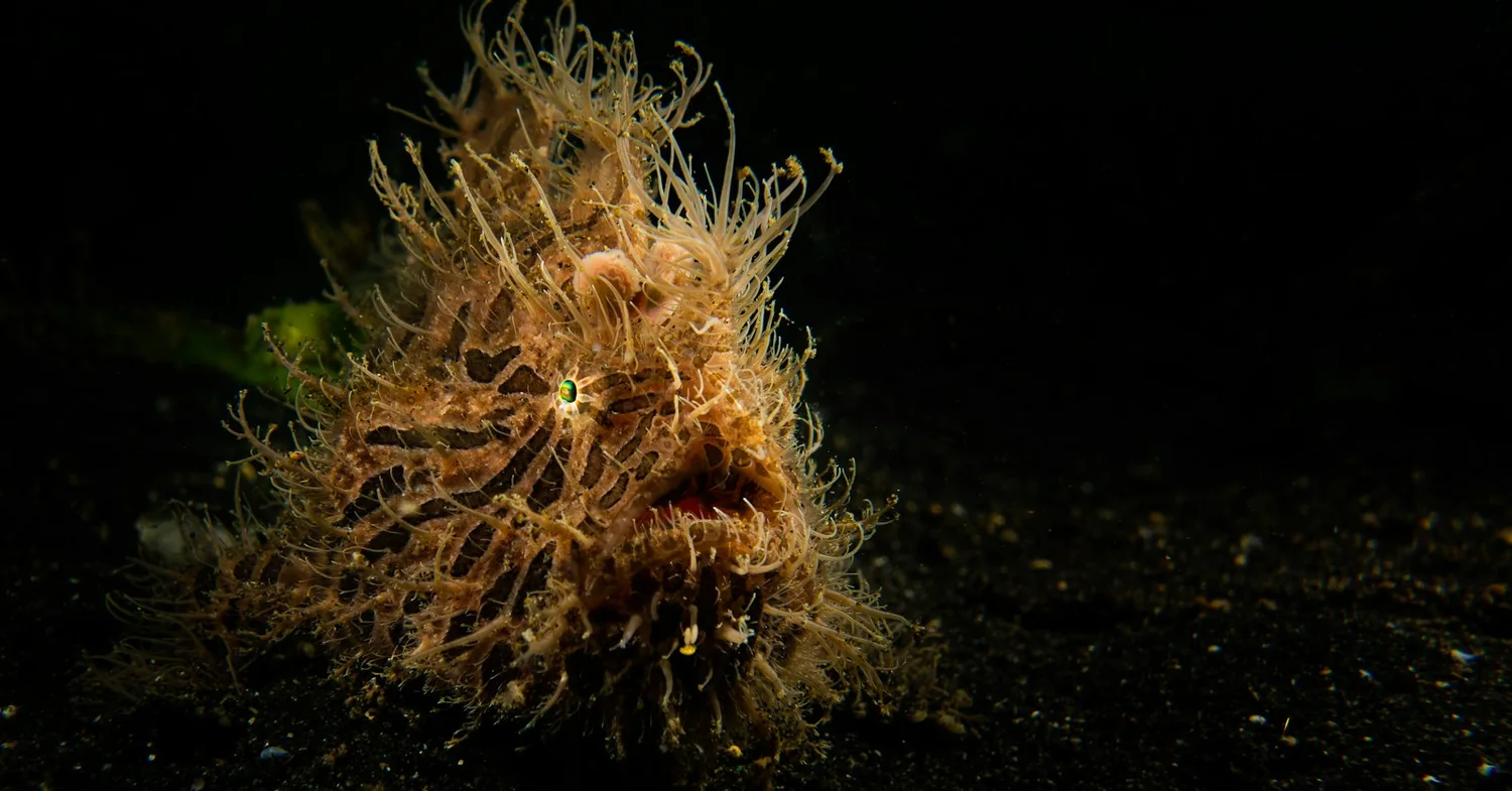
Photo: Unsplash (free licence).
Key takeaways
- Anilao is a single barangay of Mabini; the dive sites are split between Mabini and the island municipality of Tingloy, which separated from Mabini in 1955
- A dive establishment cannot legally operate without a licence from the Philippine Commission on Sports Scuba Diving, and accreditation lasts one year from issue
- The conservation fee began at 50 pesos a day under a 2003 Mabini ordinance and became a unified 100 peso pass split 50-50 with Tingloy in September 2005
- A 2007 to 2008 survey of 41 stations around the passage found mean live hard coral cover of 24 per cent; Mabini led the eight municipalities at 33.8 per cent, Tingloy trailed at 19.2
- The Philippine Coast Guard confirmed on 20 March 2023 that oil from MT Princess Empress had reached Batangas, and Tingloy was among the areas placed under monitoring
Anilao is one barangay, and the dive sites cross a municipal boundary
Start with the naming, because it decides what you pay and who polices the water. Anilao is a barangay of Mabini, a municipality on the Calumpan Peninsula in Batangas province, and the peninsula divides Balayan Bay to the west from Batangas Bay to the east. Mabini covers 4,296 hectares with about 32 kilometres of coastline.
The barangay gave its name to a dive area much larger than itself. Divers in the 1970s parked at Anilao and took boats out, and the destinations they reached in Mabini, Bauan and Tingloy became known collectively by the name of the car park. Barangay Anilao has no dive site of its own.
The second municipality matters more than the maps suggest. Tingloy was part of Mabini until it was declared a separate municipality in 1955, covers 3,241 hectares and is reached by ferry. It holds Maricaban and Caban islands and the smaller Sombrero, Bonito and Malajibongmanoc, and a large share of the well known sites sit in its municipal waters, not Mabini’s.
That split is why the fee is collected twice, and why a boat leaving a Mabini resort often crosses a jurisdiction before the first descent.
Manila is close enough to change the shape of the week. The WWF case study puts the drive at 127 kilometres and two and a half hours, and records what that did to the dive market: weekend divers commonly stayed one night and made four dives, and surveyed divers came about once a month, with fewer than 5 per cent on a first dive.
The supply side grew to match. There were 10 registered resorts by the end of the 1980s, 23 by 1994 and 73 by 2006, more than half with diving facilities. Our Anilao operator list holds 9 businesses, read on 21 August 2026.
The licence a Philippine dive shop has to hold, and who issues it
The Philippines is unusual in this directory because a national body accredits dive businesses by name. The Philippine Commission on Sports Scuba Diving was created by Letter of Instruction No. 745, issued on 29 September 1978, and it now sits under the Department of Tourism with an office on Sen. Gil Puyat Avenue in Makati City.
The obligation is flat. Its Rules and Regulations Governing the Business of Sport Scuba Diving, dated 28 January 2009, state that no person, natural or juridical, shall operate or manage a scuba diving establishment without first being licensed by the commission. Dive professionals need their own licence.
The 2003 accreditation rules define the certificate and price it. Accreditation is a certification recognising compliance with the minimum standards required in the operation of a sports scuba diving establishment or as a diving professional. It is valid for one year from the date of issuance. The annual fee for a professional dive centre, shop or facility is 2,000 pesos, a branch 500, an instructor 1,000 and a divemaster 750.
What has to be true to get it is specific. An establishment registers with the SEC or the Bureau of Domestic Trade, holds local government permits, submits an employee list, and staffs at least one divemaster and one instructor. Dive boats and bancas need Philippine Coast Guard permits and MARINA registration. Compressor output is capped at 500 ppm carbon dioxide, 20 ppm carbon monoxide and 5 mg per cubic metre of oil.
The 2009 rules add cover and conduct. Accident liability insurance is mandatory for all dive establishments and dive professionals, and destroying coral, harming endangered species, spearfishing and unauthorised salvage of artefacts are prohibited. Liveaboard vessels carry their own fittings list, down to one toilet and shower per six passengers.
One thing the scheme does not currently do is publish who holds it. As of September 2026 the commission’s website carries a home page and an application page linking to two Google Forms, with no list of accredited establishments, so the certificate on the wall is the only thing a diver can read. Which registers can be read logs what each source returned and on what date.
A second label on Anilao walls means something different. The Department of Tourism accredits tourism enterprises, including accommodation, so a dive resort can hold that without being a licensed dive establishment.
What the Verde Island Passage study actually measured
Anilao is sold on a single phrase, and the phrase is worth unpicking, because the paper behind it says something narrower and more useful. Kent Carpenter and Victor Springer published The center of the center of marine shore fish biodiversity: the Philippine Islands in Environmental Biology of Fishes in 2005.
The abstract states the method plainly. Analysis of distribution data for 2,983 species identifies a peak of marine biodiversity in the central Philippine Islands, with a secondary peak between peninsular Malaysia and Sumatra, the pattern repeated across habitat and higher taxa classes and strongest for marine shore fishes.
The comparison the paper draws is with Indonesia, not with the world. Its own words are that there is a higher concentration of species per unit area in the Philippines than anywhere in Indonesia, including Wallacea, and that special attention to marine conservation in the Philippines is justified by its identification as an epicentre of biodiversity and evolution.
The number everybody quotes is not in that abstract. 1,736 overlapping marine species over a 10 kilometre area appears in the Verde Island Passage Marine Corridor management plan framework, the 2007 document written in response to Executive Order No. 578 of 8 November 2006, which credits the figure to Carpenter and Springer and calls the result the highest concentration of marine life in the world.
So the defensible version is this. The passage lies inside the region the peer-reviewed work identifies as richest for shore fishes per unit area, and the passage-specific count is a government framework’s rendering of that work rather than a line in the paper. The passage itself runs between southern Batangas and northern Mindoro, is divided by Verde Island into a North Pass and a South Pass, and covers roughly 1.4 million hectares across five provinces.
The conservation fee is a municipal ordinance, and both towns collect
Anilao’s diver fee is one of the older user-fee schemes in Philippine marine management. WWF-Philippines surveyed more than 230 divers in 2000 and found 97 per cent of Filipinos and 86 per cent of foreigners willing to pay a per-visit surcharge for the reefs. The study recommended 400 pesos per diver for a weekend.
The divers negotiated it down. At a consultation in August 2002 they agreed to 50 pesos per day of diving, with an annual pass at 1,000 pesos. The Mabini ordinance passed in February 2003, collection started in September 2003 and the scheme launched that November.
Tingloy passed its own ordinance in late 2003 and then could not collect, because every resort and dive shop was in Mabini. The fix took until September 2005: Mabini collects on Tingloy’s behalf, the proceeds are split 50-50 after administrative expenses, and the unified pass cost 100 pesos a day or 1,800 pesos a year for access to sites in both municipalities.
Enforcement runs through tanks and boats. A resort that lets guests dive without a pass has air tanks confiscated, redeemable on payment of a 2,000 peso penalty. A boat operator caught carrying divers without passes is fined 1,000 pesos and faces a 15-day licence suspension. Each detached ticket stub is worth 10 pesos back to the boat operator. Between September 2003 and December 2006 the scheme collected 5,628,130 pesos.
The current amount is where sources stop agreeing. A resort rate sheet valid for the 2026 calendar year gives 300 pesos per person per boat diving day, not included in package rates; news reporting from 2018 gives 200 pesos per diver with 50 of it going to Tingloy. Both are stated here because the fee is set by ordinance and has been raised more than once.
The framework around it was rewritten recently. Ordinance No. 031-2023, the Mabini Integrated Coastal Management Code of 2023, was signed on 27 October 2023 and took effect on 19 January 2024. It creates an Integrated Coastal Management Office, a community law enforcement group and an Integrated Coastal Management Trust Fund holding the regulatory fees and fines, and it regulates free diving and coral propagation work.
The sanctuaries off Mabini and Tingloy, declared in 1991 and 2002
Protection here predates the fee by twelve years. A national marine park covering Sombrero Island and parts of Caban and Maricaban was proposed in 1982 and never made legal. Before that, in 1978, a presidential decree declared the islands and reefs a tourism zone and restricted spearfishing on scuba.
The working instrument arrived in 1991, when Mabini declared its first marine reserve by municipal ordinance and established three sanctuaries inside it. Their areas are recorded as Cathedral at 22.9 hectares, Arthur’s Rock at 17.9 hectares and Twin Rocks at 15.3 hectares. Baseline data were collected on all three that same year.
Tingloy followed in 2002 with the Batalang Bato Marine Sanctuary at Pulang Buli reef, off Maricaban Island. Divers know the site by the red buri palm facing it; the ordinance uses the local name. It was closed to fishing and to diving alike, the one protected patch here that divers are not meant to enter.
The monitoring series shows what the closures did. A 2005 expedition surveying nine sites across the two municipalities found live hard coral cover from 20.3 per cent at White Sand Reef to 75.3 per cent at Cathedral Reef Sanctuary at 7 to 8 metres, with Cathedral up from 53.8 per cent in 2001.
Fish told a sharper story. Target fish density was lowest at White House Reef, outside any sanctuary, at 18.0 individuals per 500 square metres, and highest inside Batalang Bato at 267.2. Batalang Bato also carried the highest target fish biomass at 93.87 kilograms per 500 square metres and showed a 153.2 per cent increase in target fish since 2001.
Sanctuary status did not guarantee it. Cathedral Reef Sanctuary recorded a 77.3 per cent decline in target fish over the same four years, and butterflyfish at Cathedral Rock fell from 19 species in 2001 to 5 in 2005, while Sombrero Island rose from 17 to 23. The report attributes anchor damage at non-sanctuary dive sites as a direct cause of rubble.
Coral cover and reef fish counts for Mabini and Tingloy
A passage-wide baseline puts the Anilao reefs in their actual position. Surveys carried out in 2007 and 2008 covered 41 stations across eight municipalities around the passage, using video and photo transects.
Overall mean live hard coral cover across the passage came to 24 per cent, the poor category on the Philippine scale, and not one of the eight municipalities reached the good band.
Mabini finished top of the eight. Its live hard coral cover was 33.8 per cent, the highest in the survey, and still only fair. Tingloy, which holds many of the island sites, came in at 19.2 per cent and sat in the poor category alongside Calatagan at 24.2, Lubang at 24.8 and San Juan at 19.6. Batangas City was last at 12.9.
Fish diversity ran the other way for Tingloy. Mabini recorded the highest reef fish species richness on the belt transects with 151 species, followed by Lubang at 147, Tingloy at 142 and Batangas City at 139. Mabini also had the most coral genera at 45, with Tingloy at 41. Mabini and Tingloy each contributed only three survey stations, so these are small samples of a long coastline.
The national picture gives that 33.8 some scale. A nationwide assessment of 166 stations in 31 provinces, sampled from 2015 to 2017, put average hard coral cover weighted by reef area at 22 per cent. No station fell in the excellent category, and more than 90 per cent were poor or fair.
The projections are the least comfortable numbers in the file. Modelled loss of live hard coral cover from rising sea surface temperature ran from 3 to 22 per cent across the passage, and Mabini at 11 to 22 and Tingloy at 14 to 21 were the two most vulnerable, because their reefs carry more of the thermally sensitive acroporids and pocilloporids. Satellite records showed the largest cover losses at Lubang and Maricaban.
Macro and muck, and what a week of it looks like
Anilao’s reputation is not built on big animals. The signature dive is a slow crawl over black volcanic sand, rubble and sponge at 5 to 20 metres, hunting animals measured in centimetres, which is the working definition of macro and muck diving.
The taxonomy backs the habit. A coral survey of Batangas in 2003 recorded 319 species and 74 genera of hard corals, a figure updated to 338 after further Anilao work in July 2007. Those counts are reported through the WWF case study rather than published as a paper of their own.
The institutional expeditions have been repeat visitors. The California Academy of Sciences ran biodiversity expeditions to the passage in 2011, 2014 and 2015. The 2014 trip spent seven weeks working sites including Mabini, Balayan Bay to Calatagan and the waters around Lubang, and collected over 400 marine species.
The 2015 expedition put nearly 50 scientists on the eastern half of the passage, including the deep, high-current water around Verde Island, working from the surface down into the twilight zone between 200 and 500 feet. It returned more than 100 species likely new to science, including more than 40 new nudibranchs.
That shapes the week. Four dives a day, most under 20 metres, with the interesting part happening inside a metre of sand. A focus light and a good dive torch do more work here than a bigger camera; the other Philippine muck coast, Dauin, reads the same way.
Amihan, habagat, and which way the passage flows
Two monsoons set the year, and they are named locally. The northeast monsoon, the amihan, dominates the wind field over this water from November to March, with wind speeds generally 8 to 10 metres per second. The southwest monsoon, the habagat, runs June to October at under 5 metres per second, interrupted by spikes tied to typhoons.
PAGASA divides the national year differently. It gives a rainy season from June to November and a dry season from December to May, split into a cool dry period from December to February and a hot dry period from March to May. The reported peak dive season here runs March to June.
The direction of the water follows the wind. Net flow in the Verde Island Passage runs west during the northeast monsoon and east during the southwest monsoon, and the passage is at its shallowest and narrowest near Verde Island itself. That reversal is the reason a site can behave differently in January and in August at the same state of tide.
Wave height is the surprise. Because the passage is narrow, the fetch is short and waves do not develop: modelled significant wave heights were 0.25 metres in 1998, 0.35 in 1997 and 0.5 metres in 2008. Even a simulated 40 knot onshore wind raised sea level by only 0.01 to 0.04 metres on the western side.
So the limiting factor is current rather than swell. The sheltered Mabini shoreline holds up when the strait does not, and the exposed corners and the water around Verde Island turn into drifts. Our drift diving list covers the technique; Puerto Galera sits on the Mindoro side of the same water.
The 2023 oil spill and what reached Maricaban Island
The passage carries the traffic as well as the reefs. Batangas hosts the country’s second largest international port, two of its three oil refineries and twelve industrial estates, and fourteen municipalities and one city border the passage. Vessel-sourced pollution was already listed as a principal threat in the 2007 framework.
The event came on 28 February 2023, when the tanker MT Princess Empress sank off Naujan in Oriental Mindoro. Published cargo figures disagree: the Philippine Coast Guard was reported as 900,000 litres of industrial fuel and departmental situation reports give 800,000 litres of industrial fuel oil. The wreck was located at 389 metres.
It reached Batangas three weeks later. The Coast Guard confirmed on 20 March 2023 that oil had arrived in the province, with sightings around Verde Island about 4.4 nautical miles offshore. Tingloy was named among the coastal areas placed under monitoring, alongside San Juan, Lobo and Calatagan, which puts the Maricaban Island dive sites inside the affected zone.
The scale was national. By early April 2023 the slick had spread across roughly 155 miles and threatened more than 20 marine protected areas, with 193,436 people in 40,897 families recorded as affected across Oriental Mindoro, Batangas, Palawan and Antique.
The legal frame was already in place and did not prevent it. Executive Order No. 578 of 2006 established the national policy on biological diversity and named the Verde Island Passage Marine Corridor specifically, creating a task force to produce a management plan within 120 days. The corridor supports over 7 million people, and their livelihoods are what a spill reaches first. Dive medical cover sits outside all of this, which is what our dive insurance comparison is for.
FAQ: scuba diving in Anilao
Where is Anilao and which municipality do the dive sites belong to?
Anilao is a barangay of Mabini, a municipality on the Calumpan Peninsula in Batangas province, about 127 kilometres from Manila. The dive area everyone calls Anilao is larger than the barangay and crosses a municipal boundary: sites along the Mabini shoreline belong to Mabini, and the sites around Maricaban, Caban and Sombrero islands belong to the separate island municipality of Tingloy, which was split off from Mabini in 1955.
Does a dive shop in the Philippines need a government licence?
Yes. The Philippine Commission on Sports Scuba Diving was created by Letter of Instruction No. 745 of 29 September 1978 and sits under the Department of Tourism. Its 2009 rules state that no person, natural or juridical, shall operate or manage a scuba diving establishment without first being licensed by the commission. Accreditation certifies compliance with minimum standards, runs for one year from issue, and requires accident liability insurance.
Can you check whether an Anilao dive centre is PCSSD accredited?
Not from the commission website as it stands in September 2026, which carries a home page and an application page linking to two Google Forms, with no list of accredited establishments. A page listing them existed at the same domain in earlier years. Asking the operator to show the certificate is the practical route, because accreditation is valid for one year from the date of issuance and the paper carries that date.
How much is the conservation fee for diving in Anilao?
It is set by municipal ordinance and it has risen repeatedly. Mabini divers agreed to 50 pesos a day in August 2002 and the ordinance passed in February 2003. From September 2005 a unified pass covering both municipalities cost 100 pesos a day or 1,800 pesos a year, with proceeds split evenly between Mabini and Tingloy after administrative expenses. Current published amounts disagree: a resort rate sheet for 2026 gives 300 pesos per diver per boat diving day, while news reporting from 2018 gives 200 pesos.
Which marine sanctuaries can you dive at Anilao?
Mabini declared a marine reserve by municipal ordinance in 1991 containing three sanctuaries: Cathedral at 22.9 hectares, Arthur's Rock at 17.9 hectares and Twin Rocks at 15.3 hectares. Tingloy declared the Batalang Bato Marine Sanctuary at Pulang Buli reef in 2002, and that one was closed to fishermen and divers alike. Cathedral, Arthur's Rock and Twin Rocks are dived regularly and were the three sites with the longest monitoring record in the area.
Is the Verde Island Passage really the most biodiverse water on earth?
The peer-reviewed paper behind the phrase is narrower than the slogan. Carpenter and Springer analysed distribution data for 2,983 species in 2005 and identified a peak of marine biodiversity in the central Philippine Islands, with a higher concentration of species per unit area in the Philippines than anywhere in Indonesia. The figure of 1,736 overlapping species in a ten kilometre area appears in the Verde Island Passage management plan framework of 2007, which credits it to that study.
What is the coral cover like on the reefs off Mabini and Tingloy?
A survey of 41 stations across eight municipalities around the passage in 2007 and 2008 put the mean live hard coral cover at 24 per cent, which is the poor category. Mabini scored highest of the eight at 33.8 per cent, which is only fair, and Tingloy came in at 19.2 per cent, which is poor. Mabini also recorded the most reef fish species on the belt transects at 151, ahead of Lubang at 147 and Tingloy at 142.
When is the best time to dive Anilao, and what do the monsoons do?
The northeast monsoon, the amihan, dominates the wind field from November to March at wind speeds of 8 to 10 metres per second, and the southwest monsoon, the habagat, runs June to October at under 5 metres per second with typhoon spikes. PAGASA gives the national rainy season as June to November and the dry season as December to May. Net flow through the passage runs west during the northeast monsoon and east during the southwest monsoon.
Did the 2023 Oriental Mindoro oil spill reach the Anilao dive sites?
Oil reached the passage. MT Princess Empress sank off Naujan in Oriental Mindoro on 28 February 2023, and the Philippine Coast Guard confirmed on 20 March 2023 that oil had reached Batangas, with sightings around Verde Island roughly 4.4 nautical miles offshore. Tingloy, the municipality holding the Maricaban Island dive sites, was among the coastal areas under Coast Guard monitoring. Published cargo figures disagree at 800,000 and 900,000 litres of industrial fuel oil.
Founder of NOMADREEF and a former digital nomad. This guide is sourced from the references below; conditions, prices and rules change, so verify current details, and follow qualified local guidance and safety briefings. About the author · LinkedIn ↗
Sources
- The licence every dive establishment needs. No person, natural or juridical, may operate or manage a scuba diving establishment without first being licensed by the commission; dive professionals licensed separately; mandatory accident liability insurance; prohibitions on coral destruction, harming endangered species, spearfishing and unauthorised artefact salvage; liveaboard fittings down to one toilet and shower per six passengers. Rules and Regulations Governing the Business of Sport Scuba Diving in the Philippines, 28 January 2009, Supreme Court E-Library. Read 20 September 2026.
- What accreditation is, costs and requires. Accreditation as a certification recognising compliance with the minimum standards required in the operation of a sports scuba diving establishment or as a diving professional; validity of one year from date of issuance; annual fees of 2,000 pesos for a dive centre, shop or facility, 500 for a branch, 1,000 for an instructor and 750 for a divemaster; business registration, local permits, Coast Guard and MARINA papers for boats, minimum staffing of one divemaster and one instructor; compressor limits of 500 ppm carbon dioxide, 20 ppm carbon monoxide and 5 mg per cubic metre of oil. Rules and Regulations Governing the Accreditation of Sports Scuba Diving Establishments, 10 April 2003. Read 20 September 2026.
- The commission and its published register. Letter of Instruction No. 745 of 29 September 1978 created the commission. Its website and application page carry the Makati City address, a tourism.gov.ph contact and two Google Form links, and no list of accredited establishments; such a page existed at the same domain in earlier years. Both read 20 September 2026, and the limits of each source are set out on which registers can be read.
- The peer-reviewed biodiversity claim. Distribution data for 2,983 species identifying a peak of marine biodiversity in the central Philippine Islands and a secondary peak between peninsular Malaysia and Sumatra, strongest for marine shore fishes, with a higher concentration of species per unit area in the Philippines than anywhere in Indonesia. Carpenter and Springer, The center of the center of marine shore fish biodiversity: the Philippine Islands, Environmental Biology of Fishes 72(4): 467-480 (2005), doi 10.1007/s10641-004-3154-4. Read 20 September 2026. The abstract carries neither the figure of 1,736 species in a 10 kilometre area nor the name of the Verde Island Passage.
- The passage, its boundaries and the 1,736 figure. The passage between southern Batangas and northern Mindoro, split by Verde Island into a North Pass and a South Pass, covering roughly 1.4 million hectares; Batangas hosting the second largest international port, two of three oil refineries and twelve industrial estates, with fourteen municipalities and one city bordering the passage; vessel-sourced pollution among the listed threats; 1,736 overlapping marine species over a 10 kilometre area credited to Carpenter and Springer. A Management Plan Framework for the Verde Island Passage Marine Corridor (PDF). Read 20 September 2026.
- The executive order behind that framework. The national policy on biological diversity, naming the Sulu-Sulawesi Marine Ecosystem and the Verde Island Passage Marine Corridor, with a task force and a management plan due within 120 days. Executive Order No. 578, 8 November 2006, Official Gazette. Read 20 September 2026.
- Coral cover, fish counts, monsoons and projections. Surveys of 2007 and 2008 across 41 stations in eight municipalities; mean live hard coral cover of 24 per cent, the poor category; Mabini highest at 33.8 per cent and Tingloy at 19.2, with Calatagan 24.2, Lubang 24.8, San Juan 19.6 and Batangas City 12.9; reef fish richness of 151 for Mabini, 147 Lubang, 142 Tingloy, 139 Batangas City; 45 coral genera for Mabini and 41 for Tingloy; three stations each for Mabini and Tingloy; modelled cover loss of 3 to 22 per cent across the passage, Mabini 11 to 22 and Tingloy 14 to 21; largest satellite-observed losses at Lubang and Maricaban; northeast monsoon winds of 8 to 10 metres per second from November to March and southwest monsoon under 5 from June to October; wave heights of 0.25 to 0.5 metres; storm surge of 0.01 to 0.04 metres under a simulated 40 knot wind; net flow west in the northeast monsoon and east in the southwest; five provinces and over 7 million people. Boquiren, Di Carlo and Quibilan (Eds), 2010, Climate Change Vulnerability Assessment of the Verde Island Passage, Philippines (PDF), Conservation International. Read 20 September 2026.
- The national coral cover baseline. 166 stations in 31 provinces sampled from 2015 to 2017, average hard coral cover weighted by reef area of 22 per cent, no station in the excellent category and more than 90 per cent poor or fair. Licuanan, Reyes, Luzon, Chan and Licuanan, Initial findings of the nationwide assessment of Philippine coral reefs, Philippine Journal of Science 146(2): 177-185. Read 20 September 2026.
- The sanctuaries and their monitoring record. The 1978 tourism zone decree and its spearfishing restriction; the 1982 marine park proposal for Sombrero, Sepoc and Layag-Layag that was never made legal; the 1991 Mabini ordinance creating one reserve with the Cathedral Rock, Arthur’s Rock and Twin Rocks sanctuaries; Batalang Bato declared in 2002 with no fishing and no diving; live hard coral cover from 20.3 per cent at White Sand Reef to 75.3 at Cathedral Reef Sanctuary at 7 to 8 metres, Cathedral rising from 53.8 per cent in 2001 to 67.5; target fish density of 18.0 per 500 square metres at White House Reef and 267.2 at Batalang Bato, with biomass of 93.87 kilograms and a 153.2 per cent rise since 2001; a 77.3 per cent decline at Cathedral Reef Sanctuary; butterflyfish at Cathedral Rock falling from 19 species to 5 and Sombrero Island rising from 17 to 23; anchor damage at non-sanctuary sites. White, Maypa, Tesch, Stockwell, Meneses, White and Mueller, 2005, Summary Field Report: Coral Reef Monitoring Expedition to Mabini and Tingloy, Batangas (PDF). Read 20 September 2026.
- The sanctuary areas in hectares. Arthur’s Rock Sanctuary (1991) 17.9 hectares, Cathedral Sanctuary (1991) 22.9 hectares and Twin Rocks Sanctuary (1991) 15.3 hectares inside the Mabini Marine Municipal Reserve (1991), and the Batalang Bato Marine Sanctuary (2002) in Tingloy. State of the Coasts of Batangas Province (PDF), Provincial Government of Batangas and PEMSEA. Read 20 September 2026.
- The fee, the towns and the numbers behind them. Mabini at 4,296 hectares with a 32 kilometre coastline, 127 kilometres and two and a half hours from Manila; Tingloy at 3,241 hectares, separated in 1955, reached by ferry, holding Maricaban, Caban, Sombrero, Bonito and Malajibongmanoc; Barangay Anilao holding no dive site of its own; 10 registered resorts by the end of the 1980s, 23 by 1994 and 73 by 2006 with more than half offering diving; a survey of over 230 divers in 2000 with 97 per cent of Filipinos and 86 per cent of foreigners willing to pay and a recommended 400 pesos per weekend; the August 2002 agreement on 50 pesos a day and a 1,000 peso annual pass, the February 2003 ordinance and September 2003 collection; the September 2005 unified pass at 100 pesos a day or 1,800 a year on a 50-50 split after administrative expenses; penalties of 2,000 pesos to redeem confiscated tanks and 1,000 pesos plus a 15-day suspension for boat operators, with 10 pesos per stub; collections of 5,628,130 pesos from September 2003 to December 2006; divers averaging one visit a month and four dives, fewer than 5 per cent first-timers; 319 species and 74 genera of hard corals recorded in Batangas in 2003. Salao, Honasan and Sandalo, 2007, Anilao Paying to Play: The Dive Fees of Mabini and Tingloy (PDF), WWF-Philippines. Read 20 September 2026. The updated figure of 338 coral species after July 2007 Anilao work comes from the WWF Coral Triangle field record, read 20 September 2026; neither coral count was published as a paper of its own.
- The current fee, and the disagreement over it. A rate sheet valid 1 January to 31 December 2026 gives an Anilao diving park fee of 300 pesos per person per boat diving day, payable on check-out and not included in package rates: Solitude Acacia Resort rates and packages. Reporting from 2018 gives 200 pesos per diver with 50 going to Tingloy: Philippine Daily Inquirer. Both read 20 September 2026; the figures disagree and both are stated.
- The 2023 coastal management code. Ordinance No. 031-2023, the Mabini Integrated Coastal Management Code of 2023, signed 27 October 2023 and effective 19 January 2024, creating the Integrated Coastal Community Management Council, the Integrated Coastal Management Office, a community law enforcement group and a trust fund holding regulatory fees and fines, and covering free diving and coral propagation. BusinessMirror, Saving Mabini, Batangas’s coastal, marine ecosystem and Batangas town okays ridge-to-reef coastal management. Both read 20 September 2026.
- The expeditions and the new species. Seven weeks in 2014 at sites including Mabini in Batangas, Balayan Bay to Calatagan and the waters around Lubang, with over 400 marine species collected: California Academy of Sciences. Nearly 50 scientists on the eastern half of the passage in 2015, including the twilight zone between 200 and 500 feet, returning more than 100 species likely new to science and more than 40 new nudibranchs: 2015 Philippine Biodiversity Expedition and the accompanying release. All read 20 September 2026.
- The seasons as the national service defines them. A rainy season from June to November and a dry season from December to May, subdivided into a cool dry season from December to February and a hot dry season from March to May. PAGASA, Climate of the Philippines. Read 20 September 2026.
- The oil spill. MT Princess Empress sinking on 28 February 2023 off Naujan, and Coast Guard confirmation on 20 March 2023 that oil had reached Batangas, with sightings around Verde Island about 4.4 nautical miles offshore and Tingloy monitored alongside San Juan, Lobo and Calatagan, at a cargo figure of 900,000 litres: GMA News, 20 March 2023. A figure of 800,000 litres of industrial fuel oil and the monitoring of Batangas City and Tingloy appear in the Department of Environment and Natural Resources situational reports. The wreck depth of 389 metres comes from NOAA Office of Response and Restoration, which gives more than 900,000 litres plus diesel. All read 20 September 2026; the volume figures disagree and both are stated.
- The nine businesses. Nine dive businesses on the Anilao operator list, read 21 August 2026, all nine published by SSI in its register of affiliated centres, and 6 of the 9 publishing a website there. None appears in the IKO or VDWS registers and none is a Green Fins member. The register files the nine under Batangas in five different spellings, from “MABINI” to “Batangas City”, because Anilao is a barangay of the municipality of Mabini in Batangas province and the register records the administrative unit rather than the dive area.