Sylt Kitesurfing: Three Legal Zones, Opposite Tides and a Cold North Sea
 by Yannick Schroth
Nov 4, 2026
14 min read
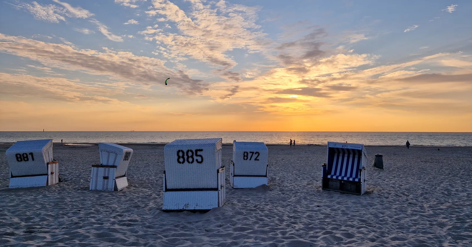
Beach chairs at Westerland at sunset, 29 July 2022, with a kite in the sky left of center. Photo: Strubbl, Wikimedia Commons, CC BY-SA 4.0, cropped.

Key takeaways
- Section 6(2) of the North Sea Navigation Ordinance bans kite and wing craft on the park's waterways, and only the three Sylt zones in Annex 3 lift that ban here; fines run up to 5,000 euros
- The west coast zone is about 900 meters wide with no time limit, and it starts where the park starts, 150 meters seaward of mean high water
- List opens around high water and Hörnum around low water, so the two windows largely alternate
- ERA5 puts July at 60 percent of days reaching 12 knots and January at 81 percent, while mean water runs from 3.0°C in February to 18.5°C in August
- Three rental portals put long-lease rents at about 18 to 21 euros per square meter, and coworking starts at 20 euros a day
Sylt kitesurfing is banned by default, and three zones are the exception
Most of the water around Sylt is national park, and the park's starting position on kites is no. Section 6(2) of the North Sea Navigation Ordinance (Nordsee-Befahrensverordnung), in force since April 2023, forbids using the federal waterways of the Wadden Sea parks “with watercraft pulled by a kite or wing, in particular kitesurfing, wingsurfing”. The next sentence lifts that ban only where Annex 3, Section A lists a permit zone.
Schleswig-Holstein has 22 entries in that list, and the first three are on Sylt. Riding outside them is an administrative offense under Section 10. Section 50 of the Federal Waterways Act sets the fine at up to 5,000 euros. Annex 3 draws each zone as a chain of coordinates.
| Annex 3 zone | Time limit in the ordinance | Latitude span | Area, calculated | Spots inside it |
|---|---|---|---|---|
| Sylt, west coast | None | 54°45.2′N to 55°3.0′N | about 3,060 ha | K4, Brandenburger Strand, Wenningstedt |
| Sylt, List | 3 hours before to 3 hours after high water | 55°1.5′N to 55°2.8′N | about 240 ha | Königshafen |
| Sylt, Hörnum | 3 hours before to 3 hours after low water | 54°45.8′N to 54°46.9′N | about 90 ha | Möwennest |
Together that is about 3,390 hectares, a quarter of the state's “just under 13,000”. Wing foilers fall under the same clause and the same zones. Windsurfers do not. The park's 2025 leaflet lets windsurfing and wave riding happen in other parts of the park too, subject to distance from birds and the entry ban on Zone 1.
That difference matters. Surf magazine's Sylt guide sends windsurfers to Munkmarsch and Rantum Ost, and neither is an Annex 3 kite zone. A windsurf spot map is not a kite permit. Sylt Marketing also lists a kite area on the Lister east coast at beach crossings 140 and 141. The List zone begins about 900 meters north of the gauge at List harbor, so check that stretch against the park's zone map before you rig.
Sylt's west coast zone starts 150 meters out, so the beach has separate rules
The west coast zone is the one that makes Sylt work as a kite island. It runs from off Hörnum to the Ellenbogen, about 900 meters wide for almost its whole length, and the ordinance gives it no tide limit. Sylt Marketing counts 40 kilometers of coast on this side.
It does not touch the sand. Section 3 of the state National Park Act puts the park boundary on the west beaches of Sylt and Amrum 150 meters seaward of mean high water, and the ordinance only applies inside the park. The first stretch you cross belongs to the beach, the bathing zones and the general shipping rules.
Those rules bite. Sylt Marketing says of Wenningstedt that surfing is not permitted in the designated swimming area, and that the water sports beach lies south of the school entrance, with signposts marking the limit. The park leaflet asks for 50 meters from visible bathing, citing Section 26 of the federal shipping rules. Ask at the school or the lifeguard hut where the line runs that day.
K4 is the pick of this coast for most visitors. Sylt Marketing places it between Rantum and Hörnum, with tidal creeks and sandbanks forming sheltered shallows at low tide. The park calls it a designated surf and kite beach, with a large car park at beach crossing 74. Surf magazine reports no groynes, a sandbank that dries about two hours either side of low water, and hollow waves with a real current once the flood starts. Learn the low-tide version first.
List and Hörnum kite on opposite tides, so a Sylt week needs a tide table
The Wadden side is where Sylt gets its flat water, and the law ties it to the clock. Annex 3 opens List “from three hours before to three hours after high water”. It opens Hörnum for the same stretch around low water. Outside those windows there is no permit zone, and the general ban is back. The two sites sit at opposite ends of the island.
The range is modest. Federal gauge values give mean high and low water of 591 and 412 centimeters at List, a range of 1.79 meters, and 604 and 399 at Hörnum, a range of 2.05 meters. The state coastal agency says Sylt is the one area on its coast where the flood runs slightly longer than the ebb. Daily predictions come from the federal hydrographic office, the BSH tide service.
Königshafen, in the crook of the Ellenbogen, is the List zone's main water. It lies in the park's Zone 1, and the park's Sylt leaflet is blunt: stay inside the buoy line, stay off the island of Uthörn, and rig, launch and land only at the kite beach. Sylt Marketing calls it the perfect learning area. Surf magazine warns of real current on the ebb, and says the depth is only good for two to three hours either side of high water.
The road in is private. Sylt Marketing's route description gives a toll of 8 euros per car, while another travel guide still says 6. Bicycles and pedestrians pass free.
Möwennest, behind the youth hostel north of Hörnum, is the low-tide counterpart. A sandbank dries offshore and leaves mirror-flat water, best in an east wind. The park asks for at least 300 meters, kite included, from the Hörnum spit, whose limit shows as cardinal marks at high water. Surf magazine reports almost no parking and mussel beds underfoot, so wear shoes.

Brandenburger Strand is Sylt's famous kite beach and the wrong first session
Westerland is where the pictures come from. The GKA Kite World Cup ran here from 25 to 30 August 2026, deciding the Kite-Surf world title and a one-off Hydrofoil Big Air title. The Citroën Windsurf World Cup followed from 25 September to 4 October, with free entry. Surf magazine gives 24 September to 3 October 2027 for the next one. Its organizer claims 200,000 spectators, so expect event weeks to fill the beach and the beds.
Pros come here for difficulty. Sylt Marketing's own entry says high waves, strong currents at times and groynes make for difficult conditions. The PWA's event notes are more specific: very tough in onshore wind because of the shore break, waves of 3 to 4 meters at the top end, and rock lines reaching about 20 meters into the sea every 100 to 200 meters from Westerland to Kampen.
You cannot see those rock lines at high tide. Signs on the beach mark them. Wenningstedt's groynes were removed in winter 2020. Sylt Marketing says kiters there need experience to handle the surf too.
If it goes wrong, call 112 ashore. At sea, Germany's rescue coordination center answers as Bremen Rescue on VHF channel 16 and on +49 421 53687-0, around the clock. The nearest hospital is the Asklepios Nordseeklinik at Norderstraße 81 in Westerland, an acute hospital of basic and standard care. Read the kite clause in your policy before the trip: our watersports insurance guide shows why that clause matters.
Sylt wind peaks when the North Sea bottoms out
The table is the whole trade-off. Wind figures are ERA5 model values for an open-water cell about 10 kilometers off Westerland, so read them as open-sea wind and not as a beach reading. Water figures are NOAA's satellite-based averages for a cell about 6 kilometers from the same beach.
| Month | Mean wind (kn) | Days reaching 12 kn | Mean water (°C) |
|---|---|---|---|
| Jan | 17.1 | 81% | 3.8 |
| Feb | 16.1 | 78% | 3.0 |
| Mar | 14.9 | 75% | 4.1 |
| Apr | 12.8 | 61% | 7.0 |
| May | 12.7 | 63% | 11.0 |
| Jun | 13.1 | 63% | 14.7 |
| Jul | 12.4 | 60% | 17.3 |
| Aug | 12.9 | 63% | 18.5 |
| Sep | 14.4 | 70% | 16.2 |
| Oct | 15.8 | 79% | 12.5 |
| Nov | 16.3 | 81% | 8.9 |
| Dec | 16.5 | 79% | 5.8 |
A day counts when at least three hours between 08:00 and 18:00 local solar time reach 12 knots at 10 meters, over 1991 to 2020. The threshold is ours, and it does not promise a session. Summer is the warm option and the lightest one. September and October carry the most wind you can ride without a serious cold-water plan.
Gauges give a check on the water. The federal sensors read 10.2°C at List and 10.5°C at Hörnum at 08:50 on 4 November 2026, a little warmer than the long-term November mean above. The travel wetsuit guide covers what fits in a bag, but a Sylt February needs a thick suit.
Every Sylt beach sits behind a Kurabgabe, and 28 days changes the math
All five municipalities charge a visitor levy, the Kurabgabe, and it is how you pay for the sand. Overnight guests get a guest card through their accommodation and pay there. Day visitors buy one online or at the controls on the beach crossings. Either way the card works across the whole island, so you can sleep in Wenningstedt and kite at Hörnum.
| Sylt municipality | Overnight, high season | Overnight, low season | Day visitor, high / low | Annual card |
|---|---|---|---|---|
| Westerland, Rantum, Tinnum, Keitum, Munkmarsch, Archsum, Morsum | €4.10 (May–Oct) | €2.05 | €4.10 / €2.05 | €114.80 |
| Hörnum | €4.10 (May–Oct) | €2.05 | €4.50 / €2.25 | €114.75 |
| Kampen | €4.00 (Apr–Oct) | €2.00 | €4.00 / €2.00 | €112 |
| List | €3.60 (May–Sep) | €1.80 | €4.00 / €4.00 | €100.80 |
| Wenningstedt-Braderup | €3.00 (May–Sep) | €1.50 | €3.50 / €1.75 | €84 |
Rates are as of 4 November 2026. The annual card is priced at 28 high-season days almost everywhere: 28 times 4.10 euros is 114.80. Anyone staying a month should buy it. Hörnum's statute also caps an ordinary guest card at 28 days, so a longer stay there needs a new card anyway.
Getting to Sylt means the Hindenburgdamm, a Danish ferry or a thin flight list
There is no road to Sylt. The Hindenburgdamm, opened in 1927, is a railway corridor only, so a car crosses on a train. That train leaves from Niebüll, takes about 35 minutes to Westerland, and you stay in your vehicle. The red DB Sylt Shuttle runs every 30 to 90 minutes from the same terminal as the blue Autozug Sylt.
The blue train costs 80 euros one way or 138 euros return for a car or small van up to 3 tons. Saver fares from 19.90 euros exist on selected trains if you book online at least 48 hours ahead. Kite bags and a car make K4 and Königshafen far easier, and the blue train's fare covers up to seven people.
Without a car, regional trains leave Hamburg-Altona hourly and take about three hours. Direct InterCity trains run once daily from Berlin and Frankfurt and twice from Cologne. The FRS ferry links Havneby on the Danish island of Rømø to List daily.
Flying is mostly seasonal. Sylt Marketing lists direct flights from 12 cities, but several are seasonal: Stuttgart April to October, Kassel May to October, Friedrichshafen July to October, Luxembourg on summer Saturdays. Nuremberg is the one it labels all year.
A month on Sylt is a housing problem before it is a kiting one
The island's own planners state the problem plainly. The 2025 housing concept for Sylt describes a strong decline in permanent housing over many years, as holiday lets and second homes push it out, and second homes in turn push out holiday lets. Remote workers arrive in the middle of that.
Rent figures come from portals, not from an official index, so treat this as a triangulated range. ImmoScout24 gives an average above 21 euros per square meter for the municipality of Sylt, within a spread of 18 to 37. Immoportal gives 17.84 and Miet-Check gives 19.89 for Wenningstedt. On 50 square meters, 18 to 21 euros means about 900 to 1,050 euros a month before utilities, if you can find a lease at all.
Short stays are the realistic route, and their prices swing too widely to quote. The campsite at Hörnum is the one published budget anchor: open 1 April to 30 September 2026, small tent pitches at 11 to 13 euros plus 8 euros per adult a night, rental caravans at 75 to 109 euros. Surf magazine notes the Hörnum east side is walkable from there.
Desks are easier. Project Bay Sylt, the coworking café in Rantum, charges 20 euros a day or 250 euros a month with 24/7 access. co[work]ing sylt in List has eight desks at 180 euros a week, or 750 euros a month without a one-year contract. A rentable room in Westerland publishes 60 Mbps down and 12 up, and costs 130 euros a day.
Off-season, the desks stay open and the island thins out. The Surf Cups on the Westerland promenade run May to October, and Surf magazine says the school at List opens May to September, so ask each school for winter dates. Levies halve in low season.
Sylt kitesurfing demands thick neoprene and a tide table
Warm water is off the table. May averages 11.0°C and June 14.7°C, and the warmest month still only reaches 18.5°C. Planning around tides is not optional either. On the Wadden side the legal window, the depth and the current all move daily, and an hour of bad timing can end in a long walk or a fine.
A first-time learner on a tight budget has better options. The beginner kite destinations list and the flat-water list name warmer water, and Fehmarn is Germany's Baltic alternative with a different set of reserve rules.
Sylt suits a different rider. Someone with a car, a thick wetsuit and solid upwind skills gets three kinds of water on one island: open North Sea waves, low-tide flats at K4 and Möwennest, and high-tide flats at Königshafen. That range is the reason to come. Take the tide table as seriously as the forecast.
Sylt's operator list: six register entries, at most four businesses
The Sylt operator list holds six entries, read on 2 September 2026: five from the VDWS register and one from IKO. Three of them are Südkap Surfing under different names, sharing one website, and one of those three lists no kitesurfing. The others are Duotone Pro Center Sylt at Westerland, Surfschule Sylt at List and Kite School Pro Sylt, which has no website in the register.
A register entry records an affiliation, not an inspection, and it says nothing about this season. It is also not the whole market. Sylt Marketing's water sports page names schools that do not appear under those names in these two registers, including Curly's Surfschule and Rückenwind Kitesurf.
For a price anchor, Duotone Pro Center Sylt published a 1x3-hour kite taster at 200 euros, a 3x3-hour course at 600 euros and private lessons at 160 euros an hour, read 4 November 2026. Those are the school's own figures, and the VDWS license is available at the end of the longer course. Our kitesurfing learning guide covers what a course should include.
FAQ: kitesurfing on Sylt
Where is kitesurfing allowed on Sylt?
In three zones listed in Annex 3 of the North Sea Navigation Ordinance: Sylt west coast, Sylt List and Sylt Hörnum. The west coast zone has no time limit. List is open from three hours before to three hours after high water, and Hörnum from three hours before to three hours after low water. Wing foiling falls under the same clause.
Can you kitesurf at Westerland on Sylt?
Yes. Westerland lies on the west coast zone, and Brandenburger Strand hosted the GKA Kite World Cup in August 2026. Sylt Marketing warns of high waves, strong currents and groynes there. The PWA adds rock lines that disappear at high tide. Stay out of marked swimming areas, and treat this beach as one for experienced riders.
What tide do you need for kitesurfing at List and Hörnum on Sylt?
The opposite ones. The List zone only exists from three hours before to three hours after high water, and the Hörnum zone from three hours before to three hours after low water. Outside those windows the general ban applies again. Mean tidal range is about 1.79 meters at List and 2.05 meters at Hörnum.
Is Sylt good for learning to kitesurf?
It can be, in the right water. Sylt Marketing calls Königshafen a learning area, and K4 and Möwennest get shallow, sheltered water around low tide. All of them depend on the tide. Brandenburger Strand is a poor first session. Duotone Pro Center Sylt quoted 600 euros for a 3x3-hour course when read in November 2026.
What does the beach fee cost for kitesurfing on Sylt?
Overnight guests pay a Kurabgabe of 3.00 to 4.10 euros a day in high season and 1.50 to 2.05 euros in low season, depending on the municipality. The guest card is valid across the island. An annual card costs 84 to 114.80 euros, which pays off at about 28 high-season days in Westerland.
When is the best time for kitesurfing on Sylt?
September and October are the best compromise. ERA5 model data for open water off Westerland shows 70 to 79 percent of days reaching 12 knots, against 60 percent in July, while mean water temperature is still 16.2 and 12.5°C. January is windier at 81 percent, with water near 3.8°C.
Note: Conditions, safety guidance and regulations change. Verify current information with official sources, including the school, the national park administration and the relevant government department, before you travel or kite.
Founder of NOMADREEF and a former digital nomad. This guide is sourced from the references below; conditions, prices and rules change, so verify current details, and follow qualified local guidance and safety briefings. About the author · LinkedIn ↗
Sources
- The kite ban and the zones (primary). Nordsee-Befahrensverordnung of 25 April 2023, BGBl. 2023 I Nr. 113, as amended by Article 3 of the ordinance of 18 March 2024: Section 3(2) on scope; Section 6(2) with the wording “mit Wasserfahrzeugen, die von einem Drachen oder Flügel gezogen werden, insbesondere Kitesurfen, Wingsurfen” and its exception for Annex 3 Section A; Section 10 on offenses; Annex 3 Section A II, entries 1 to 3 (“Sylt – List”, “Sylt – Westküste”, “Sylt Hörnum”), 22 entries in all. gesetze-im-internet.de (PDF). Read 4 November 2026; the English rendering of the clause is our translation. Spans, widths and areas are our own calculation from the published coordinates; place names are a reading aid and the coordinates are the law.
- The fine (primary). Bundeswasserstraßengesetz, Section 50(1) no. 2 and 50(2), “bis zu fünftausend Euro”. gesetze-im-internet.de. Read 4 November 2026.
- The park boundary (primary). Nationalparkgesetz Schleswig-Holstein, Section 3(1) no. 5: on the west beaches of Sylt and Amrum, 150 m seaward of the MThw line. Park administration, law leaflet 2024 (PDF). Read 4 November 2026.
- What the park asks of riders (primary). LKN.SH national park administration: water sports leaflet, December 2025 (PDF), for the 22 zones and just under 13,000 ha, windsurfing outside the zones and the 50 m from bathing; “Surfen und Kiten auf Sylt”, October 2021 (PDF), for Königshafen, K4, crossing 74 and the 300 m at the Hörnum spit; water sports page with the zone map. Read 4 November 2026. The 2021 leaflet predates the 2023 ordinance and marks only K4 on the west side; the ordinance wins.
- Tides (primary). Federal water level service, characteristic values MThw and MTnw: List auf Sylt and Hörnum; ranges are our subtraction. State of Schleswig-Holstein, water levels, for about 1.80 m at List and the flood duration around Sylt. BSH tide service. Read 4 November 2026. The PWA's event notes say “3m tide”; the gauge values are used.
- Water temperature. NOAA/NCEI 1/4 Degree Daily OISST v2.1, long-term monthly mean 1991–2020, grid cell at 54.875°N, 8.375°E, compiled 2 November 2026. Gauge readings of 4 November 2026: List, Hörnum. The BSH publishes weekly North Sea temperature analyses rather than a Sylt monthly series.
- Wind. ERA5 hourly time series, Copernicus Climate Change Service, grid cell at 55.0°N, 8.25°E, 1991–2020, compiled 2 November 2026. Contains modified Copernicus Climate Change Service information. Neither the European Commission nor ECMWF is responsible for any use that may be made of it.
- The spots (tourism board, operators and trade press). Sylt Marketing: water sports, K4, Königshafen, Lister east coast, Möwennest, Wenningstedt, Brandenburger Strand, Ellenbogen route with the 8 euro toll. Surf magazine spot guide, for tide timing, parking and the school at List. viel-unterwegs.de, for the 6 euro toll figure. Read 4 November 2026.
- The events (primary for their own dates). GKA Kite World Cup Sylt 2026 and its preview; 2025 preview naming Brandenburger Strand; Citroën Windsurf World Cup Sylt, organizer site; PWA event page, for the shore break, rock lines and current; Surf magazine, for the 2027 dates; Sylt Marketing Surf Cups. Read 4 November 2026. The PWA places rock lines from Westerland to Kampen; Sylt Marketing says Wenningstedt's groynes were removed in winter 2020.
- The levy (primary). Sylt Marketing, visitor's tax table; Hörnum statute 2026, Sections 5 and 7 (PDF); Kampen statute from 2025 (PDF). Read 4 November 2026. The Hörnum campsite price sheet gives the high season from 1 April; the statute's 1 May is used.
- Getting there. Sylt Marketing: by train, DB Sylt Shuttle, blue Autozug, FRS ferry, by air. RDC Autozug Sylt, for the saver fare. Wikipedia, Hindenburgdamm, for the 1927 opening and the rail-only corridor. Read 4 November 2026. DB's own price page refused the request, so no DB fare is quoted.
- Housing and rent (triangulated from three portals). ImmoScout24, Immoportal, Miet-Check, Wenningstedt; none is an official rent index and no primary source for current rents was found. Wohnraumentwicklungskonzept Sylt 2025 (PDF). Hörnum campsite prices 2026 (PDF). Read 4 November 2026.
- Coworking. Sylt Marketing, coworking and workation, for prices and the 60/12 Mbps figure. Read 4 November 2026. workin.space gives the same Project Bay prices.
- Emergencies (primary). German Maritime Search and Rescue Service, for MRCC Bremen; Asklepios on Sylt, for the hospital and 112. Read 4 November 2026.
- The operators. Six entries on the Sylt operator list, read 2 September 2026, from the VDWS station register and the IKO school register. Our own count, compiled from those registers. Duotone Pro Center Sylt, kite prices; Kiteschule Sylt. Read 4 November 2026.
- Left out. No statute for bathing-zone limits on the beach was reached, so that rule is given only as Sylt Marketing and the park state it. Prevailing wind direction is not quoted. Rail closure plans for 2027 were not established. Holiday rental prices vary too widely to state.