Fehmarn Kitesurfing: The Island Where the Wind Picks the Beach
 by Yannick Schroth
Sep 20, 2026
11 min read
by Yannick Schroth
Sep 20, 2026
11 min read
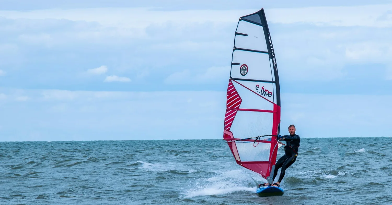
Photo: Unsplash (free licence).
Key takeaways
- Fehmarn’s coast faces north, east, south and west, so the island works in almost any direction: Orth and Gold for flat water, Grüner Brink and Altenteil for waves
- A federal order closes marked zones at Grüner Brink and Krummsteert-Sulsdorfer Wiek to kite and windsurfers all year; only commercial fishing and muscle-powered craft are exempt
- Long-term water temperature at the BSH station on Fehmarn: 4.4 °C in February, 7.5 °C in April, 19.5 °C in August, 11.2 °C in November
- The island’s own weather station records its windiest months in December to March and its calmest in August, which puts the riding season in spring and autumn
- 16 watersports businesses in and around Fehmarn appear in the VDWS register of affiliated centres, read 1 September 2026; all 16 are VDWS, none is SSI and none is IKO
The shape of Fehmarn, and why the wind picks the beach
Most destinations sell a prevailing wind. Fehmarn sells a shape. The island sits in the Fehmarnbelt between Holstein and the Danish island of Lolland, and its coastline turns through north, east, south and west. Wherever the air is coming from, some stretch of that coast has it running along the beach instead of straight onto or off it.
That single fact is the whole argument for the place. A westerly lights up the northwest corner at Altenteil and kills the south coast. An easterly does the reverse and turns Grüner Brink into a wave spot. Riders here read the direction arrow before the strength number, which is the opposite of how most spots get planned.
The island is small enough that changing coast is a short drive rather than a day out. That is why a forecast which would write off a single-beach destination merely relocates a session on Fehmarn.
Orth, Gold and Wulfener Hals: the flat side of Fehmarn
The southwest is where people learn. The Orther Reede is a shallow bay tucked behind the Krummsteert spit, mirror flat in the right direction and standing depth across most of it. A northerly arrives there over land and goes gusty, which is the one thing to know before booking a beginner week on the strength of a forecast.
Gold sits a little east of that, between Lemkenhafen and the Fehmarnsund bridge, on the southern edge of the same reede. It is one of the largest shallow-water areas on the German Baltic coast, and in a westerly the flat runs a long way out before the bottom drops. Gold and Lemkenhafen are two of the places the island’s schools actually sit.
Wulfener Hals, the spit below the village of Wulfen on the southeast, is the third flat option and the busiest. Northwest and east are its classic directions; a southwest is blocked by the campsite ground behind the beach. Kiting on the Burger Binnensee behind Burgtiefe is restricted in favour of windsurfers and paddleboards, so treat the lagoon and the open coast as separate questions.
Flügger Strand runs north from the Flügge lighthouse at the island’s southwest corner, a long flat natural beach with moderate surf. It is also the closest ordinary beach to a protected area with a hard water boundary, which makes the signage there worth two minutes before rigging.
Grüner Brink, Altenteil and Westermarkelsdorf: the Fehmarn wave coast
The north and northwest are where the Ostsee stops behaving like a lake. Grüner Brink lies on the north coast about three kilometres west of the Puttgarden ferry terminal, and in an easterly it delivers something unusual: wave, flat water and a standing area in one place. Northerly directions work as well. It is also a nature reserve, which is the next section.
Altenteil, on the northwest shoulder, is widely rated among Germany’s better wave spots and works best from west to northwest. Westermarkelsdorf at the northwest tip carries the biggest waves on the island along with stones on the beach and a current running off the headland. Southwest is its direction. Neither is a place to learn.
Presen, over on the east coast, earns a line of its own because it is the one spot on Fehmarn that functions in a straight north wind. It is stony, it breaks, and the local guidance is consistent that it suits advanced riders only. On an island this generous with options, a spot that only experts use is a signal rather than a challenge.
The Fehmarn wind year, measured at Westermarkelsdorf
The German weather service runs a climate station on the island at Westermarkelsdorf, number 05516, and its open data settles an argument the brochures usually dodge. Averaged over 1991 to 2020, the mean monthly wind force there is 4.0 Beaufort in December, January and February, 3.8 in March, October and November, and 3.5 in August.
The gusts separate the seasons more sharply than the means do. The average of each month’s strongest recorded gust at that station runs near 26 m/s in December and about 21 m/s in August. Read together, the two series say something blunt: Fehmarn’s windiest months are its coldest ones, and its calmest month is the one the tourists come for.
That is exactly why the island’s riding season is spring and autumn rather than summer. March through May and September through November sit above the August wind figure while the sea is either still carrying last year’s heat or has begun taking on this year’s. The same station records roughly 1,850 sunshine hours a year against a German average of 1,665.
Baltic water temperature off Fehmarn, month by month
The Bundesamt für Seeschifffahrt und Hydrographie publishes a monthly hydrological report for the German Baltic coast, and one of its temperature stations is Marienleuchte, on Fehmarn’s northeast corner. Readings are taken at 07:00 at a depth of one to one and a half metres. The long-term means are the useful column.
By month, in degrees Celsius: January 5.2, February 4.4, March 4.9, April 7.5, May 11.7, June 16.9, July 19.1, August 19.5, September 17.6, October 14.6, November 11.2, December 7.0. February is the floor and August the ceiling, and the gap between them is barely 15 degrees.
Two caveats belong with those numbers. The reference series behind them runs 2018 to 2024, which is short and recent, so it sits on the warm side of the island’s longer record rather than in the middle of it. And a shallow standing-depth bay like the Orther Reede warms and cools faster than an open-coast station, in both directions.
Cold water, not current, is the Fehmarn hazard
On a tropical page the safety section is about current, depth and boat traffic. Here it is about the first minute in the water. The RNLI treats anything below 15 °C as cold water, and on the BSH figures above only June through October clear that line off Fehmarn. April, when the spring wind is already good, sits at 7.5 °C.
What cold water does is immediate rather than gradual. Sudden immersion triggers an involuntary gasp, breathing rate can rise many times over, blood vessels constrict and the heart works harder. Half a pint of water in the lungs is enough to start a drowning. The RNLI’s own advice is that the initial effects pass in under a minute, so the right response is to float first and swim second.
Translate that into kitesurfing terms. A rider separated from the board in April is not facing a long swim in warm water; they are facing sixty seconds during which their breathing is not under their control. Impact vest, a leash decision made deliberately, a buddy on the beach who actually watches, and a wetsuit rated for the month rather than the air temperature. Winter riding on this coast is done in 5/4 or 6/5 suits with hood, gloves and boots, which is equipment convention rather than any published standard.
Offshore wind on Fehmarn, and the open belt to the north
An island that works in every direction also offers, at any given moment, several beaches where the wind is blowing straight out to sea. The geometry is not subtle. On the north coast a southerly is offshore. On the south coast a northerly is. On the west coast an easterly is, and on the east coast a westerly is.
The north coast is the one that matters most, because there is nothing downwind of it for a long way. The Fehmarnbelt tunnel under construction between Puttgarden and Rødbyhavn is 18 kilometres long, and that is the width of the water a failed kite on a southerly would be drifting into. It is also a heavily used shipping corridor with a ferry line running across it.
Add the construction itself. Femern A/S marks the offshore work areas as restricted areas open only to vessels involved in the build, buoyed with synchronised yellow lights and AIS markers, and the areas move as the work progresses. None of that is a hazard to a rider staying inshore, and all of it is a reason not to test an offshore day on the north coast of Fehmarn.
The closed zones at Grüner Brink and Krummsteert-Sulsdorfer Wiek
This is the part of Fehmarn that a spot guide will not tell you properly. Since 1 October 2016 a federal order, the Ostsee-Schleswig-Holstein-Naturschutzgebietsbefahrensverordnung of 27 September 2016, has governed navigation in ten Baltic nature reserves in Schleswig-Holstein. Two of the ten are on Fehmarn.
Paragraph 1 subsection 10 reads: “Im Bereich des Naturschutzgebietes „Grüner Brink“ ist es untersagt, die in Lageplan 10 gekennzeichnete Sperrzone zu befahren.” In the area of the Grüner Brink reserve, entering the closed zone marked on map 10 is forbidden. Subsection 9 says the same for Krummsteert-Sulsdorfer Wiek/Fehmarn and its map 9.
The exemption clause is where kitesurfers get caught. Paragraph 2 subsection 3 states: “Die Verbote des § 1 Absatz 2 bis 10 gelten nicht für die Erwerbsfischerei und ausschließlich muskelbetriebene Wasserfahrzeuge.” The bans do not apply to commercial fishing and exclusively muscle-powered craft. A kite is neither. A kayak is.
The state environment agency leaflets for both reserves put it without any room for reading it kindly: “In dieses Verbot sind ausdrücklich alle maschinen- und windgetriebenen Wasserfahrzeuge wie Motorboote, Segelboote, Wind- und Kitesurfer einbezogen!” All machine and wind-driven craft, motorboats, sailing boats, wind and kite surfers, are expressly included. Both leaflets give the penalty as a fine of up to 5,000 euros, and paragraph 3 of the order makes a breach an Ordnungswidrigkeit under the Bundeswasserstraßengesetz.
Neither Fehmarn zone is seasonal. That is a deliberate contrast: in the same order, the Schleimündung reserve bans motorboats, jet skis, “Windsurfgeräten und Kitesurfgeräten” in one of its zones only between 1 November and 31 March. The drafters wrote a seasonal clause where they wanted one, and did not write one for Fehmarn.
The geography stings. Grüner Brink covers 134 hectares of which roughly a third is sea, and the reserve has been protected since 1938 under a current state ordinance dating from 1989. Krummsteert-Sulsdorfer Wiek covers 395 hectares including a large part of the Orther Bucht, which is the same bay the beginner flat water sits in. The closed zone and the teaching water are neighbours, and the boundary is a line of markers rather than a fence.
On land the two behave differently. Grüner Brink can be walked on marked paths, with one beach section closed from 1 April to 30 September. The Krummsteert area is not open to the public at all, though the Sulsdorfer Wiek can be watched from the dike.
Wallnau and the Nördliche Seeniederung: Fehmarn’s other protected ground
Two more reserves sit on this small island, and neither is in that federal order. The NABU waterfowl reserve at Wallnau on the west coast has been protected since 1977, covers 297 hectares, and notably includes a 300-metre-wide strip of sea running parallel to the shore. Its water rules come from the reserve’s own state ordinance and its signage rather than from the navigation order, which is a legal distinction with the same practical answer: stay out.
The Nördliche Seeniederung Fehmarn is the newest and biggest, roughly 751 hectares, signed by the state environment minister on 22 July 2014. It runs along the northwest and north of the island from around Bojendorf past Westermarkelsdorf and the Markelsdorfer Huk towards Grüner Brink. That is the ground directly behind the island’s best wave spots.
Four reserves on one island, under three different legal instruments, with boundaries that matter on the water and not just on land. No single map settles it. The signs at each access point are the operative document, and the Fehmarn habit of building the kite on the beach rather than on the dike exists for that reason.
What the Fehmarn beach ordinance says about kiteboards and kites
Alongside the conservation rules sits a municipal one, and it is current. The Stadt Fehmarn beach ordinance in force since 1 January 2026, resolved in September 2023 and amended in March 2026, applies to four managed beaches: Burgtiefe or Südstrand, Meeschendorf, Grüner Brink and Bojendorf.
Its paragraph 6 covers water sports equipment. Operating and landing any craft which by its propulsion or construction is capable of endangering bathing, “bspw. Kiteboards, Surfboards, Wingboards”, is “außerhalb der Bootsschneisen unzulässig”, not permitted outside the marked boat lanes. Storing equipment on the beach needs permission from the Tourismus-Service Fehmarn.
Paragraph 4 goes further and bans, among a list of beach behaviours, “die Benutzung von Lenkdrachen/Drachen in der Zeit vom 01.04. bis 31.10.”, the use of steering kites and kites from 1 April to 31 October. The ordinance sets no carve-out for traction kites in that clause. Breaches of either paragraph carry up to 1,000 euros per case, and being on those beaches at all requires the local visitor levy.
Grüner Brink therefore carries two layers at once: a federal closed zone on the water and a municipal beach ordinance on the sand. The other named spots on this page, including Orth, Gold, Wulfener Hals, Flügger Strand and Westermarkelsdorf, are outside this particular ordinance, which is not the same as being outside every rule.
Kitesurfing rules in Schleswig-Holstein, and the VDWS Kitesurf-Schein
Nothing in German law requires a licence to kitesurf. The VDWS Kitesurf Grundschein is a training certificate, not a state permit. It runs on seven competence levels plus a theory level, with level 5 and the theory level making up what VDWS calls the classic Grundschein, and the association presents the card as a way to document the training to local authorities and to rent equipment.
Schools and rental shops on Fehmarn ask for it anyway, which makes it a commercial expectation rather than a legal one. Given the island, that distinction is thinner than it sounds: an unlicensed rider who cannot rent equipment and cannot get a school to launch them is not in a meaningfully freer position.
What does bind everyone is the Seeschifffahrtsstraßen-Ordnung. Its paragraph 31 covers kite and sail surfing directly. Subsection 2 requires kite and sail surfers to give way to all vessels. Subsection 3 states: “Bei Nacht, bei verminderter Sicht und während der nach § 60 Abs. 1 bekannt gemachten Zeiten darf nicht Wasserski gelaufen, Wassersportanhänge geschleppt oder mit einem Wassermotorrad oder einem Kite- und Segelsurfbrett gefahren werden.” No kiting at night or in reduced visibility, anywhere on the coastal waterways.
There is one thing this page cannot give you. No public register of businesses licensed for these activities in Germany has been found, so no reader can check a Fehmarn school against a state list the way a diver can in some countries. The pattern in other countries is logged on which registers can be read, with the date each was asked.
The Fehmarnsundbrücke, and the tunnel being built under the belt
Fehmarn is reached from the German mainland by a single bridge. The Fehmarnsundbrücke opened in 1963, runs 963 metres, carries the road and one rail track, and is a listed monument. DEGES states that static investigations showed the bridge will not carry the traffic expected in future over a longer period, which is why a replacement is planned.
That replacement is a 1.7-kilometre immersed tunnel with four road lanes and two tracks, at a cost near 700 million euros, with the bridge retained afterwards for pedestrians, cyclists and slow traffic.
The bigger project is underneath the belt itself. Femern A/S is building an 18-kilometre immersed tunnel from Puttgarden to Rødbyhavn, described as the longest of its kind in the world, made of 79 standard elements of 217 metres each within 89 elements in total. The first element went down in May 2026 and three had been immersed by August 2026. Crossing time is quoted as 10 minutes by car and 7 by train.
The schedule is the newsworthy part, and it is unsettled. On 17 May 2026 Sund og Bælt announced it is working towards opening the tunnel in two stages, road first and rail later, citing delays to the tunnel and to the land facilities on the German side; the German transport ministry had said in July 2025 that the German rail facilities could not open in 2029 as planned. No opening year is currently confirmed. Until then the route from Denmark is still the Scandlines ferry, which runs throughout construction.
The 16 VDWS centres around Fehmarn, and what a listing settles
16 watersports businesses in and around Fehmarn appear in the VDWS register of affiliated centres, read 1 September 2026. All 16 are VDWS. None is SSI and none is IKO. Thirteen of the 16 publish a website at all.
That clean sweep is worth a sentence rather than a shrug. VDWS is the German training body, and Fehmarn is a German market served largely by German riders, so the international kiteboarding certificate that dominates Egypt, Brazil and the Canaries simply is not the local currency here. A rider arriving with an IKO card will be taught, but they will be taught by a VDWS school.
The businesses sit at Burg auf Fehmarn, Wulfen, Orth, Lemkenhafen, Gold and Bannersdorf, with further centres at Heiligenhafen and Dahme on the mainland opposite. That distribution maps onto the flat water, which tells you where the teaching happens.
What a register entry settles is narrow. It says the body lists the business, on the date given. It says nothing about the instruction, the kit, the rescue boat, the briefing, or whether the school is trading this season. Every entry on the Fehmarn operator list links back to the page it was read from, so the affiliation can be checked at source rather than taken on trust.
Fehmarn is not the only German option. The Fischland-Darß operator list covers the Mecklenburg coast further east, and the Sylt list covers the North Sea, a different tide regime and a different set of reserve rules.
FAQ: kitesurfing and windsurfing on Fehmarn
Where is the best place to learn kitesurfing on Fehmarn?
The flat water of the island’s southwest. The Orther Reede is a sheltered bay behind the Krummsteert spit where a rider stands up over most of the area, and Gold, between Lemkenhafen and the Fehmarnsund bridge, sits on one of the largest shallow-water zones on the German Baltic coast. Wulfener Hals on the southeast is the third flat option. Read the signs first at Orth, because the marked closed zone of the Krummsteert-Sulsdorfer Wiek reserve lies in the same bay.
Is kitesurfing allowed at Grüner Brink on Fehmarn?
Outside the marked closed zone, yes. Inside it, no. Paragraph 1 subsection 10 of the federal Ostsee-Schleswig-Holstein-Naturschutzgebietsbefahrensverordnung of 27 September 2016 forbids entering the closed zone shown on its map 10, and the only exemptions in paragraph 2 subsection 3 are commercial fishing and purely muscle-powered craft. The state environment agency leaflet spells out that wind-driven craft including kite and windsurfers are expressly covered, and puts the fine at up to 5,000 euros.
Do you need a licence or a Kitesurf-Schein to kitesurf on Fehmarn?
No German law requires one to ride. The VDWS Kitesurf Grundschein is a training certificate rather than a state permit: seven competence levels plus a theory level, with level 5 and the theory level making up the classic Grundschein, and VDWS presents the card as a way to document the training to local authorities and to rent equipment. In practice schools and rental shops on Fehmarn ask for it, which makes it a commercial expectation rather than a legal one. What does bind everyone is the Seeschifffahrtsstraßen-Ordnung.
How cold is the water at Fehmarn, and what wetsuit does that mean?
Cold enough that it, and not current, is the hazard on this island. The BSH station at Marienleuchte on Fehmarn, measured at one to one and a half metres, has long-term monthly means of 4.4 °C in February, 7.5 °C in April, 19.5 °C in August and 11.2 °C in November over the 2018 to 2024 reference series. Only June through October clear the 15 °C line the RNLI uses to define cold water. Winter and early-spring riding on the Baltic is done in 5/4 or 6/5 suits with hood, gloves and boots, which is equipment convention rather than any published standard.
When is the best time of year for kitesurfing on Fehmarn?
Spring and autumn, because they are where usable wind meets tolerable water. DWD records for the island’s own station at Westermarkelsdorf put the mean monthly wind force at 4.0 Beaufort in December, January and February and 3.5 in August, so the windiest months are also the ones with water near 5 °C. March to May and September to November sit above the summer wind figure with the sea still holding heat or already picking it up.
Which Fehmarn spot works in which wind?
Fehmarn faces north, east, south and west in turn, which is the point of the place. Grüner Brink on the north coast turns on in easterlies and northerlies. Altenteil and Westermarkelsdorf at the northwest corner take west and southwest and hold the island’s biggest waves. Orth, Gold and Wulfener Hals on the southwest and southeast give flat standing-depth water, Wulfener Hals classically in northwest and east. Presen on the east coast is the one that works in a straight north wind, and it is not a beginner’s beach.
Can you kitesurf at Burgtiefe and Fehmarn’s other bathing beaches?
Not freely. The Stadt Fehmarn beach ordinance in force since 1 January 2026 covers Burgtiefe or Südstrand, Meeschendorf, Grüner Brink and Bojendorf. Its paragraph 6 makes operating and landing kiteboards, surfboards and wingboards inadmissible outside the marked boat lanes, and its paragraph 4 forbids the use of steering kites and kites of any sort on those beaches from 1 April to 31 October. Breaches carry up to 1,000 euros per case, and being on those beaches at all requires the local visitor levy.
What happens if you ride into a closed zone on Fehmarn?
It is a regulatory offence, not a courtesy breach. Paragraph 3 of the federal order makes entering a marked closed zone an Ordnungswidrigkeit under paragraph 50 of the Bundeswasserstraßengesetz, and the Schleswig-Holstein environment agency leaflets for both Fehmarn reserves state a fine of up to 5,000 euros. Neither of the two Fehmarn zones is seasonal. By contrast the same order restricts windsurfing and kitesurfing at Schleimündung only from 1 November to 31 March, which shows the drafters wrote a seasonal rule where they wanted one.
How do you get to Fehmarn, and will the Fehmarnbelt tunnel change it?
From the German side by the Fehmarnsundbrücke, 963 metres of listed 1963 steel carrying the road and a single rail track, which DEGES says cannot take expected future traffic long term and will be replaced by a 1.7 kilometre immersed tunnel with four lanes and two tracks. From Denmark it is still the Scandlines ferry from Rødbyhavn to Puttgarden. The 18 kilometre Fehmarnbelt tunnel is being built beneath that crossing, and Sund og Bælt said on 17 May 2026 that it is now working towards a two-stage opening with road first and rail later. No opening year is confirmed.
How many kite and windsurf schools are there on Fehmarn?
Sixteen watersports businesses in and around Fehmarn appear in the VDWS register of affiliated centres, read 1 September 2026. All sixteen are VDWS, none is SSI and none is IKO, which tells you plainly that this is a German market with a German training body. Thirteen of the sixteen publish a website. They sit at Burg auf Fehmarn, Wulfen, Orth, Lemkenhafen, Gold and Bannersdorf, plus Heiligenhafen and Dahme on the mainland opposite. A register entry says the body lists the business on the date given and nothing more.
Founder of NOMADREEF and a former digital nomad. This guide is sourced from the references below; conditions, prices and rules change, so verify current details, and follow qualified local guidance and safety briefings. About the author · LinkedIn ↗
Sources
- The closed zones, in law. Ostsee-Schleswig-Holstein-Naturschutzgebietsbefahrensverordnung of 27 September 2016 (BGBl. I S. 2180), in force since 1 October 2016. § 1 Absatz 9 and Absatz 10 close the marked zones in the reserves „Krummsteert-Sulsdorfer Wiek/Fehmarn“ and „Grüner Brink“; § 1 Absatz 4 Nummer 3 restricts „Windsurfgeräten und Kitesurfgeräten“ at Schleimündung from 1 November to 31 March only; § 2 Absatz 3 exempts only commercial fishing and „ausschließlich muskelbetriebene Wasserfahrzeuge“; § 3 makes a breach an Ordnungswidrigkeit under § 50 Absatz 1 Nummer 2 Bundeswasserstraßengesetz: OstseeSHNSGBefV, gesetze-im-internet.de. Read 20 September 2026.
- What the closed zones mean for a kite, and the fine. Official visitor leaflets issued by the Landesamt für Umwelt Schleswig-Holstein for both Fehmarn reserves, stating that all machine and wind-driven craft including wind and kite surfers are expressly covered, that only commercial fishing and muscle-powered craft are exempt, and that a breach can carry a fine of up to 5,000 euros; also the reserve sizes of 134 ha and 395 ha and the statement that the navigation rules restrict common use on 0.29 % of Schleswig-Holstein’s Baltic coastal waters: Grüner Brink leaflet (PDF, Stand October 2020) and Krummsteert-Sulsdorfer Wiek leaflet (PDF, Stand June 2024). Read 20 September 2026.
- The reserves on land, and Wallnau. Grüner Brink protected since 1938 with the current ordinance dating from 1989, 134 ha of which about one third is sea, walkable on marked paths with one beach section closed 1 April to 30 September; Krummsteert-Sulsdorfer Wiek 395 ha and not open to the public, with a boating ban on its water areas exempting only muscle-powered craft and commercial fishing; Wallnau protected since 1977, 297 ha, including a 300 m wide coast-parallel strip of sea. Published by the reserves’ appointed warden: NABU Wallnau, Schutzgebietsbetreuung. Read 20 September 2026.
- The fourth reserve. Nördliche Seeniederung Fehmarn, around 751 ha on the northwest and north coast, ordinance signed by the state environment minister on 22 July 2014: Landesregierung Schleswig-Holstein, press release, read 20 September 2026, with the area description in the Landesamt für Umwelt visitor leaflet for the reserve.
- Water temperature at Fehmarn. Long-term monthly means for the station Marienleuchte on Fehmarn, measured at 07:00 at 1 to 1.5 m depth, reference series 2018 to 2024: January 5.2, February 4.4, March 4.9, April 7.5, May 11.7, June 16.9, July 19.1, August 19.5, September 17.6, October 14.6, November 11.2, December 7.0 °C. Compiled from the twelve consecutive Hydrologische Monatsberichte for the Schleswig-Holstein and Mecklenburg-Vorpommern Baltic coast covering November 2025 to August 2026 plus September and October 2025, each Tabelle 5, published by the Bundesamt für Seeschifffahrt und Hydrographie. Read 20 September 2026. The reference series is short and recent, so it sits on the warm side of a longer record.
- The wind year and the sunshine. Monthly mean wind force in Beaufort and monthly maximum gusts for DWD station 05516, Fehmarn-Westermarkelsdorf, averaged over 1991 to 2020: 4.0 Bft in December, January and February, 3.8 in March, October and November, 3.5 in August; mean monthly peak gust near 26 m/s in December and about 21 m/s in August; about 1,850 hours of sunshine a year. Calculated from the station’s published monthly climate series at the DWD Climate Data Center. Read 20 September 2026. The German national mean of 1,665 sunshine hours for 1991 to 2020 is the DWD reference-period figure.
- The beach ordinance. Satzung über die Einschränkung des Gemeingebrauchs an dem der Sondernutzung unterliegenden Meeresstränden und über die Ordnung am Strand in den Ortsteilen Burgtiefe (Südstrand), Meeschendorf, Grüner Brink und Bojendorf der Stadt Fehmarn, resolved 28 September 2023 with a first amending ordinance of 19 March 2026, in force from 1 January 2026. § 4 Absatz 2 j) forbids „die Benutzung von Lenkdrachen/Drachen in der Zeit vom 01.04. bis 31.10.“; § 6 Absatz 1 makes operating and landing craft capable of endangering bathing, „bspw. Kiteboards, Surfboards, Wingboards“, „außerhalb der Bootsschneisen unzulässig“; § 10 sets fines up to 1,000 euros per case: Stadt Fehmarn, Strandsatzung (PDF). Read 20 September 2026.
- Night and visibility rules, and giving way. Seeschifffahrtsstraßen-Ordnung § 31, headed „Wasserskilaufen, Schleppen von Wassersportanhängen, Wassermotorradfahren, Kite- und Segelsurfen“: Absatz 2 requires kite and sail surfers to give way to all vessels, and Absatz 3 forbids riding a „Kite- und Segelsurfbrett“ at night, in reduced visibility and during announced times: SeeSchStrO § 31, gesetze-im-internet.de. Read 20 September 2026.
- The Kitesurf-Schein. Seven competence levels plus a theory level, level 5 and the theory level making up the classic Grundschein, and the licence card described as documentation of the training towards local authorities and for equipment rental: VDWS, Kitesurf Grundschein und Basic License. Read 20 September 2026. VDWS does not state that the certificate is legally required, and no German legal requirement to hold one has been located.
- The belt tunnel. 18 km immersed tunnel between Puttgarden and Rødbyhavn, 79 standard elements of 217 m within 89 elements in total, first element immersed on 4 to 6 May 2026 and three immersed by August 2026, crossing quoted at 10 minutes by car and 7 by train; offshore work areas established as restricted areas closed to all but construction vessels and marked by buoys with synchronised lights and AIS: Femern A/S, project status, Femern A/S on the first element and Femern A/S, Information to Mariners (PDF). Read 20 September 2026.
- The opening date, which is not settled. Announcement of 17 May 2026 that the link will open in two stages, road first and rail later, because of delays to the tunnel and to the German land facilities, with the German transport ministry having stated in July 2025 that the German rail facilities could not open in 2029 as planned, and Danish construction described as around two years behind schedule: Femern A/S, the tunnel will open in two stages. Read 20 September 2026. No replacement opening year is stated in that announcement, so none is given here.
- The bridge and its replacement. Fehmarnsundbrücke completed 1963, 963 m, under monument protection, to be kept for pedestrians, cyclists and slow traffic; static investigations showing the bridge cannot carry expected future traffic over a longer period; replacement by a 1.7 km immersed tunnel with four road lanes and two rail tracks at around 700 million euros: DEGES, Neubau Fehmarnsundquerung, read 20 September 2026, with the project also documented by DB InfraGO at anbindung-fbq.de. The two publications describe the tunnel section at different lengths depending on whether approach structures are counted.
- Cold water. Water below 15 °C treated as cold water, the involuntary gasp reflex and sharply raised breathing rate on sudden immersion, the first minute as the dangerous one, and the float-first advice: RNLI, the dangers of cold water shock. Read 20 September 2026. Wetsuit thicknesses for Baltic winter riding are triangulated across school and manufacturer guidance rather than taken from a published standard, and are stated here as convention.
- The spots and their wind directions. Spot character, working directions and the position of Gold between Lemkenhafen and the Fehmarnsund bridge on the southern edge of the Orther Reede are triangulated across the joint Stadt Fehmarn, Tourismus-Service Fehmarn and local kite and surf school leaflet, the official Fehmarn tourism surf pages, and independent German spot guides, read 20 September 2026. No official body publishes a wind-direction table for Fehmarn, so these are marked as triangulated rather than primary.
- The 16 businesses. All 16 from the VDWS register of affiliated centres, read 1 September 2026; none appears in the SSI or IKO registers; 13 of the 16 publish a website. They sit at Burg auf Fehmarn, Wulfen, Orth, Lemkenhafen, Gold and Bannersdorf, plus Heiligenhafen and Dahme on the mainland. Each entry links to the page it was read from on the Fehmarn operator list, and the absence of a German licence list is logged on which registers can be read.