Fort Lauderdale Diving: Three Reef Lines, a State Shipwreck Preserve and 128 Sunken Reefs
 by Yannick Schroth
Sep 20, 2026
14 min read
by Yannick Schroth
Sep 20, 2026
14 min read
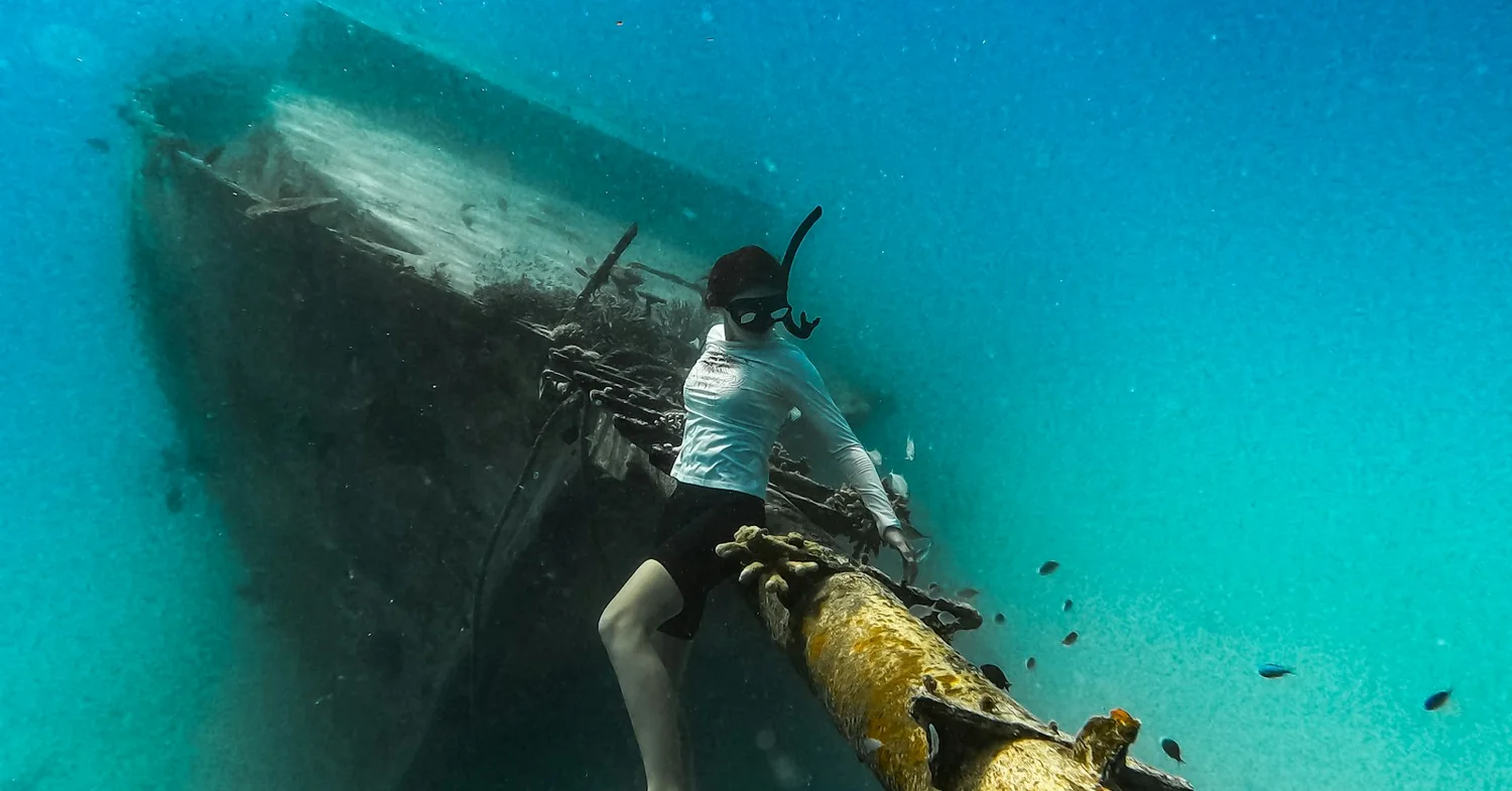
Photo: Unsplash (free licence).
Key takeaways
- Broward County counts 24 miles of Atlantic coast and three shore-parallel reef lines: Inner at 20 to 30 feet, Middle at 40 to 60, Outer at 50 to 100, with a nearshore ridge complex inside them
- At Lauderdale-by-the-Sea the town puts three reefs within 100 yards of the beach, with a tank rack at the Datura Avenue portal and two marked snorkel trails in 10 feet of water
- The SS Copenhagen, aground since 26 May 1900, became Florida’s fifth Underwater Archaeological Preserve in 1994 and sits in 16 to 31 feet under two mooring buoys
- The state artificial reef list files 128 Broward deployments from 1967 on, including the 324-foot Lady Luck in 130 feet on 23 July 2016 and the 107-foot Okinawa in 70 feet on 19 August 2017
- The first United States record of invasive lionfish came from off Dania Beach in 1985, and Florida now asks no licence, no size limit and no bag limit on taking them
Three reef lines run parallel to the Broward shore, and the far one is about a mile out
Broward County has 24 miles of coastline along the Atlantic, and the reef follows every one of them. It is not a patch field and it is not a wall on a distant drop. It is a set of long, low, shore-parallel ridges, and the whole day’s diving is decided by which line the boat stops on.
The county names three. The Inner Reef runs in 20 to 30 feet of water, the Middle Reef in 40 to 60 feet, and the Outer Reef in 50 to 100 feet. Inside all three sits a shallower nearshore ridge complex of coquina and carbonate sandstone, close enough to the sand to be swum to.
None of it is still growing. Upward growth of the outer reef stopped around 8,000 calibrated radiocarbon years before present, the inner reef around 6,000 and the middle reef around 3,700. What divers swim over here is a relict, veneered with living coral.
The tract runs well past the county line, from offshore West Palm Beach at 26°43′N south to offshore South Miami at 25°34′N, roughly 125 kilometres, all of it less than 3 kilometres from a built-up shore. Broward holds the middle slice.
Do not come expecting coral cover. Stony coral covers roughly 3 to 6 per cent of these reefs; octocorals, sponges and macroalgae do the rest. Two exceptions sit on the ridge complex offshore central Broward: a site of massive corals at about 16 per cent cover, and one with large Acropora cervicornis colonies at about 34 per cent.
The reason is latitude. These reefs sit above 25°N and behave as a high-latitude system, where winter cold fronts, occasional upwelling, heavy wave action and turbidity hold reef building back. The fish and the structure, not the coral, are what people come for.
Lauderdale-by-the-Sea puts three reefs inside 100 yards of the sand
The shore diving is not in Fort Lauderdale itself. It is at Lauderdale-by-the-Sea, the small town immediately north, where the town government publishes the beach portal at Datura Avenue and El Mar Drive and keeps a tank rack at it. The town states that three coral reefs lie within 100 yards off the beach.
Two marked trails run in 10 feet of water. The Anglin’s Pier Reef Snorkel Trail follows the reef beside the fishing pier. The Shipwreck Snorkel Trail, dedicated in 2002, is a deliberate arrangement of an anchor, five concrete cannons and a ballast pile, placed shallow enough to be read from the surface.
Two Florida rules govern that water and both are about distance. Spearing is prohibited within 100 yards of a public swimming beach, and within 100 yards of any commercial or public fishing pier or bridge open to public fishing. Anglin’s is a fishing pier, so the reef beside it is spear-free ground.
The second rule governs the flag. Under section 327.331 of the Florida Statutes the divers-down symbol must be at least 12 inches by 12 inches when displayed from the water and at least 20 by 24 inches from a vessel. On open water divers must make reasonable efforts to stay within 300 feet of it, and vessel operators to stay 300 feet off.
In rivers, inlets and navigation channels both figures drop to 100 feet, which matters at Hillsboro Inlet and the Port Everglades entrance. The device may not be displayed once every diver is aboard or ashore. Our shore diving list collects coasts that work like this one.
The SS Copenhagen is a state preserve, and three instruments keep it that way
The best-known dive here is not an artificial reef. It is a 325-foot steel screw steamer built at Sunderland by John Priestman and Co. and launched on 22 February 1898, official number 108,711, rated at 3,279 tons and driven by three triple expansion engines of 312 nominal horsepower.
On 26 May 1900 she ran hard aground on the Pompano Ledge carrying coal from Philadelphia to Havana. The wrecksite lies three quarters of a mile offshore south of Hillsboro Inlet in 16 to 31 feet of water on state submerged lands. The remains measure roughly 300 feet by 60 feet, stern to the north.
The bow is not with the rest of her. Salvage pulled it off shortly after she sank and it now rests 200 yards to the southeast in 27 feet, stem pointing nearly straight up. Anthracite from her bunkers still litters the bottom under the growth.
The state’s own site record explains the visibility in one line: water over the wreck averages 20 feet and is generally extremely clear because of the Gulf Stream. It also records what the United States Navy did with her. Fighter pilots training at Fort Lauderdale used the structure for target practice during the Second World War, which is why .50-calibre bullets turn up on the site.
For years locals dived her under the wrong name, calling her the Cumberland after an Army Corps hopper dredge wrecked off Fort Lauderdale in 1931 and also strafed. That wreck lies elsewhere; the coal settles it.
The preserve came out of a mail-out. In early 1993 the Florida Bureau of Archaeological Research asked for candidate sites, a Broward County charter boat captain nominated this one backed by the Marine Archaeological Council of Broward County, and in 1994 the wreck was dedicated as Florida’s fifth Underwater Archaeological Preserve. Two mooring buoys and a cement monument with an inset bronze plaque mark it.
Three state instruments hold it. Section 267.061(1)(b) of the Florida Statutes vests title to abandoned artifacts on state-owned sovereignty submerged lands in the Division of Historical Resources. Section 267.13 makes unauthorised investigation a first-degree misdemeanour and unauthorised excavation a third-degree felony. Rule 1A-31.0045 of the Florida Administrative Code, effective 20 July 2009, puts Underwater Archaeological Preserves outside any exploration or salvage permit the state can issue.
Federal recognition followed on 31 May 2001, when the wreck entered the National Register of Historic Places under reference number 01000532. The town estimates about 10,000 visitors a year, which for a site in 20 feet of water means snorkellers as well as divers.
What Broward County has put on the bottom since 1967, with dates and depths
The two available counts do not match, and both are worth having. The Florida Fish and Wildlife Conservation Commission files 128 deployments in Broward County in its state artificial reef list. Broward County says it has created over 150 artificial reefs since 1982. The state list also starts earlier: Erojacks off Fort Lauderdale in 25 feet and off Dania in 12 feet, both 1967.
The county’s most-told wreck has a mainland prologue. The freighter Mercedes grounded against a Palm Beach seawall in November 1984, was bought by the Broward County Environmental Quality Control Board and was blown down with 350 pounds of TNT on 30 March 1985. She sits in 97 feet. The state list gives 197 feet of hull, her registry 194.
The tugs sit shallower. The Jay Scutti, 95 feet of tugboat, went down on 19 September 1986 in 67 feet, inside recreational limits with time to spare. Dozens of barges, culverts and small vessels share that 65 to 75 foot band.
The deep end of the list is not recreational at all. The Rodeo-Lowrance, a 435-foot freighter, was sunk on 31 March 1984 in 200 feet. The Bud Krohn Reef, a 183-foot freighter, went down on 3 December 1989 in 458 feet, the deepest Broward entry the state records.
The modern flagship is the Lady Luck, a 324-foot steel tanker sunk off Pompano Beach on 23 July 2016. The state record gives her 2,557 tons, 70 feet of vertical relief and a depth of 130 feet; reports published at the sinking gave 126. A year later, on 19 August 2017, the 107-foot tug Okinawa followed in 70 feet, with 33 feet of relief and 305 tons.
Sculpture is a real category here, and it has coordinates. A Barefoot Mailman statue went in on 1 December 2016 in 38 feet, two steel statues joined the Lady Luck on 16 June 2020 in 94 feet, and 25 sculptures weighing 44.1 tons went off Hollywood on 1 November 2022 in 55 feet.
Not everything on the list is for divers. Limestone boulder piles, 969 boulders and 1,811 tons, went in on 13 June 2018 in 39 feet as mitigation, and Mount Deerfield took 500 tons in 65 feet in 2015 and 510 tons in 67 feet in 2016: replacement hardbottom, not attractions. The wreck diving list covers coasts built this way.
The tyre reef of the 1970s is still being taken back out
One Broward artificial reef went badly wrong, and the state has been undoing it for two decades. The Florida Department of Environmental Protection records that during the 1970s, between 1 million and 2 million tyres were put in the ocean off Broward County to create additional fish habitat. The state artificial reef list files the site as Osborne Tire Reef, dated 1977, in 64 feet of water.
They did not stay put. Tropical storms and hurricanes mobilised them, and the department records that their movement damaged nearby existing coral reefs. The scale of the removal has kept any single agency from finishing it.
The recovery has a paper trail with dates. The NOAA Marine Debris Program funded a reconnaissance project in August 2006, followed by a pilot to test diver retrieval, loading, transport and processing. Broward County filed project evaluation reports for 2007, 2008 and 2009, and the Department of the Army filed an after-action report for tyre removal at Fort Lauderdale in 2009.
It is still a live contract. Removal runs under agency contract SW348, renewed on 17 February 2023 and expiring 16 February 2028, and a second contract, SW349, executed on 2 September 2025 and running to 1 September 2032. The work sits under a Corps of Engineers permit issued on 18 August 2017 and reverified on 30 June 2022, and a state permit issued on 24 January 2020.
Lionfish were first recorded off Dania Beach, and Florida wants them taken
The lionfish invasion of the western Atlantic has a starting point, and it is in this county. The earliest United States record of the fish is from Florida in 1985, off Dania Beach. The arrival is attributed to the aquarium trade rather than to any storm.
What followed is measurable. Research summarised by the United States Geological Survey found recruitment of coral-reef fishes reduced by 79 per cent on reefs holding a single lionfish against reefs holding none, and native forage fish abundance down roughly 45 per cent.
Florida’s response is to remove the usual barriers. No recreational fishing licence is required when lionfish are taken with a pole spear, a Hawaiian sling, a handheld net or a spearing device designed and marketed exclusively for lionfish. Hook and line or a speargun still needs one.
The limits are as open as Florida gets. There is no minimum size, the daily bag is unlimited, the season is open year-round, and divers using rebreathers are permitted to spear and remove them. Where spearing is otherwise not allowed in state waters, the commission issues permits for lionfish removal specifically.
Coral disease arrived from the south, and the reef became an aquatic preserve in 2024
In autumn 2014 a previously undescribed disease was identified near Virginia Key in Miami, roughly 25 miles south of Fort Lauderdale. Stony coral tissue loss disease then moved north and south along the coast, reaching Martin County by 2017 and Dry Tortugas National Park by late spring 2021. Broward sits directly in the path it took north.
The state’s figures are blunt. Nearly 90 per cent of Florida’s Coral Reef has been affected, over 109,700 acres. More than 20 of roughly 45 Florida stony coral species are susceptible, and once a colony is infected it will likely die within weeks to months. The outbreak shows no seasonality and has not stopped.
Long-term monitoring across Palm Beach, Broward and Miami-Dade put numbers on what that meant locally: across 22 sites, a loss of about 30 per cent of coral density and 60 per cent of live coral tissue, with disease prevalence peaking in 2016.
The legal answer arrived late but it is specific. The southeast Florida reef area was named the Kristin Jacobs Coral Reef Ecosystem Conservation Area under chapter 2021-107, Laws of Florida, after a Broward County politician. On 1 July 2024 it became the Kristin Jacobs Coral Aquatic Preserve, 240,782 acres running 105 miles from the St Lucie Inlet in Martin County to the northern boundary of Biscayne National Park.
Separately, the Florida Coral Reef Protection Act, section 403.93345 of the statutes, applies to the sovereign submerged lands holding coral reefs off Broward, Martin, Miami-Dade, Monroe and Palm Beach. It names the department the state’s lead trustee for coral reef resources and requires a grounded or anchored vessel to be removed within 72 hours, absent extenuating circumstances, in a way that avoids further damage.
Port Everglades is the pressure point. A sand bypass project beside the port began cutting a 10.8-acre borrow pit in October 2025, and dredging was suspended in August 2026 after the Corps of Engineers acknowledged it may have exceeded incidental take limits for threatened staghorn coral.
The Florida Current, the water temperature by month, and the storm window
The clarity on these reefs has a name. The Florida Current runs north past this coast and feeds the Gulf Stream, and NOAA has measured its volume transport since 1982 from a submarine telecommunications cable across the Florida Straits near 27°N, between West Palm Beach and Eight Mile Rock on Grand Bahama. The long-term mean is 32 Sverdrups, one Sverdrup being a million cubic metres per second.
For a diver that means two things. Most boat diving here is drift diving, the boat following bubbles rather than a line, and the shallow sites are often unusually clear for water this close to a city. Our drift diving guide covers the technique.
Temperature has one awkward detail. The only NOAA water temperature station in Broward County is 8722956, South Port Everglades, and its sensor sits inside the port channel, where readings run warmer than the reef. The nearest station on open Atlantic water is 8722670, Lake Worth Pier, about 37 miles up the coast.
Hourly readings there through 2024 and 2025 average 23.6°C in January, 23.8 in February, 24.2 in March, 25.4 in April, 27.5 in May, 28.7 in June, 29.8 in July, 30.4 in August, 30.3 in September, 27.7 in October, 26.6 in November and 25.3 in December. The coldest single hour in those two years was 20.2°C and the warmest 31.9°C.
That range decides neoprene. A 3 mm suit covers June through October comfortably; January to March is 5 mm weather, and a hood is worth carrying for a 100-foot dive in February. Our travel wetsuit guide covers the trade-offs.
The calendar has one hard boundary. The Atlantic hurricane season runs from 1 June to 30 November, a window covering about 97 per cent of Atlantic tropical storms and hurricanes, with the climatological peak around 10 September. Storms here do not only cancel boats; they move the bottom, which is exactly how the tyres got loose.
Florida licenses nothing here, and what the eight businesses on our list show
There is no state licence and no state register for a dive business in Florida. What the state regulates is the diving: the divers-down rule in Chapter 327, the spearing and harvest rules the wildlife commission sets, and Chapter 267 over the shipwreck preserve. None of those licenses a company, so no state list exists to be absent from. Which registers can be read sets out what each register returns, and on what date.
Our own list is short and uniform. The Fort Lauderdale operator list holds 8 businesses, read on 1 September 2026. All 8 are published by SSI in its register of affiliated centres. None appears in the IKO or VDWS registers, none is a Green Fins member, and all 8 publish a website in the register.
The towns the register files them under are the interesting part, because only one of them says Fort Lauderdale. Three are filed under Pompano Beach, two under Dania Beach, one under Sunrise, one under Lauderhill and one under Fort Lauderdale. The search term and the addresses barely overlap.
Two of those towns are not on the water at all. Sunrise and Lauderhill sit inland, west of the coastal strip, which tells you what kind of business is filed there: a shop and a school rather than a boat, meeting divers at a marina or sending them to one. The same filing habit runs on up the shore in the West Palm Beach list and down it in the Miami list.
One absence is worth naming. Green Fins, the scheme that sends a trained assessor to score an operator in person, has no member among these eight, so there is no third-party environmental assessment to read here. Hyperbaric cover sits outside all of it, which is what our dive insurance comparison is for.
FAQ: scuba diving in Fort Lauderdale
How far offshore are the reefs at Fort Lauderdale?
Close, and in lines. Broward County describes an Inner Reef in 20 to 30 feet of water, a Middle Reef in 40 to 60 feet and an Outer Reef in 50 to 100 feet, all running parallel to its 24 miles of Atlantic coastline. A shallower nearshore ridge complex sits inside those three. Across southeast Florida the whole tract lies less than 3 kilometres from the built-up shore, so the farthest line is roughly a mile out.
Can you dive from the beach in Fort Lauderdale?
Yes, and the usual entry is Lauderdale-by-the-Sea, just north of Fort Lauderdale proper. The town publishes a beach portal at Datura Avenue and El Mar Drive with a tank rack, and says three coral reefs lie within 100 yards of the beach. Two marked snorkel trails run in 10 feet of water: the Anglin's Pier Reef Snorkel Trail, and a Shipwreck Snorkel Trail dedicated in 2002 with an anchor, five concrete cannons and a ballast pile.
What is the SS Copenhagen and can divers visit it?
It is a 325-foot British steel steamer that ran hard aground on the Pompano Ledge on 26 May 1900 carrying coal from Philadelphia to Havana. The wreck lies three quarters of a mile offshore south of Hillsboro Inlet in 16 to 31 feet of water, with the water over it averaging 20 feet. It was dedicated in 1994 as Florida's fifth Underwater Archaeological Preserve and marked with two mooring buoys and a bronze plaque, and it was added to the National Register of Historic Places on 31 May 2001.
How many artificial reefs are there off Fort Lauderdale?
The two available counts disagree. The Florida Fish and Wildlife Conservation Commission files 128 deployments in Broward County in its state artificial reef list, the earliest dated 1967 and the deepest in 458 feet of water. Broward County says it has created over 150 artificial reefs since 1982. Both counts cover a mix of ships, barges, tugs, culverts, limestone boulders and sculpture, not just divable wrecks.
What is the Lady Luck wreck off Pompano Beach?
A 324-foot steel tanker sunk as an artificial reef on 23 July 2016 off Pompano Beach, in Broward County. The state artificial reef record gives her 2,557 tons, 70 feet of vertical relief and a depth of 130 feet, while reports published at the sinking gave 126 feet. Two steel statues were added to her on 16 June 2020, recorded at a depth of 94 feet.
Do you need a licence to spear lionfish in Florida?
Not for the usual gear. Florida does not require a recreational fishing licence when lionfish are taken with a pole spear, a Hawaiian sling, a handheld net or a spearing device designed and marketed exclusively for lionfish. Hook and line or a speargun does require one. There is no minimum size and no daily bag limit, the season is open year-round, and divers using rebreathers are permitted to spear and remove them.
How warm is the water for diving off Fort Lauderdale?
The nearest NOAA sensor on open Atlantic water is Lake Worth Pier, station 8722670, about 37 miles up the coast. Hourly readings there through 2024 and 2025 average 23.6 degrees Celsius in January, 24.2 in March, 27.5 in May, 30.4 in August and 25.3 in December. The coldest single hour in those two years was 20.2 degrees and the warmest 31.9. Broward County's own NOAA station sits inside the Port Everglades channel and reads warmer than the reef.
Does Florida license dive shops or dive boats?
Florida operates no state licence and no state register for dive businesses. What the state regulates is the diving itself. Section 327.331 of the Florida Statutes sets the divers-down warning device rules, the Fish and Wildlife Conservation Commission sets the spearing and harvest rules, and Chapter 267 protects the shipwreck preserve. None of those licenses a company, so absence from any list proves nothing about a business here.
What are the divers-down flag rules in Florida?
The symbol must be at least 12 inches by 12 inches when displayed from the water and at least 20 by 24 inches when displayed from a vessel. On open water divers must make reasonable efforts to stay within 300 feet of the device and vessel operators must make reasonable efforts to stay 300 feet clear. In rivers, inlets and navigation channels both distances drop to 100 feet. The device may not be displayed once every diver is aboard or ashore.
When is hurricane season in Fort Lauderdale and what does it do to diving?
The Atlantic hurricane season runs from 1 June to 30 November, a window that covers about 97 per cent of Atlantic tropical storms and hurricanes, and the climatological peak falls around 10 September. Storms move loose material on these reefs: the Florida Department of Environmental Protection records that tropical storms and hurricanes mobilised the tyres dumped off Broward County in the 1970s, and that their movement damaged nearby coral reefs.
Founder of NOMADREEF and a former digital nomad. This guide is sourced from the references below; conditions, prices and rules change, so verify current details, and follow qualified local guidance and safety briefings. About the author · LinkedIn ↗
Sources
- The county’s reef tracts and its artificial reef count. 24 miles of Atlantic coastline; Inner Reef at 20 to 30 feet, Middle Reef at 40 to 60 feet, Outer Reef at 50 to 100 feet; the Florida Reef Tract running from the Dry Tortugas to the St. Lucie Inlet, nearly 360 linear miles; over 150 artificial reefs created since 1982. Broward County Marine Resources, Reefs. Read 20 September 2026. Its count of more than 150 since 1982 disagrees with the 128 deployments on the state list below, which begins in 1967; both are given as stated.
- Every artificial reef date, depth, tonnage and relief. 128 Broward County deployments, BO0001 to BO0128: Erojacks Ft. Lauderdale (1967, 25 feet) and Erojacks Dania (1967, 12 feet); Osborne Tire Reef (1977, 64 feet); Rodeo-Lowrance (31 March 1984, 435-foot freighter, 200 feet); Mercedes (30 March 1985, freighter given as 197 feet, 97 feet); Jay Scutti (19 September 1986, 95-foot tugboat, 67 feet); Bud Krohn Reef (3 December 1989, 183-foot freighter, 458 feet); Lady Luck (23 July 2016, 324-foot steel tanker, 2,557 tons, 70 feet of relief, 130 feet); Barefoot Mailman statue (1 December 2016, 38 feet); Okinawa Reef (19 August 2017, 107-foot tug, 305 tons, 33 feet of relief, 70 feet); limestone boulder piles (13 June 2018, 969 boulders, 1,811 tons, 39 feet); Lady Luck statues (16 June 2020, 94 feet); 1,000 Mermaids Hollywood (1 November 2022, 25 sculptures, 44.1 tons, 55 feet); Mt. Deerfield (2015, 500 tons, 65 feet) and Mt. Deerfield II (2016, 510 tons, 67 feet). FWC Artificial Reef Program, State of Florida Artificial Reef Locations, as of 6 March 2026 (PDF). Read 20 September 2026.
- The SS Copenhagen, the site and the preserve. 325-foot steel screw steamer by John Priestman and Co. of Sunderland, launched 22 February 1898, official number 108,711, 3,279 tons, three triple expansion engines of 312 nominal horsepower; aground on the Pompano Ledge on 26 May 1900 with coal from Philadelphia for Havana; wrecksite three quarters of a mile offshore south of Hillsboro Inlet in 16 to 31 feet on state submerged lands; remains roughly 300 by 60 feet, stern north; bow 200 yards southeast in 27 feet; water over the wreck averaging 20 feet and generally extremely clear because of the Gulf Stream; .50-calibre bullets from Second World War target practice by Navy pilots training at Fort Lauderdale; the confusion with the 1931 Army Corps hopper dredge Cumberland; the 1993 Bureau of Archaeological Research solicitation, the charter captain’s nomination and the Marine Archaeological Council of Broward County; dedication in 1994 as Florida’s fifth Underwater Archaeological Preserve with two mooring buoys and a cement monument with inset bronze plaque; listing 31 May 2001, NRIS 01000532. National Register of Historic Places registration form, SS Copenhagen, prepared by the Florida Division of Historical Resources (PDF). Read 20 September 2026.
- The law over the preserve. Title to abandoned artifacts on state-owned sovereignty submerged lands vested in the Division of Historical Resources, section 267.061(1)(b), Florida Statutes; unauthorised investigation as a first-degree misdemeanour and unauthorised excavation as a third-degree felony, section 267.13, Florida Statutes; Underwater Archaeological Preserves excluded from exploration and salvage permits by Rule 1A-31.0045, Florida Administrative Code, effective 20 July 2009 under section 267.031(1). All read 20 September 2026.
- Shore diving at Lauderdale-by-the-Sea. The Datura Avenue and El Mar Drive beach portal with a tank rack; three coral reefs within 100 yards of the beach; the Anglin’s Pier Reef Snorkel Trail and the Shipwreck Snorkel Trail, both in 10 feet, the latter dedicated in 2002 with an anchor, five concrete cannons and a ballast pile; an estimated 10,000 annual visitors to the SS Copenhagen. Town of Lauderdale-By-The-Sea, Snorkeling and Scuba Diving and SS Copenhagen. Both read 20 September 2026.
- The divers-down rule. Symbol of at least 12 by 12 inches from the water and 20 by 24 inches from a vessel; 300 feet on waters other than rivers, inlets and navigation channels and 100 feet on those; no display once all divers are aboard or ashore; violation a noncriminal infraction. Section 327.331, Florida Statutes. Read 20 September 2026.
- Spearing and lionfish rules. Spearing prohibited within 100 yards of public swimming beaches and of commercial or public fishing piers and bridges open to public fishing; FWC, Spearing. No recreational licence for lionfish taken with a pole spear, Hawaiian sling, handheld net or a device designed and marketed exclusively for lionfish; no minimum size, unlimited daily bag, open year-round, rebreathers permitted, removal permits issued where spearing is otherwise barred; FWC, Lionfish. Both read 20 September 2026.
- The first lionfish record and the impact figures. Earliest United States record from Florida in 1985 off Dania Beach, attributed to the aquarium trade rather than to Hurricane Andrew; recruitment of coral-reef fishes reduced by 79 per cent on reefs with a single lionfish, native forage fish abundance down about 45 per cent. United States Geological Survey, Nonindigenous Aquatic Species fact sheet, Pterois volitans. Read 20 September 2026.
- Stony coral tissue loss disease. Identified near Virginia Key, Miami, in autumn 2014; reaching Martin County by 2017 and Dry Tortugas National Park by late spring 2021; nearly 90 per cent of Florida’s Coral Reef affected, over 109,700 acres; more than 20 of roughly 45 Florida stony coral species susceptible; colonies likely to die within weeks to months; no seasonality. FWC, What is Stony Coral Tissue Loss Disease. Read 20 September 2026. The 22 monitoring sites and the losses of about 30 per cent of coral density and 60 per cent of live tissue, prevalence peaking in 2016, are from the Southeast Florida Coral Reef Evaluation and Monitoring Project analysis published as Tissue loss disease outbreak significantly alters the Southeast Florida stony coral assemblage, Frontiers in Marine Science (2022). Read 20 September 2026.
- The aquatic preserve and the coral reef act. Designation on 1 July 2024 as the Kristin Jacobs Coral Aquatic Preserve, 240,782 acres, 105 miles from the St Lucie Inlet in Martin County to the northern boundary of Biscayne National Park, covering Martin, Palm Beach, Broward and Miami-Dade counties, renamed in 2021 after the late Broward County state representative. Florida Department of Environmental Protection, Kristin Jacobs Coral Aquatic Preserve. Read 20 September 2026. Chapter 2021-107, Laws of Florida, and the 2024 amendment of section 258.39 declaring the area an aquatic preserve are recorded in Florida Senate, CS for CS for SB 1386 (2024). The lead trustee provision, the counties covered and the 72-hour vessel removal rule are in section 403.93345, Florida Statutes, the Florida Coral Reef Protection Act. Both read 20 September 2026.
- The reef tract in the scientific literature. Three shore-parallel terraces named inner, middle and outer plus a shallower nearshore ridge complex; the tract spanning 26°43′N off West Palm Beach to 25°34′N off South Miami, about 125 km, less than 3 km from the coast; stony coral cover of about 3 to 6 per cent, with patches on the ridge complex offshore central Broward at roughly 16 and 34 per cent; a high-latitude system limited by cold fronts, upwelling, wave action and turbidity. Riegl, Gilliam and Lirman, Benthic Habitat: Coral and Hardbottom, in NOAA MARES, Southeast Florida Coastal Marine Ecosystem integrated conceptual ecosystem model (PDF), drawing on Banks et al. (2007, 2008). Read 20 September 2026. The radiocarbon ages, roughly 8,000 cal BP for the outer reef, 6,000 for the inner and 3,700 for the middle, are from Banks et al., Geomorphology of the Southeast Florida continental reef tract, Coral Reefs 26 (2007). Read 20 September 2026.
- The tyre reef and its removal. Between 1 million and 2 million tyres placed off Broward County during the 1970s to create fish habitat; mobilisation by tropical storms and hurricanes and damage to nearby coral reefs; the NOAA Marine Debris Program reconnaissance of August 2006 and the pilot that followed; Broward County project evaluation reports for 2007, 2008 and 2009 and the Department of the Army 2009 after-action report; contract SW348 renewed 17 February 2023 to 16 February 2028 and SW349 executed 2 September 2025 to 1 September 2032; Corps permit SAJ-2007-00822 issued 18 August 2017 and reverified 30 June 2022; state permit 06-0272719-006-EI issued 24 January 2020. Florida Department of Environmental Protection, Osborne Reef Waste Tire Removal Project. Read 20 September 2026.
- The Florida Current. Transport measured since 1982 from a submarine telecommunications cable spanning the Florida Straits near 27°N between West Palm Beach and Eight Mile Rock, Grand Bahama; long-term mean transport of 32 Sverdrups, one Sverdrup being a million cubic metres per second. NOAA Atlantic Oceanographic and Meteorological Laboratory, Florida Current transport time series. Read 20 September 2026.
- Water temperature. Monthly figures are means computed from hourly observations for 2024 and 2025 at NOAA station 8722670, Lake Worth Pier, Atlantic Ocean (26.6128°N, 80.0342°W), retrieved from the NOAA CO-OPS data API on 20 September 2026: 23.6, 23.8, 24.2, 25.4, 27.5, 28.7, 29.8, 30.4, 30.3, 27.7, 26.6 and 25.3°C from January to December, minimum hourly value 20.2°C, maximum 31.9°C. The only NOAA water temperature station in Broward County is 8722956, South Port Everglades (PEGF1), its sensor 1.1 m below mean lower low water inside the port channel; its readings run several degrees above the pier station and are not used here.
- Hurricane season. The season of 1 June to 30 November, covering about 97 per cent of Atlantic tropical storms and hurricanes, and the climatological peak around 10 September. NOAA Hurricane Research Division, hurricane FAQ and NOAA, tropical cyclone climatology. Both read 20 September 2026.
- The eight businesses. Eight dive businesses on the Fort Lauderdale operator list, read 1 September 2026, all eight published by SSI in its register of affiliated centres and all eight publishing a website there. None appears in the IKO or VDWS registers and none is a Green Fins member. The register files them under Pompano Beach 3, Dania Beach 2, Sunrise 1, Lauderhill 1 and Fort Lauderdale 1. The limits of each source are set out on which registers can be read.
- Triangulated, not primary. The Mercedes grounding against a Palm Beach seawall in November 1984, her purchase by the Broward County Environmental Quality Control Board and the 350 pounds of TNT used on 30 March 1985 are reported by the dive press and by ship registries rather than by a government record, and her hull is given as 194 feet there against the 197 feet on the state list. The Lady Luck depth of 126 feet reported at her sinking likewise differs from the 130 feet the state records. The Port Everglades sand bypass figures, a 10.8-acre borrow pit, construction from October 2025, the Corps letter of 7 August 2026 acknowledging that incidental take limits for threatened staghorn coral may have been exceeded, and the suspension with no authorisation to resume before November 2026, come from the litigation record as reported by Earthjustice and Florida Bulldog, not from a published agency document. All read 20 September 2026.