Kaş Diving: The Closed Shores, the No-Fishing Zones and the Wrecks Sunk for Divers
 by Yannick Schroth
Sep 25, 2026
13 min read
by Yannick Schroth
Sep 25, 2026
13 min read
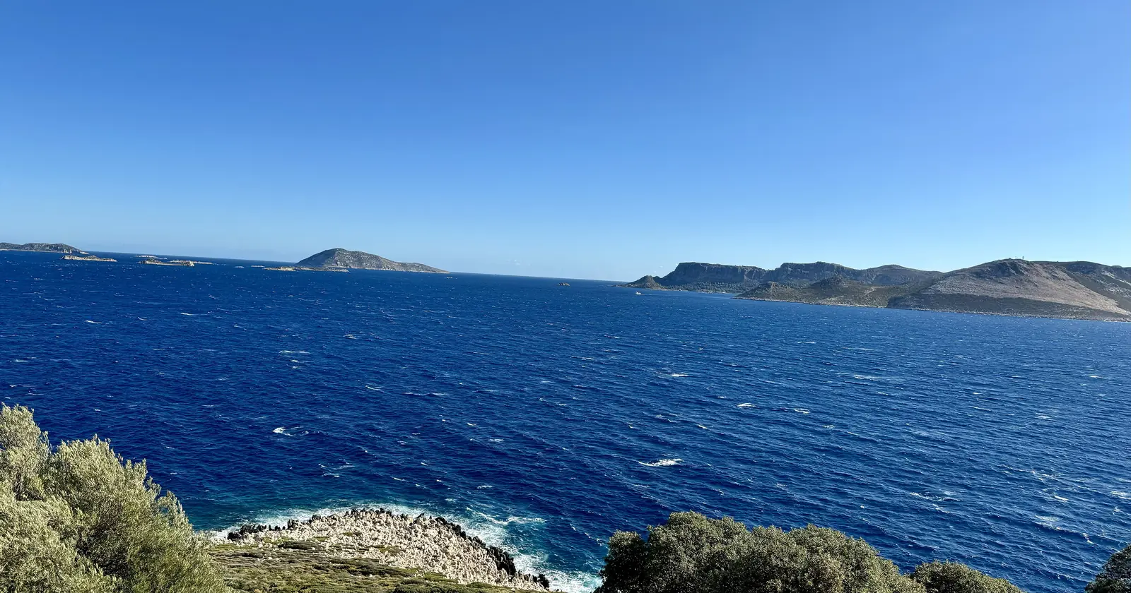
Meis, right, seen from Andifli in Kaş, September 2024. Photo: Kadı, Wikimedia Commons, CC BY 4.0.

Key takeaways
- Presidential Decision 4138 of 24 June 2021 redrew the Kaş-Kekova protected area with 260 corner points, reaching west to the Beşadalar islets off Gata Burnu
- Boxes A13 to A16 of decision 2016/8743 close the west shore of Gata Burnu, the bay at Aperlae, a short stretch south of it and the water around Kekova island to all but scientific diving
- The dusky grouper may not be taken anywhere in Turkish waters, and the other groupers carry a one-fish limit for recreational fishers and a closed season from 1 June to 31 August
- Diving, lights, swimming in, waiting at the entrance and anchoring are all banned at coastal caves where the Mediterranean monk seal lives
- The Uluburun III replica sunk off Kaş on 27 October 2006 collapsed in 2009; the reconstructed cargo field 70 meters east of it is what divers visit now
Kaş-Kekova’s boundary was redrawn by presidential decision on 24 June 2021
The diving east and south of Kaş happens inside the Kaş-Kekova Special Environmental Protection Area, declared by Council of Ministers decision 90/77 of 18 January 1990. Its line has moved since. Presidential Decision 4138, signed on 24 June 2021 and published in the Resmî Gazete the next day, issue 31522, is one sentence long: the boundaries of the area are changed as shown in the attached sketch and coordinate list, under Article 9 of Environment Law No. 2872.
The annex lists 260 corner points, each given twice, in UTM on the ED50 datum and in WGS 84. The seaward edge is drawn in whole seconds. Off the Demre side it runs south from 36°11′52″N 29°56′49″E to 36°09′43″N, south-west to 36°06′24″N 29°48′33″E, west to 29°40′32″E, then north-west to a corner at 36°08′51″N 29°37′20″E.
From there the corners stop being straight lines. They hook round the Beşadalar islets toward Meis, reaching 29°36′49″E at point 30, about 80 meters from a corner of the Beşadalar no-fishing polygon described below. Then they climb onto the Gata Burnu peninsula south of the town, where several of them fall on the Lycian Way when plotted on OpenStreetMap.
That is why this page gives no area. The environment ministry’s leaflet says 257.83 km² and describes the area as beginning at Ulu Burun, east of Kaş. The Mediterranean Conservation Society says 258.30 km², of which 92 km² is sea. The 2021 corners reach west of the longitude of Kaş harbor itself, and neither source says which line it measured.
Four boxes between Kaş and Kekova are closed to all but scientific diving
The closed water comes from a different instrument, decision 2016/8743 of 5 April 2016, whose Article 1 allows no diving inside its mapped areas other than for scientific purposes. The Antalya diving guide covers the decision itself and the 2020 procedure for reopening a box. What matters here is which boxes are Kaş’s.
Four of the 21 Mediterranean boxes fall between Kaş and Kekova: A13 to A16. A11 and A12 lie further west, at 29°21′ to 29°26′E on the Kalkan side, and A17 to A20 sit at 30°23′ to 30°30′E on the Kumluca coast, from Cape Gelidonya to Olympos. Place names below come from plotting the published corners on OpenStreetMap; the coordinates are the law.
A13 starts on the shore at 36°10.200′N 29°37.835′E, about 100 meters from the tip of Gata Burnu, and runs to 36°09.570′N 29°38.640′E. The environment ministry names the same place in its own leaflet: because of archaeological remains, diving is prohibited on the western shores of Gata Burnu.
A14 is two shore points on the meridian 29°45.400′E, at 36°09.335′ and 36°08.550′N, a line across the bay that OpenStreetMap labels with the ancient site of Aperlae. The commercial fisheries text closes the water east of almost the same line. The ministry’s second named closure, Bohça İskelesi, lies east of it too: the recreational fisheries text places Bohça İskelesi at 29°46′36″ to 29°46′40″E.
A15 is a short box south of that, between 29°44.3′ and 29°45.9′E at about 36°07.5′N. A16 is the large one. Its corners sit on the Sıçak peninsula, twice on Kekova island, once at sea and once at Gökkaya on the mainland, which puts the water off the island’s sunken shore inside it.
A 2020 paper on Kaş by Güzden Varinlioğlu of the Underwater Research Society, citing earlier studies, adds that at some shallow heritage sites “such as Kekova sunken city, any form of intrusion, including swimming, is forbidden”. If a Kaş itinerary lists Kekova or Aperlae as a dive rather than a boat stop, ask which designation it relies on.
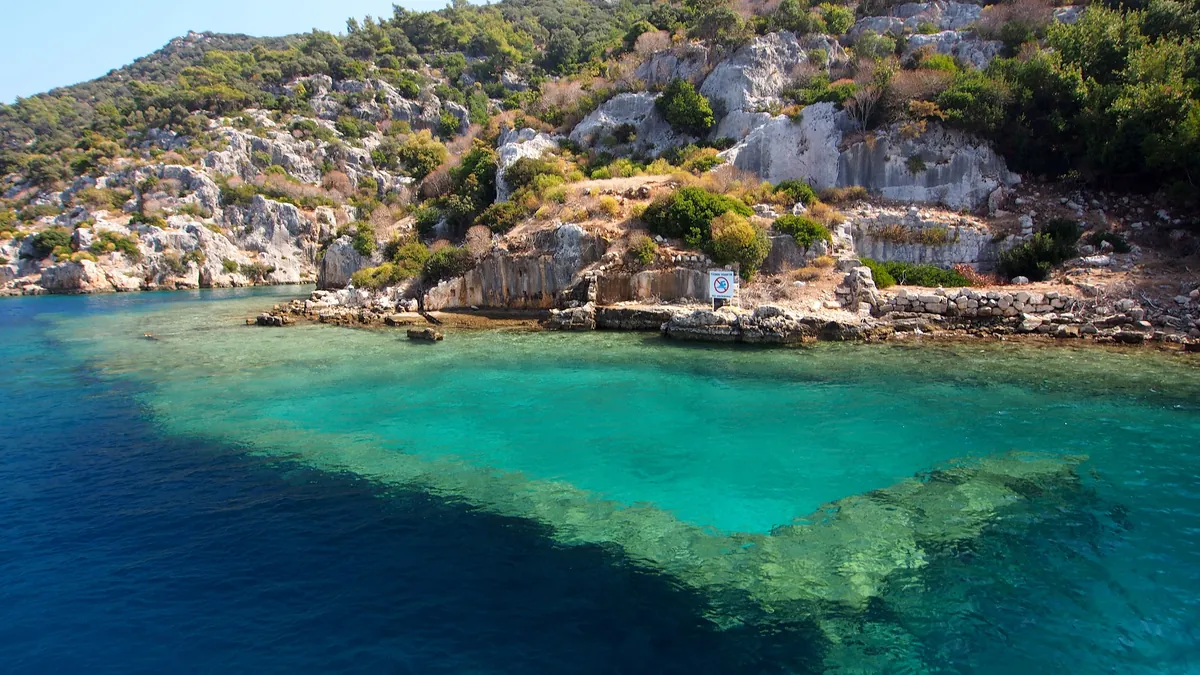

Where the 2024 fisheries rules stop all fishing around Kaş
No-take water around Kaş is set by the agriculture ministry, in two communiqués that run from 1 September 2024 to 31 August 2028: 6/1 for commercial fishing and 6/2 for recreational fishing, both published on 11 August 2024. Recreational here includes the spearfisher: 6/2 defines an amateur underwater hunter as someone who fishes with a speargun on their own breath.
The commercial list, Article 4(1)(k), names eight places “in the Kaş district”: Üçağız harbor, Sıcak Deniz, Aperlia, Ufakdere, Beşadalar, İnceburun, Çondur Burnu and Bucak Denizi. Each is bounded by coordinates, and in each the taking of any aquatic product is prohibited.
The recreational list, Article 17(1)(ç), names six, and they are not the same six: Bohça İskelesi, Ufakdere, Beşadalar, İnceburun, Çondur Burnu and Bucak Denizi, the last with an exception for rod fishing from the shore. Üçağız, Sıcak Deniz and Aperlia appear only in the commercial list, Bohça İskelesi only in the recreational one.
Beşadalar is the one most divers will cross: a five-corner polygon between 36°08′52″ and 36°10′03″N, off the tip of Gata Burnu. The İnceburun zone is the water south of a line from 36°11′33.72″N 29°38′57.24″E to 36°10′59.46″N 29°38′31.62″E, which begins under a kilometer south of Kaş harbor.
Two general clauses close more. Fishing by diving is prohibited inside the 2016/8743 boxes, so A13 to A16 are closed to spearfishing whatever the local lists say, and it is prohibited in harbors, fishing shelters and haul-out places. Both communiqués have been amended since, on 16 April 2025 and 16 September 2026, and neither amendment touched the Kaş lists.
Kaş’s dusky grouper may not be taken, and other groupers are closed all summer
Grouper is what Kaş divers come to see, and the ministry’s leaflet explains why they are there. Among the 33 marine species it lists as conservation priorities in the western part of the protected area are Epinephelus aeneus and Epinephelus marginatus, the dusky grouper. The Posidonia and Cymodocea meadows are important growing areas for young fish, “especially grouper species”.
The dusky grouper, orfoz in Turkish, is closed outright. Table 1 of the recreational communiqué, as replaced on 16 September 2026, lists it among the species whose capture is completely prohibited. The commercial text says the same in five words: in all our territorial waters, dusky grouper fishing is prohibited.
The other groupers are lagos, and the recreational table, as amended on the same day, gives them two rows: Epinephelus aeneus, at least 50 centimeters, one fish; other Epinephelus species, no minimum size, one fish. Both are closed from 1 June to 31 August. The commercial fleet has the same summer closure and may never take lagos with traps, or with a harpoon or speargun while diving.
The speargun rules in Article 16(4) apply to anyone spearfishing off Kaş. No spearfishing between sunset and sunrise. No light, no tank, no hookah, no breathing device of any kind except a snorkel. A surface buoy marking the diver is compulsory, and since 1 January 2026 a spearfisher must also hold the amateur fisher certificate that records the diving method, issued by the provincial or district agriculture directorate.
Monk seal caves on the Kaş coast are closed to divers
The same leaflet lists the Mediterranean monk seal, Monachus monachus, among the priority species of the western protected area, alongside the loggerhead and green turtles. The recreational communiqué puts the seal on its list of species whose capture is completely prohibited, which is the part everyone expects.
The part divers miss is a clause about caves. Article 8(1)(c) of the commercial text and Article 17(2) of the recreational text say that in coastal caves with an underwater or surface entrance where the Mediterranean monk seal lives, using light, diving by any means, entering by swimming or by any vessel, waiting at the cave entrance and anchoring are prohibited. The recreational version adds hunting.
The clause names no caves. Its test is whether a seal lives there, not whether a sign says so. Sea caves are part of this coast’s diving, and the Underwater Research Society has studied the freshwater discharges and sea-cave formations around Kaş in an inventory project. Before a cave dive here, ask the guide whether seals use it. A seal cave is closed to lights and fins alike.
The Uluburun wreck off Kaş lies deeper than Turkish sport diving allows
The wreck that made Kaş famous in archaeology was found in 1982, when a Turkish sponge diver described “metal biscuits with ears” on the seabed near Kaş. They were copper oxhide ingots. The Institute of Nautical Archaeology dates the ship to about 1320 BC, give or take 15 years, and counts 354 copper ingots, carried with tin in the usual ratio of 10 to 1.
INA excavated it over 11 seasons between 1984 and 1994, logging more than 22,000 dives to depths in excess of 150 feet, about 46 meters. Varinlioğlu puts the share of the original ship recovered at about 3 percent. The ship was built of Lebanese cedar, with pegged mortise-and-tenon joints and a proto-keel rather than a true keel.
The depth settles the diving question before any box does. Article 10 of the 1990 regulation on sport scuba diving in Turkish waters sets the limit at 30 meters, and 42 meters for training dives. A site worked below 150 feet is outside both. INA publishes no coordinates for the wreck, so whether it also falls in a closed box cannot be read from the annex.
Kaş’s Uluburun replica collapsed in 2009, and its cargo field is what is left
What divers in Kaş can visit is the Archaeopark in Hidayet Bay, about 2.5 kilometers east of the town. Several non-profit organizations built a 15 by 5 meter ship, Uluburun III, in 40 days and sank it, with a replica cargo, on 27 October 2006, at 20 to 30 meters and about 20 meters from the shore.
The name matters. Uluburun III is the ship on the seabed. Uluburun II was a different boat, a sailing replica built at Urla near İzmir in 2004 that sailed the Aegean and the Mediterranean. Dive listings that call the Kaş site “Uluburun II” have the name wrong.
About 70 meters east of the ship, the original wreck site was laid out again at 14 to 21 meters on sand: a 13 by 9 meter rope grid holding 84 imitation amphoras, 150 copper ingots cast in concrete and stone anchors made of aerated concrete. Anchoring by dive boats tore up the grid, and it was replaced several times after 2006.
The ship itself was built to rot, and it did. It was made of pine rather than cedar, which the project could not afford. By 2008 the sail had gone and the ship had tilted to starboard, with shipworm eating into the outer planking. The hull collapsed in 2009. By 2010 only the cargo mound was intact, and in 2011 the photographic monitoring stopped because the decay was no longer visible enough to record.
The paper also measures what the town became. Dives in Kaş rose from 35,000 to 40,000 in 2006 to 60,000 to 65,000 in 2018. Visits to the Archaeopark peaked in 2011 and then fell, as the ship disintegrated and other objects were sunk nearby as attractions.
The Dakota sunk off Kaş in June 2009 has no agreed depth
One of those objects went down on 27 June 2009. A Kaş dive instructor told Anadolu Agency in 2019 that almost everyone who comes to dive here wants to see it.
The Demirören News Agency report of that day describes a C-47 Dakota cargo aircraft retired by the Air Force’s Kayseri Air Supply Command and given to the Kaş Underwater Society, towed out by a dive boat and sunk off İnceboğaz during the 12th International Lycia-Kaş Culture and Art Festival. A second report says it was given to the district governorship.
The same agency report gives it a length of 20 meters, a wingspan of 30 and a weight on land of 6.5 metric tons, and calls it Kaş’s seventh wreck. Some dive listings call it a DC-3; the reports of the day call it a C-47. Varinlioğlu’s paper, citing a local dive center’s list, names seven sunk attractions around Kaş, the Dakota among them, with a crop duster, a coast guard boat and a tank.
The depth is where the sources part. The two reports from the day give different shallow depths for where it was first set on its wheels, and both say it would be moved later to the Bayındır harbor area. Accounts from 2019 give other figures again. This page gives none. If the Dakota is the dive you are booking, ask the operator for the depth at the bottom and plan to that.
Decompression treatment for Kaş divers: the chamber Antalya’s health system lists
The Antalya Training and Research Hospital, a Ministry of Health hospital in Antalya city, publishes an Underwater and Hyperbaric Medicine Center. The first two disease groups on its page are decompression sickness and air or gas embolism, and its treatment is the hyperbaric oxygen session.
The official pages read for this guide list no chamber in Kaş itself. That makes the operator’s emergency plan the document to ask for: which chamber it names, how a diver gets there, and whether it carries oxygen on the boat. The same question belongs in the fine print of your dive insurance.
Eleven dive centers in Kaş hold an SSI listing
The Kaş operator list holds 11 businesses, read on 1 September 2026, and all 11 come from SSI’s register of affiliated centers. A twelfth was removed by hand, because its register address is in Istanbul and only a coordinate placed it here.
The register’s town field is not much help in finding them. Nine entries carry the province name, seven as “Antalya” and two as “ANTALYA”, one carries “Kaş” and one “Antalya-Kas”. Ten publish a website in the register, though for one of them that field points back at its own register entry.
SSI rates five of the eleven for Freediving, five for Mermaid, two for Extended Range and one for freediving instructor training. Those are statements about each listing, not proof that a course runs this season. Varinlioğlu’s paper cites counts of 18 dive centers in 2010 and 20 in 2014, so one register does not cover the town, and which registers can be read sets out what the others returned. For the regional water temperature series and the rest of the 1990 rulebook, the Antalya guide carries both.
FAQ: scuba diving in Kaş
Can you dive at the Kekova sunken city near Kaş?
Not as a sport dive. Box A16 in decision 2016/8743 has corners on the Sıçak peninsula, twice on Kekova island, once at sea and once at Gökkaya on the mainland, which puts the water off the island's sunken shore inside it, and Article 1 of that decision allows only scientific diving inside its boxes. A 2020 paper in the International Journal of Nautical Archaeology adds that at Kekova sunken city any form of intrusion, including swimming, is forbidden.
Can you dive the Uluburun wreck from Kaş?
Not within Turkish sport diving rules. The Institute of Nautical Archaeology excavated it over 11 seasons between 1984 and 1994, logging more than 22,000 dives to depths in excess of 150 feet, about 46 meters. Article 10 of the 1990 regulation on sport scuba diving in Turkish waters sets the limit at 30 meters, and 42 meters for training. What recreational divers visit is the Archaeopark replica in Hidayet Bay, about 2.5 kilometers east of the town.
Is spearfishing allowed around Kaş?
Only outside the closed places and under strict rules. The 2024 recreational fisheries communiqué closes Bohça İskelesi, Ufakdere, Beşadalar, İnceburun, Çondur Burnu and Bucak Denizi in the Kaş district, and fishing by diving is prohibited inside the 2016/8743 boxes and in harbors. Spearfishing is banned from sunset to sunrise, without a light or any breathing device except a snorkel, needs a surface buoy and, since 1 January 2026, an amateur fisher certificate recording the diving method. The dusky grouper may not be taken at all.
Is the Uluburun replica wreck in Kaş still there?
Only its cargo field. Uluburun III, a 15 by 5 meter pine replica, was sunk in Hidayet Bay on 27 October 2006 at 20 to 30 meters. Its hull collapsed in 2009, by 2010 only the cargo was intact, and photographic monitoring stopped in 2011. About 70 meters east, the reconstructed wreck site at 14 to 21 meters holds 84 imitation amphoras, 150 concrete copper ingots and aerated-concrete anchors. The sunk ship was Uluburun III, not Uluburun II, which was a sailing replica.
How deep is the Dakota plane wreck in Kaş?
The sources disagree, so no figure is given here. The C-47 Dakota was sunk off İnceboğaz on 27 June 2009. The two reports from that day give different shallow depths for where it was first set down and both say it would be moved later to the Bayındır harbor area, and accounts from 2019 give other figures again. Ask the operator for the depth at the bottom before you book the dive.
Note: Conditions, safety guidance and regulations change. Verify current information with official sources, including the dive operator, the park authority and the relevant government department, before you travel or dive.
Founder of NOMADREEF and a former digital nomad. This guide is sourced from the references below; conditions, prices and rules change, so verify current details, and follow qualified local guidance and safety briefings. About the author · LinkedIn ↗
Sources
- The 2021 boundary (primary). Presidential Decision 4138 of 24 June 2021 changing the boundaries of the Kaş-Kekova Special Environmental Protection Area as shown in the attached sketch and coordinate list, under Article 9 of Environment Law No. 2872; annex headed “Kaş-Kekova Özel Çevre Koruma Bölgesi Sınır Koordinatları”, 260 points in UTM 6-degree ED50 zone 35 and WGS 84 geographic coordinates. The seaward corners quoted are points 21 to 26; the corner at 29°36′49″E is point 30. Points 38 to 96 were placed on OpenStreetMap as a reading aid only, which is where the Lycian Way and the Gata Burnu peninsula come from. Resmî Gazete, 25 June 2021, issue 31522 (PDF). Read 25 September 2026.
- The protected area, its species and the two named closures (primary). Ministry of Environment, Urbanization and Climate Change leaflet: declaration by Council of Ministers decision 90/77 of 18/01/1990; 257.83 km² beginning at Ulu Burun east of Kaş; diving prohibited because of archaeological remains on the western shores of Gata Burnu and in Bohça İskelesi Koyu; 33 priority marine species in the western part including Monachus monachus, Caretta caretta, Chelonia mydas, Epinephelus aeneus and Epinephelus marginatus; seagrass meadows as growing areas for young fish, “özellikle orfoz türleri”. Kaş-Kekova Özel Çevre Koruma Bölgeleri (PDF). Read 25 September 2026. The leaflet does not say whether its area and its starting point describe the 1990 or the 2021 line. The ministry’s protected-areas site, ockb.csb.gov.tr, refused connections on the same day, so no area figure tied to the 2021 corners could be read there: gap.
- The second area figure (secondary). Mediterranean Conservation Society: 258.30 km², of which 92 km² is marine. Akdeniz Koruma Derneği, Kaş-Kekova. Read 25 September 2026. The two figures disagree and neither is tied to the 2021 corners, so the page states no area.
- The closed boxes (primary). Decision 2016/8743 of 5/4/2016: Article 1 allowing only scientific diving inside the annexed areas; the Mediterranean annex, “AKDENİZ DALIŞA YASAK SAHA KOORDİNATLARI (WGS 84 DATUMU)”, with A11 at 29°21.779′ to 29°22.742′E, A12 at 29°24.733′ to 29°25.900′E, A13 from 36°10.200′N 29°37.835′E (Sahil) to 36°09.570′N 29°38.640′E (Sahil), A14 at 29°45.400′E between 36°09.335′ and 36°08.550′N, A15 between 29°44.300′ and 29°45.900′E, A16 with corners from 36°09.250′N 29°48.650′E to 36°13.050′N 29°54.500′E, and A17 to A20 between 30°23.935′ and 30°30.360′E. Resmî Gazete, 20 May 2016, issue 29717 (PDF). Read 25 September 2026. The amendments listed in the 2024 fisheries text, decisions 435, 2339, 2802 and 5068, concern Black Sea and Aegean boxes. Place names (Gata Burnu, Aperlae, Kekova, Sıçak, Gökkaya, Kalkan, Kumluca) come from plotting the published corners on OpenStreetMap and are a reading aid, not part of the decision.
- The Kekova swimming restriction (primary, reporting earlier studies). Varinlioğlu G. (2020), Assessing a Decade of Kaş Underwater Archaeopark, International Journal of Nautical Archaeology: “In some shallow-water heritage sites, such as Kekova sunken city, any form of intrusion, including swimming, is forbidden”, citing Karataş (2011) and Aysen et al. (2016). The underlying instrument was not read for this guide: gap.
- Commercial fishing rules (primary). 6/1 Communiqué on commercial fishing, No. 2024/20, valid 1/9/2024 to 31/8/2028: Article 4(1)(k) listing the eight Kaş district places; Article 8(1)(b) prohibiting fishing by diving in the 2016/8743 areas; Article 8(1)(c) on monk seal caves; Article 26 prohibiting dusky grouper fishing in all territorial waters, closing lagos (Epinephelus spp.) from 1 June to 31 August and barring traps, harpoons and spearguns for lagos. Resmî Gazete, 11 August 2024, issue 32629. Amended by No. 2025/11, Resmî Gazete, 16 April 2025, issue 32872, and No. 2026/25, Resmî Gazete, 16 September 2026, issue 33372 (PDF); both amendments were read in full and neither changes Articles 4(1)(k), 8(1)(c) or 26. Read 25 September 2026.
- Recreational fishing and spearfishing rules (primary). 6/2 Communiqué on recreational fishing, No. 2024/21, consolidated text showing its two amending instruments of 16/4/2025 and 16/9/2026: Article 3(1)(d) defining the amateur underwater hunter; Article 6 and Table 1 as replaced on 16/9/2026, listing Monachus monachus and Epinephelus marginatus among the species whose capture is completely prohibited; Table 7 as amended on 16/9/2026, with lagos Epinephelus aeneus at 50 cm and one fish and other Epinephelus spp. at one fish, both closed 1 June to 31 August; Article 16(4)(a) to (ç) on spearfishing hours, light, breathing equipment, the buoy and the certificate required from 1/1/2026; Article 17(1)(ç) listing the six Kaş places; Article 17(2) to (4) on monk seal caves, the 2016/8743 areas and harbors. mevzuat.gov.tr, consolidated text (PDF) and Resmî Gazete, 16 September 2026, issue 33372, No. 2026/26 (PDF). Read 25 September 2026.
- The Uluburun wreck (primary). Institute of Nautical Archaeology project page: found in 1982 by a Turkish sponge diver who described “metal biscuits with ears”; dated ca. 1320 ± 15 BC; excavated over 11 seasons between 1984 and 1994 with more than 22,000 dives to depths in excess of 150 feet; 354 copper ingots; copper and tin in the usual ratio of 10:1; Lebanese cedar, pegged mortise-and-tenon joints and a proto-keel. INA, Uluburun Late Bronze Age Shipwreck Excavation. Read 25 September 2026. INA gives no coordinates for the wreck, so its position against the closed boxes is not stated: gap.
- The sport diving depth limit (primary). Regulation on scuba diving for sporting purposes in Turkish territorial waters, Article 10: 30 m for sport scuba dives, 42 m for training dives, medical personnel and equipment for dives past 30 m. Resmî Gazete, 3 March 1990, issue 20450, text as first published (PDF). Read 25 September 2026. The consolidated text on mevzuat.gov.tr did not load on that day, so the article was read as published in 1990 and not in consolidated form: needs human check for later amendments.
- The Archaeopark and Uluburun III (primary, peer-reviewed). Varinlioğlu G. (2020), Assessing a Decade of Kaş Underwater Archaeopark, International Journal of Nautical Archaeology: Hidayet Bay about 2.5 km east of Kaş; Uluburun III, 15 × 5 m, built in 40 days and sunk on 27 October 2006 at 20 to 30 m about 20 m from the shoreline; Uluburun II as the 2004 sailing replica built at Urla by the 360 Degree Historical Research Society; the cargo site 70 m east at 14 to 21 m in a 13 × 9 m grid with 84 amphoras, 150 concrete copper ingots and aerated-concrete anchors; pine instead of cedar; shipworm; collapse of the hull in 2009, cargo alone intact in 2010, monitoring ended in 2011; grid damage from anchoring; about 3 percent of the original hull recovered; the SAD sea-cave inventory; 35,000 to 40,000 dives in 2006 and 60,000 to 65,000 in 2018; 18 dive centers in 2010 and 20 in 2014 as cited from Başak (2012) and Ornat et al.; seven sunk attractions as cited from a Kaş dive center (2018). doi:10.1111/1095-9270.12389, read in the author’s uploaded copy (PDF). Read 25 September 2026.
- The Dakota (triangulated). The date of 27 June 2009, the donation, the site off İnceboğaz, the festival, the dimensions and the plan to move the aircraft rest on two reports of the day: DHA via Gazete Vatan, “Kaş’ın 7’inci batığı”, 27 June 2009 and Türkiye Turizm, “Uçak turizm için Kaş’da batırıldı”, 28 June 2009; the year is confirmed a third time by Hürriyet, “Sualtındaki uçak filomuz”, 25 August 2019. The recipient differs between the two 2009 reports, the Kaş Underwater Society in one and the district governorship in the other, and both are stated. The depth is left out: the two 2009 reports give different initial depths and a planned move, and the 2019 accounts in Hürriyet and in Anadolu Agency, 25 November 2019 give different figures again. Read 25 September 2026.
- Hyperbaric treatment (primary). Antalya Training and Research Hospital, Hiperbarik Oksijen Tedavisi page dated 25 June 2020: Sualtı Hekimliği ve Hiperbarik Tıp Merkezi; hyperbaric oxygen sessions; disease groups beginning with decompression sickness and air or gas embolism. antalyaeah.saglik.gov.tr. Read 25 September 2026. Opening hours, availability outside office hours and travel time from Kaş are not published there and are not stated: gap. A Kaş-specific sea temperature series was not found; the regional series is in the Antalya guide: gap.
- The eleven businesses. Eleven dive businesses on the Kaş operator list, read 1 September 2026, all published by SSI in its register of affiliated centers; town field “Antalya” seven times, “ANTALYA” twice, “Kaş” and “Antalya-Kas” once each; program ratings Freediving 5, Mermaid 5, Extended Range 2, freediving instructor training 1; a twelfth entry removed because its register address is in Istanbul. The limits of each source are set out on which registers can be read.