Cairns Diving: The Green Zone, the Charge and the Stinger Calendar
 by Yannick Schroth
Sep 20, 2026
12 min read
by Yannick Schroth
Sep 20, 2026
12 min read
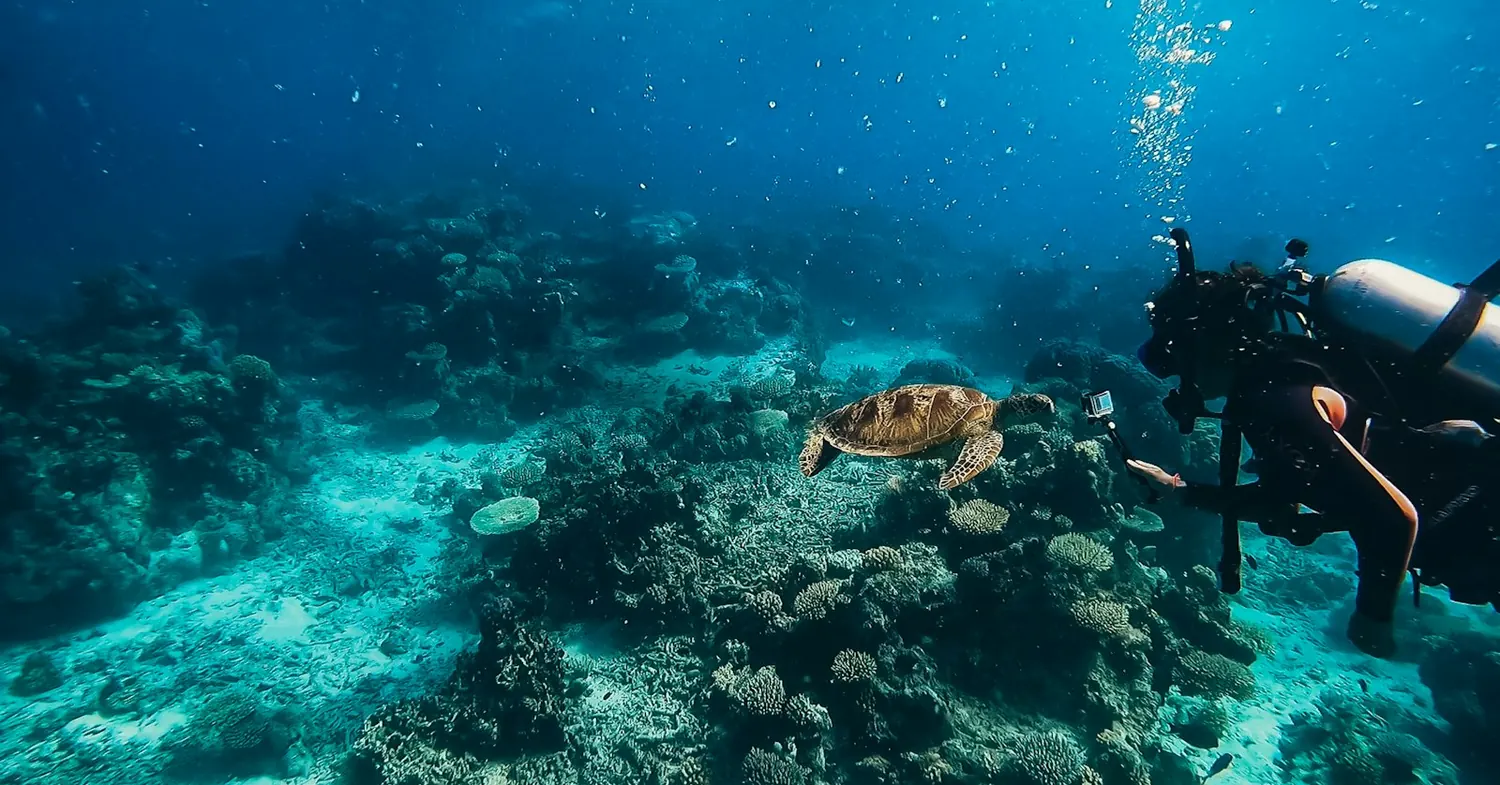
Photo: Unsplash (free licence).
Key takeaways
- Green zones are about 33% of the Great Barrier Reef Marine Park: diving and photography need no permit, a commercial tourism program does
- The Environmental Management Charge is $8.50 per person per full day and $4.25 per part day, collected by the operator; both rise on 1 April 2027
- Queensland’s 2024 code of practice keeps non-certified divers above 12 metres and entry-level trainees above 18, with a lookout stationed out of the water
- AIMS counts Cairns in the central Great Barrier Reef, where average hard coral cover rose from 28.6% in 2025 to 31.6% in 2026 against a long-term average of 20.0%
- Marine stingers are in tropical Queensland water all year and the risk is higher from November to May, which is why the suit is full-length in summer
Cairns belongs to the central Great Barrier Reef, not the northern
The Reef is not one number, and Cairns does not sit where most summaries put it. The Australian Institute of Marine Science splits its Long-Term Monitoring Program into three regions. Northern runs from Cape York to Cooktown. Central runs from Cooktown to Proserpine. Southern runs from Proserpine to Gladstone. Cairns is in the middle one.
That matters because the three moved differently. In the 2025-2026 survey season, average hard coral cover in the central region was 31.6%, up from 28.6% a year earlier and well above the region’s long-term average of 20.0%. Thirty-nine reefs were surveyed there. The northern region came in at 35.1% and the southern at 26.4%.
The figures come from manta tow surveys on 121 reefs between August 2025 and June 2026: 5,175 tows covering 1,035 kilometres over 135 days at sea. Across the whole Reef, 56% of surveyed reefs showed no net change, 28% increased and 16% declined. Twelve reefs carried cover between 50% and 75%, and none above 75%.
The recent history is violent. The 2024 mass bleaching was the fifth since 2016 and had the largest spatial footprint ever recorded on the Reef. A sixth followed in 2025. Cover fell hard, then steadied. A late monsoon in the summer of 2025-2026 cooled the water and held bleaching down, though sea surface temperatures still ran 0.7 to 1.2°C above average.
Two cyclones crossed that season. Tropical Cyclone Koji, category 1, went through the central region in January 2026 and damaged two surveyed reefs. Severe Tropical Cyclone Narelle, category 5, crossed the northern region in March, after most northern surveys were finished. Crown-of-thorns starfish are building again, in what AIMS calls the fifth recorded wave of outbreaks since the 1960s.
One label needs keeping straight. The Reef Authority’s own Northern Management Region covers both what AIMS calls Northern and what it calls Central, which is why a regional bleaching declaration for the north in 2026 included the water off Cairns. Two agencies, two meanings of the same word.
What a green zone off Cairns permits, and what the boat needs
Zoning is the spine of the Great Barrier Reef Marine Park and colour is the shorthand. The Marine National Park (Green) Zone is about 33% of the Marine Park. Anyone can enter it and swim, snorkel, dive, sail and take photographs. Nothing may be taken: no line fishing, no spearfishing, no collecting, no crabbing, no trawling.
The part visitors rarely notice is that the boat is in a different position from the body on it. Boating, diving and photography are a plain yes. A tourism program in a green zone requires a permit. So the operator holds a permission the passenger does not. Any fishing gear aboard must be stowed inboard or in rod holders, with all apparatus out of the water.
Anchoring is allowed in a green zone, but in high-use and sensitive areas a mooring may be necessary or a no-anchoring area may be marked with buoys. Travelling through with fish already on board is legal, because the offence is fishing there rather than carrying a catch.
The other zones a Cairns boat crosses are worth knowing by colour. Habitat Protection (Dark Blue) is about 28% of the Marine Park, with trawling banned but line fishing, bait netting and snorkel spearfishing allowed. Buffer (Olive Green) is roughly 3% and permits trolling for pelagic species only. Preservation (Pink) is under 1%, and nobody enters without written permission.
Scientific Research (Orange) is also under 1%. Two of its areas exclude the public altogether, next to the Australian Institute of Marine Science near Townsville and around One Tree Island Research Station. For anyone not doing research, the rest of the orange zone behaves like a green one.
Permits come through a joint system run by the Reef Authority and the Queensland Department of the Environment, Tourism, Science and Innovation. Permit applications and decisions can be searched through the Authority’s online tool, which makes the permission behind a Cairns day boat a public record rather than a claim on a brochure.
The Environmental Management Charge: $8.50 a day, rising in 2027
Everyone on a commercial trip into the Marine Park pays a charge, and the permit holder collects it. The standard full-day rate is $8.50 per person. A full day means a trip of three hours or more, or one entering the Marine Park before 5pm, or leaving after 6am, or any of the first three days of an extended charter.
Part days cost $4.25. That covers trips under three hours, a first day entering after 5pm, and a last day leaving before 6am. Overnight trips are counted as multiple full days, so a stay of two days and one night is recorded as two full days rather than one.
On extended trips the meter stops. Once a passenger has paid the maximum charge of $25.50, the fourth and subsequent days with the same operator are exempt, although the operator still has to record them in the logbook. A visitor who already paid the full charge to another operator on the same day pays nothing to the second.
Other rates sit around the edges. Non-tourist charters, such as survey, research or filming work, are $2 per person, payable on the first day of a trip. Standalone semi-submersible or glass-bottomed boat excursions and sight-seeing flights are 40 cents each. No GST is payable on any of it.
Nobody pays who is carried free of charge and falls into one of five groups: children under four, beneficiaries of registered charities, supervised school groups, people on tourism trade familiarisations or accompanying visitors as driver, guide or instructor, and media crews reporting on Marine Park issues. Pay for the service and the charge applies.
The rate is reviewed annually and changed in line with the Brisbane Consumer Price Index, and the Reef Authority gives twelve months of notice so wholesale prices and brochures can be reset. The notice currently standing says that from 1 April 2027 the full day goes to $9.00 and the part day to $4.50. Fixed quarterly charges do not change.
Queensland’s diving rules: a declaration, a lookout and a depth ceiling
Recreational diving in Queensland runs on its own statute rather than on general work safety law alone. The Safety in Recreational Water Activities Act 2011 sets the duties. The Safety in Recreational Water Activities Regulation 2024 sets out what must be done. The Recreational diving, recreational technical diving and snorkelling Code of Practice 2024 says how to do it.
The regulation’s list is short and blunt. Count everyone aboard. Take a medical declaration from entry-level certificate divers and non-certified divers. Take a medical certificate where the declaration calls for one. Advise snorkellers about medical conditions. Provide lookouts or guides, rescuers and first aid. Supervise non-certified divers. Keep a dive safety log.
The counting rule is more specific than it sounds. A designated crew member must carry out the count twice, either in two different ways that require the people counted to take part, or with a head count plus one participatory method. If the two do not match, recount. If they still disagree, the emergency plan starts.
A lookout is a job rather than a spare pair of eyes. The person must be positioned out of the water where they can see the whole area in which people are diving or snorkelling, and must be solely engaged in that task for the whole time, including entries and exits. The only exception is while they are conducting a rescue or giving first aid.
Depth is capped by category. Non-certified divers should not dive beyond 12 metres. Entry-level divers in training should not go beyond 18 metres. Children aged 10 and 11 stay above 12 metres either way. Certified divers are advised not to exceed the depth they were trained to or have experience at.
Training groups have numbers as well. Eight students to one instructor, or ten with an instructor plus at least one certified assistant. For children aged 10 and 11 it is two per instructor with no more than four people in the group, and adding an assistant does not raise that. Minimum age for entry-level training is 10, with parental consent under 18.
Where a medical evaluation is required, the certificate should be issued in English within the 90 days before the course starts, preferably by a practitioner with experience in diving medicine, and the operator keeps a copy for at least a year. Crew are on a separate track: occupational divers need a certificate of medical fitness under AS/NZS 2299.1:2015, no more than twelve months old. If you plan to get certified while travelling, those are the papers Cairns will ask for.
Marine stingers off Cairns run from November to May
Tropical Queensland water holds dangerous jellyfish all year. The risk rises in the marine stinger season, which the Queensland Government dates November to May. The two groups that matter are the box jellyfish, Chironex fleckeri, and the Irukandji.
The geography is drawn loosely and it is moving. Workplace Health and Safety Queensland tells dive operators that caution must be exercised in tropical waters generally north of Bundaberg, and adds that this range may be extending southwards. Cairns is a long way inside that line.
The duty on an operator is set out plainly: advise divers of the risk, tell them where first aid can be reached, tell them to wear protective clothing such as a lycra bodysuit or a wetsuit, and equip the first aid kit to deal with marine stings. The full-length suits handed out on Cairns boats in summer sit inside that duty.
For swimmers the state advice has a different texture. Swim at patrolled beaches between the red and yellow flags, obey the safety signs, stay out when a beach is closed, swim inside stinger nets where they are provided, do not touch stingers washed up on the sand, and consider a full-body lycra suit.
Treatment is specific. Call triple zero. While the ambulance is coming, pour vinegar onto the sting and give oxygen or CPR if required. Irukandji symptoms may take 20 to 40 minutes to develop, which is the reason the advice says to seek medical aid when in doubt rather than waiting to feel worse. Our page on marine life safety covers the wider list.
One more animal belongs on a Cairns page. Crocodiles live in fresh and salt water in northern Queensland. The state advice is to swim only in designated safe swimming areas, to take extra care around water at night and during the breeding season from September to April, and to stay back from the water’s edge.
Sea temperature off Cairns, from a buoy anchored in 1975
Queensland has measured waves off Cairns since 2 May 1975. The instrument is a Datawell 0.7 metre Waverider at 16.7305 degrees south, 145.7126 degrees east, in 12 metres of water, and it logs sea surface temperature alongside wave height every half hour.
In the verified 2025 record the coolest monthly mean was 23.5°C in July and the warmest was 30.1°C in January. The annual mean was 27.1°C. Individual half-hourly readings ran from 21.7°C to 32.7°C across the year.
The 2026 record to the end of July sits close to it. July averaged 23.2°C and February 30.3°C, with May at 25.3°C and June at 24.0°C.
Translated into neoprene, a 3 mm full suit covers most of the Cairns year, and a 5 mm or a hooded vest earns its place between June and September. From November to May the suit is doing two jobs, warmth and stinger cover, so a full-length skin goes on even when the water reads 30 degrees.
The buoy is not the outer reef, and that limit is worth carrying. It sits inshore in 12 metres of water, and no Australian agency publishes a visibility series for the reefs the Cairns day boats run to, so any clarity figure you meet is a description rather than a measurement.
The same record holds the site’s largest waves. The biggest maximum wave height logged there is 5.6 metres, on 12 April 2014, followed by 5.0 metres on 28 February 2000 and 4.7 metres on 23 January 2013. All three fall in the cyclone half of the year.
Green Island at 27 kilometres, Michaelmas Cay at 41
Two named cays carry a large share of the shallow diving and snorkelling out of Cairns, and both are governed more tightly than the water around them. Queensland Parks puts Green Island at 27 kilometres offshore from Cairns, and Michaelmas and Upolu Cays National Park at 41 kilometres north-east.
Green Island is 12 hectares of true coral cay, built over thousands of years from sand and coral rubble deposited on the calm side of a platform reef. It became a national park in 1937, a marine park in 1974, part of the Great Barrier Reef Marine Park in 1975 and part of the World Heritage Area in 1981.
In 1990 the public areas were declared a recreation area, taking in the national park, the esplanade and the surrounding marine park out to 1.6 kilometres beyond the reef edge. The waters sit in Scientific Research (Orange) or Marine National Park (Green) zones, so fishing is prohibited and anchoring is sand only.
The island and reef are the sea country of the Guru-Gulu Gungandji people, who know Green Island as Wunyami. Under the Gunggandji Traditional Use of Marine Resources Agreement, accredited by the Commonwealth and State governments on 28 June 2016 for a five-year period, no hunting of turtle or dugong is allowed around the island.
Michaelmas Cay is a bird site first and a dive site second. Up to 20,000 breeding pairs use it at one time, across four ground-nesting species: brown noddies, sooty terns, crested terns and lesser crested terns. It holds one of the largest sooty tern colonies in Queensland, and visitors ashore must stay inside a roped-off area.
The protection has a radius. The Michaelmas Cay Locality runs one nautical mile around the cay, with special regulations set out in the Cairns Area Plan of Management, and the Reef Authority lists the cay as a Sensitive Location in its Offshore Cairns Sector. Disturbed adult birds abandon nests, which is what the rope and the radius are for.
Osprey Reef sits in a different park with a different manager
A liveaboard leaving Cairns for the Coral Sea crosses out of the Great Barrier Reef Marine Park and into the Coral Sea Marine Park. That is a separate Commonwealth reserve managed by Parks Australia rather than by the Reef Authority, and its management plan has been in operation since 1 July 2018.
The scale is hard to hold in the head. The park covers 989,836 square kilometres, 2,200 kilometres at its longest and 1,300 at its widest, with depths from 0 to 6,000 metres and an average depth of 2,188 metres. Inside it are 34 reef areas, 67 cays and islets and about 15,000 square kilometres of reef.
The zoning uses a different set of names: National Park, Habitat Protection and Special Purpose. Recreational fishing is allowed in much of the park but not in National Park zones. Parks Australia says visibility can reach 60 metres out there, and names Osprey Reef among the top ten dive sites in the world.
The animals are the reason the trip is long. Black marlin spawning aggregations gather near Osprey Reef. Humpback whales pass through between June and November. Six of the world’s seven marine turtle species occur in the Coral Sea, and at least 45 historic shipwrecks lie inside the park.
Most visitors arrive the same way, on liveaboards from Port Douglas, Cairns, Townsville, Mackay, Airlie Beach or Gladstone, often calling at Great Barrier Reef sites on the route out. That is the practical split between a Cairns day boat and a Cairns liveaboard: one stays in a single park, the other works two. Our liveaboard destinations page sets that against the rest of the world.
Some ground is now closed. South Islet in the Willis Islets, Bird Islet at Wreck Reef, North East Cay in the Herald Cays and Magdelaine Cay South, all roughly 500 kilometres off the Queensland coast, are shut to the public so those locations can be protected and restored.
Seven dive businesses in Cairns, and what a register settles
Seven dive businesses appear on the Cairns list, read on 13 September 2026. Four of the seven are published by SSI in its own register of affiliated centres. Three are Green Fins members, read from that register on 15 August 2026. All seven publish a website, which is a low bar and still not universal elsewhere.
The Green Fins entries need reading with care. All three are at Digital Member level, and the record for each states assessment: none, self-evaluation only. Nobody went and looked at them. Green Fins is voluntary, so a Cairns business outside it is outside a scheme rather than below a standard.
The town field is untidy, which is normal for registers and worth saying out loud. Three of the seven are filed under CAIRNS, one under Brinsmead, and three carry no town field at all. That is a property of the register rather than of the businesses in it.
Australia has no compulsory national register of dive centres. The instruments that govern the activity are work health and safety law and Australian Standards, and a standard is a technical document rather than a list of who is trading. AS/NZS 2299.1:2015 sets medical fitness criteria for occupational divers and names nobody at all.
Cairns does have one public record that most dive destinations lack. A business running a tourism program in the Marine Park needs a Marine Park permit, and permit applications and decisions can be searched through the Reef Authority’s online tool. That is a permission to operate inside a park, not an audit of anybody’s teaching.
What a listing settles is narrow: the body lists the business, on the date given. Every entry on the Cairns operator list links back to the page it was read from. Which registers can be read logs what each source returned and when, and how we check sets out the rest of the method.
FAQ: scuba diving in Cairns
Can you dive in a green zone on the Great Barrier Reef?
Yes. The Marine National Park (Green) Zone is about 33 per cent of the Great Barrier Reef Marine Park, and anyone may enter it to swim, snorkel, dive, sail and take photographs. It is a no-take zone, so line fishing, spearfishing, collecting, crabbing and trawling are all out. The boat is in a different position from the passenger: a commercial tourism program in a green zone needs a Marine Park permit, which the operator holds and you do not.
How much is the Environmental Management Charge for a dive trip from Cairns?
The standard rate is $8.50 per person for a full day and $4.25 for a part day. A full day means three hours or more in the Marine Park, or a trip entering before 5pm or leaving after 6am. On extended trips the charge stops once a passenger has paid the maximum of $25.50, so the fourth and later days with the same operator are exempt. From 1 April 2027 the full day rises to $9.00 and the part day to $4.50.
How deep can you dive in Cairns without a certification?
Queensland's code of practice says a dive operator should ensure non-certified divers do not dive beyond 12 metres. Entry-level divers in training should not go beyond 18 metres, and children aged 10 and 11 stay above 12 metres whichever category they are in. Certified divers are advised not to exceed the depth they were trained for or have experience at. These are figures in the Recreational diving, recreational technical diving and snorkelling Code of Practice 2024.
When is stinger season in Cairns?
November to May. The Queensland Government states that marine stingers are present in tropical Queensland waters all year round but that the risk is higher during the marine stinger season, which it dates November to May. The two dangerous groups are the box jellyfish, Chironex fleckeri, and the Irukandji. Workplace Health and Safety Queensland tells dive operators that caution is needed in tropical waters generally north of Bundaberg and that the range may be extending southwards.
How warm is the water for diving in Cairns?
The Queensland wave buoy off Cairns records sea surface temperature every half hour. In its verified 2025 record the coolest monthly mean was 23.5 degrees Celsius in July and the warmest was 30.1 degrees in January, with an annual mean of 27.1 degrees. The 2026 record to the end of July gives 23.2 degrees in July and 30.3 degrees in February. The buoy sits inshore in 12 metres of water, so it is not a measurement of the outer reef.
Is the coral off Cairns recovering?
Cairns falls in what the Australian Institute of Marine Science calls the central Great Barrier Reef, which runs from Cooktown to Proserpine. Average hard coral cover there rose from 28.6 per cent in 2025 to 31.6 per cent in 2026, above the region's long-term average of 20.0 per cent, across 39 reefs surveyed. That followed the 2024 mass bleaching event, the fifth since 2016, and a sixth event in 2025 whose measured impact was limited.
Do you need a medical certificate to learn to dive in Cairns?
You need a medical declaration first. Non-certified divers and entry-level certificate divers must complete a medical self assessment on the approved form. If an entry-level diver's declaration indicates that a medical evaluation is required, a medical certificate issued within 90 days of the activity must be provided, preferably by a doctor with experience in diving medicine, and the operator keeps a copy for at least a year. Minimum age for entry-level training is 10.
How far offshore are Green Island and Michaelmas Cay from Cairns?
Queensland Parks gives Green Island as 27 kilometres offshore from Cairns and Michaelmas and Upolu Cays National Park as 41 kilometres north-east of Cairns. Green Island is a 12-hectare coral cay that became a national park in 1937 and sits inside Scientific Research or Marine National Park zones, so fishing there is prohibited. Michaelmas Cay carries up to 20,000 breeding pairs of seabirds and has its own one-nautical-mile locality with special regulations.
Is Osprey Reef part of the Great Barrier Reef?
No. Osprey Reef lies in the Coral Sea Marine Park, a separate Commonwealth reserve of 989,836 square kilometres managed by Parks Australia rather than by the Reef Authority, with a management plan in operation since 1 July 2018. Its zones are named National Park, Habitat Protection and Special Purpose. Most visitors reach it on liveaboards from Port Douglas, Cairns, Townsville, Mackay, Airlie Beach or Gladstone, often calling at Great Barrier Reef sites on the way.
How many dive businesses are there in Cairns?
Seven appear on this directory's Cairns list, read on 13 September 2026. Four of the seven are published by SSI in its own register of affiliated centres. Three are Green Fins members, read from that register on 15 August 2026, all at Digital Member level with the record for each stating assessment: none, self-evaluation only. All seven publish a website. Australia has no compulsory national register of dive centres to check them against.
What does a Marine Park permit prove about a Cairns dive operator?
It proves the operator is permitted to run a tourism program in the Great Barrier Reef Marine Park, and nothing about the teaching, the boats or the briefings. Permits are granted through a joint system run by the Reef Authority and the Queensland Department of the Environment, Tourism, Science and Innovation, and permit applications and decisions can be searched online. That makes the permission a public record rather than a claim, which is more than most dive destinations offer.
Founder of NOMADREEF and a former digital nomad. This guide is sourced from the references below; conditions, prices and rules change, so verify current details, and follow qualified local guidance and safety briefings. About the author · LinkedIn ↗
Sources
- Every zoning figure. Marine National Park (Green) Zone about 33% of the Marine Park with boating, diving and photography permitted and a tourism program requiring a permit; fishing apparatus stowed inboard; anchoring allowed subject to moorings and no-anchoring areas; Habitat Protection (Dark Blue) about 28% with trawling prohibited; Buffer (Olive Green) approximately 3% with trolling for pelagic species only; Preservation (Pink) under 1% and no entry without written permission; Scientific Research (Orange) under 1% with two closed areas adjacent to the Australian Institute of Marine Science near Townsville and One Tree Island Research Station. Great Barrier Reef Marine Park Authority, Interpreting zones, page updated 8 January 2025. Read 20 September 2026.
- Every charge figure. Full day $8.50 and part day $4.25 with their timing rules; maximum charge $25.50 and the exemption for the fourth and subsequent days of an extended trip; non-tourist charter $2 per person; semi-submersible, glass-bottomed boat and sight-seeing flight excursions 40 cents; no GST; the five free-of-charge categories including children under four; annual review against the Brisbane Consumer Price Index with twelve months of notice; and the increase to $9.00 and $4.50 from 1 April 2027. Great Barrier Reef Marine Park Authority, What are the charges?, page updated 9 September 2026. The rule that overnight trips are recorded as multiple full days comes from the same Authority’s Tourism visitation data page. Both read 20 September 2026.
- Coral cover and the region boundaries. Northern region from Cape York to Cooktown, Central from Cooktown to Proserpine, Southern from Proserpine to Gladstone; central region average hard coral cover 31.6% in 2026 against 28.6% in 2025 and a long-term average of 20.0%, across 39 reefs; northern 35.1% and southern 26.4%; 121 reefs surveyed between August 2025 and June 2026 using 5,175 tows over 1,035 kilometres and 135 days at sea; 56% of reefs unchanged, 28% increased, 16% declined; twelve reefs between 50% and 75% cover and none above 75%; sea surface temperatures 0.7 to 1.2°C above average; Cyclone Koji and Severe Tropical Cyclone Narelle; the fifth recorded wave of crown-of-thorns outbreaks since the 1960s; and the Reef Authority declaring regional bleaching in its Northern Management Region, which the report equates to the Northern and Central regions. Australian Institute of Marine Science, Annual Summary Report of Coral Reef Condition 2025/26, published 11 August 2026, and its Quick Look summary (PDF). The 2024 event being the fifth mass bleaching since 2016 and having the largest spatial footprint recorded comes from the 2024/25 report. All read 20 September 2026.
- The Queensland diving law. The Safety in Recreational Water Activities Act 2011, the Safety in Recreational Water Activities Regulation 2024 and its list of requirements, and the Recreational diving, recreational technical diving and snorkelling Code of Practice 2024. Workplace Health and Safety Queensland, Diving, snorkelling and recreational water activities laws. The depth ceilings of 12 and 18 metres, the 12-metre limit for children aged 10 and 11, the eight-to-one and ten-to-one instructor ratios, the two-per-instructor rule for children aged 10 and 11, the minimum age of 10, the double head count and the requirements on a lookout are quoted from the Code of Practice 2024 (PDF). Both read 20 September 2026.
- Medical requirements. Medical self assessment for non-certified and entry-level certificate divers, a medical certificate within 90 days where the declaration requires an evaluation, the copy kept for at least a year, and the AS/NZS 2299.1:2015 certificate of not more than twelve months for occupational divers. Workplace Health and Safety Queensland, Medical fitness for diving. Read 20 September 2026.
- Marine stingers and crocodiles. Stingers present all year with the risk higher in the November to May season, box jellyfish and Irukandji named, vinegar and triple zero, the 20 to 40 minute delay in Irukandji symptoms, stinger nets and lycra suits, and the crocodile breeding season of September to April: Queensland Government, Dangerous marine life. The tropical range described as generally north of Bundaberg and possibly extending southwards, the November to May season for operators, and the operator duties on advice, protective clothing and first aid kits: Workplace Health and Safety Queensland, Marine stingers. Both read 20 September 2026.
- Sea temperature and waves. The buoy installed 2 May 1975 at latitude -16.7305 and longitude 145.7125951 in 12 metres of water, a Datawell 0.7 m Waverider, and the site record of maximum wave heights headed by 5.6 metres on 12 April 2014, 5.0 metres on 28 February 2000 and 4.7 metres on 23 January 2013: Queensland Government, Cairns wave monitoring. The monthly means quoted here are calculated from the verified half-hourly records for that buoy published as Coastal Data System: Waves (Cairns), 2025 and 2026 files, 17,521 rows for 2025 and 8,689 for 2026 to the end of July. Both read 20 September 2026. The same buoy’s temperature record for 2022, 2023 and 2024 runs several degrees colder than its 2021, 2025 and 2026 records, so those three years are not used here.
- Green Island. 27 kilometres offshore from Cairns, 12 hectares of coral cay, national park 1937, marine park 1974, Great Barrier Reef Marine Park 1975, World Heritage Area 1981, recreation area 1990 extending 1.6 kilometres beyond the reef edge, waters in Scientific Research (Orange) or Marine National Park (Green) zones, fishing prohibited, and the Gunggandji Traditional Use of Marine Resources Agreement accredited on 28 June 2016 for five years with no turtle or dugong hunting around the island. Queensland Department of the Environment, Tourism, Science and Innovation, Green Island National Park and its About page. Read 20 September 2026.
- Michaelmas Cay. 41 kilometres north-east of Cairns, up to 20,000 breeding pairs at one time across brown noddies, sooty terns, crested terns and lesser crested terns, the roped-off area ashore, and the one-nautical-mile Michaelmas Cay Locality whose special regulations are set out in the Cairns Area Plan of Management. Queensland Department of the Environment, Tourism, Science and Innovation, Michaelmas and Upolu Cays National Park. The cay being listed as a Sensitive Location in the Offshore Cairns Sector comes from the Reef Authority’s own site arrangement map, Michaelmas Cay Locality (Offshore Cairns Sector), 2019. Both read 20 September 2026.
- The Coral Sea Marine Park. 989,836 square kilometres, 2,200 kilometres long and 1,300 wide, depths from 0 to 6,000 metres with an average of 2,188 metres, 34 reef areas, 67 cays and islets and about 15,000 square kilometres of reef; National Park, Habitat Protection and Special Purpose zones with recreational fishing excluded from National Park zones; visibility described as up to 60 metres; black marlin spawning near Osprey Reef; humpback whales between June and November; six of the seven marine turtle species; at least 45 historic shipwrecks; the management plan in operation from 1 July 2018; liveaboard departures from Port Douglas, Cairns, Townsville, Mackay, Airlie Beach and Gladstone; and the closure of South Islet, Bird Islet, North East Cay and Magdelaine Cay South about 500 kilometres off the coast. Parks Australia, Coral Sea Marine Park. Read 20 September 2026. The description of Osprey Reef as one of the top ten dive sites in the world is Parks Australia’s wording and is quoted as such, not measured.
- Marine Park permits. Permits granted by the Great Barrier Reef Marine Park Authority and the Queensland Department of the Environment, Tourism, Science and Innovation through a joint permission system, and a public permit application and decision search. Great Barrier Reef Marine Park Authority, Permits. Read 20 September 2026.
- The seven businesses. Seven dive businesses on the Cairns list, read 13 September 2026: four published by SSI in its register of affiliated centres, three Green Fins members read from that register on 15 August 2026 and all three at Digital Member level with the record for each stating assessment: none, self-evaluation only, and seven of seven publishing a website. Three are filed under CAIRNS, one under Brinsmead and three carry no town field. From divessi.com and the Green Fins member register, with every entry linked to the page it was read from on the Cairns operator list. What each source returned, and on what date, is logged on which registers can be read.