Safaga Diving: The Salem Express, Safaga’s Islands and the Reef Reserve of 2025
 by Yannick Schroth
Sep 25, 2026
13 min read
by Yannick Schroth
Sep 25, 2026
13 min read
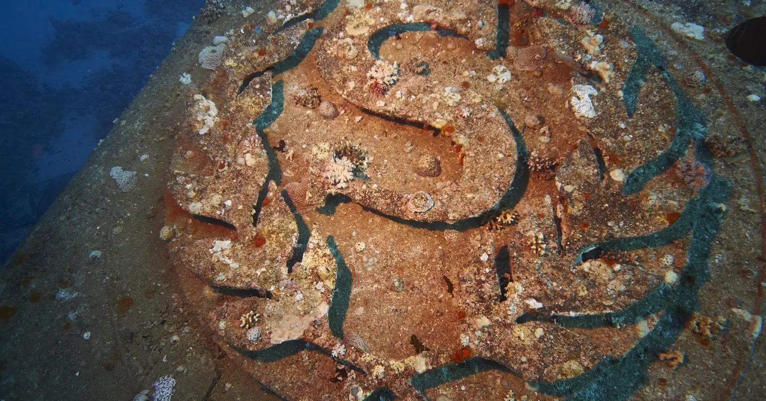
Photo: HotPepper, Wikimedia Commons, CC BY 3.0. Cropped.

Key takeaways
- The Great Fringing Reefs protectorate, Decree 4419 of 2025, covers 1,800 km² in the Red Sea governorate, and a 2026 study describes it as a coastal strip about 2 to 5 km wide running south from Hurghada
- Decree 642 of 1995 named Safaga Island and Tobia Island as protected, with 1 km of water around each; a 2020 decree then redrew that protectorate’s boundary more than 300 km further south
- The environment agency’s own leaflet bans anchoring, fishing, coral contact and landing on any Red Sea island except one corner of Giftun Kebir
- Egyptian law counts something as an antiquity only once it is 100 years old, unless the Prime Minister designates it; no designation for the Salem Express turned up
- Landsat mapping puts the reef area at the Safaga–Abu Soma site at 47.81 km² in 1985 and 36.28 km² in 2025, a loss of 24.1 percent
Safaga’s coast lies inside the reef reserve Egypt declared in December 2025
The newest line on the map of Egyptian protected areas runs along the shore you dive from. On 4 December 2025 Egypt’s acting environment minister announced Prime Ministerial Decree 4419 of 2025, which declares what the government calls the Great Coral Reef, or Great Fringing Reef, of the Red Sea a marine protected area. The State Information Service says the decree fixes the area “based on official maps and coordinates” and hands management to the governors of the Red Sea and South Sinai.
The Egyptian Environmental Affairs Agency lists it as its 31st protectorate: Great Fringing Reefs, declared 2025, 1,800 km², in the Red Sea governorate, in the category of a sustainable-use protected area. That category matters for a diver. The State Information Service says projects inside the area will be allowed under strict environmental regulations, and the minister described the decree as a step for the blue economy through sustainable tourism.
Where exactly the line runs is harder to pin down. The coordinates were not in any copy of the decree we could open. A peer-reviewed study published in July 2026, by Hesham El-Asmar and colleagues at Damietta University, describes the protected area as running from Hurghada to the southern border at 22°N, about 2 to 5 km wide along the shore and widening to 30 to 70 km in the far south. Safaga sits on that stretch of coast.
Two things follow from that description. On it, the fringing reef off the town and its beaches is in the reserve. An offshore reef several kilometers out may or may not be, and the study itself argues the strip is narrow compared with the nutrient plumes coming off the development centers it measured. Until the coordinates are public, “is this site inside?” is a question for the operator and the protectorate office, not for a travel page.
Safaga Island and Tobia Island were named in a protectorate decree in 1995
The islands off Safaga have a longer legal history than the coast. Prime Ministerial Decree 642 of 1995, issued on 1 April 1995 and published in al-Waqa’i’ al-Misriya no. 83, rewrote Article 1 of the 1986 decree that created the Elba protectorates. Its first item covers the coastal mangroves and the Red Sea islands in Egyptian territorial waters between latitude 27°15′N and 22°N, together with 1 km of water around the land of each island.
Then it names them. The list starts with Giftun Kebir and Giftun Soghayar off Hurghada, runs through Abu Ramada, Abu Minqar and Umm Gawish, and includes Tobia Island and Safaga Island before continuing south to Wadi Gimal, the Brothers, Abu el Kizan, which the decree itself glosses as Daedalus Reef, and Zabargad. Safaga, at about 26°44′N, is well inside the latitude band.
The same instrument has since moved. In 2006 the northern islands became a protectorate of their own, the Northern Red Sea Islands, under Prime Ministerial Decree 1618 of 2006. Then Decree 1618 of 2020, dated 13 August and published in the Official Gazette no. 37 on 10 September 2020, amended the boundaries of the Elba protectorate “according to the attached map and coordinates”. The annexed table has 214 points. None lies north of 23°50′N, more than 300 km south of Safaga.
Article 2 of that 2020 decree adds that the armed forces keep their military sites inside the protectorate as strategic areas. For a diver the practical reading is narrower than the legal one. Which decree covers Safaga Island and Tobia Island today is not settled by any text we could read, and the agency’s own rules for the Red Sea islands, which follow, do not wait for the answer.
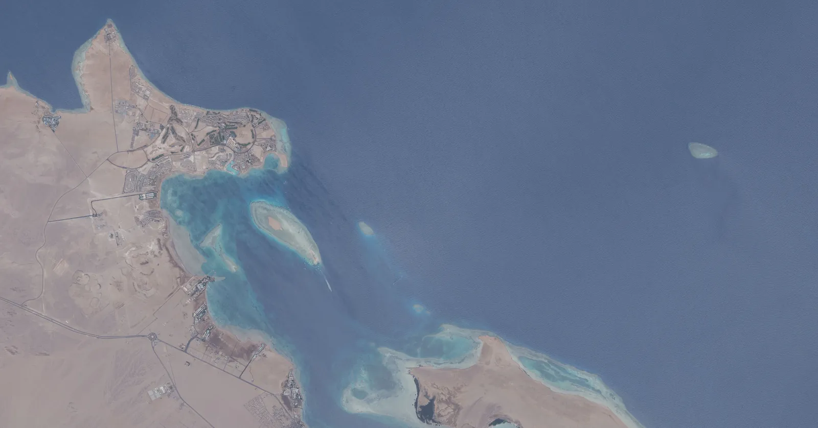
Photo: Earth Science and Remote Sensing Unit, NASA Johnson Space Center, ISS Expedition 74, Wikimedia Commons, public domain. Cropped.

What Egypt’s protectorate rules ask of a Safaga dive boat
The Egyptian Environmental Affairs Agency publishes a short leaflet for its Red Sea Islands and Northern Islands protectorates, and it lists Safaga’s international seaport among the ways in. Its environmental instructions are blunt. Landing on any Red Sea island is not permitted, except in the south-eastern part of Giftun Kebir where tourist projects are allowed. Using an anchor is prohibited inside the protectorates, and boats use the marine mooring buoys instead.
The rest reads like a dive briefing with legal weight behind it: no feeding fish or birds, no touching, walking or standing on coral, no fishing inside the protectorate, no collecting shells or coral, and no rubbish over the side. The leaflet ties these to Law 102 of 1983 on natural protectorates and to the environment law, Law 4 of 1994 as amended by Law 9 of 2009. The buoy system itself, and who installed it, is covered on the Hurghada diving page.
The same leaflet sets the visit fees, and it is specific about where they apply. A fee is charged for the distant southern islands, named as the Brothers, Rocky, Zabargad and Abu el Kizan: 5 US dollars per person per day for foreigners and 5 Egyptian pounds for Egyptians. A fee for Giftun is collected by the Red Sea governorate. No fee is named for Safaga’s islands.
Treat those amounts as the agency’s last published figures rather than today’s price. The leaflet carries no date, and the agency’s protectorates page states that its pages on visit fees are being updated.
There is also a paper requirement on the business rather than on you. Minister of Environment Decree 202 of 2019, published on 26 August 2019, obliges every company organizing tourist programs inside the protectorates of South Sinai and the Red Sea, diving and snorkeling named first, to apply to the agency for an activity permit. It took effect three months after it was issued. That permit is separate from the tourism license discussed further down.
The Salem Express off Safaga is 65 years short of Egypt’s antiquities threshold
The Salem Express was a passenger ferry on the run between Jeddah and Safaga, and in December 1991 she was carrying pilgrims home from the Hajj. Near midnight, in a storm, she struck Hyndman Reef south of Safaga and sank. The wreck lies on its starboard side in about 30 meters of water. These points agree across every account we read; the exact date does not, with sources giving the 14th, 15th or 17th.
The death toll disagrees more. Even the figures described as official differ between sources, and estimates run far above them, so no number is given here. What the accounts do agree on is that the recovery of bodies was called off, that remains are still inside, and that divers report the openings to the lower decks were welded shut afterwards. This is a grave site in every sense except, as it turns out, the legal one.
Egypt’s heritage statute is Law 117 of 1983, the Antiquities Protection Law. Its Article 1 counts property as an antiquity when it comes from the successive periods of civilization on Egyptian land “till before 100 years” and carries archaeological, artistic or historical value. A ship lost in 1991 crosses that line in 2091. Article 5 gives the Supreme Council of Antiquities authority over antiquities in the local and territorial waters, but only once they are antiquities.
The exception is written into the next article. Article 2 lets the Prime Minister declare any property of historic, religious or other value an antiquity, “without being bound with the time limit”. No such decree for the Salem Express turned up. The later amending laws we read, Law 91 of 2018 and Law 20 of 2020, left Articles 1 and 2 as they were.
So the restraint you will see on the site is custom, not statute: briefings that keep divers outside the hull and ask for respect. That is the right way to dive it regardless of what the law says. Anyone planning a trip around wrecks can compare it with the other sites on our wreck diving list.
Panorama Reef and Tobia Arbaa show Safaga’s deep and shallow ends
Two reef sites come up in almost every Safaga dive plan, and they could hardly be less alike. Panorama Reef, also called Abu Alama, is a large offshore reef reached by boat from Safaga. Every description we read gives it sheer walls on its long sides and a plateau at each end, north and south, with gorgonian fans on the drop-offs.
The depth figures quoted for Panorama’s plateaus and walls vary from source to source, so none is repeated here. The same goes for its currents: several dive pages mention them, and none is a source a safety statement should rest on. Ask the boat for its own briefing on the day.
Tobia Arbaa is the opposite end of the scale: a cluster of coral pillars standing on sand at about 12 meters, reached by boat from Safaga or Soma Bay. Its English nickname is the Seven Pillars, although arba‘a is Arabic for four and one log counts five, two of them split. It shares its name with Tobia Island, one of the two islands off Safaga that the 1995 decree named.
Northern Safaga Bay grows coral carpets as well as reefs
Safaga Bay is one of the better-studied pieces of reef in the northern Red Sea, and the reason is scientific rather than touristic. In 1997 Bernhard Riegl and Werner Piller mapped the coral assemblages of northern Safaga Bay and found nine. Four belong to steep ground: Acropora on exposed windward reefs, Porites on sheltered leeward ones, Millepora where currents hit and Stylophora on reef flats.
The other five grow on low relief, which is where Safaga gets unusual. A faviid carpet covers low ground between 10 and 25 meters and thins as the water turns more turbid. A Porites carpet grows between 5 and 15 meters where the water is clearest. There is a Sarcophyton soft-coral carpet where the suspension load is high, and platy corals below 25 meters where light runs short.
The same authors explained two years later why carpets matter. A coral carpet builds framework but has no clear zonation, because it grows only where there is no pronounced gradient. The carpet holds on to sediment while a reef exports it, and they considered carbonate accumulation higher in carpet areas because carpets cover so much more ground.
The sediment between them is alive too. A 1998 study took thirteen bulk samples in the northern bay, from reef slopes and seagrass to a mangrove channel and down to 40 meters, and separated the shells into 622 mollusc taxa. For a diver the lesson is simple: the flat stretches between Safaga’s reefs are habitat, and fins belong well above them.
Satellite mapping puts the Safaga–Abu Soma reef loss since 1985 at 24.1 percent
The 2026 study behind the reserve’s boundaries also measured what has been lost. It mapped reef extent from Landsat images at five sites along the Egyptian coast, one of them Safaga–Abu Soma. There the mapped reef covered 47.81 km² in 1985, 44.61 in 2020, 37.89 in 2022 and 36.28 km² in 2025. That is a loss of 11.53 km², or 24.1 percent.
That was the smallest proportional loss of the five sites, against 36.7 percent at El Gouna and 31.8 percent at Hurghada. It also left Safaga–Abu Soma with the smallest remaining reef area of the three northern sites. The authors warn that the figures show relative change within the mapped extents, carry the uncertainty of remote sensing, and should not be read as the loss for the whole Egyptian coast.
Inside Abu Soma Bay the study found reef extent falling from 10.93 km² in 2020 to 9.94 km² in 2025, a drop the authors link in time to resort building there after 2015, without ruling out heat stress over the same years. Offshore of Safaga–Abu Soma they recorded a localized chlorophyll anomaly of 0.45 mg/m³, about half the 0.97 found off Hurghada. One of their field validation dives, in late 2024, was on the reefs south of Safaga.
Who runs dives from Safaga: 28 dive centers among 36 businesses
Two documents stand behind a dive center here. The tourism license comes from the Ministry of Tourism and Antiquities, and renewing it runs through an audit by the Chamber of Diving and Water Sports, whose 2025 audit manual says the chamber then sends its membership letter to the ministry. What that license does and does not prove is set out on the Hurghada diving page.
One line in the same manual is worth using as a customer. Every center must keep a written emergency plan with emergency contacts and nearby medical centers, including data on the availability of recompression chambers. The chamber’s own list of medical facilities names one in Safaga: Deco International at the Safaga General Hospital, emergency line +2 012 219 0383. Ask the center to show you its emergency plan before your first dive all the same, because the plan is what the boat crew will follow.
The Safaga operator list holds 36 watersports businesses, read on 13 September 2026. 28 are dive centers. The other eight are wind and sailing businesses, six of them teaching kitesurfing. 23 of the dive centers carry a CDWS license number; 19 businesses appear in the SSI, IKO or VDWS registers of affiliated centers, and 6 appear in both kinds of source.
The registers file some of these businesses under Soma Bay or Abu Soma rather than Safaga town, and a register’s town field is not always where the boats leave from. Only 15 of the 36 publish a website. SSI rates six of its Safaga centers for freediving, five for Extended Range and four for rebreather, which says what the listing carries, not that a course runs this season. Which registers can be read explains the limits of each source.
If you are choosing between Red Sea bases rather than between shops, the Marsa Alam diving guide covers the flying-after-diving arithmetic for a Red Sea week, and the Sharm El-Sheikh diving guide the national park at the tip of Sinai. For cover on a boat far from a chamber, see the dive insurance guide.
FAQ: scuba diving in Safaga
Is the Salem Express wreck protected by law?
Not by Egypt’s heritage statute, as far as the texts go. Article 1 of the Antiquities Protection Law, Law 117 of 1983, covers property from before 100 years, which the 1991 wreck reaches in 2091. Article 2 lets the Prime Minister designate younger property, but no such decree for the Salem Express turned up. Remains are still inside, and briefings keep divers outside the hull out of respect.
Is Safaga inside a marine protected area?
The coast is. Prime Ministerial Decree 4419 of 2025 declared the Great Fringing Reefs protectorate, listed by the environment agency at 1,800 square kilometers in the Red Sea governorate. A 2026 peer-reviewed study describes it as a strip about 2 to 5 km wide from Hurghada south to 22 degrees north. Safaga Island and Tobia Island were named separately in a protectorate decree in 1995.
Do divers pay a protectorate fee in Safaga?
The environment agency’s leaflet names a fee of 5 US dollars per person per day for foreigners only at the distant southern islands, the Brothers, Rocky, Zabargad and Abu el Kizan, and says Giftun’s fee is collected by the Red Sea governorate. It names no fee for Safaga’s islands. The leaflet is undated and the agency says its fee pages are being updated.
How deep is Tobia Arbaa?
Its coral pillars stand on sand at about 12 meters. It is known in English as the Seven Pillars, although arba‘a is Arabic for four and one dive log counts five pillars, two of them split. It shares its name with Tobia Island off Safaga.
How many dive centers are there in Safaga?
The Safaga operator list holds 36 watersports businesses, read on 13 September 2026, of which 28 are dive centers. 23 of the dive centers carry a CDWS license number and 19 businesses appear in the SSI, IKO or VDWS registers of affiliated centers. Some are filed under Soma Bay or Abu Soma rather than Safaga town.
Note: Conditions, safety guidance and regulations change. Verify current information with official sources, including the dive operator, the protectorate office and the relevant government department, before you travel or dive.
Founder of NOMADREEF and a former digital nomad. This guide is sourced from the references below; conditions, prices and rules change, so verify current details, and follow qualified local guidance and safety briefings. About the author · LinkedIn ↗
Sources
- The protectorates in force, including the 2025 reserve. Primary. Egyptian Environmental Affairs Agency, Nature Conservation Sector, list of protectorates declared under Law No. 102 of 1983: no. 31, Great Fringing Reefs, declared 2025, 1,800 km², Red Sea governorate, sustainable-use protected area, Prime Minister’s Decree No. 4419 of 2025; no. 25, Northern Red Sea Islands, Prime Minister’s Decree No. 1618 of 2006; no. 5, Elba, Prime Minister’s Decree No. 450 of 1986, amended by Decree No. 642 of 1995 and further amended by Decree No. 1618 of 2020. EEAA list, English (PDF) and Arabic (PDF), both uploaded July 2026. Read 25 September 2026.
- The announcement of Decree 4419 of 2025. Primary. State Information Service, “Egypt declares Red Sea’s Great Coral Reef a new marine protected area”, 4 December 2025: the decree “defines the full extent of the reef area as a protected zone, based on official maps and coordinates”, builds on protections declared in 1986, 2003 and 2006, and tasks the governors of the Red Sea and South Sinai. sis.gov.eg; the Middle East News Agency report of the same day, naming Decrees 450 of 1986, 143 of 2003 and 1618 of 2006, on maspero.eg. Read 25 September 2026.
- The extent of the reserve and the Safaga–Abu Soma reef figures. Peer-reviewed. El-Asmar HM, Felfla MS, Ahmed E, Gamal M, Elbayomi GM, Abo Zeid SM (2026), Toward Sustainable Marine Governance in the Egyptian Red Sea, Sustainability 18(14), 7456, published 21 July 2026: the MPA under Decree 4419/2025 “extending from Hurghada to the southern border at latitude 22° N, with a coastal width of ≈2–5 km”, widening to 30–70 km in the south; Table 1, Safaga–Abu Soma reef extent 47.81, 44.61, 37.89 and 36.28 km² for 1985, 2020, 2022 and 2025, loss 11.53 km² or 24.1%; El Gouna 36.7% and Hurghada 31.8%; Abu Soma Bay 10.93 km² in 2020 and 9.94 km² in 2025; chlorophyll-a anomalies of 0.45 mg/m³ at Safaga–Abu Soma and 0.97 at Hurghada; validation site “South of Safaga Coral Reefs”, September to November 2024. doi:10.3390/su18147456. Read 25 September 2026. The paper describes the decree; the decree’s own coordinates were not reachable, so the boundary here rests on this description.
- Safaga Island and Tobia Island in the 1995 decree. Primary. Prime Ministerial Decree No. 642 of 1995, issued 1 April 1995, al-Waqa’i’ al-Misriya no. 83, 10 April 1995, replacing Article 1 of Decree No. 450 of 1986: coastal mangroves and Red Sea islands in Egyptian territorial waters between latitude 27°15′N and 22°N, with 1 km of water around the land of each island, the list including Tobia Island and Safaga Island. FAOLEX reproduction (PDF, Arabic) and mksegypt.org. Read 25 September 2026.
- The 2020 boundary of Elba. Primary. Prime Ministerial Decree No. 1618 of 2020, dated 13 August 2020, Official Gazette no. 37, 10 September 2020: Article 1 amends the boundaries of the Elba protectorate according to the attached map and coordinates; Article 2 reserves military sites inside it to the armed forces as strategic areas; the annexed table of 214 points, read in full, runs from about 21°59′N to 23°49′N. Gazette scan on manshurat.org. Read 25 September 2026.
- The rules and fees in the Red Sea island protectorates. Primary. Egyptian Environmental Affairs Agency, General Directorate of Red Sea Protectorates, leaflet “Red Sea Islands and Northern Islands protectorates” (Arabic, undated): Safaga International Seaport among the sea access points; no landing on any Red Sea island except the south-eastern part of Giftun Kebir; anchors prohibited and mooring buoys used; no feeding, coral contact, fishing, collecting or waste; visit fee for the distant southern islands (Brothers, Rocky, Zabargad, Abu el Kizan) of 5 US dollars per person per day for foreigners and 5 Egyptian pounds for Egyptians; the Giftun fee collected by the Red Sea governorate. eeaa.gov.eg (PDF). Read 25 September 2026. The agency’s protectorates page states that its pages on visit fees are being updated, so the amounts may not be current.
- The activity permit for tour companies. Primary. Minister of Environment Decree No. 202 of 2019, al-Waqa’i’ al-Misriya no. 189, 26 August 2019: Article 1 obliges all companies organizing tourist programs inside the natural protectorates of South Sinai and the Red Sea (diving, snorkeling, safari, religious and cultural visits, glass-bottom boats and others) to apply to the agency for activity permits; Article 2 brings it into force three months after issue. FAOLEX reproduction (PDF, Arabic). Read 25 September 2026.
- The antiquities threshold. Primary. Law No. 117 of 1983 as amended by Law No. 3 of 2010, the Antiquities Protection Law, official English text in the UNESCO database of national cultural heritage laws: Article 1 (“till before 100 years”), Article 2 (designation by the Prime Minister “without being bound with the time limit”), Article 5 (Supreme Council of Antiquities authority in local and territorial waters). Law 117 of 1983 as amended in 2010 (PDF). Later amendments checked: Law No. 91 of 2018, Official Gazette no. 23 bis (a), 11 June 2018, replaced Article 2 of the promulgating law and Articles 4 onward of the Antiquities Protection Law, not Articles 1 or 2 of it (text reproduced here); Law No. 20 of 2020 added Articles 42 bis 2 and 45 bis 1 only (qadaya.net). Read 25 September 2026.
- The loss of the Salem Express. Triangulated from independent accounts: the Jeddah–Safaga route and the returning pilgrims, the grounding on Hyndman Reef south of Safaga near midnight in a storm, the wreck on its starboard side in about 30 m, the recovery called off with remains inside, the openings welded. Red Sea Wreck Project, Gulf News archive, Divernet, Wrecks at Risk and Wikipedia. Read 25 September 2026. Left out on purpose: the date of the sinking, given as 14, 15 or 17 December 1991; and the death toll, where figures called official range from 464 to 470 and other estimates reach far higher. No Egyptian instrument declaring the wreck a tomb or restricting dives on it was found: unverified, needs human check.
- Panorama Reef and Tobia Arbaa. Triangulated. Panorama Reef as Abu Alama, an offshore reef reached from Safaga with walls and north and south plateaus: Blue Planet Liveaboards, divers-guide.com, redsea-diving.com. Tobia Arbaa as pillars on sand at about 12 m, called the Seven Pillars: PADI dive site page, Nemo Dive Club, divers-guide.com, which counts five pillars, two of them split. Read 25 September 2026. Depths for Panorama and statements on its currents differ between these sources and are left out.
- Coral carpets and molluscs in Safaga Bay. Primary, peer-reviewed. Riegl B, Piller WE (1997), Distribution and environmental control of coral assemblages in northern Safaga Bay (Red Sea, Egypt), Facies 36, 141–162, doi:10.1007/BF02536881: nine assemblages, the faviid carpet between 10 and 25 m, the Porites carpet between 5 and 15 m, the Sarcophyton carpet and the platy assemblage below 25 m. Riegl B, Piller WE (1999), Coral frameworks revisited: reefs and coral carpets in the northern Red Sea, Coral Reefs 18, 241–253, doi:10.1007/s003380050188: carpets without zonation, “the carpet retains, the reef exports”. Zuschin M, Hohenegger J (1998), Subtropical coral-reef associated sedimentary facies characterized by molluscs (Northern Bay of Safaga, Red Sea, Egypt), Facies 38, 229–254, doi:10.1007/BF02537367: thirteen bulk samples to 40 m, 622 taxa. Abstracts read 25 September 2026.
- How a dive center is licensed. Chamber of Diving and Water Sports, Manual and Protocol of Audits for Diving Centers and Safari Boats, version 4, 2025: renewal of the Ministry of Tourism license, the membership letter sent to the Ministry of Tourism and Antiquities, and the written emergency plan including data on recompression chamber availability. CDWS manual (PDF). Read 25 September 2026.
- The recompression chamber (primary). Chamber of Diving and Water Sports, list of medical facilities: “Safaga Deco International at the Safaga General Hospital, Emergency (+2) 012 219 0383”. cdws.travel. Read 25 September 2026. Whether the chamber is staffed around the clock is not stated there.
- The 36 businesses. The Safaga operator list, read 13 September 2026, compiled from the CDWS member register and the registers of affiliated centers published by SSI, IKO and VDWS. A register’s town field records where a body files a business, not necessarily where it operates; the limits of each source are set out on which registers can be read.
- Gaps. The area of the Northern Red Sea Islands protectorate is given as 1,709.7 km² by the agency’s list and 1,991 km² by the State Information Service, so no area is given above. Whether Safaga Island and Tobia Island now fall under the 2006 decree, the 2025 decree or neither could not be settled from the texts read.