Da Nang vs Nha Trang: Which Base for Surf and Diving?
 by Yannick SchrothOct 27, 202615 min read

My Khe Beach, Da Nang, February 2024, with surf breaking offshore: the Da Nang side of this comparison. Photo: Ray in Manila, Wikimedia Commons, CC BY 2.0, cropped.
| Da Nang | Nha Trang | |
|---|---|---|
| Coast | My Khe, a long beach facing the open sea to the east | A bay, with Hon Tre and smaller islands between the city beach and the open sea |
| Model hours with 1 m of sea or more, October / December | 53% / 80% off My Khe | 14% / 83% off the bay |
| Sea surface, February / August | 23.4 / 30.2 °C | 24.9 / 28.5 °C |
| Wettest month at the city rain gauge | October, 581 mm on average | November, 435 mm on average |
| Tropical storms passing within 200 km, 1996 to 2025 | 39, of them 29 in September or October | 19, of them 14 in November |
| Protected reef for a day trip | Cu Lao Cham, 70,000 dong a visit; coral zones off Son Tra | Hon Mun, closed to swimming and diving since 27 June 2022 |
| Airport | Da Nang International, about 5.5 km from My Khe | Cam Ranh International, about 28 km south of the city |
| Dive schools on our lists | No list on this site | 6, all in SSI's register |
| Visa | The same e-visa: up to 90 days, single or multiple entry | |
Sea state is modeled significant wave height, 2023 to 2025; water is NOAA's satellite sea surface temperature, 2021 to 2025; rain is the average of complete months at the two airport and city weather stations, 1995 to 2024. All are calculated for this page and explained below. Rules, fees, timetables and visa terms are as read on the issuing body's pages on 27 October 2026.
Da Nang vs Nha Trang for surf: the swell reaches My Khe a month earlier
Both cities sit on the same coast and share the same engine. From October to February, in the winter monsoon, the waves in all three model cells below come from the northeast, and both seas build. The difference in Da Nang vs Nha Trang is when it starts, and how much of it reaches a beach you can walk to.
These are monthly means of significant wave height, with the share of model hours carrying a meter of sea or more, for two cells of open sea and one inside Nha Trang's islands:
| Month | Off My Khe, Da Nang | Off Nha Trang Bay | Inside Nha Trang's islands |
|---|---|---|---|
| January | 1.29 m, 72% | 1.41 m, 83% | 1.07 m, 58% |
| March | 0.88 m, 32% | 0.84 m, 33% | 0.67 m, 21% |
| May | 0.53 m, 2% | 0.45 m, 0% | 0.35 m, 0% |
| July | 0.37 m, 0% | 0.54 m, 4% | 0.38 m, 0% |
| September | 0.50 m, 10% | 0.46 m, 4% | 0.33 m, 0% |
| October | 1.10 m, 53% | 0.67 m, 14% | 0.50 m, 2% |
| November | 1.48 m, 80% | 1.21 m, 63% | 0.91 m, 38% |
| December | 1.48 m, 80% | 1.40 m, 83% | 1.08 m, 59% |
Calculated for this page from Météo-France's MFWAM wave model, run for Copernicus Marine on a grid of 1/12° (about 9 km), January 2023 to December 2025, 8,768 three-hourly values per cell. The cells are centered at 16.00° N 108.42° E, about 19 km east-south-east of My Khe; 12.17° N 109.33° E, east of Hon Mun; and 12.17° N 109.25° E, inside the line of islands. Shares of hours are shares of the model's three-hourly steps.
October is the month that separates them. Off My Khe the monsoon sea is already up, with a meter or more in more than half the hours and a mean wave period of about 7 seconds. Off Nha Trang it is one hour in seven. By December the two open seas are level. From May to September both are small, and the summer waves off Nha Trang come from the south-southeast rather than the northeast.
The third column shows what the islands do. Hon Tre and the smaller islands sit between Nha Trang's city beach and the open sea, and inside them the model's waves are a fifth to a third smaller in every month. Our Da Nang guide covers My Khe's surf schools and its flat summers.
Nha Trang's Hon Mun reef: closed since June 2022, and still charged for
The Khanh Hoa Party Committee's own news portal calls Hon Mun Nha Trang's best-known dive site. On 24 June 2022 the Nha Trang Bay Management Board announced that swimming and diving at Hon Mun would stop from 27 June 2022 "cho đến khi có thông báo mới", until further notice, because coral there and elsewhere in the bay had been damaged and was declining. The provincial Party standing committee named climate change, Typhoon Damrey in 2017 and storm number 9 in 2021, along with illegal fishing, dredging and tourism waste.
The pause is still the policy. On 20 May 2026 the Ministry of Agriculture and Environment reported young coral colonies growing back at Hon Mun, and quoted the board describing "tạm dừng các hoạt động bơi, lặn ở phân khu bảo vệ nghiêm ngặt Hòn Mun", the suspension of swimming and diving in the Hon Mun strict protection sub-zone, as its most direct measure, with patrols around the clock.
The fee is where it gets odd. Khanh Hoa's Resolution 02/2025/NQ-HĐND, in force since 25 August 2025, charges tourists on boats inside Nha Trang Bay per person and trip: 6,000 dong for Hon Mieu, 8,000 for Hon Tam, Hon Tre or Hon Mot, 10,000 for Hon Mun, 40,000 for all routes. Its first article excludes the strict protection sub-zones, from Dam Bay out to Hon Mun, Hon Noc and Hon Cau, with the water "ra phía biển 300 mét", 300 meters out from each island at the lowest tide. A boat to Hon Mun pays; the reef itself is not where you are going.
What divers can still do in the rest of the bay is in the Nha Trang diving guide, along with the coral surveys behind the closure.
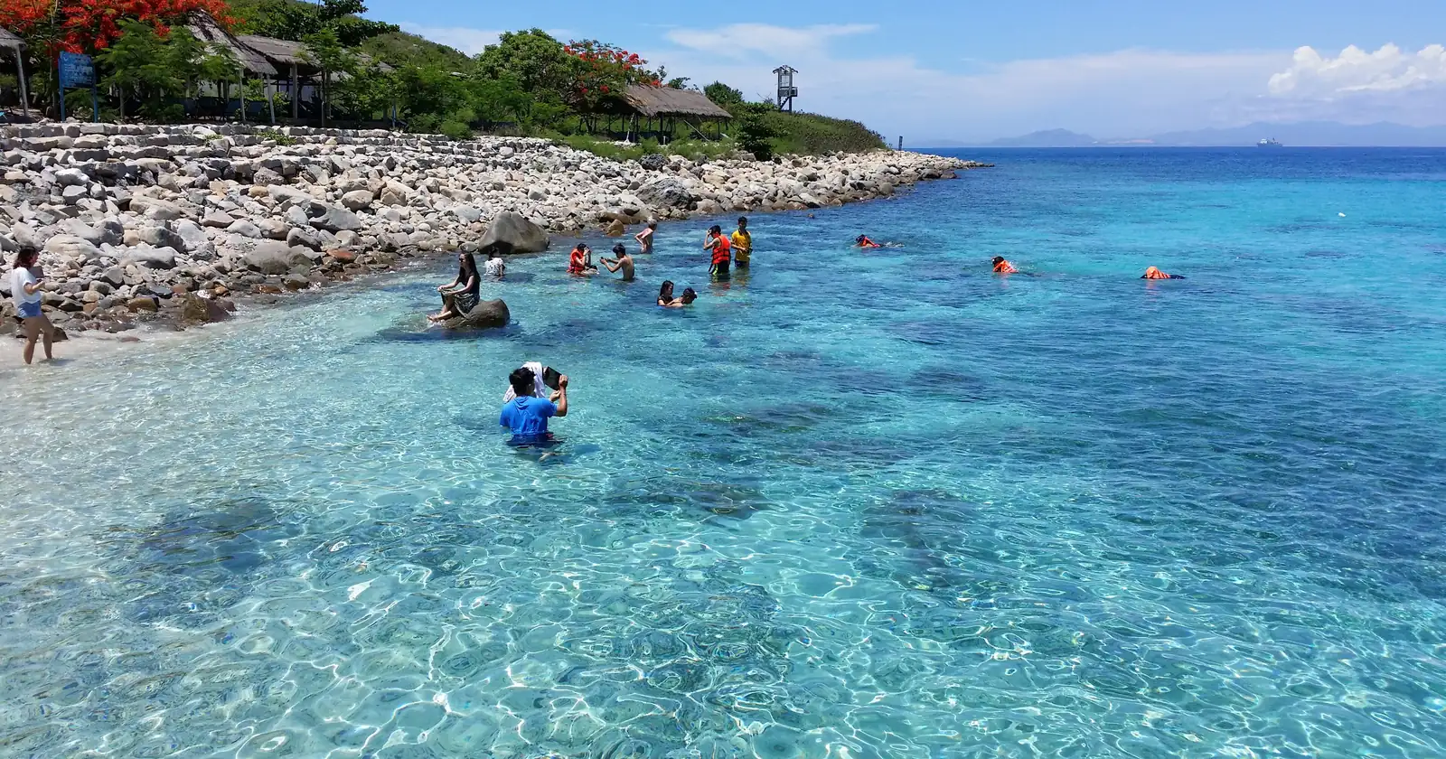
Cu Lao Cham, the Da Nang reef day: 70,000 dong and three kinds of water
Da Nang's offshore reef is Cu Lao Cham, seven islands whose reserve is centered about 28 km southeast of My Khe in a straight line. Since the 2025 reorganization of provinces under National Assembly Resolution 202/2025/QH15, the reserve belongs to Da Nang city, which re-established it in January 2026 as Cu Lao Cham Nature Reserve: 23,530 hectares with its buffer zone, of which 21,887 are sea.
The visit fee is set by Da Nang's People's Council in Resolution 16/2026/NQ-HĐND: "Mức thu: 70.000 đồng/người/lượt", 70,000 dong per person per visit, in force since 10 June 2026 and collected by the reserve's management board. Children under 16 and pupils are exempt, as are Vietnamese citizens aged 60 or over and residents of Tan Hiep, the islands' own commune. Everyone enters free at Tet and on three anniversaries, among them 26 May, the day UNESCO recognized the biosphere reserve.
The rules are in a management regulation issued on 28 May 2026 and in force from the same 10 June. The reserve is split into zones. In the 566.81 hectares of strict protection, around Hon Tai, Bai Nan, Hon Mo, Hon La, Hon Kho and the north of Hon Lao, the listed activities are buoys, research, education, patrols and monitoring, plus forest trails on land; boat tourism is not among them. The 1,120.41-hectare restoration zone allows ecotourism "nhưng không gây tổn hại", as long as it does no harm. Organized tourism belongs in the service zone. Anything not listed is banned.
Article 9 is the line for a boat day: tour boats must load and moor at set points, and "nghiêm cấm các hoạt động thả neo trên rạn san hô, thảm cỏ biển", anchoring on coral or seagrass is strictly banned. Guides must be trained by the board each year, and tour operators sign an environmental commitment with it. Ask your operator whether it has one.

Son Tra's coral zones: a Da Nang rule from 2007 that is still in force
Closer to town, the reefs around the Son Tra peninsula have their own regulation. Da Nang's Decision 54/2007/QĐ-UBND, of 13 September 2007, sets up a management area of 3,940 hectares from Hon Chao to the south of Hai Van pass and around Son Tra. The city's official gazette still lists it as in force.
Its core is small. The strict protection zone is 82 hectares at Hon Sup, Bai But, Huc Lo, Vung Da and the east of Bai Bac, from the shore out to 300 meters and an average depth of 12 meters, holding 36.2 hectares of coral. A restoration zone of 48.5 hectares lies at Bai Nom. Everything else is a zone of "khai thác hợp lý", reasonable use.
Article 7 bans destroying reefs and fishing with explosives, electricity or poison across the whole area. In the restoration zone it adds a ban on anchoring boats on coral; in the core, a ban on collecting coral or any marine life. The article names no ban on swimming, snorkeling or diving, and its tourism clause asks that tourism not harm the area's resources and that tourism projects be approved. On paper, then, Son Tra's core is open to a snorkeler in a way Hon Mun's is not today.
Da Nang and Nha Trang water temperature: Nha Trang warmer to May, Da Nang in summer
The two seas are not the same temperature, and the gap changes sides during the year. NOAA's satellite sea surface temperature, averaged by month:
| Month | Off My Khe | Cu Lao Cham | Nha Trang Bay, Hon Mun |
|---|---|---|---|
| January | 24.0 °C | 24.1 °C | 24.5 °C |
| February | 23.4 °C | 23.5 °C | 24.9 °C |
| April | 25.6 °C | 25.5 °C | 27.7 °C |
| May | 27.8 °C | 27.7 °C | 29.4 °C |
| August | 30.2 °C | 30.0 °C | 28.5 °C |
| October | 28.6 °C | 28.5 °C | 28.6 °C |
| December | 25.6 °C | 25.8 °C | 26.0 °C |
Monthly means of NOAA's Optimum Interpolation sea surface temperature, version 2.1, 2021 to 2025, from the monthly-mean file NOAA's Physical Sciences Laboratory publishes. The quarter-degree cells are centered at 16.125° N 108.375° E, 15.875° N 108.625° E and 12.125° N 109.375° E.
Nha Trang is warmer from January to May, by up to 2.1 °C in April. Then it stalls: its water dips from 29.4 °C in May to 28.5 in August, while Da Nang climbs past 30. That summer dip matches the upwelling that temperature loggers recorded in Nha Trang Bay from 2008 to 2019. February off Da Nang, near 23.4 °C, is the coldest water on this page; our travel wetsuit guide covers what to wear at that end.
Da Nang vs Nha Trang in the wet season: October rain against November rain
Both cities get most of their year's rain in four months, and they are not quite the same four. Average monthly rain at the two weather stations:
| Month | Da Nang airport | Nha Trang |
|---|---|---|
| February | 17 mm | 10 mm |
| June | 41 mm | 39 mm |
| August | 142 mm | 64 mm |
| September | 456 mm | 198 mm |
| October | 581 mm | 300 mm |
| November | 468 mm | 435 mm |
| December | 242 mm | 143 mm |
| Year | 2,269 mm | 1,456 mm |
Calculated for this page from the daily rain-gauge records of Da Nang International (WMO 48855) and Nha Trang (WMO 48877) in NOAA's Global Historical Climatology Network, 1995 to 2024. Only months with at most two days missing are used, between 13 and 21 per calendar month.
Da Nang's rain arrives early and hard. September already brings 456 mm and October is the peak, so September to December holds 77% of its year. Nha Trang's season starts more slowly and peaks in November, when the two cities are level. It also has the drier year, about two thirds of Da Nang's.
For a month of remote work the practical reading is simple. September and October favor Nha Trang. From February to June both are dry; January is wetter in Da Nang, 66 mm against 33.
Typhoon season near Da Nang and Nha Trang: September and October against November
Near these two cities, storm season does not fall in the same months. In the tracks the Japan Meteorological Agency keeps for the western North Pacific, as compiled in NOAA's IBTrACS archive, these are the storms of tropical-storm strength or more whose centers passed within 200 km of each city, 1996 to 2025:
| Da Nang | Nha Trang | |
|---|---|---|
| Storms within 200 km in 30 years | 39 | 19 |
| June to August | 7 | 1 |
| September | 16 | 0 |
| October | 13 | 2 |
| November | 3 | 14 |
| December | 0 | 2 |
| Within 100 km | 15 | 6, all in November |
Counted for this page: each storm once, in the month of its closest approach, at 34 knots or more of 10-minute sustained wind in the Tokyo center's record. The points are My Khe and the center of Nha Trang.
Typhoon Damrey shows what a Nha Trang November can bring: it passed about 40 km from the city on 4 November 2017 at 70 knots, and the province names it among the causes of Hon Mun's coral loss. Typhoon Kalmaegi passed about 160 km away in November 2025. Da Nang's recent close calls came in September and October, among them Noru in 2022 and Trami in October 2024.
None of this forecasts a single season. It says when to keep plans loose: September and October in Da Nang, November in Nha Trang. Check that your travel insurance covers a missed flight and a storm, not only a hospital.
Da Nang to Nha Trang by train: six a day, nine to eleven and a half hours
The two cities are 438 km apart in a straight line and 524 km by the North-South railway. Vietnam Railways' own timetable service lists six trains each way on a weekday, Tuesday 10 November 2026:
| Train | Leaves Da Nang | Arrives Nha Trang | Time |
|---|---|---|---|
| SE5 | 00:36 | 10:17 | 9 h 41 |
| SE9 | 06:03 | 16:52 | 10 h 49 |
| SE21 | 07:55 | 19:18 | 11 h 23 |
| SE3 | 10:43 | 21:05 | 10 h 22 |
| SE1 | 13:29 | 22:35 | 9 h 06 |
| SE7 | 22:30 | 08:40 next day | 10 h 10 |
Northbound, the first train leaves Nha Trang at 02:47 and the last at 21:58; the quickest, SE2 at 03:51, reaches Da Nang at 13:06. SE7 south and SE10 north are the overnight trains that save a night's rent, leaving at 22:30 and 21:58.
Listed fares for the Da Nang to Nha Trang leg run from 419,000 dong for a soft seat on SE3 to 1,150,000 dong for a lower berth in a four-berth compartment on SE5 or SE7. SE21 also lists a two-berth VIP compartment at 1,831,000. The railway notes that fares include insurance and change with the booking date, the passenger and the berth.
Flying into Da Nang or Nha Trang: one airport in town, one 28 km south
Both cities have an international airport run by ACV, the Airports Corporation of Vietnam. The difference is distance. Da Nang International sits inside the city, about 5.5 km from My Khe in a straight line and 3.5 km from the railway station.
Nha Trang's airport is Cam Ranh International, which ACV lists in Bac Cam Ranh ward. It lies about 28 km south of Nha Trang station in a straight line. For a single arrival that is a detail. For a month with a mid-stay trip out, or a train in and a flight home, it is half a morning.
For the Da Nang vs Nha Trang leg itself, the railway is the one link with a published timetable here, and the overnight trains spare you an airport transfer at both ends.
A month in Da Nang or Nha Trang on Vietnam's 90-day e-visa
The paperwork is identical in both cities. The Immigration Department's e-visa portal states that the e-visa "có thời hạn không quá 90 ngày, có giá trị một lần hoặc nhiều lần": valid for up to 90 days, single or multiple entry. The fee is 25 USD for a single entry and 50 USD for multiple entries, paid online and not refunded if the visa is refused. Some passports are exempt from visas, and the portal links that list.
The portal offers no visa for remote work. Its application form lists four purposes of entry, tourist, visiting relatives, working and business, plus "others", and its notes say foreigners who enter to work need a work permit or a certificate of exemption under the Labor Code. Among a foreigner's duties it lists "Hoạt động tại Việt Nam phải phù hợp với mục đích nhập cảnh": your activities must match the purpose you entered for.
One more duty catches people renting a flat for a month. Foreigners must show their passport to the place they stay so that a temporary residence declaration is made. With a private landlord, ask how it will be done. The Da Nang guide covers internet, coworking and rent there.
Dive schools on the Nha Trang list, and none for Da Nang
| Da Nang | Nha Trang | |
|---|---|---|
| Schools listed | No operator list on this site | 6 |
| In the SSI register | 6 | |
| With freediving programmes in that register | 3 | |
| Green Fins | Not read for this list |
The Nha Trang list was compiled on 21 August 2026 from SSI's register of affiliated centers. It shows which schools SSI lists there, not how many dive shops Nha Trang has, and it does not show which of them run trips while Hon Mun is closed. The register page explains which registers of Vietnamese operators can be read and which cannot.
Da Nang has no operator list on this site, for diving or surf. Before you book in either city, ask a school for its training-body number and check it with the body that issued it.
Da Nang vs Nha Trang in five lines
- Da Nang for surf from October: a meter of sea or more in 53% of October hours off My Khe, against 14% off Nha Trang.
- Nha Trang's Hon Mun has been closed to swimming and diving since 27 June 2022, and still was in May 2026.
- Cu Lao Cham has cost 70,000 dong a visit since 10 June 2026, and anchoring on coral is banned.
- Rain peaks in October in Da Nang and in November in Nha Trang; storms come in September and October near Da Nang, November near Nha Trang.
- Six trains a day link the two, 9 h 06 at the quickest, on the same 90-day e-visa.
Da Nang for the winter swell, Nha Trang for an early-autumn month on the water
Pick Da Nang if you surf, or want to learn, and can come between October and February. My Khe faces the swell, the airport is in town, and Cu Lao Cham and the Son Tra reefs are a day out. Do not pick it for September or October if rain and storms would cost you work.
Pick Nha Trang if you want the water more than the waves: warmer from January to May, drier in September and October, and a bay sheltered by islands. Divers should read the Nha Trang diving guide first, because Hon Mun is still off limits. Do not pick it for November.
For the kite coast further south, see Mui Ne and Kalpitiya vs Mui Ne. Divers in either city should check that their dive insurance pays for evacuation to a chamber.
FAQ: Da Nang vs Nha Trang
Is Da Nang or Nha Trang better for surfing?
Da Nang, especially early in the season. In wave-model data for 2023 to 2025, the open sea off My Khe carries a meter of sea or more in 53% of October hours, against 14% off Nha Trang Bay. By December the two open seas are level, but Nha Trang's city beach sits behind Hon Tre and smaller islands, where the model's waves are about a fifth to nearly a third smaller.
Can you still dive at Hon Mun in Nha Trang?
No. The Nha Trang Bay Management Board suspended swimming and diving at Hon Mun from 27 June 2022 until further notice, and on 20 May 2026 the Ministry of Agriculture and Environment still described the suspension in the Hon Mun strict protection sub-zone as the board's main measure. Khanh Hoa's bay fee charges 10,000 dong for the Hon Mun boat route but excludes the strict zone itself.
How much does it cost to visit Cu Lao Cham from Da Nang?
70,000 dong per person per visit, under Da Nang People's Council Resolution 16/2026/NQ-HĐND, in force since 10 June 2026 and collected by the reserve's management board. Children under 16, pupils, Vietnamese citizens aged 60 or over and residents of Tan Hiep commune are exempt. The boat fare is separate, and anchoring on coral or seagrass is banned.
When is the rainy season in Da Nang and Nha Trang?
Later and lighter in Nha Trang. Station records for 1995 to 2024 average 456 mm in September and 581 mm in October at Da Nang airport, against 198 mm and 300 mm at Nha Trang, whose wettest month is November at 435 mm. Tropical storms follow a similar split: near Da Nang mostly in September and October, near Nha Trang in November.
How long is the train from Da Nang to Nha Trang?
9 h 06 on the quickest train, SE1, and up to 11 h 23 on SE21, over 524 km of the North-South railway. Vietnam Railways lists six trains each way on a weekday in November 2026, including the overnight SE7 at 22:30. Listed fares run from 419,000 dong for a soft seat to 1,150,000 dong for a lower berth in a four-berth compartment.
Is the water warmer in Da Nang or Nha Trang?
It depends on the month. NOAA satellite data for 2021 to 2025 put Nha Trang Bay at 24.9 °C in February against 23.4 °C off My Khe, and up to 2.1 °C warmer in April. In August it is the other way round: 30.2 °C off Da Nang and 28.5 °C off Nha Trang, where the water dips after May.
Sources
- Sea state. Météo-France MFWAM global wave model, Copernicus Marine product GLOBAL_ANALYSISFORECAST_WAV_001_027 (1/12°, about 0.083°, three-hourly values, no interpolation), significant wave height, wave direction and mean wave period, 1 January 2023 to 31 December 2025, read from Copernicus Marine on 2 November 2026 for the cells centered at 16.00° N 108.42° E, 12.17° N 109.33° E and 12.17° N 109.25° E. Monthly means and the shares of model hours at 1 m or more are calculated for this page. Shares of hours are shares of the model's three-hourly steps. Generated using E.U. Copernicus Marine Service Information; https://doi.org/10.48670/moi-00017. Copernicus Marine
- Sea surface temperature. NOAA OISST v2.1, monthly means published by NOAA's Physical Sciences Laboratory (sst.mon.mean.nc), quarter-degree cells at 16.125° N 108.375° E, 15.875° N 108.625° E and 12.125° N 109.375° E, January 2021 to December 2025, averaged by calendar month for this page. Read 27 October 2026. NCEI's own ERDDAP copy of the daily dataset was not available on that date. NOAA PSL, product page. The upwelling in Nha Trang Bay from June to August is from Kunzmann and others, Vietnam Journal of Marine Science and Technology 24(4), 2024.
- Rain. NOAA NCEI, Global Historical Climatology Network Daily, stations VMM00048855 (Danang Intl, WMO 48855) and VMW00041010 (Nha Trang, WMO 48877), daily precipitation 1995 to 2024; months with more than two days missing or a quality flag left out; averaged by calendar month for this page. Read 27 October 2026. GHCN-Daily, Da Nang file, Nha Trang file
- Storm tracks. NOAA NCEI, IBTrACS v04r01, western North Pacific file (version of 25 October 2026), seasons 1996 to 2025, 10-minute sustained wind from the Tokyo regional center (RSMC Tokyo, Japan Meteorological Agency) of 34 knots or more, great-circle distance to 16.054° N 108.247° E (My Khe) and 12.239° N 109.197° E (Nha Trang), each storm counted once in the month of closest approach. Calculated for this page, 27 October 2026. IBTrACS
- The Hon Mun suspension, 2022. Nha Trang Bay Management Board notice of 24 June 2022 suspending swimming and diving at Hon Mun from 27 June 2022 "cho đến khi có thông báo mới", and the provincial standing committee's conclusion naming climate change, Typhoon Damrey in 2017, storm number 9 in 2021 and human causes, as published by the Khanh Hoa Party Committee portal on 25 June 2022, which also calls Hon Mun "điểm lặn biển nổi tiếng nhất của Nha Trang", Nha Trang's best-known dive site. Read 27 October 2026. tinhuykhanhhoa.vn
- The Hon Mun suspension, 2026. Ministry of Agriculture and Environment, "Tín hiệu vui từ đáy biển Hòn Mun", 20 May 2026: recovering coral, "tạm dừng các hoạt động bơi, lặn ở phân khu bảo vệ nghiêm ngặt Hòn Mun", and patrols "24/24 giờ". Read 27 October 2026. mae.gov.vn
- The Nha Trang Bay fee. Khanh Hoa People's Council, Resolution 02/2025/NQ-HĐND of 15 August 2025, in force from 25 August 2025, Khanh Hoa Official Gazette No. 017+018 of 15 September 2025: the fee area and the excluded strict protection sub-zones (Article 1), who pays and who is exempt (Article 2), the six routes at 6,000 to 40,000 dong per person per trip, accident insurance not included (Article 3). Read 27 October 2026 from the gazette's signed file. congbaokhanhhoa.gov.vn
- Cu Lao Cham. Da Nang People's Committee, Decision 373/QĐ-UBND of 26 January 2026 renaming the reserve Cu Lao Cham Nature Reserve, Tan Hiep commune, 23,530 ha including 21,887.2 ha of sea; Decision 63/2026/QĐ-UBND of 28 May 2026, the reserve's management regulation, in force from 10 June 2026 (zones in Article 5, permitted activities by zone and the ban on anything not listed in Article 6, tourism and the anchoring ban in Article 9); Da Nang People's Council, Resolution 16/2026/NQ-HĐND of 29 May 2026, the visit fee of 70,000 dong per person per visit from 10 June 2026 and its exemptions. All from Da Nang's official gazette, read 27 October 2026. Decision 373 (PDF), Decision 63/2026 (PDF), Resolution 16/2026 (PDF)
- Son Tra. Da Nang People's Committee, Decision 54/2007/QĐ-UBND of 13 September 2007 on managing and conserving coral reefs from Hon Chao to south Hai Van and the Son Tra peninsula: 3,940 ha (Article 5), the 82 ha strict zone with 36.2 ha of coral, the 48.5 ha restoration zone at Bai Nom and the reasonable-use zone (Article 6), banned activities by zone (Article 7), tourism (Article 11). Listed as in force in Da Nang's official gazette search on 27 October 2026. congbao.danang.gov.vn (PDF)
- Trains. Vietnam Railways, "Giờ tàu - Giá vé" (timetable and fares) service linked from dsvn.vn, Da Nang (km 791) to Nha Trang (km 1315) and back, for Tuesday 10 November 2026: departure and arrival times and listed fares by class; "Giá vé đã bao gồm tiền bảo hiểm. Giá có thể thay đổi theo 1 số điều kiện: thời gian mua vé, đối tượng đi tàu, vị trí chỗ trên toa". Read 27 October 2026. dsvn.vn, timetable service
- Airports. ACV, Airports Corporation of Vietnam, list of its airports: "CHKQT Đà Nẵng", Hoa Cuong ward, and "CHKQT Cam Ranh", Bac Cam Ranh ward. Read 27 October 2026. acv.vn. Distances are great-circle distances calculated for this page from OpenStreetMap positions of the two airports and the Da Nang and Nha Trang railway stations, read 27 October 2026. OpenStreetMap
- E-visa. Vietnam Immigration Department, national e-visa portal: "Thị thực điện tử được cấp qua giao dịch điện tử, có thời hạn không quá 90 ngày, có giá trị một lần hoặc nhiều lần" (in English: "Vietnam e-Visa is valid for maximum of 90 days, single or multiple entry"); fees of 25 USD and 50 USD, non-refundable; the purposes of entry on the form; the work permit note; the duties to act "in accordance with the purpose of entry" and to present a passport to the accommodation for the temporary residence declaration. Read 27 October 2026. evisa.gov.vn
- SSI register, for the Nha Trang count. divessi.com
- Counted from the operator list: Nha Trang, compiled 21 August 2026. Da Nang has no operator list on this site.