Hon Mun Has Been Shut Since June 2022, and the Nha Trang Boats Go Elsewhere
 by Yannick Schroth
Sep 20, 2026
13 min read
by Yannick Schroth
Sep 20, 2026
13 min read
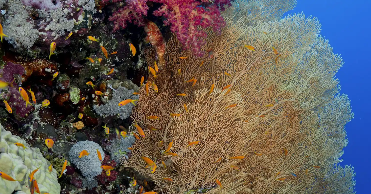
Photo: Unsplash (free licence).
Key takeaways
- Swimming and diving at Hon Mun stopped on 27 June 2022 and were still described as suspended in reporting dated 28 May 2026
- A January 2022 survey put live coral cover at Hon Mun at 41.63 per cent in the northeast and 7.8 per cent in the southwest
- 17 registered diving companies worked 6 dive sites at Hon Mun before the closure; the replacement point at Hon Rom runs dives of 15 to 20 minutes in groups of one to three
- Diving is regulated as a risky tourism product under Decree 168/2017/ND-CP, which requires written notice to the provincial tourism department 15 days before operating
- The bay visit fee runs from 6,000 to 40,000 dong a head and explicitly excludes the strict protection sub-zones, including the water within 300 metres of Hon Mun
Hon Mun became Vietnam's first marine protected area in 2001
The Hon Mun Marine Protected Area Pilot Project started in June 2001 after a long preparatory period. It was financed by the Global Environment Facility through the World Bank, by the Royal Danish Government through Danida, by IUCN and by the Vietnamese government, and it was the country's first marine protected area.
The line it drew encloses 160 square kilometres: the waters around Hon Mun and eight other islands lying up to 10 kilometres off Nha Trang. Roughly 38 square kilometres is land and 122 is water. The nine islands are Hon Tre, Hon Mieu, Hon Tam, Hon Mot, Hon Mun, Hon Cau, Hon Vung, Hon Rom and Hon Ngoc.
Khanh Hoa's People's Committee created the Hon Mun MPA Authority in March 2002 and approved a temporary zoning plan the same year. About 40 mooring buoys went in to keep anchors off the coral. The site later took the name Nha Trang Bay Marine Protected Area.
The reason for choosing this water was the coral. The biodiversity assessment done during the set-up phase recorded more than 340 coral species inside the area, the highest count in Vietnam, and 44 coral genera at Hon Mun itself, against 65 hard coral genera for Vietnam's south central zone as a whole.
The same assessment recorded the harder facts too. Reef fish status was described as very poor, sedimentation was rising and crown-of-thorns starfish were already killing reef-building corals. About 5,300 people lived on the islands inside the boundary, 95 per cent of them living off fishing, which is the arithmetic every rule since has had to work around.
Swimming and diving at Hon Mun stopped on 27 June 2022
In June 2022 photographs of bleached and broken coral at Hon Mun went round Vietnam and the province moved. On 21 June 2022 the standing committee of the Khanh Hoa Party Committee issued a conclusion accepting that the reefs had declined and ordering activity in vulnerable parts of the bay to stop, Hon Mun first.
The Nha Trang Bay Management Board issued its notice on 24 June. From 27 June 2022, swimming and diving in the Hon Mun area were suspended until further notice. Glass-bottom boats and boat tours went with them.
The conclusion named causes on two sides. Objective: climate change and two large storms. Subjective: gaps in state management, weak coordination between agencies, illegal fishing, dredging, unauthorised construction on the shore and pollution from tourism. Accounts of that same conclusion disagree on the storms, one naming 2017 and 2021 and another 2019 and 2021.
By 19 August 2022 the city had closed six of the seven dive points in the bay. On 7 November 2022 the provincial People's Committee issued Decision No. 3028, the overall plan to restore Nha Trang Bay to 2030, built around 16 tasks.
The suspension has outlasted every timetable put to it. A report on the Hon Chong reef dated 28 May 2026 still describes swimming, diving, glass-bottom boats and tourist activity as suspended inside the strict protection sub-zone, with the board patrolling and clearing crown-of-thorns starfish month by month.
The coral figures behind the closure, and the ones that disagree
Start with the survey that triggered it. In January 2022 the Nha Trang Bay Management Board surveyed the Hon Mun sub-zone and put live coral cover at 41.63 per cent in the northeast, 24.6 in the northwest, 14.5 in the southeast and 7.8 in the southwest.
Against 2015 the same account gives two comparisons that do not use those sectors. It pairs the northeast and southwest at 53.7 per cent in 2015 falling to 32.62, and the southeast and northwest at 52.2 falling to 11.15. The pairings cannot be reconciled with the four sector figures, so the sector figures are the ones to carry.
The long series is bleaker. Measured against a 1994 study, average coral cover across the bay had fallen about 7.2 percentage points to 22.8 per cent, and the area of coral from 754 hectares to 636.6. Institute of Oceanography monitoring from 2002 to 2015 had found the strictly protected areas stable while points outside them lost cover.
Published research is harsher. A study of 10 sites over the three years to 2019 found mean coral cover down 64.4 per cent, with site losses between 43 and 95 per cent, Acropora down 80.6 and Montipora down 82.3, and concluded that by the end of 2019 more than 90 per cent of the bay's corals were gone. Crown-of-thorns starfish stood at 4.2 per 100 square metres.
A 2025 remote-sensing study counts the loss in hectares instead: 191.38 hectares of coral disappeared from the protected area between 2002 and 2024, 125.06 of them by 2016 and 66.32 in the eight years after. Its authors attribute the loss to land-use change, warming and the starfish.
Enforcement was thin while this happened. In 2022 the board had one patrol vessel and six crew for more than 296 square kilometres of bay, and that March it fined a boat 12.5 million dong for fishing with electric guns north of Hon Rom, inside the strictly protected sub-zone.
Where diving runs instead: Hon Rom, and the four pilot areas of June 2024
Before the closure, 17 registered diving companies worked six dive sites at Hon Mun. That is the business the suspension removed in a single notice.
The board opened a temporary dive point in the Hon Rom area, and its terms are unlike anything Hon Mun ran. Dives are held to 15 to 20 minutes with one to three people in a group, and divers are told to stay 30 to 50 centimetres off the coral and not to touch, sit on or lever at it, dead colonies included.
On 12 June 2024 the provincial People's Committee approved a pilot reopening of recreational diving at four places, none of them Hon Mun: north of Hon Rua island, an artificial reef deployment area, northeast of Tri Nguyen island, and the water between Bai Tranh and Bai Soi on the east side of Tri Nguyen. It attached conditions on inspection, on criteria for choosing operators and on penalties for diving outside the scheme.
An earlier proposal had gone further. In August 2023 the board asked to reopen one site on the southern side of Hon Mun, conditional on a fresh Institute of Oceanography survey, with entry limited to divers holding international certification, capped numbers and round-the-clock patrols. It did not happen, and tourism at Hon Mun could not resume in 2024.
What has changed is the coral. An end-2023 survey put cover in the north and northwest of Hon Mun back at 30 to 50 per cent, on hard corals growing about a centimetre a year. Monitoring in early 2026 by the Institute of Oceanography, the coastal branch of the Vietnam-Russia Tropical Centre and the board found reefs recovering at 2 to 4 metres at Hon Chong, Hon Mun and Bai Cui, on the rubble the 2017 and 2021 storms left behind.
The bay charges a visit fee, and it stops at the protected core
Resolution 02/2025/NQ-HDND, passed by the Khanh Hoa People's Council on 15 August 2025 and in force from 25 August, sets a fee for visiting the Nha Trang Bay scenic landmark. It replaced a resolution of 13 December 2016 that had charged for visiting the Hon Mun Marine Reserve.
The fee is per person per trip and excludes accident insurance. Route 1 to Hon Mieu is 6,000 dong. Routes 2, 3 and 4, to Hon Tam, Hon Tre and Hon Mot, are 8,000 each. Route 5 to Hon Mun is 10,000. Route 6, all routes combined, is 40,000.
Who pays is narrow: tourists moving by inland waterway craft inside the bay boundary. Exemptions run long and include children under six, people with disabilities, residents of Khanh Hoa and anyone aged 60 or over. Children from six to under 16, school and college groups and poor households pay half.
The boundary is the part worth reading. The fee applies inside the bay as defined by Decision No. 738/QD-UB of 21 March 2005, from Mui Ke Ga to Mui Cu Hin, and then carves out the strict protection sub-zones: the whole east and southeast of Hon Tre, from Dam Bay out to Hon Mun, Hon Noc and Hon Cau, plus the water within 300 metres seaward of each island's shoreline at the lowest tide.
So the protected core is not simply closed. It sits outside the charge the rest of the bay pays. Collection began on 25 September 2025 at four points: the Nha Trang tourist wharf, the Phu Quy and Institute of Oceanography inland waterway wharves, and the Ana Marina park. The board keeps 80 per cent of the take and pays 20 to the state budget, and from September 2025 to 30 April 2026 the fee raised more than 5.8 billion dong.
What Vietnamese law asks of a business that takes tourists underwater
Vietnam has no diving statute. It handles recreational diving as a tourism product with a risk to the life and health of the tourist, under the Law on Tourism of 2017 and Decree 168/2017/ND-CP, signed on 31 December 2017 and in force from 1 January 2018.
Article 8 lists what qualifies. Clause 3 names diving underwater alongside paddling through rapids, jet skis, board riding and parasailing towed behind a boat. Once a product is on that list, Article 9 attaches five duties.
The operator must post warnings and guidance on climate, weather and health. It must have a rescue plan, rescue staff in place, prompt response to an incident and communication maintained with guests throughout. It must use trainers, technicians and guides with expertise appropriate to the activity. It must publicise the safety rules and give technical instruction before the activity starts. And it must supply safety equipment meeting standards, show guests how to use it and supervise that use.
Article 10 adds the paperwork. The business must notify the provincial tourism department in writing at least 15 days before it starts operating. The department then has 15 days to check the notice and publish on its information portal the list of businesses meeting the requirements, and it may demand corrections before operations begin. Tour operators that subcontract these activities must use only suppliers that meet them.
No public register of licensed Vietnamese dive operators is readable, and which registers can be read logs what each source returns and on what date.
Our own list is short and says less than people expect. The Nha Trang operator list holds 6 businesses, read on 21 August 2026. All 6 are published by SSI in its register of affiliated centres and all 6 publish a website there. None appears in the IKO or VDWS registers and none is a Green Fins member. The town field the register files them under names Khanh Hoa province, which is the province Nha Trang sits in rather than a mistake.
Water temperature and the two seasons of Nha Trang Bay
Nha Trang Bay covers about 507 square kilometres and holds 19 coastal islands; the inner bay is about 130. Two monsoons cross it and the water column shows both of them.
Loggers at Hon Rom recorded temperature at 10 and 18 metres from 2008 to 2019, at a station in 19 metres of water at the southern entrance to the bay. Yearly cycles ran between averages of 24°C in winter and 29°C in summer. Extremes reached 31°C, in September of 2010 and 2014, and 21°C between October and March, in 2008 and 2011. Daily swings of up to 8°C tracked the tide.
The structure changes with the season, and that is the part a diver feels. From June to August strong north-northeasterly winds drive upwelling: the surface heats while the deeper water cools, and the column separates. From December to February the pattern reverses into downwelling and mixes, so surface, 10 metres and 18 metres read the same.
Weather splits the year cleanly. The dry season runs January to August and the rainy season September to December, with an average of 1,285 mm falling from September to November, 70 to 80 per cent of the annual total.
That rain arrives through two rivers. The Cai enters north of the city and the Tac, also called the Be, to the south, and both carry sediment into the bay. Their plumes are visible from land and sometimes reach several kilometres offshore. The study that recorded the temperature series attributes the poor development of the nearshore reefs to that sediment together with the 21 to 31 degree annual range.
Tides here are mixed and mainly diurnal, about 40 centimetres at neap and more than 2 metres at spring, which is enough to decide a shallow dive. Our travel wetsuit guide covers the trade-offs at the cold end of that range.
What Typhoon Damrey and the 2021 storms did to the reefs
Typhoon Damrey came ashore in Khanh Hoa at about four in the morning on 4 November 2017, the strongest storm to strike southern Vietnam in 16 years, with maximum sustained winds near 150 km/h at landfall. In this province alone 114,000 homes were damaged or destroyed.
Underwater the accounting is separate and specific. The head of the Nha Trang Bay Management Board put the loss in the richest parts of the bay, Hon Mun, Hon Mot, Hon Tam and the northeast of Hon Tre, at 70 to 80 per cent of corals after Damrey. At Hon Tam alone, hard coral cover fell from 56.8 per cent in July 2017 to 12.5 per cent that December.
Two more blows followed. In 2019 corals began bleaching as water temperatures rose in parts of the bay, and the hard coral bleaching rate that year was 39.5 per cent. At the end of 2021 storms struck the reefs again and up to 70 per cent of the reef in the southwest of Hon Mun and to the south was washed ashore.
The exposure has not gone anywhere. In November 2025 Typhoon Kalmaegi, storm number 13 of the year in Vietnam's numbering, crossed the coast north of the province and brought heavy rain across the stretch from Hue down to Khanh Hoa. Heat is the other threat the board watches: it closed the Hon Chong to Dang Tat reef to visitors from May to August 2026 on advice that coral bleaches if sea temperature passes 30.5°C for two to three consecutive weeks.
The recompression chamber is in Nha Trang itself
Not every dive destination has one within reach. Military Hospital 87, at 78 Tue Tinh in Nha Trang, runs a naval medicine department with hyperbaric oxygen treatment, and diving accidents and decompression sickness are on its list of what it treats.
In September 2018 the department was described as holding one chamber taking six patients at a time, large enough for a doctor to sit inside with them, plus two single-person transparent chambers, staffed by three doctors and four trained technicians and running over 2,500 hyperbaric sessions a year. One case given was a 26-year-old fisherman with diving paralysis who recovered over a month.
The hospital serves the armed forces and the public across the south central provinces, the central highlands, Naval Region 4 and the Truong Sa islands, so the chamber exists for commercial and military divers rather than for tourism. Being near a chamber and being covered for one are different questions, which is what our dive insurance comparison is for.
Khanh Hoa absorbed Ninh Thuan on 1 July 2025 and Nha Trang city ended
Addresses here changed recently, and the change reaches the diving. Under National Assembly Resolution 202/2025/QH15 of 12 June 2025, Ninh Thuan and Khanh Hoa were merged into one province keeping the name Khanh Hoa from 1 July 2025, covering 8,555.86 square kilometres with more than 2.24 million people.
Resolution 1667/NQ-UBTVQH15 of 16 June 2025 then rearranged the units below it: 65 in all, 48 communes, 16 wards and one special zone. Nha Trang city ceased to exist as an administrative unit. Vinh Nguyen ward, which holds the piers the dive boats leave from, was folded together with Van Thanh, Loc Tho, Tan Tien and Phuoc Hoa into a new ward called Nha Trang, 47.13 square kilometres and 136,118 people in 2024.
The merger also pulled a second reef coast into the same province. Vinh Hy bay and Nui Chua, a UNESCO biosphere reserve of 106,646 hectares designated in 2021, with an extensive nearshore coral reef, seagrass and turtle nesting beaches, now sit inside Khanh Hoa in its southern half. If you are choosing a base rather than a dive day, where to learn to dive weighs the same trade-offs across other coasts.
FAQ: scuba diving in Nha Trang
Can you still dive at Hon Mun in Nha Trang?
No. The Nha Trang Bay Management Board gave notice on 24 June 2022 that swimming and diving in the Hon Mun area would stop from 27 June 2022 until further notice, and reporting dated 28 May 2026 still describes swimming, diving, glass-bottom boats and tourist activity as suspended inside the strict protection sub-zone. A proposal in August 2023 to reopen one site on the southern side of Hon Mun was not carried out, and the four pilot dive areas the province approved in June 2024 are all elsewhere in the bay.
Why was diving at Hon Mun stopped?
Because the coral cover collapsed. A survey by the Nha Trang Bay Management Board in January 2022 put live cover at 41.63 per cent in the northeast of Hon Mun, 24.6 in the northwest, 14.5 in the southeast and 7.8 in the southwest. The standing committee of the Khanh Hoa Party Committee concluded on 21 June 2022 that climate change, two large storms and human causes including illegal fishing, dredging, unauthorised construction and pollution from tourism were responsible, and ordered activity in the most vulnerable parts of the bay to stop.
Where can you dive in Nha Trang Bay instead?
At a temporary point in the Hon Rom area, and at four places the Khanh Hoa People's Committee approved for a pilot on 12 June 2024: north of Hon Rua island, an artificial reef deployment area, northeast of Tri Nguyen island, and the water between Bai Tranh and Bai Soi on the east side of Tri Nguyen. At the Hon Rom point dives are held to 15 to 20 minutes with one to three people in a group, and divers are told to stay 30 to 50 cm off the coral.
How much coral has Nha Trang Bay lost?
Against a 1994 study, average cover across the bay had fallen about 7.2 percentage points to 22.8 per cent and the coral area from 754 hectares to 636.6 hectares. A study of 10 sites over the three years to 2019 found mean cover down 64.4 per cent and concluded that more than 90 per cent of the bay's corals were gone by the end of 2019. A 2025 remote-sensing study measured 191.38 hectares of coral lost from the protected area between 2002 and 2024.
What does Vietnamese law require of a Nha Trang dive operator?
Diving for tourists is a tourism product with a risk to life and health under Decree 168/2017/ND-CP, in force since 1 January 2018. Article 9 requires warnings and guidance on weather and health, a rescue plan with staff in place and communication kept up throughout, trainers and guides with appropriate expertise, published safety rules and instruction before the activity, and safety equipment meeting standards with supervised use. Article 10 requires written notice to the provincial tourism department at least 15 days before operations start.
Is there a fee to visit Nha Trang Bay?
Yes, collected since 25 September 2025. Resolution 02/2025/NQ-HDND of the Khanh Hoa People's Council, passed on 15 August 2025, charges tourists travelling by inland waterway craft 6,000 dong per person for the Hon Mieu route, 8,000 for Hon Tam, Hon Tre or Hon Mot, 10,000 for Hon Mun and 40,000 for all routes combined, accident insurance not included. Children under six, people with disabilities, residents of Khanh Hoa and anyone aged 60 or over are exempt. The strict protection sub-zones sit outside the fee area.
When is the best time of year to dive in Nha Trang?
The dry season runs from January to August and the rainy season from September to December, with an average of 1,285 mm of rain falling from September to November, 70 to 80 per cent of the annual total. The Cai and Tac rivers carry that water into the bay as sediment plumes that are visible from land and sometimes extend several kilometres offshore. The warmest water comes in September, when the surface has reached 31 degrees Celsius in some years.
How warm is the water for diving in Nha Trang?
Loggers at 10 and 18 metres near Hon Rom recorded yearly cycles between averages of 24 degrees Celsius in winter and 29 in summer from 2008 to 2019. Extremes reached 31 degrees in September 2010 and 2014 and 21 degrees between October and March in 2008 and 2011, with daily swings of up to 8 degrees tracking the tide. From June to August upwelling leaves the deeper water colder than the surface; from December to February the column mixes and reads the same at all three levels.
Where is the nearest recompression chamber to Nha Trang?
In Nha Trang itself. Military Hospital 87 at 78 Tue Tinh runs a naval medicine department that treats diving accidents and decompression sickness. In September 2018 the department was described as holding one chamber taking six patients at a time, with room for a doctor inside, plus two single-person chambers, staffed by three doctors and four trained technicians and running over 2,500 hyperbaric sessions a year. It serves the armed forces and the public across the south central provinces.
Founder of NOMADREEF and a former digital nomad. This guide is sourced from the references below; conditions, prices and rules change, so verify current details, and follow qualified local guidance and safety briefings. About the author · LinkedIn ↗
Sources
- The pilot project, the boundary and the first biodiversity survey. Project start in June 2001 with financing from the Global Environment Facility through the World Bank, the Royal Danish Government through Danida, IUCN and the Vietnamese government; 160 square kilometres around Hon Mun and eight other islands up to 10 kilometres offshore; the Hon Mun MPA Authority created by the Khanh Hoa People's Committee in March 2002; a temporary zoning plan approved in 2002; about 40 mooring buoys; more than 340 coral species, 44 coral genera at Hon Mun and 65 in the south central zone; very poor reef fish status, rising sedimentation and crown-of-thorns outbreaks; about 5,300 island residents, 95 per cent living from fishing. Ehler, Nguyen and Nguyen, Mid-Term Review, Hon Mun Marine Protected Area Project, August 2003 (PDF), published by IUCN. Read 20 September 2026.
- The nine islands, the 1994 comparison and the Party conclusion. The protected area as 38 square kilometres of land and 122 of water around Hon Tre, Hon Mieu, Hon Tam, Hon Mot, Hon Mun, Hon Cau, Hon Vung, Hon Rom and Hon Ngoc, and the name change from Hon Mun Marine Protected Area; average cover across the bay down about 7.2 percentage points from 30 per cent in 1994 to 22.8 per cent, with coral area down from 754 to 636.6 hectares; six of seven dive points closed; the Khanh Hoa Party standing committee conclusion of 21 June 2022 naming climate change, two large storms and human causes. Vietnam News Agency, 19 August 2022. Read 20 September 2026. This account dates the two storms to 2019 and 2021; the account below dates them to 2017 and 2021, and both readings are given in the text.
- The January 2022 survey and the storm damage. Live cover at Hon Mun of 41.63 per cent in the northeast, 24.6 in the northwest, 14.5 in the southeast and 7.8 in the southwest; the 2015 pairings of 53.7 falling to 32.62 and 52.2 falling to 11.15; Institute of Oceanography monitoring from 2002 to 2015 showing the strictly protected areas stable; 70 to 80 per cent of corals destroyed after Damrey with Hon Tam falling from 56.8 per cent in July 2017 to 12.5 in December; a 39.5 per cent bleaching rate in 2019; up to 70 per cent of the southwestern Hon Mun reef washed ashore at the end of 2021; one patrol vessel and six crew for more than 296 square kilometres, and the 12.5 million dong fine in March 2022. Vietnam News Agency and Viet Nam News, 19 June 2022. Read 20 September 2026.
- The suspension notice. The Nha Trang Bay Management Board notice of 24 June 2022 suspending swimming and diving in the Hon Mun area from 27 June 2022 until further notice, and the reasons given, including Typhoon Damrey in 2017 and storm number 9 in 2021. Khanh Hoa Party Committee, 24 June 2022, alongside Tuoi Tre, 22 June 2022. Both read 20 September 2026.
- The restoration plan and its 16 tasks. Decision No. 3028 of the Khanh Hoa People's Committee dated 7 November 2022 approving the overall plan to restore Nha Trang Bay to 2030, with 16 tasks drawn up with the Institute of Oceanography, the Nha Trang branch of the Vietnam-Russia Tropical Centre and Research Institute for Aquaculture No. 3, and the tasks still being worked through in 2025. Nguoi Do Thi and Bao Khanh Hoa, 5 March 2025. Both read 20 September 2026.
- The operators, the Hon Rom terms and the 2023 recovery figures. Seventeen registered diving companies at six dive sites at Hon Mun before the closure; the temporary Hon Rom point with dives of 15 to 20 minutes for groups of one to three; the 30 to 50 centimetre rule; and cover of 30 to 50 per cent in the north and northwest of Hon Mun in the end-2023 survey. Tuoi Tre, 29 February 2024. Read 20 September 2026.
- The four pilot dive areas. Approval by the Khanh Hoa People's Committee on 12 June 2024 of recreational diving at four places, with hard coral growth of about a centimetre a year and no reopening of Hon Mun in 2024. Zing News, 13 June 2024. The August 2023 proposal to reopen a site on the southern side of Hon Mun, limited to divers with international certification and subject to a new Institute of Oceanography survey, is from the Vietnam National Authority of Tourism. Both read 20 September 2026.
- The 2026 position. Early 2026 monitoring by the Institute of Oceanography, the coastal branch of the Vietnam-Russia Tropical Centre and the Nha Trang Bay Management Board finding reefs recovering at 2 to 4 metres at Hon Chong, Hon Mun and Bai Cui, and fee revenue of more than 5.8 billion dong from September 2025 to 30 April 2026: Bao Khanh Hoa, 5 May 2026. The temporary closure of the Hon Chong to Dang Tat reef from May to August 2026, the 30.5 degree bleaching threshold and the continuing suspension of swimming, diving, glass-bottom boats and tourism inside the strict protection sub-zone: Nguoi Lao Dong, 28 May 2026 and Nong Nghiep va Moi Truong, 20 May 2026. All read 20 September 2026.
- The peer-reviewed decline. More than 90 per cent of the corals in Nha Trang Bay gone by the end of 2019; crown-of-thorns starfish at 4.2 per 100 square metres; 10 target sites over three years to 2019 with mean coral cover down 64.4 per cent and site losses of 43 to 95 per cent; Acropora down 80.6 per cent and Montipora down 82.3 per cent. Tkachenko, Huan, Thanh and Britayev, Extensive coral reef decline in Nha Trang Bay, Vietnam: Acanthaster planci outbreak the final event in a sequence of chronic disturbances, Marine and Freshwater Research 72(2), 186-199 (2020). Read 20 September 2026.
- The loss in hectares. 191.38 hectares of coral lost from the Nha Trang Bay marine protected area between 2002 and 2024, 125.06 of them between 2002 and 2016 and 66.32 between 2016 and 2024, from Landsat and Planet imagery classified with machine learning, attributed to land-use change, warming and starfish. Hieu and others, Trends in Coral Reef Habitats over Two Decades: Lessons Learned from Nha Trang Bay Marine Protected Area, Vietnam, Water 17(8), 1224 (2025). Read 20 September 2026 through the Semantic Scholar record of the paper, the publisher page being closed to automated access.
- Temperature, monsoon and rivers. The bay at about 507 square kilometres with 19 coastal islands and an inner bay of about 130; loggers at 10 and 18 metres at Hon Rom from 2008 to 2019 at a station in 19 metres of water; yearly cycles between averages of 24 and 29 degrees Celsius with extremes of 31 degrees in September 2010 and 2014 and 21 degrees between October and March in 2008 and 2011; daily fluctuations up to 8 degrees correlated with the tides; summer upwelling and winter downwelling with a mixed column; a dry season from January to August and a rainy season from September to December with 1,285 mm in September to November, 70 to 80 per cent of the annual total; the Cai and Tac rivers and their visible plumes; a mixed, mainly diurnal tide of about 40 centimetres at neap to more than 2 metres at spring. Kunzmann, Hoang, Brefeld, Pinter and Pohlmann, A long-term dataset of in-situ temperature data reveals wind-induced up- and downwelling in the coastal waters of Nha Trang, South Central Vietnam, Vietnam Journal of Marine Science and Technology 24(4), 319-334 (2024). Read 20 September 2026.
- The visit fee. Resolution 02/2025/NQ-HDND of the Khanh Hoa People's Council of 15 August 2025, in force from 25 August 2025, replacing Resolution 24/2016/NQ-HDND of 13 December 2016 on the Hon Mun Marine Reserve fee; the bay boundary from Mui Ke Ga to Mui Cu Hin under Decision No. 738/QD-UB of 21 March 2005; the carve-out of the strict protection sub-zones east and southeast of Hon Tre, from Dam Bay out to Hon Mun, Hon Noc and Hon Cau, including water to 300 metres seaward of the shoreline at lowest tide; the fee table at 6,000 to 40,000 dong per person per trip with accident insurance excluded; the exemptions and half-price categories; and the Nha Trang Bay Management Board, under the Khanh Hoa Department of Agriculture and Environment, keeping 80 per cent and paying 20 to the state budget. Khanh Hoa Official Gazette, issue 017+018 of 15 September 2025. Read 20 September 2026 from the gazette's own file of the resolution. Collection from 25 September 2025 at the Nha Trang tourist wharf, the Phu Quy and Institute of Oceanography inland waterway wharves and the Ana Marina park is from Bao Khanh Hoa, 27 September 2025.
- The diving law. Decree 168/2017/ND-CP detailing the Law on Tourism, signed by Prime Minister Nguyen Xuan Phuc on 31 December 2017 and in force from 1 January 2018, recorded at the government legal document portal. The government's own file of the decree is a scan without machine-readable text, so the wording of Article 8 on risky tourism products, Article 9 on the five safety measures and Article 10 on the 15-day notice to the provincial tourism department and the published list of compliant businesses is taken from two independent reproductions that agree: Luat Minh Bach and Chia Khoa Phap Luat. All read 20 September 2026.
- The six businesses. Six dive businesses on the Nha Trang operator list, read 21 August 2026, all six published by SSI in its register of affiliated centres and all six publishing a website there. None appears in the IKO or VDWS registers and none is a Green Fins member. What each register can and cannot show is set out on which registers can be read.
- Damrey and Kalmaegi. Landfall in Khanh Hoa at about 4 a.m. on 4 November 2017 with maximum sustained winds near 150 km/h, the strongest storm to hit southern Vietnam in 16 years, and 114,000 homes damaged or destroyed in the province: the storm record and the United Nations situation update of 11 November 2017. Typhoon Kalmaegi as storm number 13 of 2025, making landfall to the north of Khanh Hoa in early November 2025 with heavy rain from Hue to Khanh Hoa: the government policy portal. All read 20 September 2026.
- The chamber. Military Hospital 87 at 78 Tue Tinh, Nha Trang, its naval medicine department with one six-patient hyperbaric chamber and two single-person chambers, three doctors and four trained technicians, over 2,500 hyperbaric sessions a year, treatment of diving accidents and decompression sickness, and the case of a 26-year-old fisherman with diving paralysis. Bao Khanh Hoa, September 2018. Read 20 September 2026. The description is eight years old and the equipment may have changed.
- The merger. National Assembly Resolution 202/2025/QH15 of 12 June 2025 merging Ninh Thuan into Khanh Hoa from 1 July 2025, the new province at 8,555.86 square kilometres with more than 2.24 million people, and Resolution 1667/NQ-UBTVQH15 of 16 June 2025 arranging 65 commune-level units, 48 communes, 16 wards and one special zone: the government policy portal, 16 June 2025. The new Nha Trang ward, formed from Van Thanh, Loc Tho, Vinh Nguyen, Tan Tien and Phuoc Hoa at 47.13 square kilometres and 136,118 people in 2024, is from the Nha Trang entry. Nui Chua as a UNESCO biosphere reserve of 106,646 hectares designated in 2021, with coral reefs, seagrass and turtle nesting beaches, is from UNESCO. All read 20 September 2026.