Cape Town Diving: The Kelp, the Cold Side and the Permit That Ended in 2024
 by Yannick Schroth
Sep 20, 2026
14 min read
by Yannick Schroth
Sep 20, 2026
14 min read
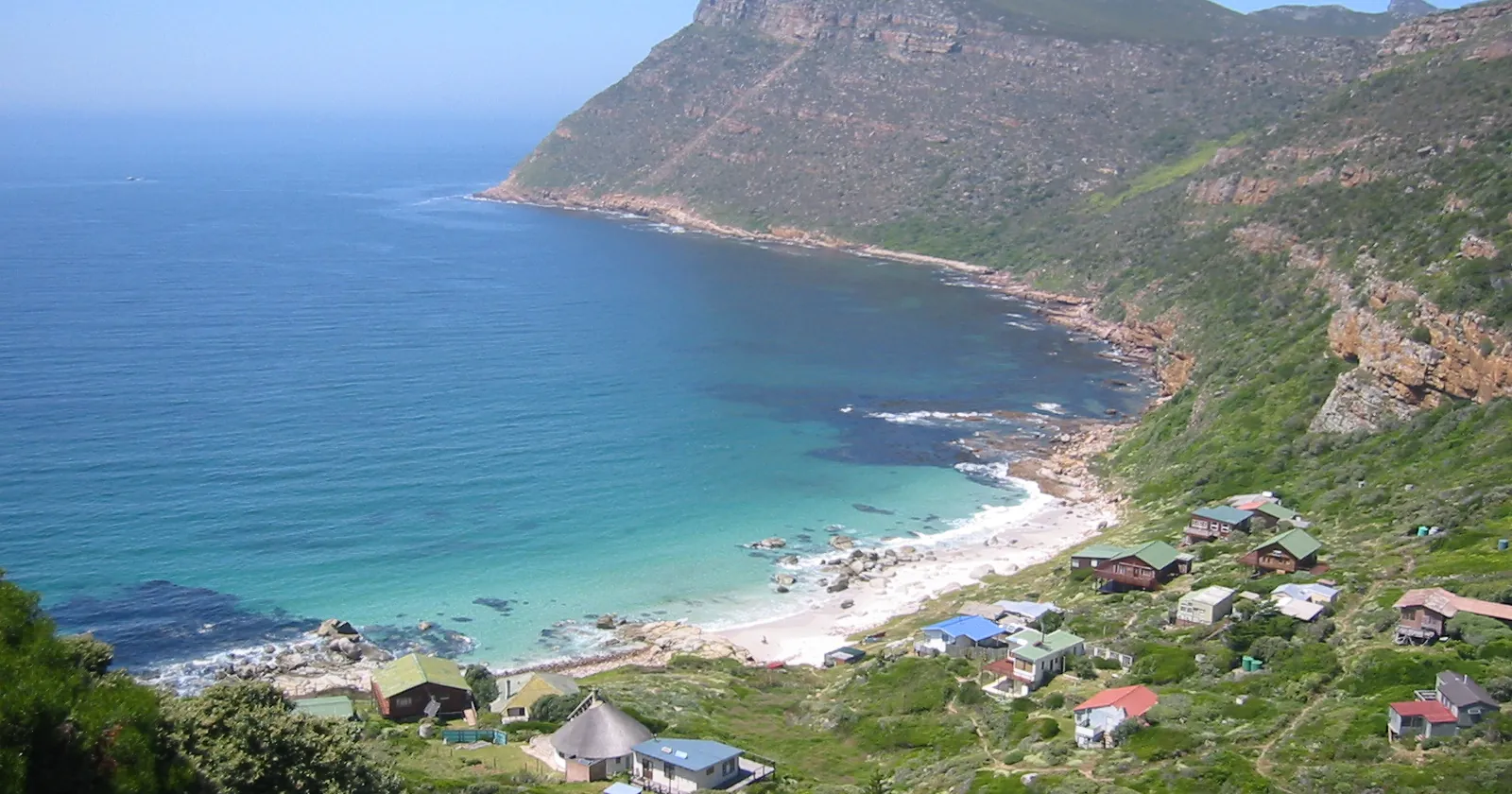
Photo: Tjeerd Wiersma, Wikimedia Commons, CC BY 2.0.

Key takeaways
- Regulation 8, which made a personal SCUBA diving permit compulsory across the whole marine protected area, was deleted by Government Notice R4786 on 3 May 2024
- Regulation 9 was rewritten rather than removed: a dive business still needs a permit, and it applies to the Table Mountain National Park Manager, not to the Minister
- Four of the six no-take zones sit on water divers use, and the prohibition in them is on fishing and spearfishing rather than on entering
- Kommetjie on the Atlantic shore records no summer warming at all, but a drop of 2 to 3°C against its own winter, while False Bay warms the way you would expect
- No white shark has been sighted in False Bay since August 2018, and sevengills now average 0.96 sightings an hour where the survey recorded none before
The scuba permit Cape Town divers carried was deleted on 3 May 2024
For twenty years the water off Cape Town came with a piece of paper. The Table Mountain National Park Marine Protected Area was declared by Government Notice 695 in Government Gazette 26431 of 4 June 2004, under section 43 of the Marine Living Resources Act 18 of 1998. Three of its regulations were held back and commenced on 31 December 2004.
Regulation 8 was one of them, and it was blunt. No person could scuba dive or attempt to scuba dive in the protected area except on the authority of a SCUBA diving permit, valid for a maximum of twelve months, applied for to the Park Manager on a form, at a fee the Minister set. The Minister also fixed how many of those permits could exist at all.
That regulation is gone. Government Notice R4786 in Government Gazette 50617 of 3 May 2024 deleted regulation 8 outright, and the consolidated text now carries the heading with nothing under it. Nobody diving here as an individual needs a permit from anyone any more.
Regulation 9 went the other way. It was substituted rather than deleted, and what remains is two short subregulations: no person may operate a SCUBA diving business in the protected area without a permit, and the application goes to the Manager and may be issued subject to conditions. The 2004 version had capped such permits at sixty months and let the Minister limit how many existed. Both of those went with the rewrite.
One oddity survives the edit. The same amendment deleted the definition of “SCUBA diving business”, which in 2004 read as a commercial enterprise involving transporting, guiding or providing scuba gear to divers. Regulation 9 still uses the phrase. The regulations now require a permit for a thing they no longer define.
Where the Table Mountain MPA begins and ends, Green Point to Muizenberg
Regulation 4 draws the box by coordinates rather than by landmark, and it is larger than most visitors to Cape Town assume. It starts at the high-water mark at Green Point, 33°54.075'S 18°24.037'E, and follows the shore all the way round the Cape Peninsula to Bailey’s Cottage at Muizenberg, 34°06.590'S 18°28.25'E.
From Muizenberg the line runs east to 18°33.413'E, then south to 34°24.444'S, then west to 18°15.000'E, then north and back to Green Point. So the shape is the whole peninsula shoreline with a rectangle of open water hung off it. The World Database on Protected Areas records the area as 955.86 km²; the regulation itself states no figure.
Two details in regulation 4 matter more than the corner points. The protected area includes the water, the seabed and the airspace to 1,000 metres above sea level, which is the clause a drone operator over a dive boat should read before launching. And its eastern edge sits inside False Bay, not at the far shore, so Gordon’s Bay and Strand in the north-eastern corner of the bay lie outside it.
That boundary explains a pattern in the registers. Two of the three Cape Town dive centres we carry are filed at addresses on the eastern side of the bay, where regulation 9 has nothing to say. Where a business is filed is not where it dives, but it is worth knowing which rulebook covers the boat you are standing on.
Four of the six no-take zones sit on water Cape Town divers use
Regulation 5 splits the protected area into six Restricted zones and one Controlled zone, the Controlled zone being everything left over. The six are named, and anyone who has dived here will recognise most of them: Karbonkelberg from Hout Bay to Oudekraal, Cape of Good Hope from Schuster’s Bay Point at Scarborough to Hoek van die Bobbejaan, Paulsberg from Venus Pool to Smitswinkel Point, Castle Rock from Partridge Point to Millers Point, Boulders from Seaforth to Rocklands, and St James between the St James and Kalk Bay tidal pools.
Read regulation 6 and notice what it does not say. No person may fish within any Restricted zone, and no person may spearfish in one. Fishing gear aboard a vessel passing through must be stowed. Diving is not mentioned at all, which is the point: these are no-take zones, not no-entry zones, and the Oudekraal strip and the Castle Rock strip are dived precisely because nothing is taken out of them.
There is exactly one carve-out, and it is species-specific. Anyone authorised under the Act to fish for snoek may do so inside the Karbonkelberg Restricted zone, provided the fishing happens at depths in excess of thirty five metres. A spearfisher gets no equivalent exemption anywhere in the six.
The Controlled zone is not open water either. Regulation 7 says no person may fish or attempt to fish there unless authorised by the Minister in terms of the Act. So the difference between the two categories is narrower than the names suggest: the Restricted zones close fishing absolutely, the Controlled zone closes it subject to permit.
Boulders deserves its own line. The zone runs across the penguin colony at Simon’s Town, and the African penguin was uplisted by the IUCN from Endangered to Critically Endangered in October 2024. That decision rests on an assessment recording a fall from roughly 44,300 breeding pairs in 1993 to about 9,900 in 2023. Boulders is a restricted zone and a penguin colony for the same reason.
What the MPA rules still ask of a Cape Town dive boat
Regulation 11 is short, and it is the part a Cape Town skipper actually works under. Every vessel that has deployed divers inside the protected area must display the alpha flag, the diver-down flag that tells other craft to keep clear. No vessel may tie itself to a demarcation buoy. Nor may one moor or anchor inside a Restricted zone for more than twenty four continuous hours without the Minister’s written authority.
Personal watercraft and hovercraft are banned outright across the whole area, and the 2024 amendment sharpened the definition: under three metres long, an inboard engine driving a water-jet pump, and designed to be operated by people sitting, standing or kneeling on rather than within the hull. The same amendment added a speed rule that had not existed before.
Since 3 May 2024, except in an estuary, no motorised vessel may exceed 8 knots within 500 metres of the high-water mark anywhere in the protected area, unless it is an emergency or the boat is launching or approaching a launch site. A second insertion the same day made it an offence under these regulations to operate a vessel here in contravention of the Merchant Shipping Act 1951 or of any rule or directive issued by the South African Maritime Safety Authority.
The price of getting it wrong is stated. Regulation 12 makes any contravention an offence carrying a maximum fine of R100,000 or imprisonment for up to two years. Scientific work has its own route through regulation 10, a research permit from the Minister valid for up to twelve months, restricted to recognised research institutes and institutions of higher learning.
Why the Atlantic side of a Cape Town dive gets colder in summer
Here is the thing that surprises divers arriving in Cape Town, and it is measured rather than anecdotal. A 2013 study assembled in situ seawater temperatures from 87 sites along the roughly 2,700 kilometres of South African coast, taken with hand-held thermometers and underwater temperature recorders over periods running from 1972 to 2012. Two of those sites sit on opposite sides of this peninsula.
At Kommetjie, on the exposed Atlantic flank, the in situ data show no warming of the surface layer in summer and instead a drop of 2 to 3°C relative to winter. Satellite products disagree with the water by up to about 6°C in midsummer there, which is why a forecast page and a dive briefing can be describing different oceans. Across the mountain at Muizenberg, inside False Bay, the seasonal warming happens the ordinary way.
The mechanism is wind. Summer here is dominated by south-easterlies that accelerate over the mountains south of Cape Town and fan out, and those winds are upwelling-favourable: they push surface water offshore and pull cold Benguela water up in its place. The dry, clear, famous Cape summer day and the cold water are the same weather event.
Winter reverses it. Eastward-moving atmospheric waves cross the tip of Africa at three to twenty day intervals, replacing the subtropical ridge with coastal lows and downwelling-favourable north-westerlies, which bring rainfall, stormy seas and onshore mixing, most often between May and September. Inside False Bay a summer reanalysis section along 18.6°E put the upper 20 metres at about 20°C, with shelf-edge upwelling forming a wedge of 12°C water below 60 metres.
None of that makes one side better. It makes the season a choice of coast rather than a choice of month, which is why local operators switch sides with the wind and why a travel wetsuit bought for the tropics is the wrong tool for either.
Green water in False Bay is a plankton season, not a dirty bay
Upwelling delivers nutrients, and nutrients grow plankton, and plankton is what a diver sees as green water. The numbers for False Bay are specific. Average chlorophyll in the euphotic layer runs at about 4 mg m⁻³, and it splits seasonally: 5.5 in summer against 2.1 in winter. Satellite-derived chlorophyll inside the bay exceeds 10 mg m⁻³ where winds and currents shear into clockwise gyres.
Those gyres are the reason. They increase the residence time of the water, which lets nutrients build up and blooms develop, and month-to-month productivity tracks wind angle, the intensity of pulsed upwelling and how much rotary circulation is running. Cool Benguela water enters the bay at its south-western corner and works round.
The bay is not uniform, and that is useful. Remnants of repeated upwelling off Cape Hangklip leave a cold patch in the middle of the bay, while warmer water hugs the north-eastern coast beneath the wind shadow of the eastern mountains. Sea conditions follow the same asymmetry: offshore swell heights oscillate around 2 metres while nearshore heights sit near 1 metre after attenuation, and swell periods of 9 to 13 seconds bunch below 8 seconds inshore.
So a green day is a productive day rather than a polluted one. It also means the visibility complaint and the life you came to see have the same cause, which is a trade most people accept once someone explains it to them.
Cape Town dives inside a kelp forest that stops at Cape Agulhas
The department that regulates the resource is precise about where Cape Town’s kelp grows. South Africa has two important kelps, Ecklonia maxima and Laminaria pallida, and the fisheries department’s own harvesting guide places them on rock “in the cool waters between Cape Agulhas and northern Namibia”. Cape Town sits in the middle of that band, and the Benguela upwelling described above is what keeps it cold enough.
Ecklonia is the main kelp in the shallower water from Agulhas around Cape Columbine, with Laminaria growing underneath it or slightly deeper, down to about 20 metres. In the Northern Cape the pattern flips and Laminaria develops a hollow stipe and takes over the shallows. A kelp sporophyte takes about two years to grow from the rock to the surface.
That two-year figure is why harvesting is written the way it is. A cut plant is not replaced quickly. Cutting a whole plant kills it and hands the space to the smaller plants growing among it; cutting only fronds, at least 25 centimetres above where they join the primary blade on Ecklonia and 30 centimetres above the stipe on Laminaria, leaves the plant alive and lets the same one be cut again four to six months later.
For a diver the forest is the dive rather than the scenery behind it. Nearly 400 other seaweed species and hundreds of animal species live in or around these beds, feeding on the constantly eroding frond tips or sheltering in the holdfasts. Abalone, sea urchins, alikreukel and chitons eat the kelp directly, and rock lobsters eat the filter feeders that eat what the kelp sheds.
White sharks left False Bay in August 2018 and sevengills moved in
The shark story in Cape Town is not marketing, it is one of the better-documented apex predator losses anywhere. A standardised monitoring programme ran at Seal Island in False Bay from 2000 to 2018 and logged 6,333 white shark sightings across 4,952.4 hours of observation, plus 8,076 predatory attacks on Cape fur seals across 3,288 hours.
Then it stopped. The record shows no white sharks over 20 consecutive sampling days between 27 March and 21 May 2017, and none over 60 consecutive sampling days between 3 August 2017 and 29 May 2018. A follow-up study published in 2025 reports that no white shark has been sighted in False Bay since August 2018, with boat-survey abundance falling from 1.64 sightings an hour across 2000 to 2015 to 0.3 an hour across 2016 to 2020.
Something took the vacancy. Sevengill sharks, whose usual False Bay aggregation sits in the inshore kelp at Millers Point, about 18 kilometres south-west of Seal Island, turned up at Seal Island itself: 120 sightings, all of them in 2017 and 2018, where the survey had recorded none in the seventeen years before. The 2025 paper puts them at 0.96 sightings an hour in boat surveys that previously never saw them.
The knock-on effects are measured too. Cape fur seal sightings rose from 10.52 to 65.21 per million visitors between the two periods, and three prey groups fell: Cape horse mackerel by 22 per cent, pyjama catsharks by 40 per cent and smoothhound sharks by 21 per cent. If you booked Cape Town expecting the Seal Island breach, read those dates before you pay a deposit.
A Cape Town wreck older than 60 years is an archaeological site
South Africa does not treat old wrecks as attractions with a courtesy rule attached. The National Heritage Resources Act 25 of 1999 defines “archaeological” to include wrecks, being any vessel or aircraft or part of one wrecked in South Africa, together with any cargo, debris or artefacts associated with it, which is older than 60 years or which SAHRA considers worthy of conservation.
The responsibility is national rather than provincial. Section 35(1) carries a proviso putting the protection of any wreck in the territorial waters and the maritime cultural zone on SAHRA, and its Maritime and Underwater Cultural Heritage unit holds records for nearly 3,000 historical shipwrecks around the coast. One of the sites it monitors is the wreck of the SS Maori, which it dates to 1909, off Hout Bay.
What section 35(4) forbids without a permit is worth reading in full rather than paraphrasing, because it is broader than “do not take souvenirs”. You may not destroy, damage, excavate, alter, deface or otherwise disturb the site. Removing material from its original position, collecting it or owning it is barred in the same breath. Nor may anyone bring onto the site equipment that assists in the detection or recovery of metals or archaeological material, which is the clause a diver with a metal detector will fall foul of first.
SAHRA states the permissive half plainly: a permit is not required to visit most maritime and underwater heritage sites, provided they are not disturbed or interfered with and no artefacts are removed or damaged. Get it wrong and section 51 routes a contravention of 35(4) to item 2 of the Schedule, which is a fine or imprisonment for up to three years, or both.
The 60-year line moves every January, and that is the part worth doing arithmetic on. In 2026 it falls at 1966, so the ships lost on this coast before the war are protected by age, while the naval frigates scuttled off Smitswinkel Bay in the late 1970s are not yet, unless SAHRA rules them worthy of conservation on their own merits. Our wreck diving list covers coasts built around this kind of dive.
South Africa’s diving regulations stop at the recreational instructor
Divers arriving from Europe or the Gulf often ask which authority licenses a dive shop here. The occupational rulebook is the Diving Regulations 2009, made by the Minister of Labour under section 43 of the Occupational Health and Safety Act 85 of 1993 and published as Government Notice R.41 in Government Gazette 32907 on 29 January 2010. Its name says 2009 and its gazette says 2010, which trips up more than one citation.
Regulation 2(1) casts the net wide: the regulations apply to all diving operations and all persons engaged in diving operations in South Africa or its territorial waters, with defence force operations run under naval publication SANOP 96 deemed compliant. Subregulation (2) then lifts five categories back out, and the second of them is the one that matters here: the regulations do not apply to persons who are recreational dive masters or diving instructors.
So the document standing between a business and this water is not an occupational licence. It is regulation 9 of the marine protected area regulations, the SCUBA diving business permit issued by the Park Manager, and that permit is not published as a list anyone can search. A prospective customer has to ask the operator or the park. Which registers can be read logs what each source returned when we went looking.
Our own count for this city is small and mixed. The Cape Town operator list holds 5 watersports businesses, read on 20 September 2026. Three are dive centres published by SSI in its register of affiliated centres; two are kite schools published by IKO, which is a fair picture of a city where the same wind serves both sports.
What the registers carry beyond the affiliation is thin. Three of the five publish a website there and two do not. None is a Green Fins member, so no in-person environmental assessment sits behind any entry on this coast. SSI rates one of the three dive centres for Freediving, which is a statement about the centre’s listing and not evidence that a course runs this season. For the cold-water certification itself, the dive insurance guide covers what a policy does and does not reach at these temperatures.
FAQ: scuba diving in Cape Town
Do you still need a permit to dive in Cape Town?
Not as an individual. Regulation 8 of the Table Mountain National Park Marine Protected Area regulations required every diver to hold a SCUBA diving permit, valid for a maximum of twelve months. It was deleted outright by Government Notice R4786 in Government Gazette 50617 on 3 May 2024. Regulation 9 survived in shorter form, so the business that takes you out still needs a permit, applied for to the Park Manager.
How cold is the water for diving in Cape Town?
It depends which side of the peninsula you are on, and the Atlantic side reverses the season you expect. The in situ record at Kommetjie shows no warming of the surface layer in summer at all, but a drop of 2 to 3 degrees Celsius relative to winter. Inside False Bay a summer reanalysis section put the upper 20 metres at about 20 degrees, with a wedge of 12 degree water below 60 metres.
When is the best season for diving in Cape Town?
The two coasts run on opposite calendars, which is why locals switch sides rather than months. Summer south-easterly winds are upwelling-favourable and pull cold, clear water up the Atlantic shore. The north-westerlies that follow the coastal lows are downwelling-favourable and bring rainfall, stormy seas and onshore mixing, most often between May and September, which is when False Bay tends to be the calmer choice.
Where does the Table Mountain MPA start and stop?
It follows the high-water mark from Green Point at 33 degrees 54.075 minutes south, 18 degrees 24.037 minutes east, round the peninsula to Bailey's Cottage at Muizenberg. From there a line runs east to 18 degrees 33.413 minutes east, south to 34 degrees 24.444 minutes south, then west to 18 degrees 15 minutes east. It covers the water, the seabed and the airspace to 1,000 metres above sea level.
Can you still see white sharks diving in False Bay?
No white shark has been sighted in False Bay since August 2018, according to the 2025 paper in Frontiers in Marine Science that tracked the loss. Boat-survey abundance had already fallen from 1.64 sightings an hour across 2000 to 2015 to 0.3 an hour across 2016 to 2020. Sevengill sharks, not recorded in those boat surveys before, now average 0.96 sightings an hour.
What is the kelp forest diving in Cape Town like?
The forest is the dive rather than the backdrop. South Africa's two important kelps are Ecklonia maxima and Laminaria pallida, and the fisheries department puts them in the cool water between Cape Agulhas and northern Namibia. Ecklonia dominates the shallows and Laminaria grows underneath it or slightly deeper, down to about 20 metres. A single plant takes about two years to reach the surface.
Is it legal to dive Cape Town’s shipwrecks?
Visiting is legal; touching is not. A wreck older than 60 years falls inside the definition of archaeological in the National Heritage Resources Act 25 of 1999, and section 35(4) forbids disturbing, collecting or owning the material without a permit. SAHRA states that a permit is not required to visit most sites provided nothing is disturbed and no artefacts are removed. Contravening section 35(4) carries a fine or up to three years' imprisonment.
Is spearfishing allowed inside the Table Mountain MPA?
Not in the six Restricted zones. Regulation 6 says no person may fish within any Restricted zone and no person may spearfish in one, and fishing gear aboard vessels passing through must be stowed. The single exception is snoek in the Karbonkelberg zone, and only at depths in excess of thirty five metres. In the surrounding Controlled zone, fishing needs the Minister's authorisation.
Does South Africa license recreational diving instructors?
The occupational rulebook steps around them. The Diving Regulations 2009, published as Government Notice R.41 in Government Gazette 32907 on 29 January 2010, apply to all diving operations in South Africa and its territorial waters. Regulation 2(2)(b) then says they do not apply to persons who are recreational dive masters or diving instructors. Inside the MPA, the business permit under regulation 9 is the document that bites.
How many dive operators does our Cape Town list hold?
Five watersports businesses, read on 20 September 2026. Three are dive centres published by SSI in its register of affiliated centres, and two are kite schools published by IKO. Three of the five publish a website in the register and two do not. None is a Green Fins member, so no in-person environmental assessment sits behind any entry on this coast.
Note: Conditions, safety guidance and regulations change. Verify current information with official sources, including the dive operator, the park authority and the relevant government department, before you travel or dive.
Founder of NOMADREEF and a former digital nomad. This guide is sourced from the references below; conditions, prices and rules change, so verify current details, and follow qualified local guidance and safety briefings. About the author · LinkedIn ↗
Sources
- The marine protected area, its boundaries and its zones. Notice declaring the Table Mountain National Park Marine Protected Area under section 43 of the Marine Living Resources Act 18 of 1998, Government Notice 695 in Government Gazette 26431 of 4 June 2004, as amended by Government Notice R4786 in Government Gazette 50617 of 3 May 2024, consolidated text: regulation 4 on the boundaries from Green Point to Bailey’s Cottage and the airspace to 1,000 metres; regulation 5 creating six Restricted zones (Karbonkelberg, Cape of Good Hope, Paulsberg, Castle Rock, Boulders, St James) and one Controlled zone; regulation 6 prohibiting fishing and spearfishing in Restricted zones with the snoek exception above thirty five metres in Karbonkelberg; regulation 7 on fishing in the Controlled zone; regulation 8 shown as deleted by regulation 2 of GNR 4786; regulation 9 as substituted by regulation 3 of GNR 4786; regulation 10 on scientific research permits; regulation 11 on the alpha flag, demarcation buoys, personal watercraft, the twenty-four-hour mooring limit and the 8-knot speed rule inserted by regulation 4 of GNR 4786; regulation 12 on the R100,000 maximum fine; regulation 14 commencing regulations 8, 9 and 10 on 31 December 2004. Consolidated regulations as at 3 May 2024 (PDF). Read 20 September 2026.
- The permit as it read before deletion. The 2004 notice as first published: regulation 8(1), “No person may SCUBA dive or attempt to SCUBA dive in the Marine Protected Area except on the authority of a SCUBA diving permit”, with the Minister determining the maximum number issued, applications to the Manager, and a maximum validity of twelve months; regulation 9 as first enacted, with a maximum validity of sixty months and a ministerial cap on numbers; the definition of “SCUBA diving business” as a commercial enterprise which involves transporting, guiding or providing scuba gear to divers, since deleted by regulation 1(c) of GNR 4786. Government Gazette 26431, 4 June 2004 (PDF). Read 20 September 2026.
- The recorded area of the protected area. World Database on Protected Areas record 306178, reported area 955.86 km². The declaring regulation states no area, so this figure comes from the WDPA rather than from the instrument. Protected Planet, WDPA 306178. Read 20 September 2026. Published area figures for this site differ between sources; only the WDPA value is quoted here.
- The occupational diving rulebook and its recreational exclusion. Diving Regulations 2009, made under section 43 of the Occupational Health and Safety Act 85 of 1993, Government Notice R.41 in Government Gazette 32907 of 29 January 2010: regulation 2(1) applying the regulations to all diving operations and all persons engaged in diving operations in South Africa or its territorial waters, with SANDF operations under SANOP 96 deemed compliant; regulation 2(2)(b) excluding persons who “are recreational dive masters or diving instructors”, alongside four further exclusions. Diving Regulations 2009, GN R.41, GG 32907 (PDF, Sabinet reproduction). Read 20 September 2026.
- Wrecks as archaeological sites. National Heritage Resources Act 25 of 1999: the section 2 definition of “archaeological” paragraph (c), covering wrecks in the internal waters, territorial waters or maritime culture zone with their cargo, debris and artefacts, “which is older than 60 years or which SAHRA considers to be worthy of conservation”; the section 35(1) proviso placing wrecks in the territorial waters and the maritime cultural zone with SAHRA; section 35(4)(a), (b) and (d) on disturbance, removal, collection, ownership and detection or recovery equipment; section 51(1)(b) routing a contravention of section 35(4) to item 2 of the Schedule, a fine or imprisonment for a period not exceeding three years or both. National Heritage Resources Act 25 of 1999, consolidated text (PDF). Read 20 September 2026.
- What SAHRA says a diver may do. “A permit is not required to visit most maritime and underwater cultural heritage sites, provided they are not disturbed or interfered with and that no artefacts are removed or damaged”; nearly 3,000 historical shipwrecks around the coast; the Maritime and Underwater Cultural Heritage unit and its monitoring of the wreck of SS Maori (1909) off Hout Bay. SAHRA, Maritime and Underwater Cultural Heritage and SAHRA, the wreck of SS Maori (1909). Read 20 September 2026. SAHRIS, the agency’s site record system, did not respond when checked on the same day, so individual wreck records were not read there. The scuttling dates for the Smitswinkel Bay ships are described here only as the late 1970s, which is the limit of what could be confirmed without those records: unverified, needs human check.
- The two sides of the peninsula. Smit AJ, Roberts M, Anderson RJ, Dufois F, Dudley SFJ, Bornman TG, Olbers J, Bolton JJ (2013), A Coastal Seawater Temperature Dataset for Biogeographical Studies: Large Biases between In Situ and Remotely-Sensed Data Sets around the Coast of South Africa, PLOS ONE 8(12): e81944: 87 sites over about 2,700 km of coast, in situ records from hand-held thermometers and underwater temperature recorders covering varying periods between 1972 and 2012; the Kommetjie and Muizenberg case study, with “no warming of the surface layer in summer but rather a drop of 2–3°C relative to winter” at Kommetjie and satellite differences up to about 6°C in midsummer there. doi:10.1371/journal.pone.0081944. Read 20 September 2026.
- Wind, upwelling, temperature and chlorophyll in False Bay. Jury MR (2020), Coastal gradients in False Bay, south of Cape Town: what insights can be gained from mesoscale reanalysis?, Ocean Science 16, 1545–1557: summer south-easterlies accelerating over the mountains and fanning out, upwelling-favourable and diverted around the peaks of Cape Hangklip and the Cape Peninsula; downwelling-favourable north-westerlies with frontal troughs bringing rainfall, stormy seas and onshore mixing most often in May to September; the December 2012 to February 2013 HYCOM section along 18.6°E with an upper 20 m layer at 20°C and a shelf-edge upwelling wedge of 12°C below 60 m; cool Benguela water entering from the south-western corner; a cold area in mid-bay from upwelling off Cape Hangklip against warmer water on the north-eastern coast in the wind shadow; satellite chlorophyll above 10 mg m⁻³ in the gyres; offshore swell around 2 m against nearshore near 1 m, with 9 to 13 second periods bunching below 8 seconds inshore. The average euphotic-layer chlorophyll of 4 mg m⁻³ and the 5.5 summer against 2.1 winter split are Brown et al. (1991) as reported in that paper. doi:10.5194/os-16-1545-2020. Read 20 September 2026.
- The kelp. Anderson R and Rothman M, The Guide to Kelp Harvesting in South Africa, Department of Forestry, Fisheries and the Environment: the two important kelps being Ecklonia maxima and Laminaria pallida, growing on suitable rock “in the cool waters between Cape Agulhas and northern Namibia”; Ecklonia as the main kelp in shallower water from Agulhas around Cape Columbine, with Laminaria underneath it or in slightly deeper water down to about 20 m; about two years for a sporophyte to grow to the surface; almost 400 other seaweed species and hundreds of animal species in and around the beds; the named herbivores; frond cutting at least 25 cm above the primary blade on Ecklonia and 30 cm above the stipe on Laminaria, re-cuttable after four to six months. DFFE, Guide to Kelp Harvesting in South Africa (PDF). Read 20 September 2026.
- The white sharks and the sevengills. Hammerschlag N, Williams L, Fallows M, Fallows C (2019), Disappearance of white sharks leads to the novel emergence of an allopatric apex predator, the sevengill shark, Scientific Reports 9, 1908: monitoring at Seal Island from 2000 to 2018; 6,333 white shark sightings across 4,952.4 hours; 8,076 attacks on Cape fur seals across 3,288 hours; 120 sevengill sightings recorded only during 2017 and 2018; no white sharks over 20 consecutive sampling days between 27 March and 21 May 2017 and over 60 consecutive sampling days between 3 August 2017 and 29 May 2018; Millers Point, about 18 km south-west of Seal Island, as the sevengills’ usual inshore kelp aggregation. doi:10.1038/s41598-018-37576-6. Read 20 September 2026.
- What followed the loss. Hammerschlag N, Herskowitz Y, Fallows C, Couto TBA (2025), Evidence of cascading ecosystem effects following the loss of white sharks from False Bay, South Africa, Frontiers in Marine Science 12: 1530362: no white sharks sighted in False Bay since August 2018; boat-survey abundance of 1.64 ± 0.03 sightings per hour across 2000 to 2015 against 0.3 ± 0.02 across 2016 to 2020; sevengills absent from boat surveys before and averaging 0.96 ± 0.03 per hour after; Cape fur seal sightings rising from 10.52 ± 2.27 to 65.21 ± 32.55 per million visitors; Cape horse mackerel down 22 per cent, pyjama catsharks down 40 per cent and smoothhound sharks down 21 per cent. doi:10.3389/fmars.2025.1530362. Read 20 September 2026.
- The penguins at Boulders. The African penguin Spheniscus demersus was uplisted from Endangered to Critically Endangered by the IUCN in October 2024. The supporting assessment records a fall from about 44,300 breeding pairs in 1993 to about 9,900 in 2023, a decline of 77.8 per cent over three generations, and projects the Critically Endangered threshold under criterion A4ab being exceeded by 2028: Sherley RB and co-authors, The African Penguin Spheniscus demersus should be considered Critically Endangered, Ostrich 95(3), 2024, doi:10.2989/00306525.2024.2355618, with the listing announced by BirdLife International, the Red List Authority for birds. Read 20 September 2026. The journal’s own page refused automated requests on that date, so the figures above rest on the publisher abstract and the Red List Authority announcement rather than on the full text.
- The five businesses. Five watersports businesses on the Cape Town operator list, read 20 September 2026: three dive centres published by SSI in its register of affiliated centres and two kite schools published by IKO in its register of affiliated schools. Three of the five publish a website in the register; none is a Green Fins member; SSI rates one of the three dive centres for Freediving. Two of the three dive centres are filed by SSI under towns on the eastern shore of False Bay. The register’s town field records where a body files a business, not necessarily where it operates, and the limits of each source are set out on which registers can be read.